
After a month in Florida it was time to start westward. Big Bend seemed like a great next place to hole up for a little bit given its proximity to nothing. I was hoping to score a week in the Chisos Basin CG, but that was not happening. We ended up with M-F in Rio Grande Village, and somehow scored the weekend in Chisos. I knew I wanted to do at least one peak (Emory) since it was the park’s high point, and there is enough other stuff to do as well to fill the 8 days we were going to be here.
Day 0: Getting there
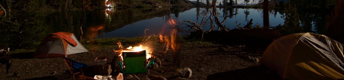
At the Rio Grande Village CG there is a “nature walk” that goes down to the river, but also a little hill to go up and watch the sunset. We got there with plenty of time to enjoy both. If you have good photography equipment take it with you. The Sierra del Carmen range light up with some amazing hues of reds and pinks thanks to the color of the rocks. I came back for my night wander to do some stargazing. It had been way to long since I have had a good dark sky.. While the night sky here is good its not middle of Nevada dark, but it is still pretty good none-the-less. I was just stoked to have a great night sky.


Day 1: Ernst Ridge Trail

Today was a fun little jaunt along the Rio Grande to the Hot Springs at the end of the trail. It was supposed to be a 6-ish mile out amd back, but we started from the CG so that pushed us closer to 9 miles. This walk offers a lot of interesting site seeing that covers geology as well as natural amd human history. The walk offers great views of the Rio Grande, the Sierra de (mountains), fossils and petroglyphs on the walls around the Hot Springs. Oh yah and hot springs too, which (so and so ) Langford back in the early 1900s created a resort nearby. After lunch amd some time checking out the area history we headed back.


Day 2: Grapevine Hills

The plan today was to head over towards Grapevine Hills and walk out to a balanced rock, however i checked SOTAmaps and realized I was looking right at a peak. It had been six weeks so the urge overtook me to send Meesh on her way and I opted to run up the hill. One thing i will note is that every kind of plant here wants to stick and prick you whether its a cactus or not. This is not the same as say the whitethorn or manzanita i encounter regularly in Nevada. It was the first peak that I was trying out a new EFRW built with K6ARK’s balun kit. I had been using a linked EFHW for the past couple of years and the polystealth wire was starting to get worse for wear. At the end of the day I wound up with about 30 qsos on 28mhz and 21mhz including on contact with Northern Ireland. Most of the contacts were North American based, so not too bad given the last minute decision and no real alert, or other activators in the hills today. Tomorrow we are headed to the Lost Mine trail and I will snag Casa Grande Peak.
Day 3: Casa Grande Peak

I wanted to do some Summits on the Air after my day on Grapevine Hills, and I had been eyeing Casa Grande or it’s neighbor Lost Mine Peak located in the Chisos Mountains sky island. . After pouring over maps, and data I chose Casa Grande, and to be fair it was the more impressive looking peak overall. I took off ahead of Michele from the parking area as she was not following me up this peak (and for good reason). The first mile you follow the Lost Mine trail, and then turn off onto a no longer maintained almost goat trail to the summit. A goat trail it was, it looks like quite a few people head up this peak such that there are multiple goat trails in the absence of a well flagged/cairn’d route to a peak that has a steep approach. Some of the terrain encountered did include a little bit of class 3/4 scrambling (because I like scrambling solid rock instead of fighting with Talus and Scree), and some talus/scree runs that at least have some trees that can be used for hand holds. Once you get up the last gully the trail levels out pretty good and the last 50 or so feet of elevation is a gradual trail. At one point you cover 500 feet of vertical gain over 700-800 feet of horizontal distance. The summit offers a 360 degree viewpoint as far as the eyes can see. Look South towards the Rio Grande, the Sierra del Carmen range and Mexico, glance across the way at Emory Peak which stands close by (and was done later in the week), so plenty of views to be had. Another successful SOTA activation, so we wont go into that, but lets shift into the down route. Looking downhill you can see quite a few options including where some individuals have just bombed straight down the talus fields, which on the map does cut off a LOT of distance back to the parking lot/trail head. I’m not down with that though as rocks hurt and the angle was steep enough that a controlled descent was just not possible. If you can handle that, more power to you. That said as I was trying to contour around, I did wind up on yet another rock band where I was doing a bit of low grade class V climbing but also having to contort and bend to not end up wearing the prickly pear cacti. I almost managed to get cliffed out at one point too, but found a good animal use trail to finally rejoin the “correct” (old/original) trail back to the Lost Mine trail. All in all it took me longer to get down than get up since I had to do a lot of route finding/navigating off the summit. So be warned if you decide to go after this peak.
Day 4: Moving day
Not a lot to really report here, we slow rolled out of Rio Grande Village to Chisos Basin. This is considered “an island in the sky” which I called out above. It was much cooler, but also much more crowded as most people are here to hike some of the trails in the area as well as bag the higher, but easier to reach Emory Peak. There are a plenty of trails to be had here for later days.
Day 5: Emory Peak

Today’s goal was some Summits on the Air, and the high point of the National Park, and knowing it was a Saturday I wanted to get an early start to keep the crowding on the summit to a minimum while I had an antenna mast up, that and I was starting from the campground, not the Visitor Center area, so that added about 3/4 a mile each way. So on the trail we go with an interesting inversion occuring outside the basin. There was fog/clouds pouring over the Panther Pass area creating a fun misting effect. Fortunately the Emory Peak side of the basin was without the inversion, so views were had all around. I was well ahead of the crowds so far and made it to the trail junction in about 2 hours of walking. This trail junction has a pretty posh setup, there are bear boxes right there, an AED and a nearby privy. Onwards and upwards, the trail stays pretty moderate until the last little bit where the final push for the summit is 2-3 minutes of solid rock scrambling (class IV climbing) onto the top of the summit block. There are two blocks, the taller one is to the right/North when standing between them, or from a visual perspective, the one that contains the radio systems. Speaking of radio systems, one of the antennas was being held up with 5mm paracord..I guess if it works, it works. the USGS marker is close to an edge, but not too crazy. Note that there are sheer drops on the Western side of both summit blocks, so be advised if you have issues with exposure. (actually if you have issues with exposure do not bother with the climb up, but enjoy the saddle as a place to rest, grab lunch etc. It is possible to activate from the saddle, but it will be harder to be out of the way given that some folks will go after both summit blocks. Pretty straight forward SOTA day, 28mhz/10M got me France, Sweden, Germany, Spain and the UK for DX, and the usual suspects from about North America. By the time I wrapped up and started heading down the crowds were really ascending on the summit. It took a good 10 minutes to get off the summit block as I had to wait for a window to sneak down in between groups heading up. Something to be aware of regardless of your intentions for the summit. Pretty much the same story at the trail junction as well, easily 100+ people hanging out, having lunch and resting before the final push up. Note that the Pinnacle’s trail provides access to the South Rim Loop, and many other backcountry campsites, so most people were dropping packs into the bear boxes to snag Emory as part of their outing. Had some enjoyable conversations with individuals on my down walk, including someone sporting the brand new Durston Kakwa 55. This individual was working his way to Florida to put his few remaining possessions in storage and was headed up the AT this spring. He was doing a three day shake down trip to try out the new gear here in Big Bend, and he could not have picked a better place for it..


Day 6: Time to start moving on

However we had time for one last hike on the Window View Trail which is accessed directly from the campground, so we were like a 30 second walk to that TH. This is a pretty short trail that goes to a very cool feature. The trail ends at the top of a waterfall. note that the rock is pretty polished, so even when the creek is dry test your footing as you approach the edge. It is a pretty short trail, but note you descend down to the waterfall, the return is a climb of about 500-600 feet of elevation gain that’s pretty much sun exposed. So if it is summer, carry copius amounts of water and consume it. We made it back to the campground around noon, so with that we decided to head on out of town to cut our drive time to Guadalupe down.
Final Thoughts
Big Bend was pretty damn impressive. I would totally return there, especially with the backpack and check out the South Rim loop, (note that from Feb thru April that trail is closed because of Falcon nesting). It would be fun to put together a 5-6 day loop, during the new moon to really get that star gazing in. I will note, that while this area is good for stargazing and I had some great dark sky nights I still find the skies in Nevada to be darker and clearer. If Big Bend is on your list and you have the time, doing a 7-10 day trip is very possible spending 3-4 nights in each of the three campgrounds. While we never made it to the Cottonwood campground, what I can say is that Chisos vs Rio Grande Village offered two completely different experiences and moving between them was super easy.
A few remaining shots of some sunsets, and random wild life.


Up Next: Guadalupe Mountains National Park, and the Texas State high point.
