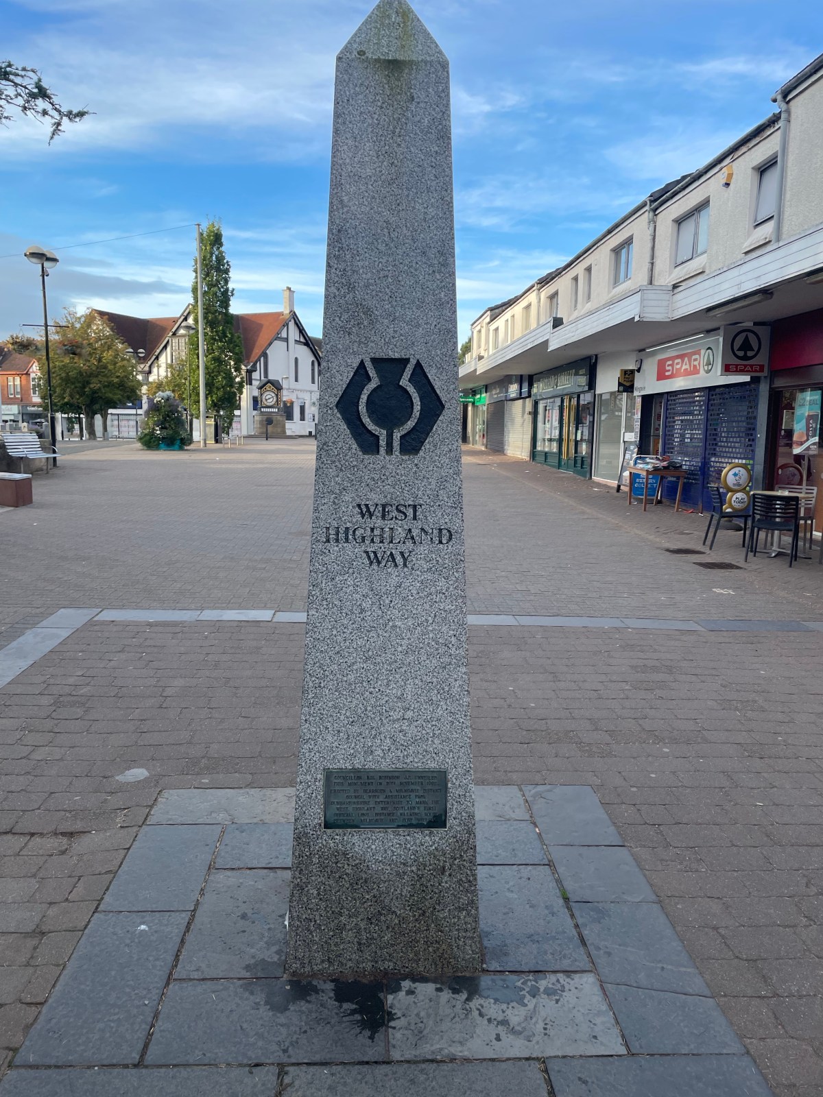
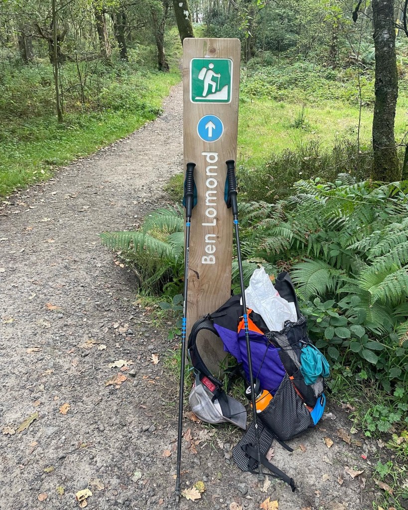
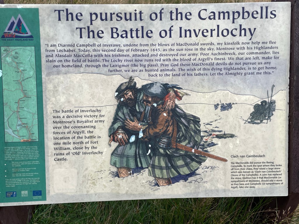
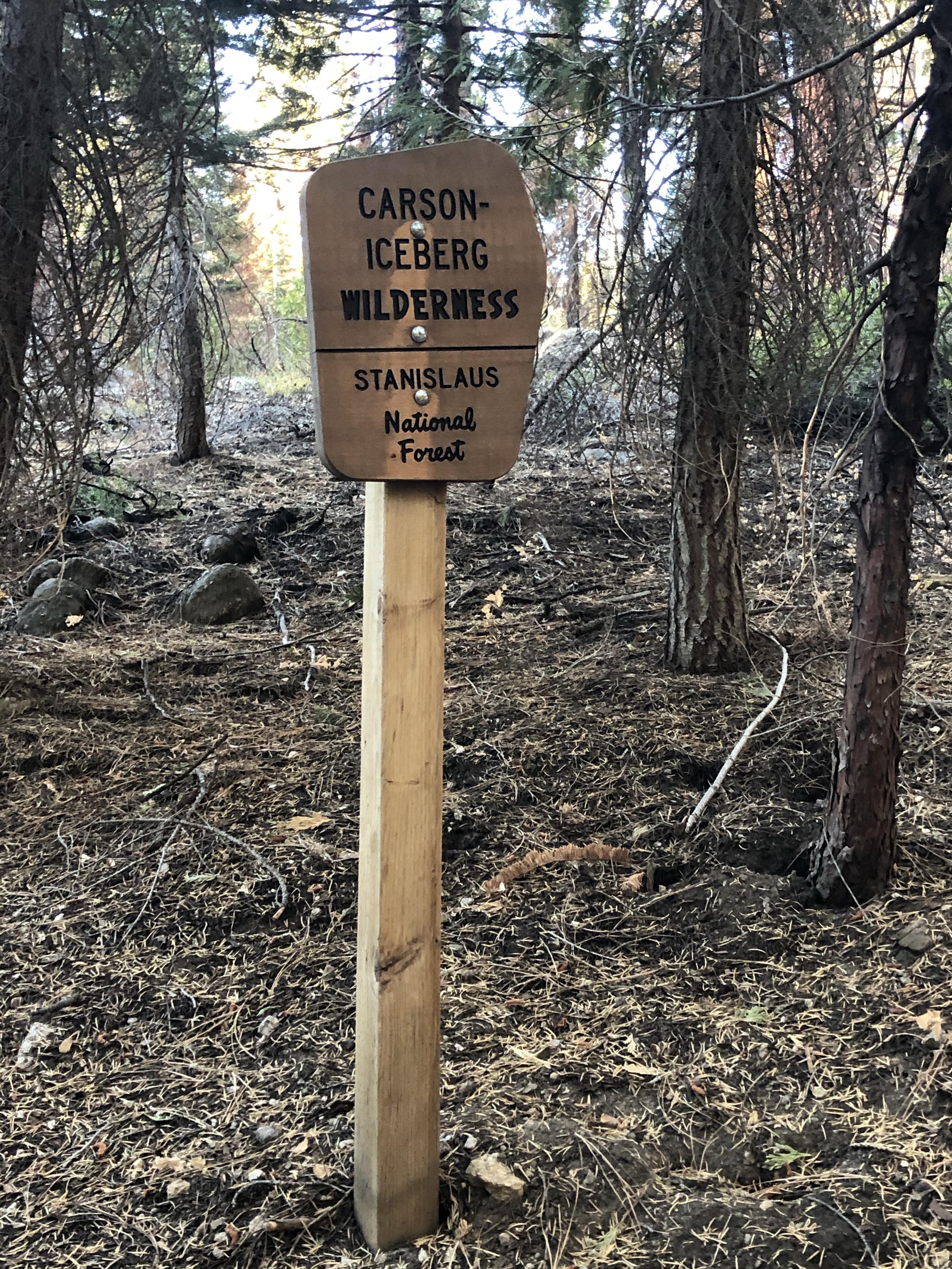
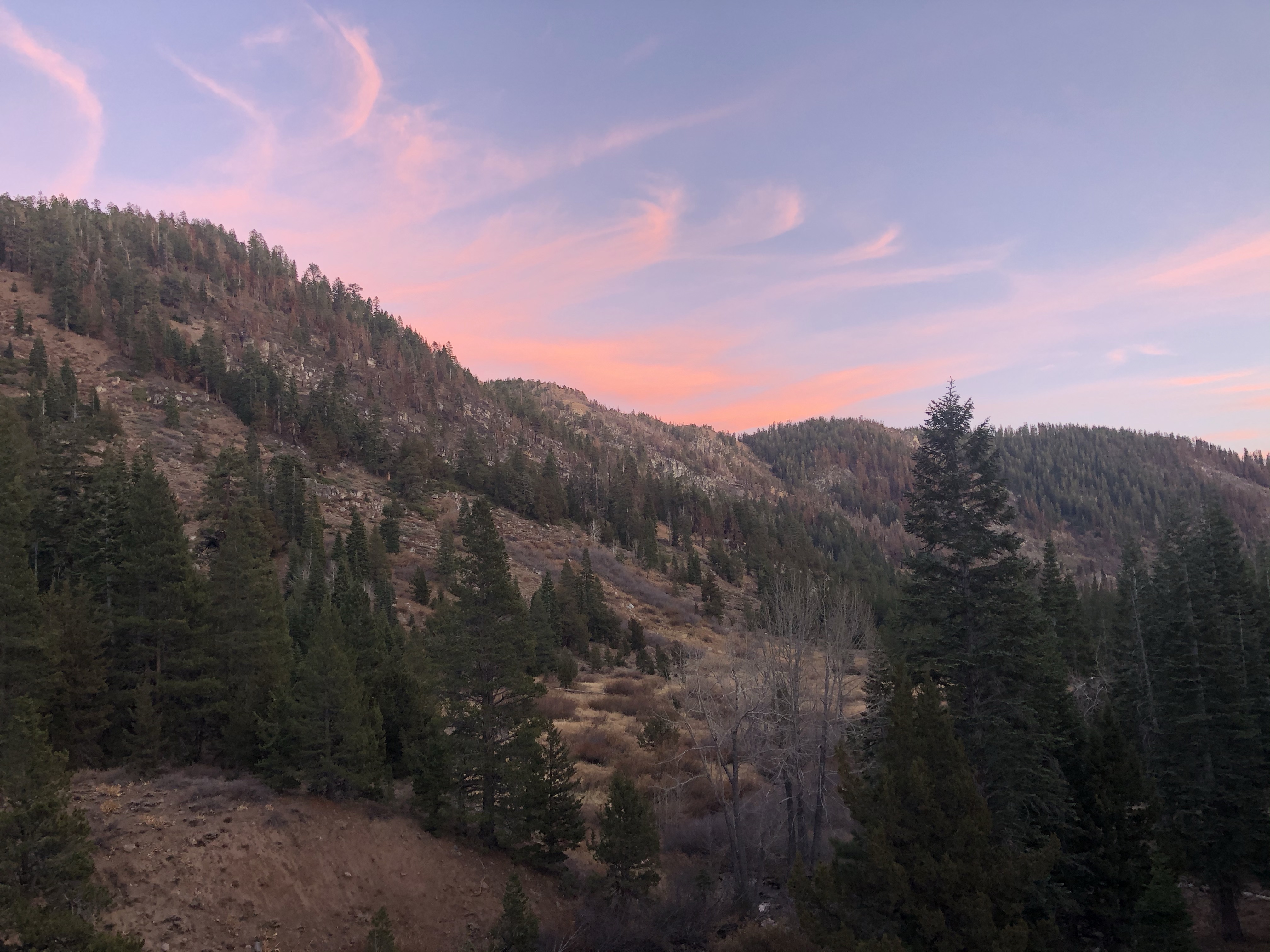
The Scotland Great Outdoor Challenge (TGOC), what is it?
This is not your typical thru-hike. For starters, its a coordinated and organized walk that you sign up for. Next once you are “approved” you create your own bespoke route. You are given a list of 15-20 starting locations on the West Coast of Scotland, and a list of 10(-ish) finishing locations. From there you draw some lines, and connect some dots (resupply) to make your route. You route does go through a vetting process with feedback to keep you on the rails. Once that whole planning process is done you show up in May with 300-400 others and start walking East.
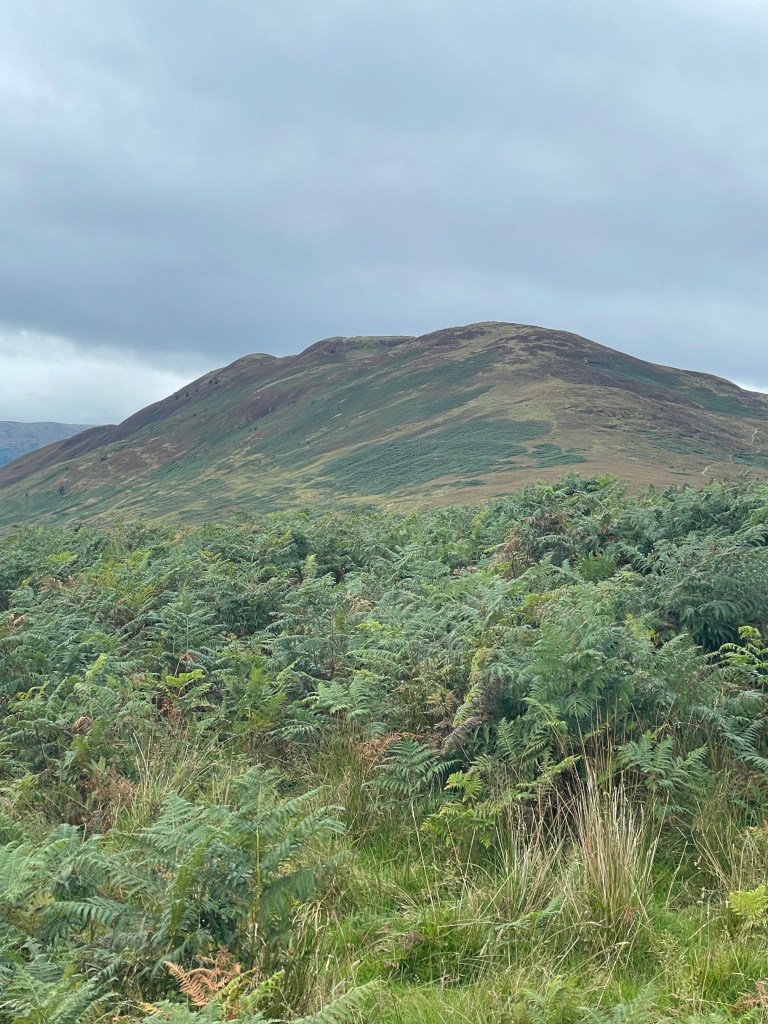
Maybe you have done a ton of walking, and have planned plenty of excursions, but the added logistics of connecting two dots 200 miles apart with the various tracks, roads, munros (mountains) and Scottish right-of-ways does spice things up a bit, thus why there is a vetting process. This is one of those elements in my opinion where people find out whether or not they do not know what they do not know.
Given that you can pick your route, you can make it as hard, easy, long or as steep as you want. This also allows you to make it as remote or as civilized as you would like. I chose a mostly low mix of a route because this is my first crossing (however not my first time walking in Scotland). Because of the issues the “mankle” was giving me on the Pennine Way last month, this may work to my advantage.
If you are someone who enjoys a multi-week jaunt with solitude, this walk is not for you. Despite the fact that you sign up, and even pay a fee to enter, the Challenge fills up quickly. They limit the number of signups to 400, and I would guestimate 300 or more end up setting off from the various starts, folks scattered aboot all heading in one direction, you do the maths. However that also means signing up as a solo will give you plenty of opportunities at developing tramilies as well.
My Route:

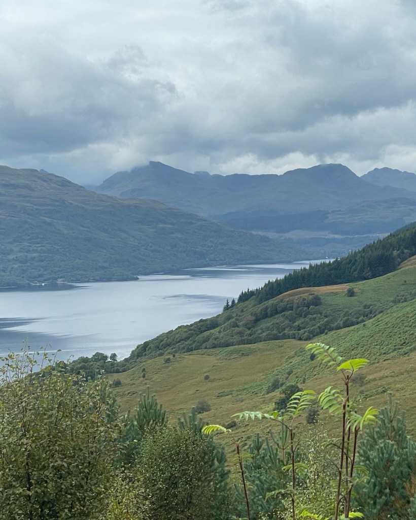
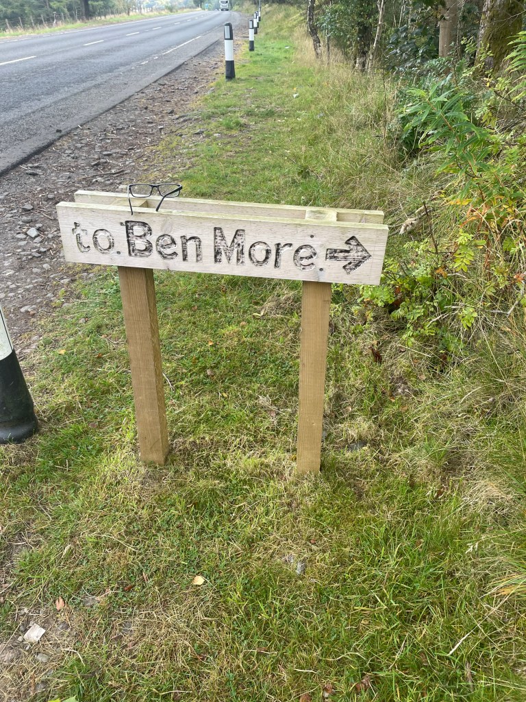
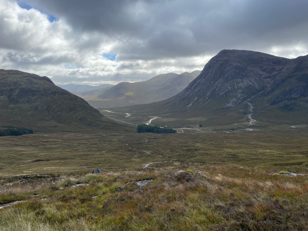
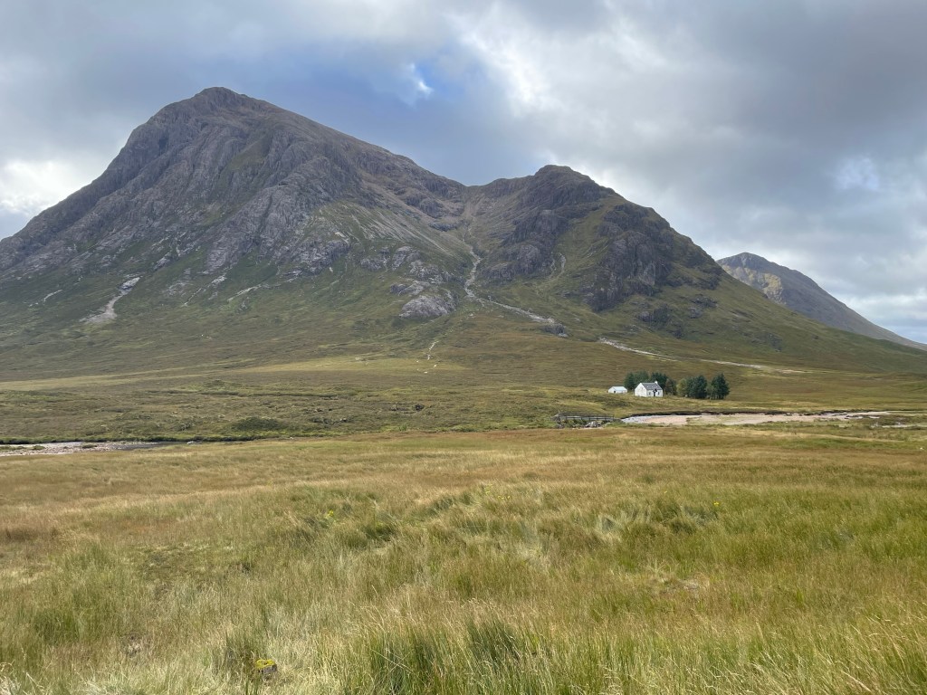
I picked Shiel Bridge as my start, and had planned to finish in the seaside village of Inverbervie. I started out following the Afric Kintail Way, then broke off to take some non named walking tracks to Fort Augustus (first restock). Then I took an old military road (see Jacobite rebellion) over the Correyairiack Pass towards Kingussie (second restock). This first half of the walk was the easiest for me to plan and put together, and I have had some experience with this part of Scotland, so the route was pretty much memorized, other then deciding to cut a day way short hoping for another great viewing night of the Aurora I stuck to my plan.
After Kingussie I got a little creative in the field doing some on the fly reroutes to take in some of the more interesting sights. I was on the trade route and had met up with a wonderful walking partner, so on we continued together for the next few days. Up through Glen Feshie to the Ruigh Aiteachain bothy for a tent night (with about 40 other participants). It was the first night in a few days I saw some new faces.
After this I continued along Glen Feshie into Braemar for my last resupply. I diverted off my path down to Loch Callater lodge for a very social evening (guitar play, sing alongs and was fed some awesome food). The next day was up and over Loch Nagar and rejoined my route at Spittal of Glenmuick (Balmoral Estate). I walked past the Sheilin of Mark Bothy to Muckle Cairn, then down through Tarfside. Again I had to leave my route thanks to some thunder and lightning moving into the area, so diverted to Edzell. This set me up for a 15 mile road walk into Montrose instead of my OG planned finish of Inverbervie.
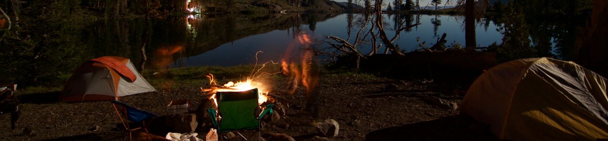
If my math is right, I walked about 185 miles with a few very short days (active rest days) and a couple of 20+ days, but most days I was clocking in about 15 miles. For nights, I ended up sleeping in a bothy 1 night, Hotel/Hostel 4 nights, and 8 nights in a tent with a combination of at bothies, at one caravan park and wild camps.
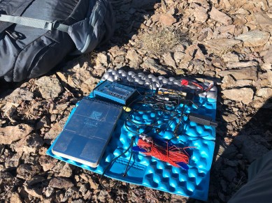
What was in my kit:
I scored a house sit in Belfast, so that allowed me to prune down my kit a bit more from when I left the US at the beginning of April. Gone was the Sunmits on the Air kit (about 1.5kg/4lbs), a pair of shorts and my extra sunshirt, ditched some of my First Aid kit (SOAP notes and quick guide etc)

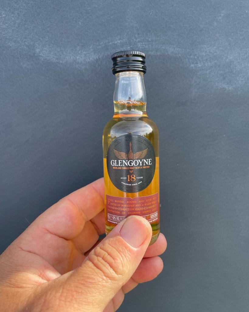
I lived in Montane Terra pants, I like them for all conditions personally, so here is to hoping I do not rip them up and a Zpacks/EvolvedSupply Mirage Sun Hoodie. For the temps and conditions, the weight of this shirt is perfect. I am schlepping an Atom Packs Custom Mo 50L, Western Mountaineering Terralite bag, Big Agnes Rapide SL pad, Durston X-Mid 1P (Gen 1), MSR Pocket Rocket Deluxe, GSI Haulite 1.5L cookpot for my kitchen. Gore Tex jacket/pants (it supposedly rains in Scotland, but I’ve yet to see it), and a light puffy for those cooler nights. 1 smart wool 250 long sleeve, and 1 smart wool 150 short sleeve.
The miscellaneous bag included a 10k and 20k charge block, a few feet of 2mm cordage, some duct tape, sunscreen, midge/tick spray, tick removers, Rawlogy cork ball, UK charge block, charge cables for Garmin watch, iPhone and the battery bricks. On my back with food and water, it felt like about 30 lbs, but I had no real way to measure it for sure.
Bothies:
According to the MBA website: “A bothy was originally farm accommodation for itinerant workers; now a bothy is an open shelter usually in a remote location where travellers might have need of four walls and a roof. Most bothies are old cottages and at least several hours walk from the public road.” Reality is they are nicer than any of the lean-tos on the Appalachian Trail.
Highlights of the Trip:
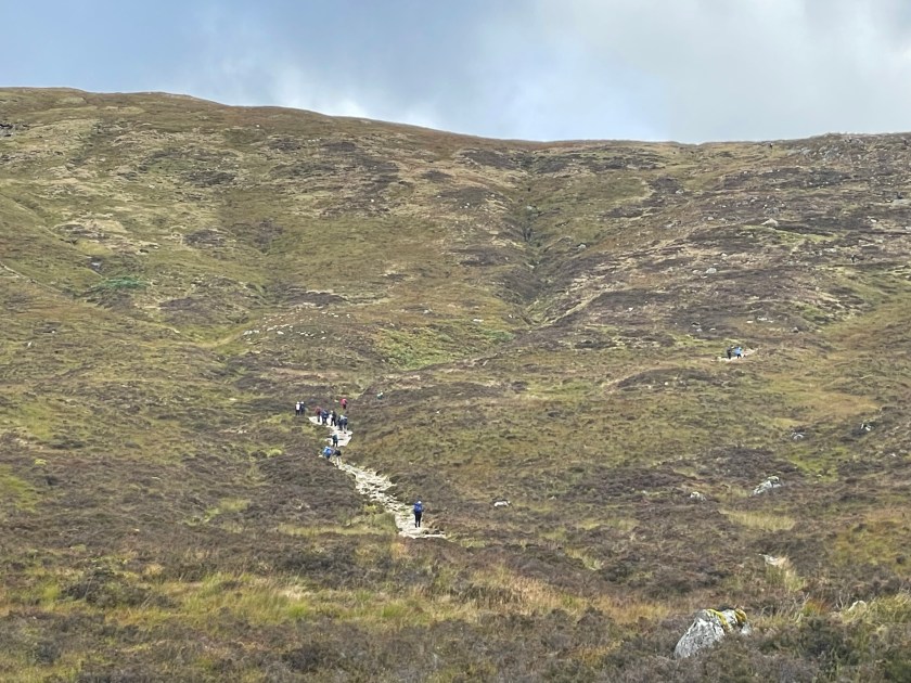
I met a lot of wonderful people while walking. Unless you intentionally plan a socially isolated path (good luck) you cross paths with quite a few other TGO participants. This year’s starters totaled 337 people, with about 40 dropping out within the first few days. I was consistently encountering 20-30 people on a daily or bi-daily basis while scooching along my route.

Seeing the Northern Lights: As an amateur radio operator, I tend to have some clue what is happening with the sun. For those not in the know, we are at the peak of the 11 year solar cycle (aka Solar Maximum). What I did not know though was that a G4 class solar storm had spewed solar material at the Earth on May 9th. I managed to snag some cell service and my app popped that I had a 100% chance certainty to view the Aurora Borealis in my location if the sky was cloud free. This Aurora may be the most magical thing I have ever seen before.
Doing the typical swimming in mountain rivers, which Glen Feshie came at the right time in the right place and the right temperature.
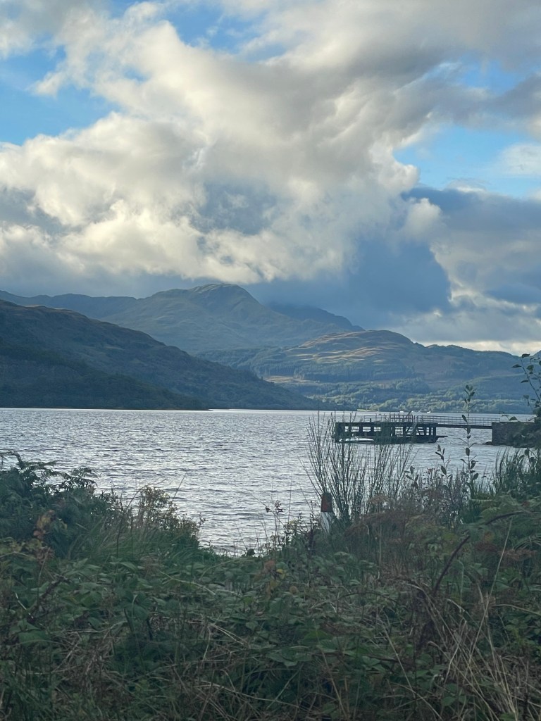
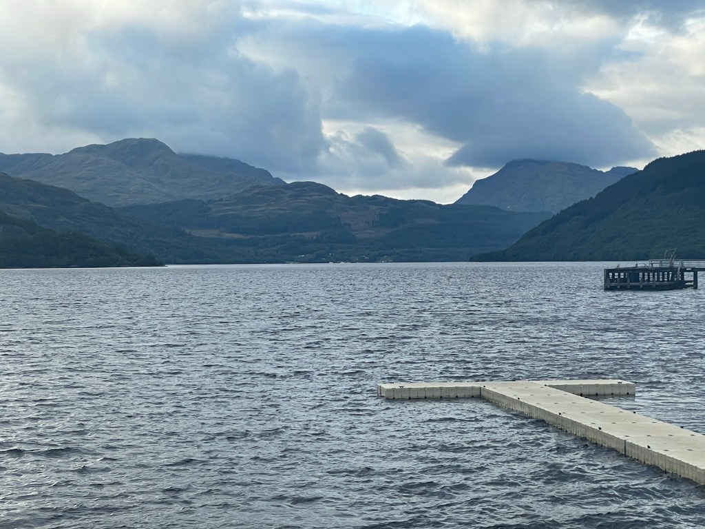
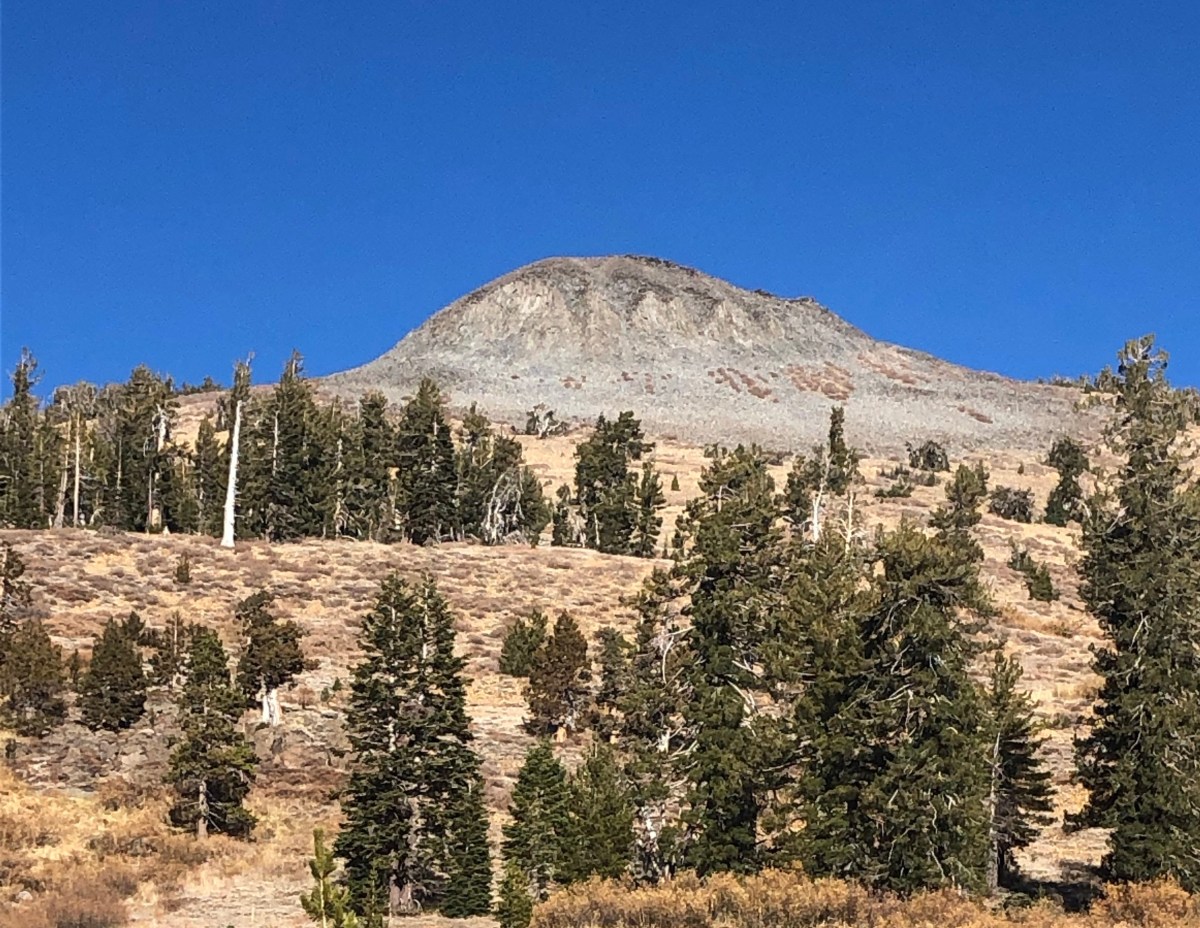
Sleeping and hiking to high locations in a tree free environment. Okay lets face it, that Scotland is tree free maybe is not a good thing, however it does make for some amazing views from the tops of the munros. At one point I was walking along three lochs (lakes), and the juxtaposition of new forest growth being backdropped by windmills and a three loch gravity hydro electric system in place was cute.
The night at Loch Callater with the gathering of folks, the shared good food, and the sing along in the lodge with the two guitarists. Loch Callater was not part of my original route, and I intentionally diverted just for this experience.
Getting there: (a four day adventure to itself)
I had already been on that side of the Atlantic for a month given my failed attempt at the Pennine Way. After spending some time in the Wicklow Mountains in Ireland, and scoring a house sit in Belfast it was time to move on to Shiel Bridge, the start of my crossing. If you are not familar with the public transit in the UK, it is amazing.
From Belfast I took a ferry back over to the other Island. From our landing spot in Cairnryan Scotland I took the city connect up to Glasgow and stayed the night. The next day the goal was to visit Montrose to drop spare clothes and other parts of my kit not going on the walk. After Montrose move up to Aberdeen and if there was time to take the bus out to Braemar and back to drop off my last resupply. I managed to make all those moves in a single day using nothing but the UK’s public transit. Speedy train from Glasgow to Montrose, bus to Aberdeen and buses to Braemar and back. Once you know and understand their system, it is quite easy to move around.
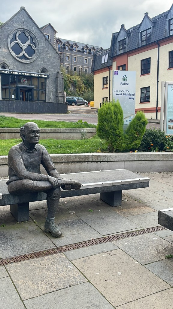
The next day I moved over to Fort Augustus as a single move. Train to Inverness (my first visit). Inverness was not what I expected. You come out of the train/bus station and you are met with all the major outdoor shops and a few local ones too. It does make sense though as Inverness is the Northern end of the Great Glen Way (on the list). I did not want to get to Glen Shiel too quickly, plus I had not visited Loch Ness yet so I moved on down to Fort Augustus for a night. Compared to Fort William (end of the West Highland Way), Fort Augustus seems to be well kept. Fort William is cute, but it seems to be run down. There is also part of the Caledonian Canal system there and so of course I watched as boats (BIG and small) moved up/down the 5 tier lock between Loch Ness and the Canal heading South. There is a great Fish and Chips shop to be had in Fort Augustus, and no it is not the one where you get off the Bus station, it’s down by the Canal.
The final day I took an early bus out to Shiel Bridge so I could setup in the campsite before the scheduled rains were set to move in (there is that Scottish Weather I have heard about :D). I met my first co challenger on that last bus.
The Day-by-Day breakdown
Day 1: Along Glen Affric

Today started out a bit of a cloudy threatening day. I left my campsite, and walked up to the Kintail lodge to “check in” (sign-out) to start my route. Shiel Bridge is usually the popular starting location, but this year was ranked 3rd. That said there were still 40 people on the list to start here. The walk started out with about 2 miles of road walking before joining the Affric Kintail way and heading East through Glen Affric.
Because the walking track was a farm access road for sheep farmers, the walking was very pleasant. Eventually I reached the first bothy along Glen Affric, the Glen Licht House. This makes for a good lunch and rest spot. After here the next couple of miles is a 1000 foot climb into the upper Glen.
There are plenty of options to sleep along Glen Affric. There are three bothies and plenty of wild camps along the way. I pushed a mile or so past the Glen Affric Youth Hostel and found a quiet spot along the River to call it a day. Day one ended up being 14.25 miles. A lot of sheep, some amazing uphill walking along a beautiful glen, and a first night campsite with only a few neighbors.
Day 2: Affric Kintail to River Enrick.

Today was a twenty mile day, but it was well worth it. I also dealt with a bit of an emotional state, go figure. One of those it’s hot, this sucks, the views are gone now that I am out of the Glen type days/internal monologues I battled with for a few miles.
I bumped into one chap that was asking me about my route, and then started talking up some route to Cougie Lodge. Consulting my maps I was unable to find this location, and it was not part of my original path, so when I did finally see the sign that said “Cougie Lodge this way” I opted to continue along my own planned path. That whole not venturing into the unknown. It did not help that the path looked pretty rough. nor that the individual I’d talked to did use the words “right boggy mess”. I was still fresh off the mess of the Pennines so avoiding bog at the expense of extra miles was worth it.
Sometime well into mid afternoon I finally reached my turn off the Affric Kintail way to venture over a hill towards the the town of Tomich. It was starting to get later on in the day, and hunger was talking to me pretty loudly so I stopped off at a small wood with trash cans to do some dinner and a “cuppa”. Afterwards I continued on to where I was hoping to stay the night, and uh..well what was on most maps as a bothy actually ended up being a rather pricey (and locked up) holiday home on a lake. It was here that I flipped my phone on and got the alert from the Aurora App (100% chance if no clouds).
This changed the mission of my day. After pouring over my map hoping to find a high, and dry spot near a good water source I was back on the move by around 2000. The target was a body of water a few miles away so I picked up the pace on what was an old Forestry Scotland trail and logging area. I made it to said body of water just before sunset, and quickly realized it was not suitable. The location was very boggy with no flat spots anywhere and the “body of water” was a large bog hole with no easy way to get water. I made my way back to the “trail” and continued along until the next Glen (Valley) that I had spotted on the map at the confluence of two rivers. This area would serve me well, even though there were dirt roads near by, it was obvious these roads were there to serve the nearby wind farm, and not regularly travelled.
Camp was made, and around 2300 a very interesting light show started to emerge. I stayed awake until about 0130 watching an amazing and very magical light show. All kinds of crazy colors to be had all around me. This was not the first time I’d experienced the Aurora Borealis, but this was by far the best one I have ever seen. I actually joked to myself at one point “well nothing else on this walk is going to top this, so I could quit right now and not be bothered by the decision”.


Day 3: A wee little move

Last night’s light show was amazing, and supposedly the storm was big enough that tonight was supposed to be even better. I decided to take a short day and walk to the top of the last hill to go over before Fort Augustus. A couple of hours later, I had walked a short three miles up the hill to Loch ma Stac. Nearby was a Victorian era shooting lodge being retrofitted by the Mountain Bothy Association.
I would like to think “Loch ma Stac” translates to Lake of the Sky. I am thinking it is something more simple like “stacked lake”. This is the top loch of a gravity hydro electric setup. I setup my tent in a suitable area well away from the structure which was reinforced with scaffolding. I did check out the lodge, and on the roof were inscriptions going all the way back to the 1970s.
Today seemed like a nice enough day, no clouds or anything in the sky until I decided to lay down around 2100, (and set an alarm for 2300 for hopefully another light show). At the end of the day though the clouds had moved in and the sky was completely obscured. If there was another light show it was well above the clouds so I opted to just roll back into bed and call it a night.
Day 4: to Fort Augustus
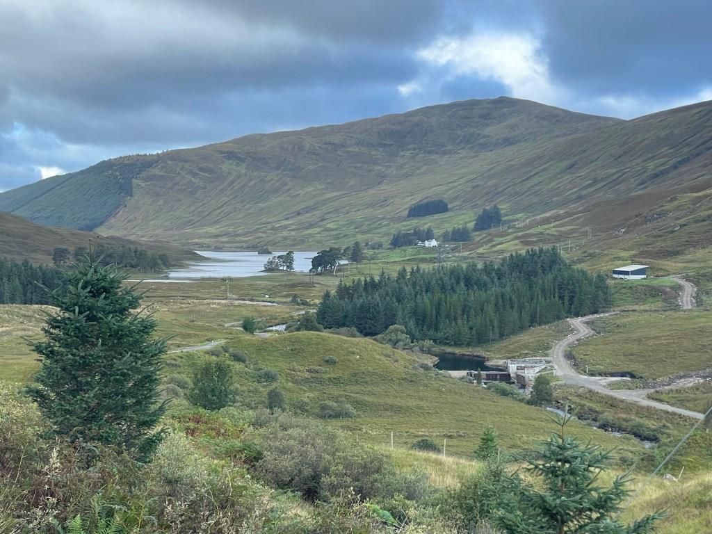
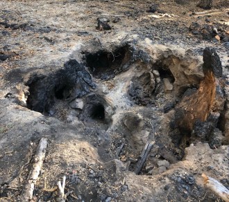
By the time I woke up the clouds had moved on, and another nice sunny day was on tap. The first mile was along the edge of Loch ma Stac, and then downhill on the access road past two more Loch’s and dams. I ended up calling today “the Dam walk” for that reason. It is a bit concerning though that in May the three lochs were all pretty low. The logging industry as well as Forestry Scotland could take some lessons from the US West in what happens after years of drought, and cash crop forests not properly managed. Peat also has a nasty habit of burning for months on end underground. In my opinion if the current weather pattern stays as is, then in 5-10 years Scotland could have the same issues with fire the US west has.
Next up was the village of Invermoriston for some lunch. After lunch I had six miles of the Great Glen way down to Fort Augustus at the Southern end of Loch Ness. The Great Glen way does get quite a lot of walkers, so there was no shortage of folks to chat with who were heading N towards Inverness. Fort Augustus was finally a place to get some laundry done. It was also my first food resupply. The local/convenient store here at the one gas station had enough for me to put together a good menu for the next 3 days. Bubble and Squeak Idahoan Potatoes, ramen, cous cous etc., and a stack of flapjacks for lunch.
I stayed at Morag’s Lodge, which was a hostel right off the GGW a few minutes walk from the town center. There is also a good chip shop in town (not the one at the bus stop). At the bar in Morag’s there was quite the gathering of TGO walkers, so plenty of stories to be shared, and new friends to be made.
Day 5: Over Corrieyairack Pass

Not sure why I was worried about the walk today, but this was going to be “the Forester pass” of this walk for me. Okay, maybe that is a bit of an exaggeration but the first ten miles covered an elevation gain of 2500 feet. At the base of the climb up, I met up with another individual who I had met at the bar last night. Mark from California, and despite being taller than me, and a former Marine we both walked about the same pace. The nice thing about walking with someone else, is you cover a bunch of miles and do not even realize it. At the top of the climb is the remains of an old telegraph station. The walk down the backside is a lot steeper, and the knees were a little miffed when it was over. We continued walking along the General Wade’s Military road with the intention of staying near Garva Bridge. The last few miles we ended up on tarmac. We managed to get our tents up and dinner cooked before the rains moved in. Most people stayed at Margrave Bothy a couple of miles back, so it was just myself, Mark and two other Challengers, plus a lady and her dog in a van. It was the first night ticks were an issue too.
Day 6: Newtonmore
Today’s path was through Laggan, with a stop off at the Laggan Cafe. My original goal was to stay near the “Centre of Scotland” marker and finish at a caravan park 30 minutes from Newtonmore. Challenge Control was hanging out at a hostel in Newtonmore, and Mark was headed there so I decided to knock out that last couple of miles. This choice set me up for yet another 3 mile day for Kingussie which was my next resupply. Pushing along, Mark and I made the Laggan cafe where I utterly destroyed their menu. Two mains, two deserts, two pints of beer and 2 coffees. As lunch went on a nice gathering of TGO crossers formed. The food was quite good, so if you do come this way it is worth it for a stop in. After lunch, and hearing my plans to walk past the Centre of Scotland Mark decided to stick with me. To get to Newtonmore there are two options out of Laggan. One is to head North through the East Highland Way. The other is continuing along General Wade’s Military road which is now A and B roads through the countryside. The high route would have been easier on the feet, but as I said, I wanted to walk by that marker :D.. Misguided goals?
Once we were on the A889 we quickly came across a place called “The Monarch”. What intrigued me was the remains of an old Chapel. Yes I get it, old and falling apart chapels are a dime a dozen in the UK. We chatted up the owner who was there doing the lawn etc preparing for an incoming party. A couple other chaps (Rob and Graham) ended up walking with us until the Caravan park, but we pushed on ahead the last mile or so into Newtonmore. Why did I want to continue on to the hostel? Well TGO control was setup there, and it allowed me to check in a day early, and it setup an easy day into Kingussie. More time at the bar?
It was also here I ended up meeting my walking partner for most of the rest of the trip. Newtonmore is at some strange crossroads as well, just on the outskirts was a very US looking truck stop. No, not a modern day Love’s or Bucees, but like what they used to look like. A diner with showers etc. More on that later since I snagged breakfast there the next day. Life in a hostel is always fun, ie..meeting other trail walkers and such (and hoping no one snores).


Day 7: Sauntering along to Kingussie
Since this was another three mile day, and others were taking a zero at Newtonmore I decided to lag about a bit. Off in search of Breakfast with “The Beaver Lady” and her son and nephew we ventured back to the truck stop (Newtonmore Grill) at the edge of town. This was an odd place to find this kind of restaurant, but a lot of truckers do run through here from various locations. Breakfast for dinner, dinner for breakfast, whatever your fancy. So I opted to build a cheeseburger with an egg on top, almost like a bacon western bacon burger. Lindsay (the Beaver Lady) was fun getting to know and I was in need of a new walking partner. Since her son was about to bail on her with her nephew I offered to walk with her since this was her 6th crossing. She was however zeroing today and I was moving on, so we agreed to meet up the next morning where I was staying.
Back at the Hostel I grabbed my kit and started walking out with some others pushing onto Kingussie. Rob and Graham, the two gents we met yesterday were also heading to Kingussie so we walked together, man those guys had some long legs and a long stride. Most folks over there really do walk about 1/2 mph faster than I, so it was a fun struggle. Granted this was a good area to speed through, this was more of a ranching/grazing valley so not a lot of views to be had.
As the day went on though, plenty of us gathered about the area campsites, hostels and hotels in the area, and ultimately overan an outside beer garden at one of the hotels. Fun gathering hearing old stories, and making new friends, and well showing off the images of the Aurora a few nights ago. I guess i am one of the few backpackers who bothers to view the night sky in all it’s wonders.
Day 8: Into Glen Feshie
The OG plan today was about 8 miles to setup for a SOTA peak however that was no longer part of this walk, and a lot of folks had been talking up the bothy at Ruigh Aiteachain. Today’s distance ended up 11 miles. Along those eleven miles we encountered the Ruthven Barracks from the 18th century. A wonderful swimming hole mid day (it was a hot day). So after a dip we suited back up and headed into a wood. So the story with this bothy is that there is an individual who stays in the bothy for most of the year as kind of a care taker.
This particular bothy because someone hangs out throughout most of the year was nicer than most. Equipped with a cooking stove. The Bothy was already filling up, but I had opted to pitch out on the grounds elsewhere. After a hotel night, I wanted to be back under the skies and trees.


Day 9: Continuing thru Glen Feshie to Red Bothy

We headed out again today following the Feshie River up through Glen Feshie. One of the guys I was walking with was talking about how most people call Glen Affric (see day 1 &2) the most beautiful Glen in Scotland. Which do not get me wrong, it’s raw, beautiful and is flanked by some serious mountains. I will admit though that Glen Feshie does have it’s own appeal. I personally put them as even but for different reasons. Glen Feshie is a bit wider, the mountains are a little smaller. As I called out similar in beauty, but for different reasons. The RAF was out today, so we were buzzed a few times. This was another short, 11 mile day.
I opted to stay inside the bothy, for no other reason than to just have the experience. Then again, I will probably be reminded why shared rooms can be uh…hard to sleep in. Do any of you snore?. The Red Bothy was recently reopened after a year of refurbishment by volunteers with the MBA. In the cooking/gathering room there was a nice family style table, a wood stove, another table and some chairs. A log book, and the usual things you would find in a bothy. The Bothy Code etc. In the bunk room were four double stacks, so room for eight. Tonight though, only four of us were staying inside.
Outside I think there were close to 10 other tents scattered about, and who can blame them. It was a nice clear evening, so after dinner I did a short night wander before finally turning in. Note that since we are getting further into May that it was never actually dark at night. The sun would sort of dip under the horizon around 2200, and make itself known again around 0300. The darkest it ever got was “twilight”.


Day 10: The Red Bothy to Braemar:

Another 12 mile day on tap to a town for resupply and check in with TGO challenge control. I diverted a little bit to a place called Mar Lodge. The custodians of this place put on coffee and snacks for TGO walkers, plus it was a good place to fill back up on water. This was about midway of my day. The lodge also allows you to send a resupply here. That might have been nice to know given the last minute shuffle with the only local co-op in Braemar.
While walking, I bumped into an octegenarian lady on her 9th crossing. Man these Scots are some hard core walkers. One of the walks she had done that sounded really interesting is the “Path of the Gods” in Italy. No not the 5 mile walk along the Amalfi Coast, but some 80-ish mile walk between Bologna and Florence. Okay that’s on the list now :D.
Back on the move I had about a mile of road walking from the lodge to some wood that would drop me into Braemar. I ended up bumping into one of those walkers I had been bouncing into every few days, so we decided to head down into Braemar together. Off in the distance I could see and hear a thunderstorm moving away from us. Always a fun thing to see and hear when it is far away (and not accompanied with rain). Marteen and I strolled on into Braemar and I destroyed the menu of yet another small cafe for 2nd lunch.
I really wish I had taken more pictures of this village. It was very idyllic, but also very posh. There is one Inn there called the Fife Arms, apparently lots of famous people come here to stay. Beer Pints are also £10-15. Despite that this village is way out in the boonies, like 2 hours from anywhere, I can understand why this village is the way it is. Balmoral Castle is about 20 miles to the East. I stayed at the Caravan Park on the South side of town, and I am glad I booked this early. It was a tent city, easily 40 tents pitched on their spare lawn. They had a guy that reminded me of Haggrid directing us where to put our tents so that we all had space. It was about a 5Mx5M square. It was nice to have a shower too.
Back into town after getting cleaned up, I had dinner and headed to one of the local Pubs to reconfigure the next leg. I wanted to divert to a place I had even put on my map during planning. The Loch Callater Lodge is very much worth the stop. It is nestled in a beautiful valley, and you can only access it by walking. Some volunteers who have been a part of the TGO for a while come out with all kinds of food and do up great meals, and sausage and bacon rolls etc. On top of that, well you watched the video above. Even though it would add a day to my total walk, I was still finished within the required 14, but it meant one more 5 mile (rest) day.
I managed to come up with a reroute that put me back on my path only 10 miles outside of Braemar and also put me going over a Munro.
Day 11: Braemar to Loch Callater Lodge:

Well, a wet day sort of. It did rain through the night, but I had time to kill this morning so I was not in too much of a hurry. I walked back into town for some coffee and a second breakfast before venturing along.
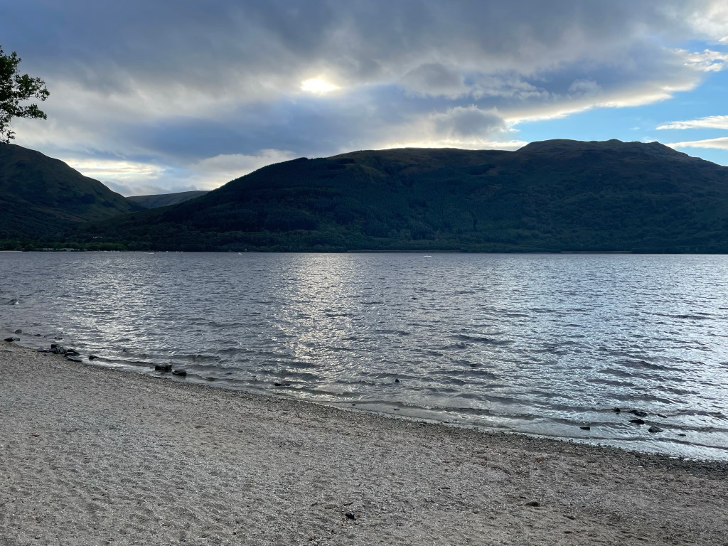
Finally on the move around noon, I made it to the Lodge by 1500, and WOW, this place was spectacular. You can either walk along the road (not advisable) between Braemar and Aucallater or stay on the West side of the nearby river. Then you turn up a 3 mile, small climb in on Jock’s Road following and meandering with the Callater Burn (creek/river) to the Lodge.
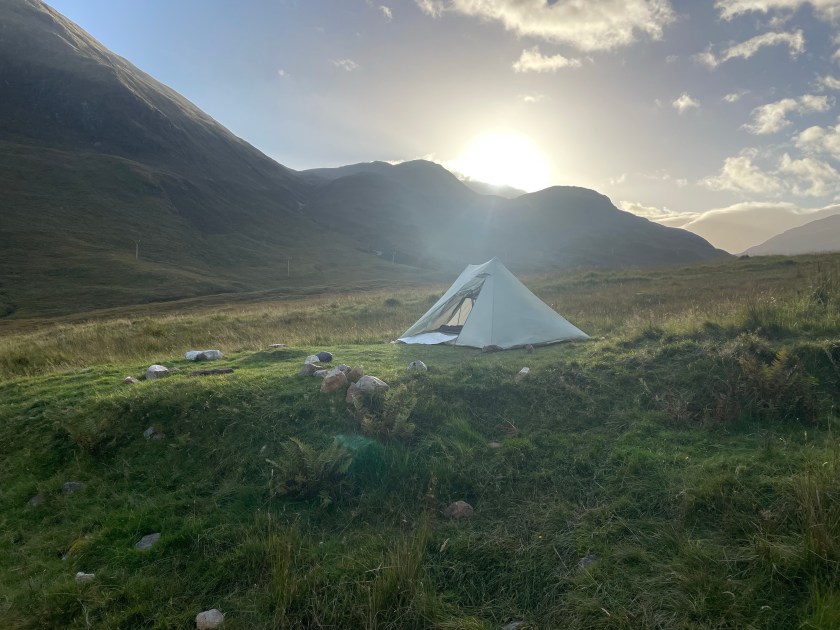
The hills here reminded me of those early days on the crossing back in Glen Affric. The lodge was nestled on the banks of a loch with an outflow. It was all fenced in, there was a bothy next to the lodge, and an outhouse for doing your business. We were flanked on 3 of the 4 sides by tall mountains too. This lodge also has a connection to the Royals. As I called out above, Balmoral Castle and estate were only about 20 miles away from Braemar, and I was directly south of the Castle. One of the volunteers at the lodge was one of the hunting guides at the lodge. This is where the Royal family would come to hunt the Red Deer that roam the hills. There was a cairn on a little knoll above the bothy commemorating the Queen’s Jubilee.
Just as I was promised, they put on a good show for you. As soon as I walked up to the lodge someone was shoving a bacon roll in my hand. Tea was to be had too. I totally wandered around checking out the surrounding area (as well as spying that steeeeeeep climb out of there for tomorrow). It was a gray day, no rain, but breezy too with a bit of a chill. Another night outside, I pitched on the green around the Lodge, as did another 15 of us. Remember what I said about snoring? This might be one of the first times I have encountered snoring, in stereo while camped outside.
They fed us an amazing pasta dinner too. You would think pasta would be boring, but no it was jazzed up very well, and at some point we all retired into the bar room and did a few hours of sing-a-long. Surprisingly some of the Scottish songs I knew, they also tossed in a fair bit of Beatles, the Eagles, Sir Elton etc. Although I sure would have loved to hear me some “Take me home (Country Roads)”.
Sacked out after one of my more favorite social days on the Crossing.


Day 12: Loch Callater Lodge to Shielin of Mark (Muckle Cairn)

A new day, newly refreshed after a fun night. I went looking for Lindsey (the Beaver Lady) only to find out she had already moved on. After getting my fill of Bacon Rolls, I was ready to head up the hill. I am going to repeat that these guys really take care of the crossers, so make sure you bring some paper money with you to kick some back! After all, they are all volunteers giving their time freely. Essentially trail angels, but on steroids. So yah after my fill of Bacon Baps and Coffee I was off.
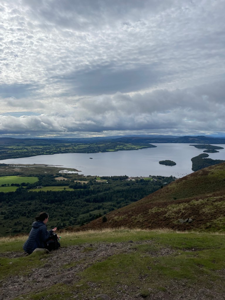
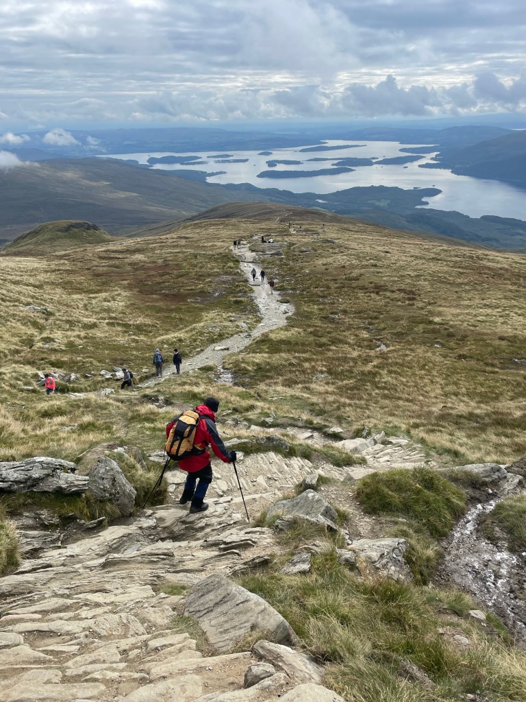
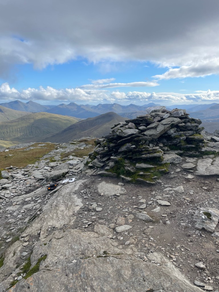
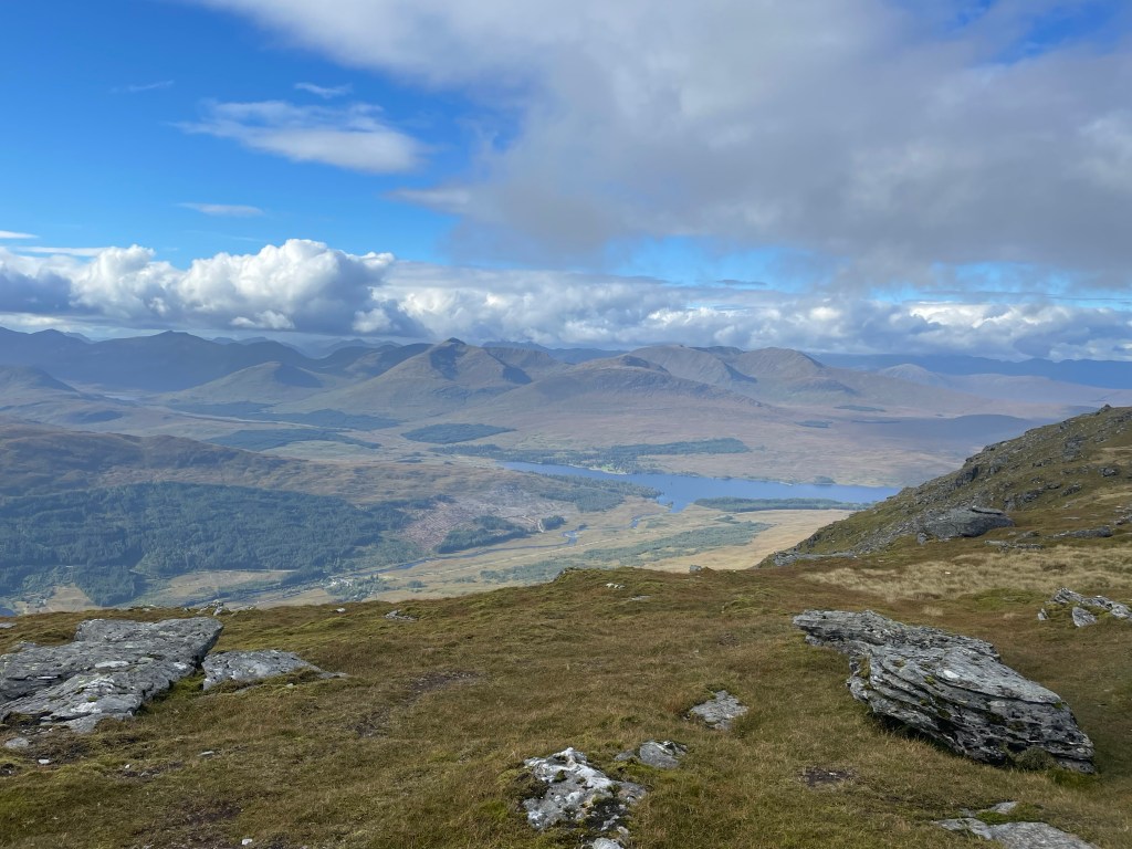
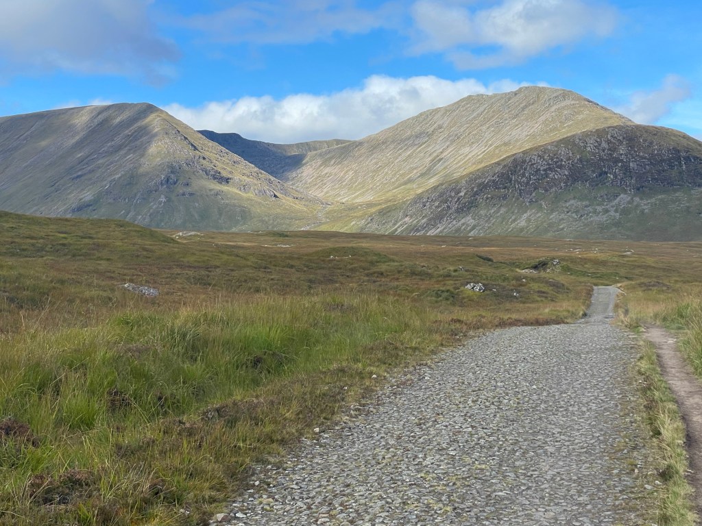
My goal today was to head to the Sheilin of Mark Bothy and assess if I would stay or move on. First up though was an up and over the hills to get back to my original route. That said I realized i was going to finally come close to a munro (mountain) so I diverged off and decided to walk up to the top of Lochnagar.
Since it was a little wet last night (no real rain, just dew and such) I went ahead and laid out my Durston fly and inner, and my tyvek ground cloth, and then set off for the last 100 yards to the summit.
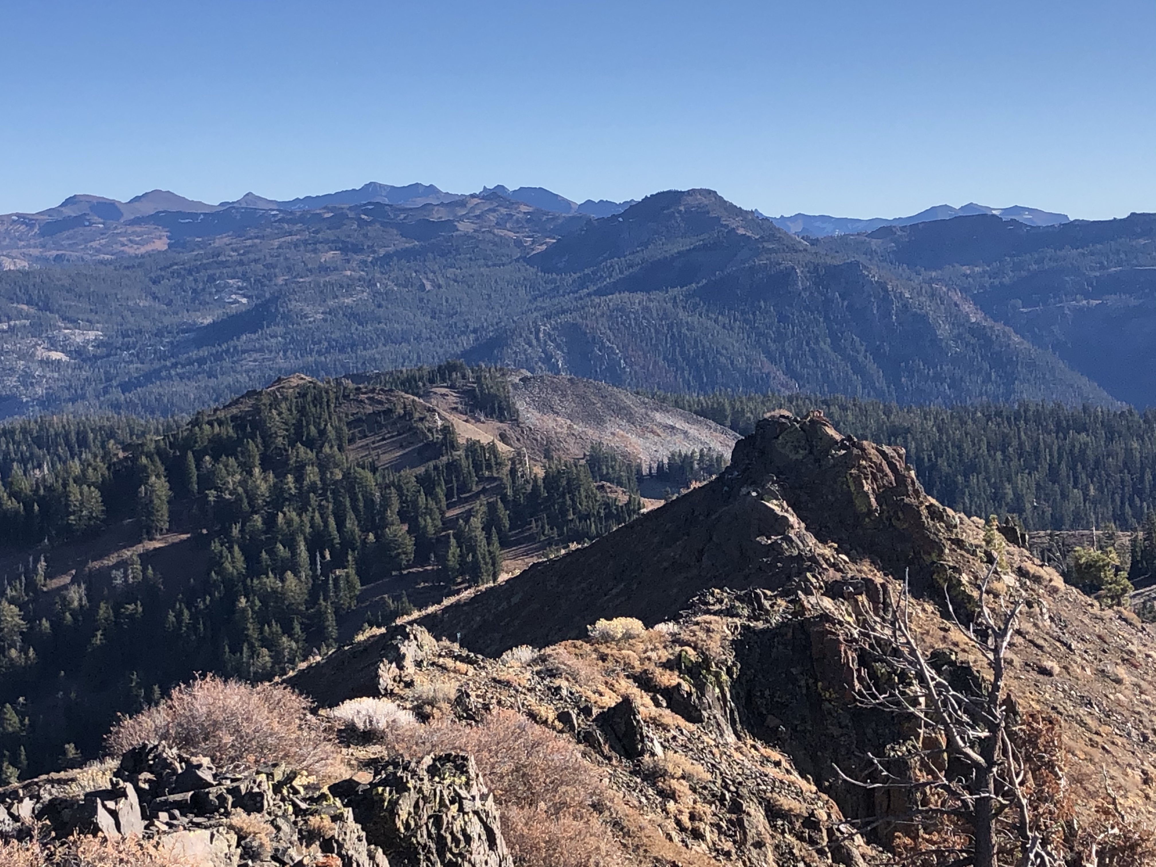
As usual the Scottish hills deliver yet another amazing set of views, 360 degrees in all directions and for miles. This is one of the reasons why I love being above the treeline (okay to be fair, Queen Vic cut out all the trees to fuel the industrial revolution). That said though while the view to the sea was blocked by the next range, I could see 50-60 miles in every direction. In true typical UK form though the trail off the summit was DOWN..and I mean DOWN. Switchbacks? Never heard of them. At the bottom of the route over Lochnagar I met up with what was my original route, and I was walking into the Balmoral Forest.
I ended up bumping into Rob and Graeme, and we continued together East to the Sheilin of Mark Bothy. By the time we got there the bothy was full, and a pretty good sized tent city was building up. I also knew this was my last night “in the mountains” as it were. After a few nights of very social camping, I wanted some “me” time, so after filling up ALL my water containers I pushed on.
The path from the bothy to Muckle Cairn was known to be a bog without a trail that was about a mile long to the forest roads. Another key factor was if the bog was wet, I would rather finish with wet feet than start with wet feet. Once I made the ridge with Muckle Cairn and with how clear it was (and there being NO rain in the forecast tonight) I decided to camp on top. It was actually cool because I was able to see the bothy I had left behind, and the tent city below. Oh and it was amazingly and eerily quiet.


Day 13: to Edzell (another reroute day)

My viewpoint on Muckle Cairn, looking back towards the Sheilin of Mark bothy gave me a fun perspective. As the morning moved along, and I was grabbing breakie and coffee I was watching the tent city below disappear one by one. The objective today was through Tarfside, and onto a high-ish spot somewhere above the village of Fettercairn. The weather had other things in mind.
The walk down from Muckle Cairn was an old “land rover road” (or maybe Rover road). I saw it referenced both ways. The drop down into the valley passed two bothy’s, both of which would have been good places to stay. From my perspective the one at the bottom of the hill had the most idyllic setting. Both are on the Lee Plantation.
At the bottom of the hill the path follows the Water of Lee. and begins to enter back into some semblance of civilization. At Tarfside the local Elks Club(?) puts on lunch at the Chapel on the west side of town. If you do decide to camp there the hosts put on a BBQ for the campers. I stopped in, filled up the water and moved on. While there one of the TGO challenge folks was warning us the weather was about to turn a bit rough, so I was starting to reconsider my route options. I had heard a few folks talking about the town of Edzell as their next destination. It took me a few extra miles to get to some cell service, and it looked like my only real option was walking along a B road. As I was spying my route off in the distance, and as the TGO folks warned, the clouds were building and turning ugly, so with that in mind, I jumped down to the B road, and booked a room at a place in Edzell and started to put the hammer down to walk that way.
Like day two, around 1800 hunger was yelling at me. So I found a space on the side of the road to make some dinner about 6 miles out. I ended up rolling into Edzell at 2030, just in time to get a beer in the restaurant and meet up with some other challengers. It turns out one of those folks was also a Summits on the Air person. Funny that was now the 2nd SOTA peep I had bumped into totally accidentally while on this walk. All in all with re-route i ended up doing a 23 mile day, about half and half dirt vs pavement.
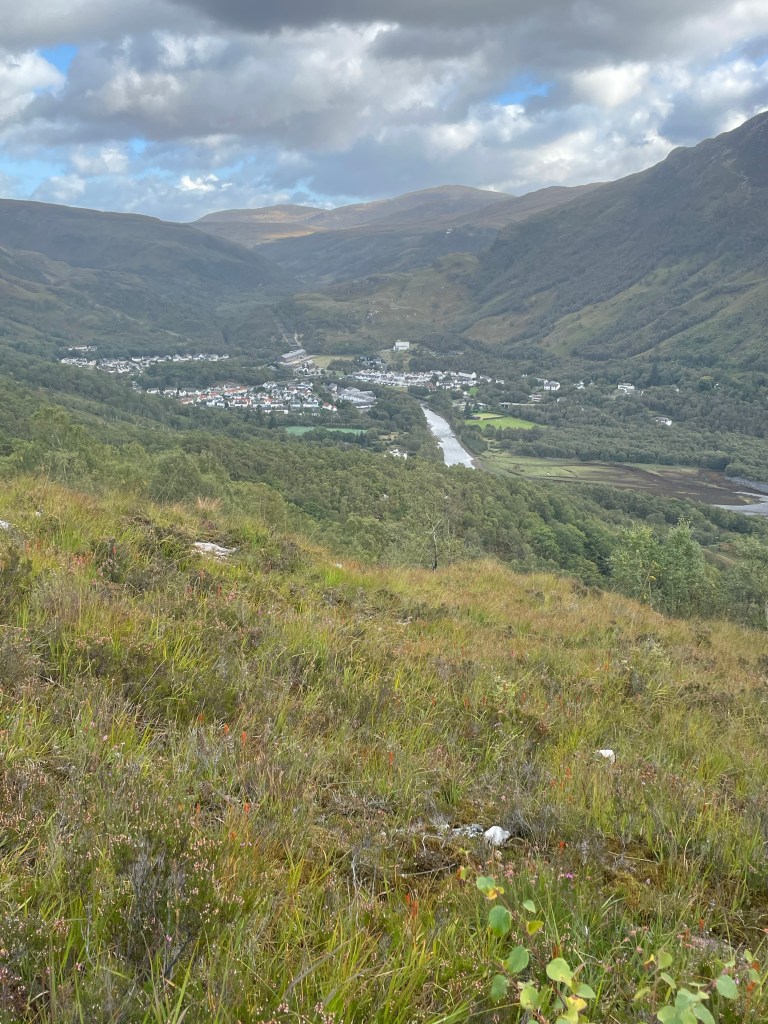
Day 14: To the Sea, Montrose:
And here we go, the final day, ALL pavement. I knew some rain was in the forecast, and my goal was to try and beat the rain to the coast. Yah failed miserably, but I needed the shower anyway. The bridge on the South side of town was out, so we had to do a little backtracking. Once on the move it was a straight shot along a bunch of B roads, no real elevation gain/loss and the views today were mostly pasture lands. The fields were a great mix of green with yellow (rapeseed), and the usual cow and sheep pastures. Sure enough the weather forecast was on point, and about 2 miles from Montrose the weather opened up on me. As I noted though it was all good, as I needed a shower and my pants had not seen a washing machine in 2 weeks.


Conclusion:
Would I do this again? Oh heck yeah. This was an amazing experience overall. The logistics of planning a legitimate route, learning a new mapping service (OSMaps), and figuring out some of those Scottish Place names was a fun challenge. It might be a couple of years before I do my next one, but I really want to build a path with at least 7 munros on my path. The camaraderie and shared experience with the other walkers, that whole tramily thing. Just like in the US though, each tramily for each trail has its own culture, and that is true for the TGO.
Thanks for the read, and catch you on the next saunter!


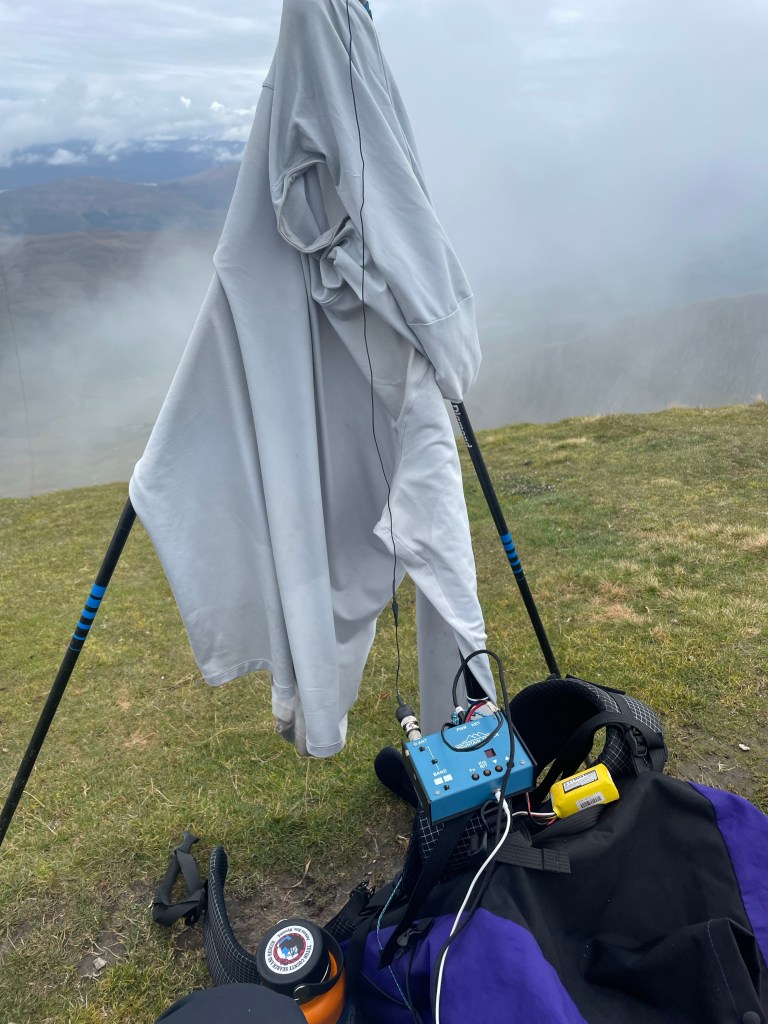


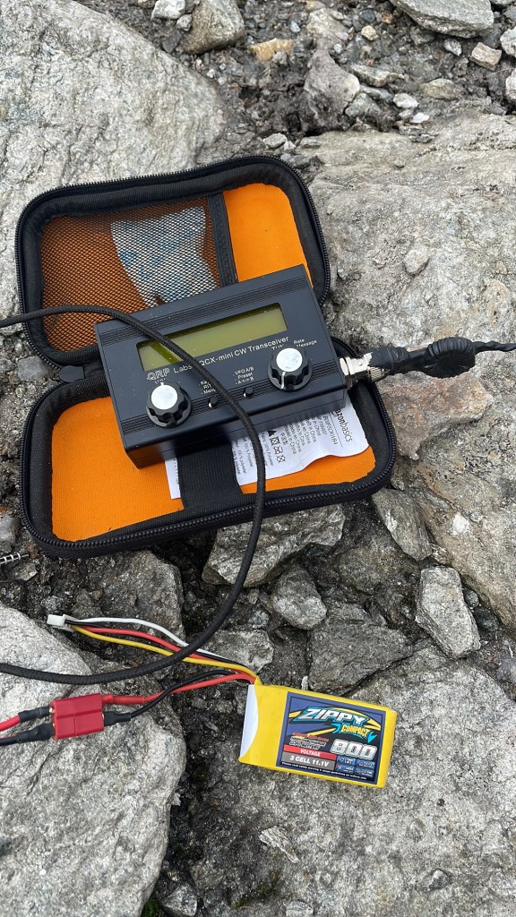


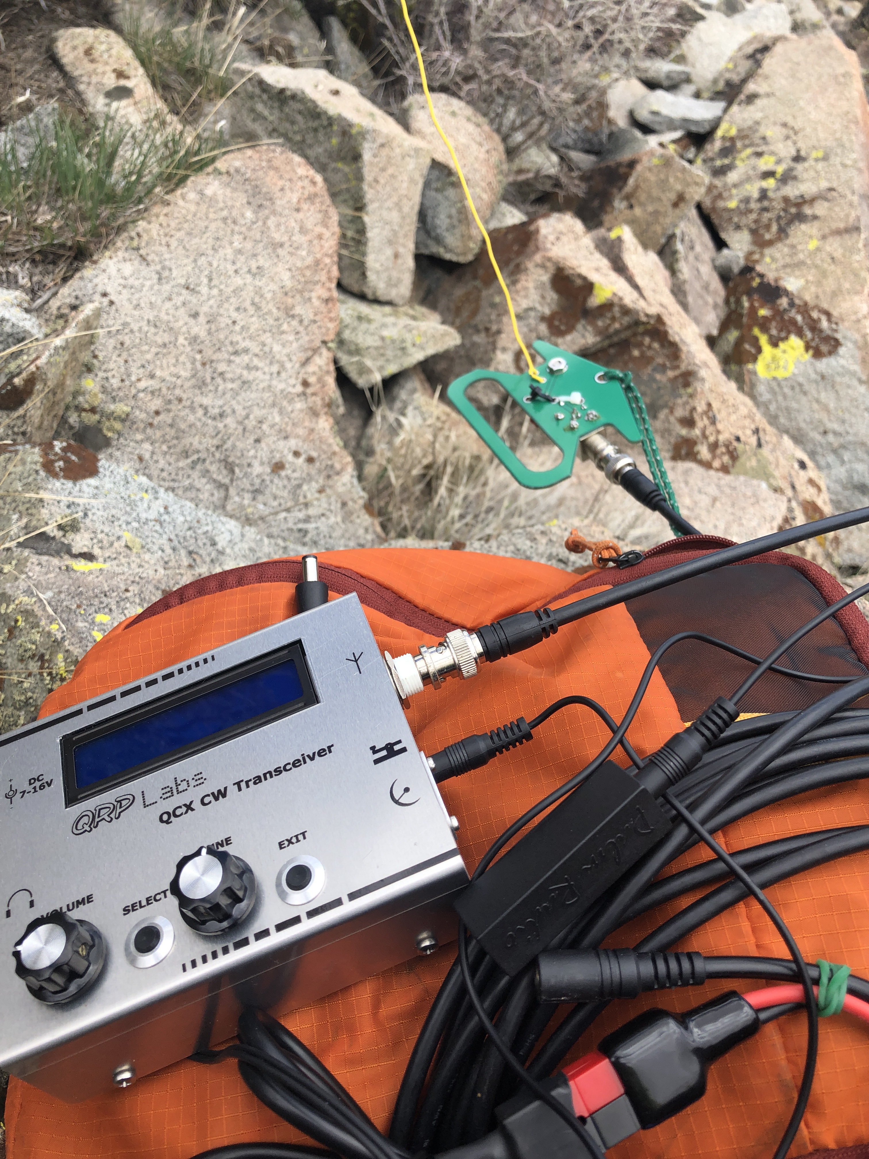 I have chased a few folks with the QCX from the QTH, but now it was finally time to use the QCX as my activation rig. It was on Easter Sunday and on a day that 30m propagation was not great and I was not on summit till noon. SotaWatch showed that I was the first spot in over two hours. I managed seven QSO over 25 minutes and then my battery decided it was time to shut off for recharge (oops..been testing a lot, forgot to check levels). Either way it was a successful activation on a unique summit. Full disclosure it was also the first time I have done an activation without using the decoder, and I managed to get a good copy on all those who called me whom I could hear, so I am getting better there too. Contacts included: AG6VA, K0RS, KR7RK, W7USA, WA9STI, W7GA and K7RJ. According to RBN I was reaching the VE6WZ beacon up in Calgary, approximately 700 miles. Last time I checked, I was putting out 2watts of power, but that was before I really tuned my EFHW. On the approach drive in *4×4 road* I managed to make it to within a mile of the summit, but overall this is a drive up summit. Either way, b/c I am in run training, the 1 mile 400 foot elevation just helps with the training, and I do my best thinking when I’m walking (more on that below). Those structures you see on the summit proper are from past deployments I think, all the radio towers, cell towers, and TV towers have been moved to other nearby peaks, overall (at least on 30m) this was an RF quiet peak.
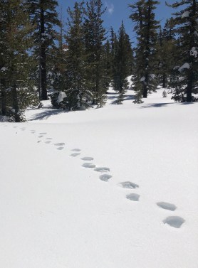 Even in the winter roads and trails still look obvious so navigating was pretty easy. When I reached the top of Tunnel Creek trail/the Saddle I opted to stay along the ridge instead of dropping down to Twin Lakes. So it was spring time, and not sure why I’d not considered this in my planning, but, I was starting to notice more and more bear tracks going between trees.


