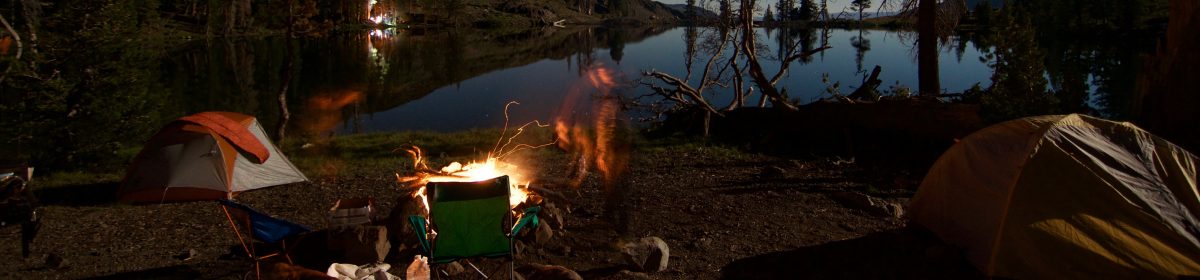
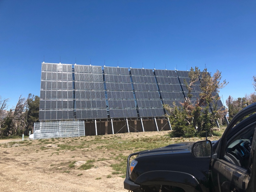
 After spending all day on SAR duty Saturday, it was time to do some SOTA on Sunday, but I wanted to be in range of the basin if a SAR did break out. I goto the Burnside area a lot for camping and was thinking that since both peaks are near drive up i would see if I could snag em both in a single day.. Reality was I woke up Sunday morning without that as a plan, and just decided over breakfast to get after it. I had tried to drive up to Hawkins back in May to do a “sleep on top and activate overnight” activation, but the road was still blocked by snow, and the winds picked up with some sort of incoming weather so I had to bail on that idea. Similar with Pickett’s I’d hiked up from the gate at Pickett’s junction to scout the road, and since I had Lola (my pup) with me, I did not want her on that rock as it would tear up her pads etc.. This was a pretty straight forward activation though. Drive out Burnside road grab the road that goes up Hawkins, park past the solar station and walk up the 15 minutes it takes to get to the summit. Another option that is probably faster is before the road loops around on the north side, there is a pull out/sort of road on the right that goes straight up. I am thinking that might save a few minutes on approach. Regardless see my notes below about doing a 2-fer here so you wont even be on this road ;-). About the time I was realizing I left my cell phone in the truck was about the time I was topping out. Oh well, I had my HT with me, APRS ftw yet again! (just no summit pics).
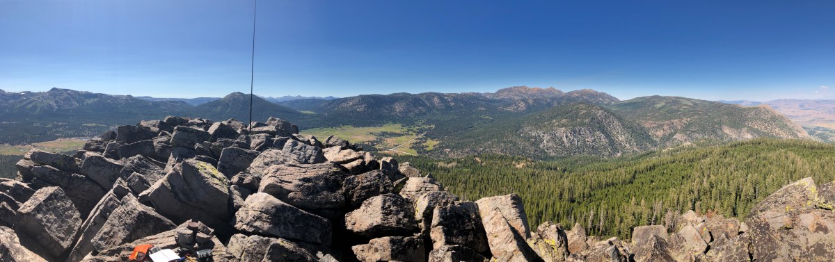
So once on top there is a large-ish flat area that is away from the antenna installation that sits on top. This almost looks like it could be a heli-pad if a helicopter needed to bring stuff in. I setup my vertical there and ripped thru the activation pretty quick. In 20 minutes I had 14 contacts between 20 ssb, and 30 cw. 20m was real strange today, folks that would normally be reachable on 40 were giving me 59 on 20 (Oregon as an example) while others that I would normally get in the midwest were giving me 33 etc. While tearing down I took this time to look over the landscape to see if there was a better way to get to Pickett’s that did not involve driving all the way down, almost all the way out, and up Pickett’s Peak road which I remembered being a bit more rough then the NFS road up to Hawkins peak.
| Time | Call | Band | Mode | Notes |
|---|---|---|---|---|
| 18:44z | N1GB | 14MHz | SSB | s53, r52 |
| 18:44z | W0MNA | 14MHz | SSB | S53, R33 |
| 18:45z | ND0C | 14MHz | SSB | S55, R33 |
| 18:47z | W0ERI | 14MHz | SSB | S55, R55 |
| 18:48z | N6DNM | 14MHz | SSB | S53 R55 |
| 18:49z | N0TA | 14MHz | SSB | S55, S2S W0C/FR-179 |
| 18:50z | NS7P | 14MHz | SSB | S57 R44 |
| 18:51z | W7TAO | 14MHz | SSB | S55, R44 |
| 18:53z | KE0HNW | 14MHz | SSB | S2S, W0C/SJ-026, S57, R33 |
| 19:02z | K6HPX | 10MHz | CW | 55N, 52N |
| 19:03z | K6EL | 10MHz | CW | 599, 55N |
| 19:04z | NQ7R | 10MHz | CW | 55N, 5NN |
| 19:05z | KB7HH | 10MHz | CW | 55N, 55N |
| 19:07z | K0MT | 10MHz | CW | 55N 55N |
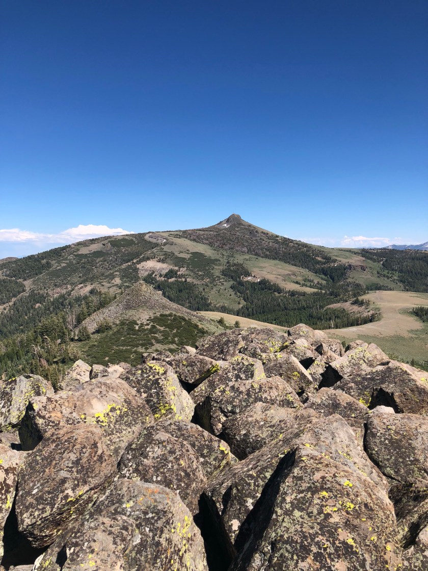
 It took me about an hour to drive around and up to an area that could access Pickett’s peak. I ended up with about a 30 minute bushwhack, so not that bad. It sounded like a SAR was about to break out so I made it to a flat spot in the AZ, and setup and started my activation on 20ssb. The SAR worked itself out, and I opted to relocate onto the summit proper. (this explains the break in QSO times in the chart below). I ended up with 10 contacts between 20 and 17 ssb, and 30 cw. I was not getting any responses on 40 hear either. 17m seemed to give me the longest QSO of the day.
| Time | Call | Band | Mode | Notes |
|---|---|---|---|---|
| 21:30z | WW7D | 14MHz | SSB | 59, 57 |
| 21:34z | K5RHD | 14MHz | SSB | s53, r32 |
| 21:35z | K7MK | 14MHz | SSB | s55, r55QSB, ID |
| 21:36z | K6HPX | 14MHz | SSB | 52, 51 |
| 22:15z | K6MW | 14MHz | SSB | s59, s59 |
| 22:20z | WW7D | 14MHz | SSB | S2S, W7W/cw-074 |
| 22:26z | NS7P | 10MHz | CW | 55n, 55n |
| 22:47z | VE6CC | 18MHz | SSB | 53, 44, Calgary |
| 22:48z | KD0YOB | 18MHz | SSB | S2S, W0C/PR-090 |
| 22:49z | W7MSX | 18MHz | SSB | s57, r57 |
I had no intention of doing any S2S (because my chaser and activator points are about even), but I still got hit up 5 times. I have a loose goal to make Shack Sloth and Mountain Goat on the same activation if possible. I always welcome S2S though!
From both peaks, AT&T Cell service is there but spotty because you can see down into Carson Valley/Minden/Gardnerville. There is a Verizon tower on the antenna structure on Hawkins so that should serve those folks well.
So enough about the activation, this is just a suggestion, and I included it on the SOTA page for both peaks as a way to just drive up to a high point in between and access both summits with not that much hiking and less pain on your vehicle’s suspension.
At Pickett’s Junction drive in on Burnside road about 4 miles to NFS road 31019B. Follow that road up to a flat area that has both Picketts and Hawkins peak visible. When I look at maps and sat imagery, it almost seems like this road should connect to Picketts peak road somehow, but I could not figure it out after my activations. Once you park just figure out which order you want to hike them. Picketts is closer to this saddle then Hawkins is. I am guestimating 1.5 to 2 miles to Hawkins, and maybe 30 minutes from car to the top of Picketts.
Thanks for stopping by, de N6JFD 73
