So WAY back in 2019 I had planned to hike the West Highland Way in spring of 2020 and sprinkle in some Summits on the Air as well. I think we know what happened to that though. Since I was working a pretty good job at the time I had booked a a combination of some wild camping and pretty posh stays, and at the beginning of pandemic all but one of those places had agreed to refund the bookings. The Bridge of Orchy hotel was the one place that would not do a full refund and 2022 was the last year they were willing to push the stay back (kind of a “use it or lose it” thing). So with that in mind I put a date kind of in the middle of the end of September and took my original plan to build forward and backwards.
For those that do not know the WHW is about 100 miles long starts in the suburbs of Glasgow, walks north along Loch Lomond and then heads up into the Scottish Highlands, most people take 5-7 days to do, and if I were just doing the trail that would have been a fair assessment for me too, but I was also bagging munros to play radio. So my plan called for about 11-12 days (12 days if I had opted for a side trip up into the Mamores range to circle around and come across the CMD Arete to finish on Ben Nevis before descending into Fort William.

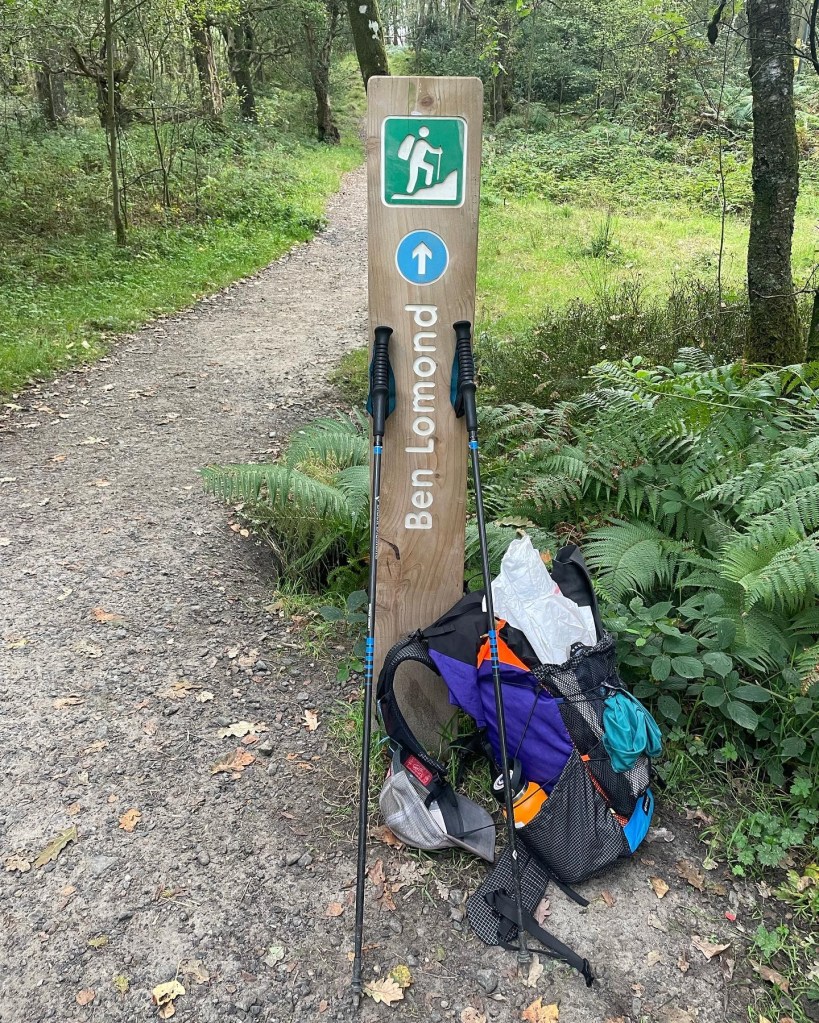
Day 1: Milngavie to Drymen (Camping): 17 – Sept

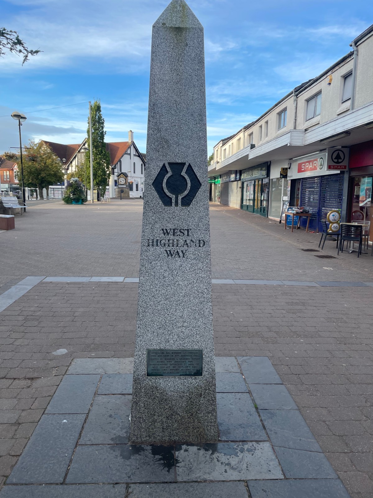
Woke up at the Hostel in Glasgow and hit the train early. I needed to be at the train station in Milngavie (pronounced “Mull-Guy”) to leave my extra clothes/luggage with AMS. They were going to hold and deliver to Fort William on the 28th. Once that was all sorted, I worked my way to the marker that is the start of the WHW. There were already a few groups of people amassing the area as they were getting their pictures in front of the obelisk. I grabbed some breakfast, and a last coffee at the nearby Costa, and hit the trail.

Walking the first bit is sort of urban, but is not unlike some walking I had recently done in Wales. It is quiet, it is a nice urban path, but in the trees and quiet none-the-less. Keep in mind, this was the suburbs of Glasgow and not in the city centre, so that did help with the quiet factor. You experience what you might normally see at a local town park, the trail runners, the dog walkers (lots of fun dogs to say hello to this morning) and the occasional mountain biker. This is definitely the beginning of the hike though, everyone is clean, everyone is fresh and ready to hit the trail. Within an hour though you are finally getting out of town, and starting to get into some of the more rural areas. Once you get out of town, you really start to experience some strange and interesting stuff, here was a lost hiker that never seemed to get past this one location.
About an hour before Glengoyne (more on that later) I came across a familar name, the “John Muir Way”. Wow so I have now walked the entire John Muir in California, parts of it in Tennessee and now parts of it in Scotland. Even cooler that the West Highland way is considered part of the “International Appalachian Trail”.
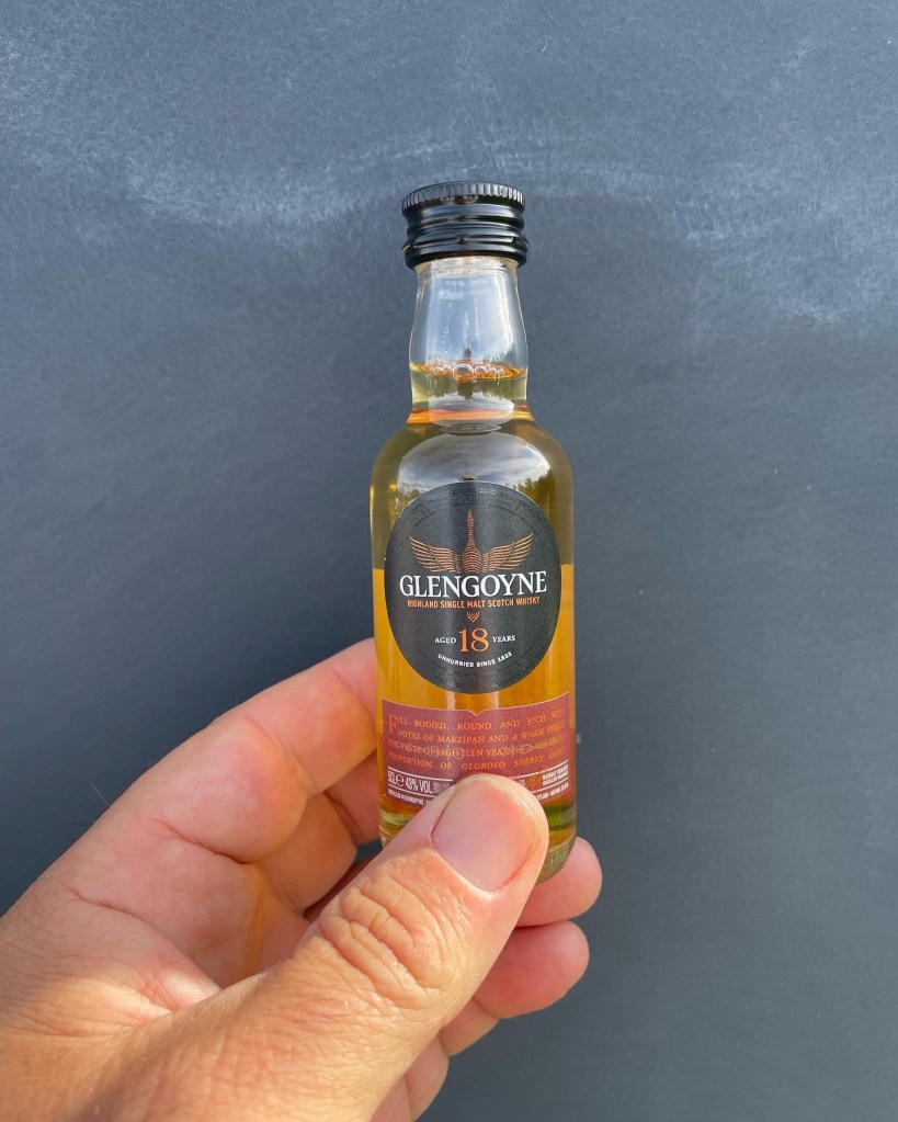
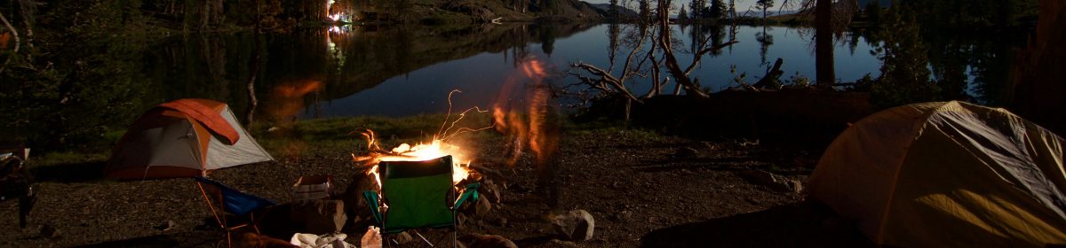
A few hours out of town I made it to a distillery that is just off the Way called “Glengoyne”. Keep in mind I knew this distillery was there, and I have been there before, so I headed on up because it was time to refill the water bottle with some of their natural spring water and I wanted to pick up a little nippy bottle for the end of the trail. I scored this 7.5cl of 18yo scotch, found a good place to carry it so it would not break and headed on. A bit further I started to find some of the honesty boxes, this is the one part of the trail where cash is still required. So far tap and pay (thank you Covid?) has done well, but those honesty boxes do need some cash. Good news is I did bring some along because an Ice Cream was definitely sounding good at this time of the day. The last couple of miles of day one was along a roadway. It was kind of funny as I was swallowed up by a large guided group of folks who were doing the full luggage transfer, carry a light day pack of snacks and water method. Nothing wrong with that, but this groups’ guides had definitely let the group get VERY spread out. As I was walking into the driveway for Drymen Camping one of those hikers thought I was her guide and asked me “how much further till we stop for lunch, I’m tired and hungry”. Well funny enough I had been listening to their guides a while back saying they were going to do lunch up in Drymen. “Oh well I am stopping here but it sounds like ya’ll are eating lunch about a miile further up the road”. It sounds like that group was doing a full 20 miler all the way to Balmaha for day one. Ouch, I was perfectly happy doing my 12-13 miles and just strolling into a relaxing evening camping.
Drymen camping was a nice place, the gentleman (family?) that runs the place had expanded to support larger tents as a result of Covid so on top of the small spots (which was a bunch of us in 1 and 2p tents) up above were some of the big 6-8 people tents as well as some campervans and overland rigs. I do respect the love of campervanning (#vanlife in the US) that the UK folks do. Something I would experience a lot over the days to come.
Day 2: Drymen over Conic Hill to Rowardennan 18-Sept
I wanted an early start because today was going to be a SOTA day with my first taste of combining some decent miles, a hill climb AND an activation. I was also looking forward to finally breaking in my new SotaBeams carbon 6. After having some almost not-activations in Wales I reached out to SotaBeams when in Keswick to get a Carbon 6 ordered and delivered to Glasgow before hitting the walk. I pounded some breakfast (while there are very few bag/dehydrated meals I like in the US, I really became a fan of Adventure Food’s breakfast and veggie meals. Their Knusper Meusli is probably my favorite breakfast and you can have it warm or hot. Anyway I was on the trail I think before most people were even up, but I wanted to be on top of Conic Hill by 10am for my activation to ensure I had time to get down to Balmaha for lunch and make the Rowardennan Youth Hostel with plenty of time to chill that evening.
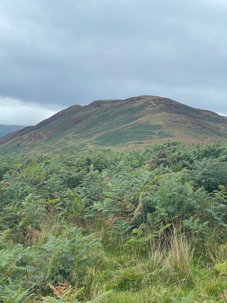
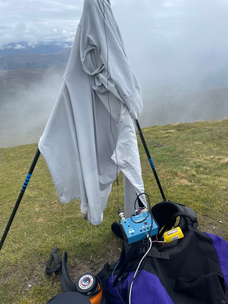
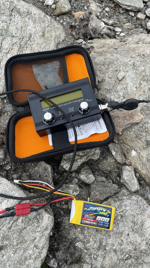
Once I got past Drymen and was getting further into the Trossachs, the environment around me was really starting to change and turn more green. Plus I was staring to get into some easy climbing. That said I was also encountering more sheep/cow/range lands. Plenty of forest lands were encountered too. The final push up Conic Hill was not as hard as I was thinking, but the walking in Wales and the Lakes did have me ready for almost anything :D. At first I was thinking I could just run this activation on 2m, but I really wanted to break in my new mast, so I broke out the MTR2 (Thank you N6IZ, another story for another time, but I normally use an MTR3b_LCD) and setup in a way to not interfere with the ever grown crowds on the summit. I even drew the interest of some drone pilots who were not sure what was going on with my wire and tall mast.
After an hour I managed 13 contacts between 2m, 20m and 40m, but was ready to head down into Balmaha as it was getting crowded on top.
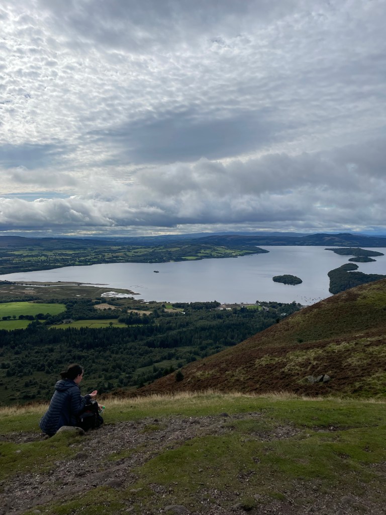
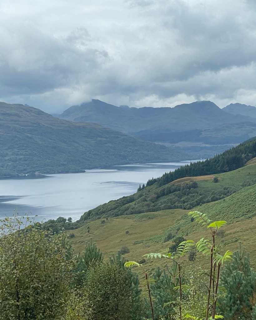
The walk to Rowardennan was pretty uneventful, still playing with both an (sub)urban interface, and getting into the hills while also walking along the Southern end of Loch Lomond. I swear though that it smelled very sea like at this end of the Loch.
So once at the Rowardennan area I do want to make a comment about “The Clansmen”. As a walker you want to get there no later than 6pm. They only want to cater to the clients in the hotel they are attached to. I was able to get in and get some food there, and there was a nice view for sunset, but yah get their early, call ahead or just know that the Youth Hostel (if that is where you are staying ) does serve dinner, or just be ready to have your own food. I was not ready to break into my other camp meals yet so I opted for an early dinner at the Clansmen. The views from the Youth Hostel are quite nice as well!

Day 3: Ben Lomond (SOTA day) 19-Sept
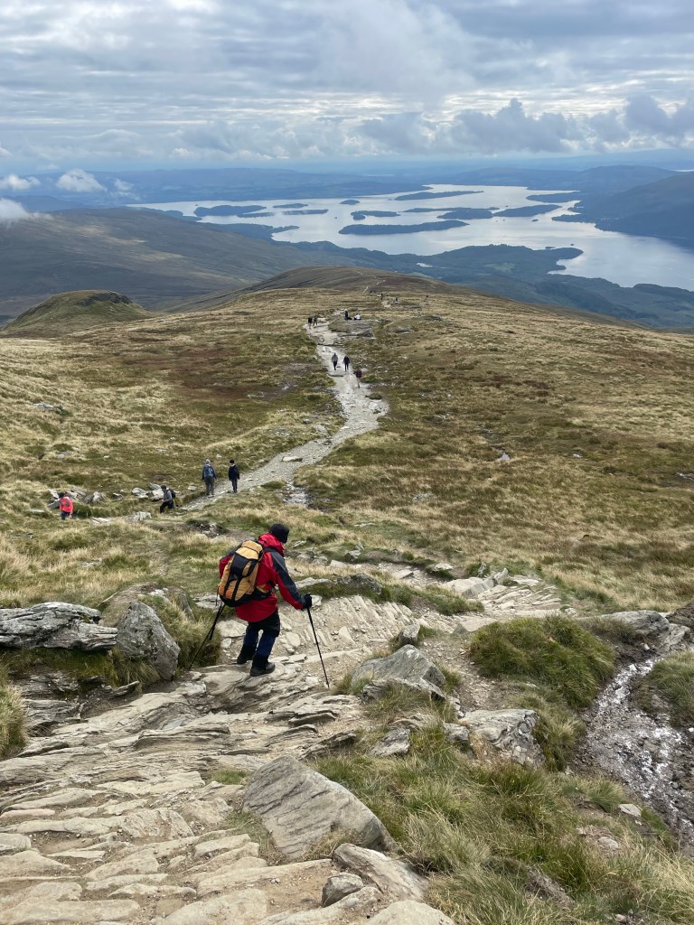
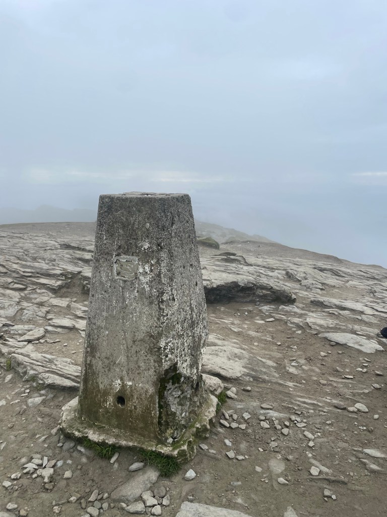
So, this could technically be considered a “zero day” since I was not moving forward, however I was doing a day dedicated to just SOTA. Today my goal was Ben Lomond. Another early start was the plan, had a decent breakfast at the YHA and then headed back the 1/2 mile to the trailhead for Ben Lomond. Walking up was a bit of a dreary morning, not that crazy “Scotland rain” I had heard so much about, but dreary none-the-less. Not that I could see them the crowds ahead of me, but once I made it above treeline, the fog was making the visibility “shite”, and I could tell there was a decent amount of folks ont he trail ahead of me. This was my first (second actually) taste of Scottish munro walking; lots of stone steps, straight up, no meandering, just pitter patter, lets get at ‘er. I went ahead and setup just off the summit area, but still at the top block (something that would be a mistake as the day went on). This was another very successful activation though netting 29 contacts on 20/40 on the MTR2 and I even broke out the QCX mini (17m) for a few contacts including one VE (North American) QSO. It was worth it do the extra band for sure. As I went past noon, I noticed the crowd on the summit was actually quite big AND the winds were threatening to knock my makeshift mast supports down, so after 90 minutes of activation time I decommissioned the setup and walked back down the hill. Oh btw, did I mention today was the day of the Queen’s funeral? It was a bank holiday for everyone in the UK, so as a result all the non-royalists(?) from the area decided okay, lets go walk a hill. I was definitely swimming downstream as a million of my not-so-closest friends were heading up to the summit. All in all a great “zero-day” to do some Summits on the Air and get some hill walking in as the day did turn out to be quite sunny and enjoyable.
That evening at dinner I ended up eating with a couple of gentlemen who were also staying in my bunk room at the YH, Roy and his brother Tom from the Bay Area (California). They were both retired and were off on one of their annual adventures together. It was an fun/odd mix because while I was having some big days here and there my zero days would allow the three of us to keep bumping into each other as time went on.
Day 4: Rowardennan to Crianlarich: 20-Sept
Day four was going to be my biggest day of the trip and I was a little nervous. To be fair I did have a strange 18 mile day in Wales but today was going to be a 20+ mile day overall.
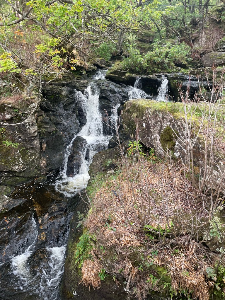
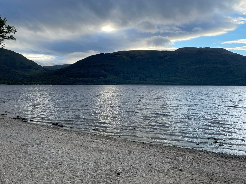
Hit up one last breakfast at the YH and then hit the trail. There is a side trail that takes you directly up from the hostel to the WHW, so no real backtracking. The walk here up until the Inversnaid Hotel is along Loch Lomond, and is quite pretty. I was unable to get a good picture of the Inversnaid falls, but it is pretty impressive. that I can say. It is worth it to grab a snack (second breakfast) and top off your water because from here the fun really begins. Note that shortly after the Inversnaid hotel you have an option; a high route and a low route. The high route is pretty much a doubletrack forest road. The low route (so I have read and was told by folks) is this crazy almost rock climbing up and down affair that runs along Loch Lomond. As noted I had read how rough it was so I, and this other couple I bumped into decided to take the high route. The high route reminded me a lot of walking through some of the coastal areas of Oregon, very rainforest like. The trail does drop to lake level the last few miles of Loch Lomond and it in some ways reminded me of the West Coast Trail up in British Columbia. Off camber ladders, crazy bridges, and some rock scrambling. I made it to Beinglas farm around 2pm and was not really wanting to wait for them to open up at 3pm, so I opted to head on. I had read earlier in the day while walking that Beinglas’ lease was not being renewed next year so what seems to have been a staple for campers and hikers wanting a mid day treat was probably going to be no more (or at least a new/different form) in the years to come. Beware the Willy Wonky Hobbit tunnel that goes under the ScotRail line. It starts out okay for average height folks, but starts to get shorter in the middle and by the end you are bear/crab/crouch/duck walking to get to the end :D. From here on out the trail runs through a farm land with plenty of sheep, but looks East over the valley that is past Crianlarich. I had booked the YHA in Crianlarich (I really do like the YH’s) but this one I can tell was not going to meet the standards that Rowardennan had set.. The room was nice enough but there was mold on the ceiling, and they were starting to run short on things. The Rod and Reel restaurant is really good, I ate there both nights and enjoyed both meals, even had the Steak Pie on the second night (I’m normally a vegetarian but lets just say that the food in EU is so much better than the US that meat made it’s way back into my diet :D).
Day 5: Ben More and Stob Binnein
So, I am just going to set this out now and say this is maybe the 3rd hardest day of hiking ever and my second hardest SOTA day ever. Mt Dubois (W6/WH-001) will probably always be my hardest SOTA day but this day was a very close second. My round trip mileage from Crianlarich was just shy of 13 miles. Four miles was the walk to/from the Ben More Trailhead and Crianlarich.
Once you actually get to the Trailhead, that is when the real fun starts. (see below) The first 2000 feet of elevation gain is pretty much stone steps that are on a steep grade, steep enough that looking down the steps gave me a bit of vertigo. It was a typical weather day this day. The last 500 feet of elevation was in the clouds, and there was no visibility. Given the wonky weather (pretty windy and misty) I decided to go for a VHF only approach. I was also still far enough South that Glasgow was in reach. Both summits did qualify on VHF. The hike down the backside and then back up to Stob Binnein was more of the same, steep down and steep up. The REAL fun of this hike was for the downroute back to the road. No I did not go back over Ben More but followed the goat/sheep trail that is on the Western slope all the way down. The stairs would have been easier :D. The total down route from the col in the middle took me about as long as both up routes. Given the moldy ceilings on the YHA, once I did get back to town I marched straight to the Best Western and booked a nicer room for the night. However I did take advantage of the laundry at the YHA before pulling all my stuff out and relocating. Again another night at the Rod and Reel for some good beers and the Steak Pie I spoke about above.


Day 6: Crianlarich to Tyndrum
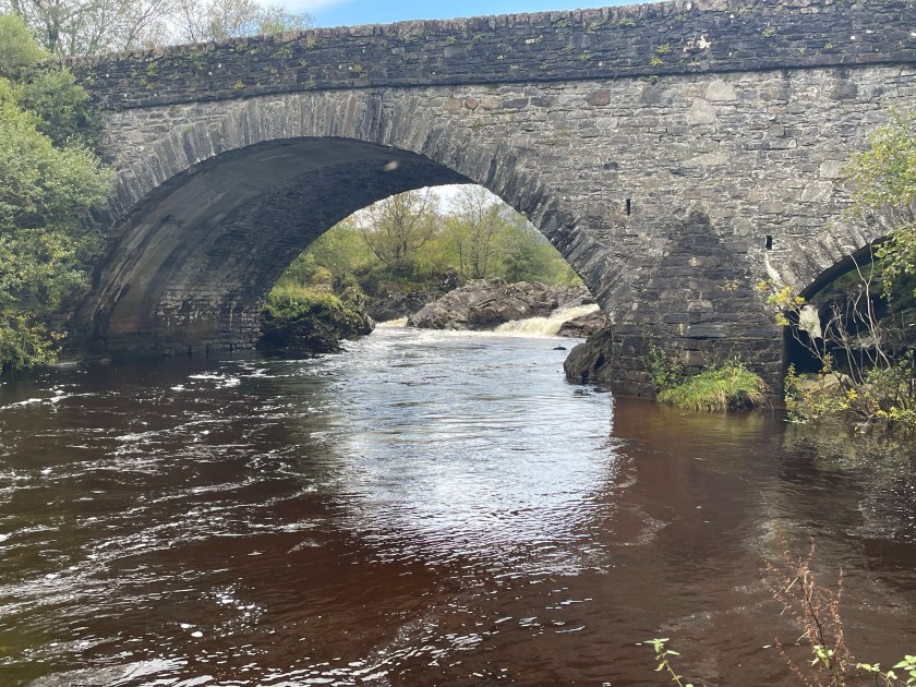
Today was supposed to be a walk to Tyndrum with a SOTA peak, but I was still pretty beat from the 20 mile day plus the 4600 feet 13 mile double SOTA day. Today was just a good 7 mile jaunt with a history lesson and some cool valleys along the way as we just start getting further into the Highlands. Once you make it Tyndrum the Green Welly is a great place to restock. I will note that Tyndrum is at some sort of crossroads as it is a pretty busy town. The walk in is pleasant enough as you walk along the stream (Crom Allt). Not that Tyndrum is anything more than a small town, but it is a slight contrast to the villages of the past few nights, as it was quite a busy town. There are a couple of big hotels, quite a few campgrounds and there is still the iconic/idyllic old world style inns too. There are a couple of wild camping spots between “By the Way” and crossing the A road that goes through Tyndrum. I took todays extra free time to snag a massage (she is reachable on WhatsApp), do a little restocking and just relax before pushing on the next leg of the trip.
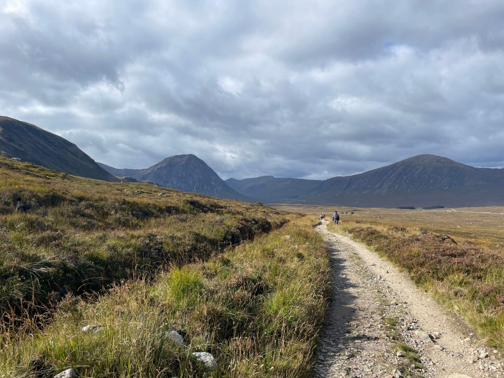
Day 7: Tyndrum to Bridge of Orchy and Beinn Dorain (Hike and SOTA day)
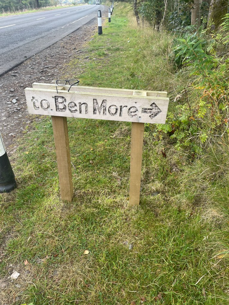
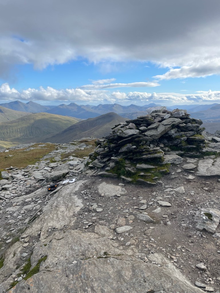
All rested up and ready to move on, I grab an early breakfast and hit the trail. Technically there are two options (depending on where you stay), walk right through town, or just head out towards the “By the Way” campsite and pickup the trail. Here the trail starts getting more remote and into the Highlands. The valleys are surrounded by larger hills. I was only going about 7 miles to Bridge of Orchy Hotel (the one that prompted me to run this trip this fall). So, you follow the A82 road a bit but then head out into farm country, and the scenery is beautiful at this rate. I cannot remember the name of the lodging along the way but right before the Kinglass River is a neat little camp site way out in the country. They have a store and depending on the time of day you walk through there second breakfast or lunch is an option. So I made the Hotel around 11am and took this opportunity to offload about half my weight to scale down to just what I needed for heading up and doing some SOTA. This was another one of those straight up trails, although I use the phrase “trail” loosely. Depending on how early you head up, or how late you want to stay up it is possible to get two activations. I went after Beinn Dorain but as noted given enough time (or the desire to come down later) then CS-025 would add about an hour of walking overall (plus the activaiton time). If I had stayed an extra day in Bridge of Orchy the two-fer would have been worth it.
The activation was going well, I qualified the with the MTR2 and some VHF action, but something was itching me to break out the QCX mini today. I netted 12 contacts just on the QCX mini over a 40 minute window including TM2SOTA. Most of the contacts were to the southern end of the EU continent including Spain, Italy and even Ukraine. I took my sweet time with the QCX since I was not going after the second summit. Overall a fun activation.


Day 8: Bridge of Orchy to Glencoe Mountain Resort 24-Sept
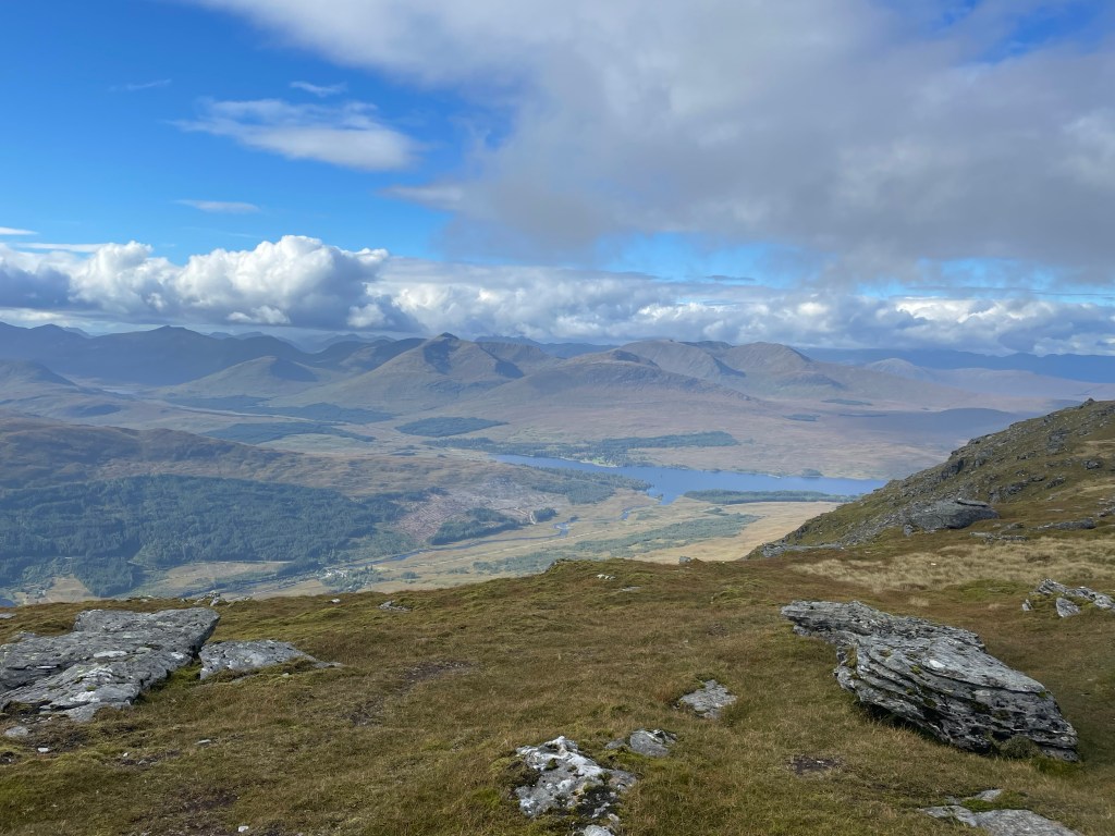
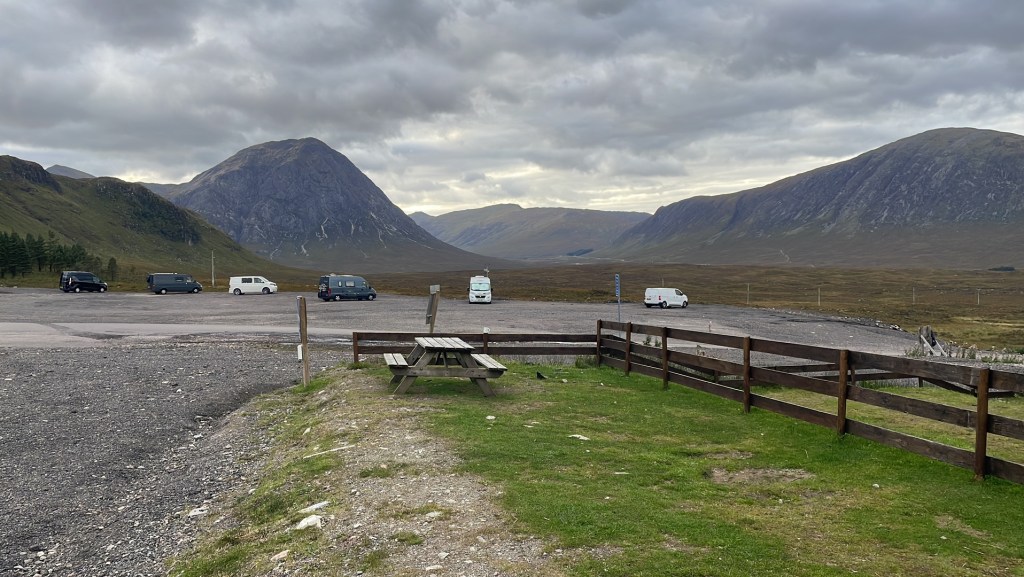
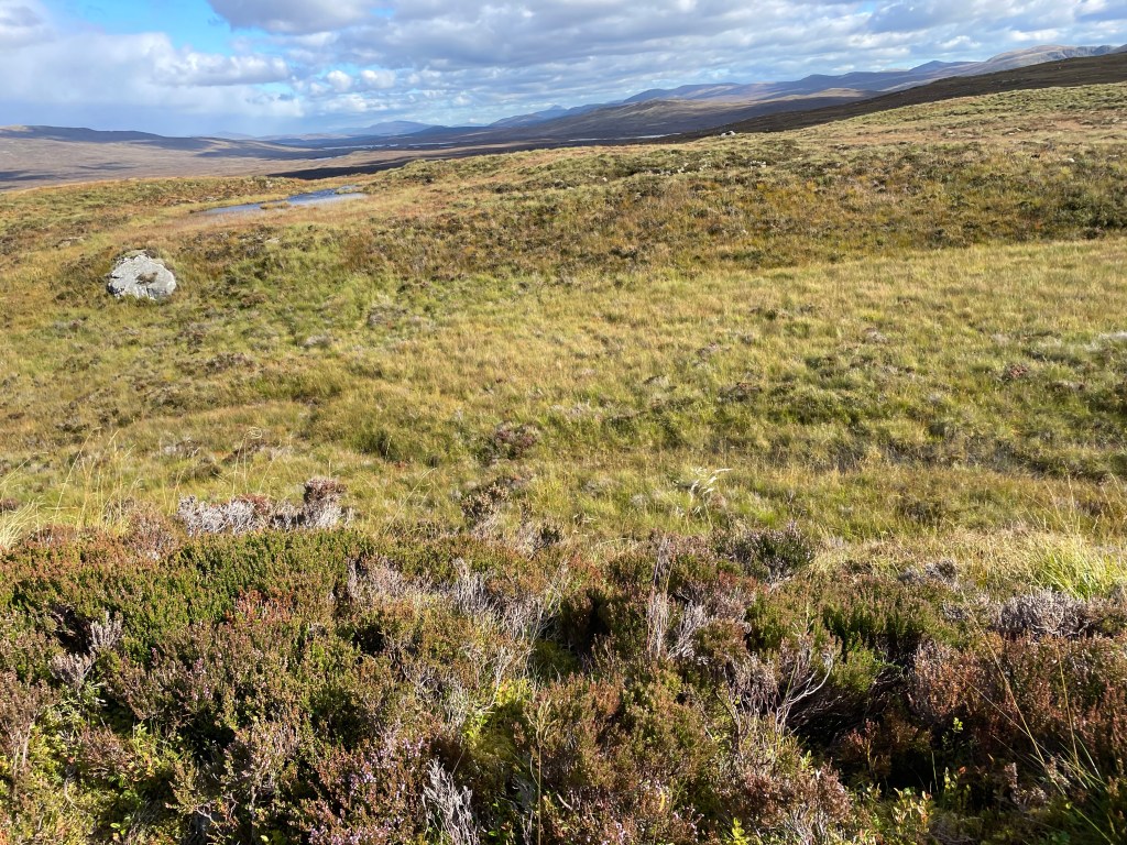
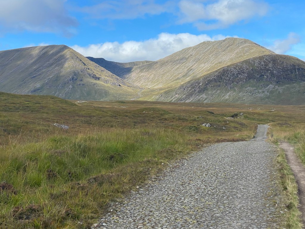
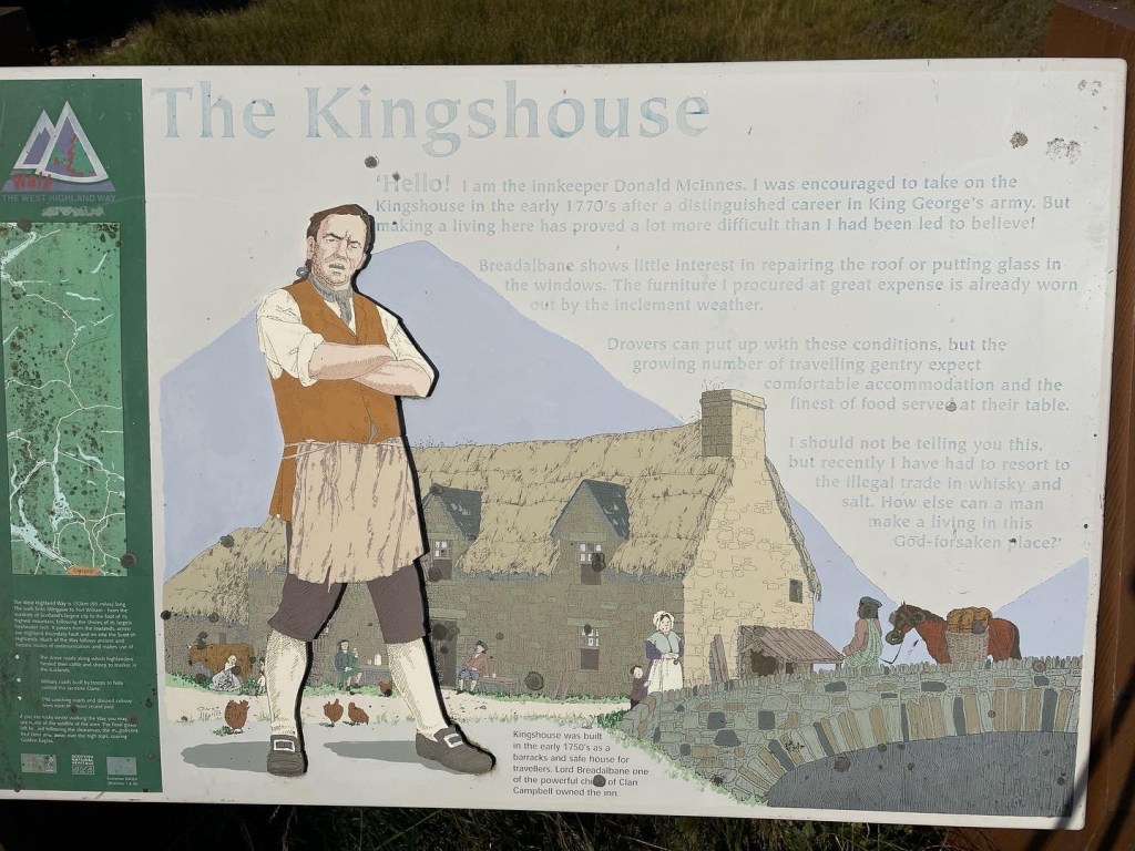
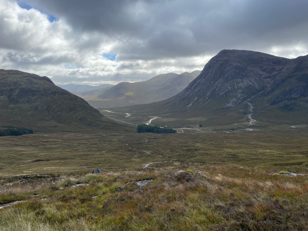
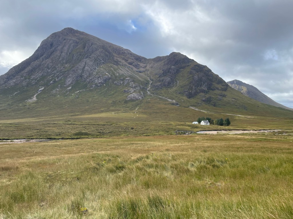
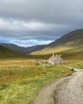
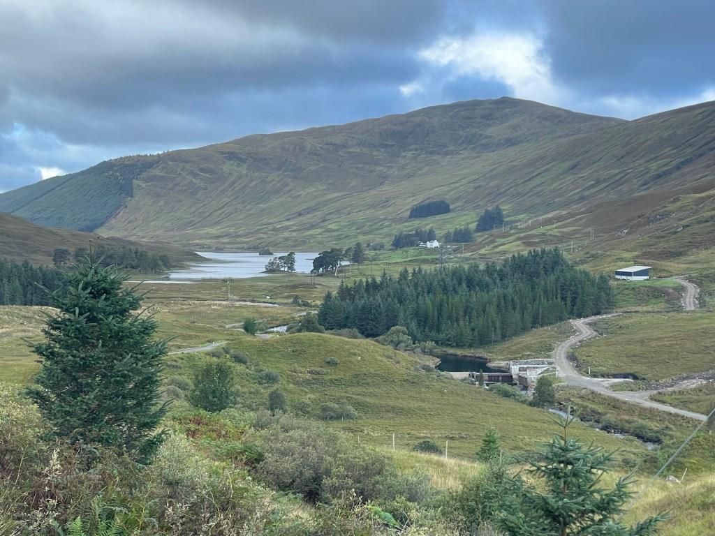
Another short day, only 11 miles and no SOTA. The point of today was to just get to Glencoe Mountain Resort which is across from Kingshouse Inn. Today was the first real autumal day of the year. The air was crisp, the temperature was pleasant, the sun was shining and there were some clouds in the area. A joyous breeze. Inveroran is just over the hill from Bridge of Orchy and offers a quick refreshment, a short ways along the country road and the Way heads over a bridge and heads up the old Drovers road. Not sure how I missed this peak when I was doing my planning but a few miles from GMR is yet another peak I cannot pronounce Stob a’Choire Odhair. This 6 pointer is accessible directly from the West Highland Way. I almost went after this peak, but for some reason just kept enjoying the saunter along the beautiful day. GMR was a two day stop over with the goal of two Summits. A few shots of just how inspiring this area was (at least for me). No roads, mountains, and walking an old Drover’s road.


Day 9: Meall a’Bhuiridh (SOTA Day) 25-Sept
SOTA day with the goal of two peaks Meall a’Bhuiridh and Criese. The goal was to head up the lift to get a little head start on the walk head over the col and scale up what (on a topo map) looked like a probably a hard class 3 or maybe an easy class 4 to the next ridge line. Mother Nature had something else in mind. A storm system was moving in and the winds were already starting to rip. Rain was also coming down sideways :D. The winds were such that one side of my body was completely wet while the other side was dry. With that in mind and the wx turning quickly I opted to go ahead and just work Meall a’Bhuiridh instead. That was a smart move as I only mustered one VHF QSO, so I did find a place where the winds were not going to rip up my mast and worked this peak with 17m. I managed 7 QSOs in 15 minutes, tore the setup down quickly and started my way down the peak the way I came up with the winds now howling. On the way down the winds were ripping hard enough to blow me off my feet on one occasion. Strong enough to actually throw me a couple of feet through the air. After some crab walking and lots of bracing I managed to get all the way off the hill in one piece, but yet another epic day on this fun little adventure! By the time I was back down to GMR the winds were ripping and the rain was sheeting hard so I opted to move into one of the little hobbit huts and dry everything out.
Day 10: GMR to wild camping 26-Sept
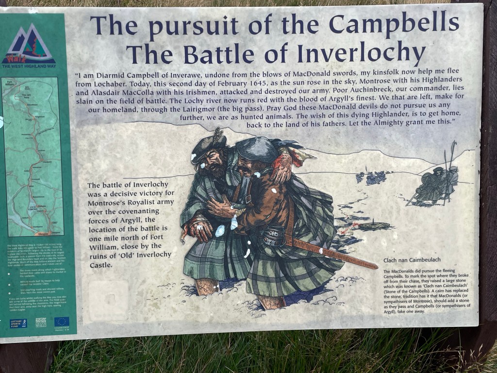
So, after having finished a few good sota peaks and realizing it had been a few years since I finished a named long trail (as opposed to multi-day segments of long trails) I shifted my focus now on the rest of the walk to Fort William (okay it is only two days away), so with a new day and the weather being pleasant again, no crazy Scottish weather the goal was to make Kinlochleven for lunch and then head up into the wild country to have one last night of wild camping. The Way follows the road for the first few miles and then turns up into the high country on a trail feature aptly named “the Devil’s Staircase”. I lifted this from the Internet as a history of the naming.
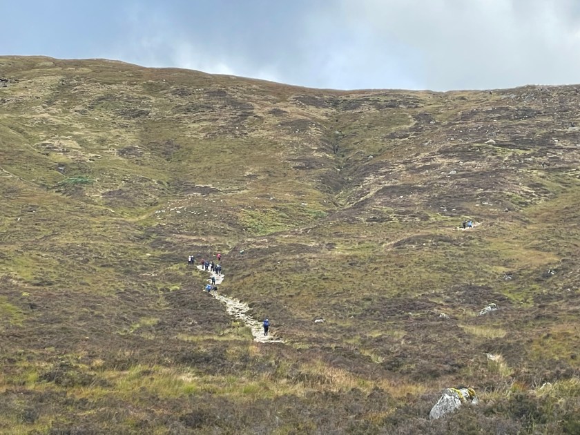
This part of the trail is very scenic, and does give you that Highland scenery that one hopes to see. For what it is worth this many days in heading up the Staircase was pretty easy, and for anyone else even on a weeklong itinerary this number of days in the jaunt up the stairs is not going to be that tough, so do not let the name scare you.
From here you descend down the valley into Kinlochleven over a couple of miles. The trail is nice walking so it should not take very long. You do need to get in before 1500 hours as that is when most shops do shut their kitchen for mid day break. I found a nice sandwich shop, and even enjoyed a milkshake with my lunch. Kinlochleven also hosts the local Ice Climbing centre. It might be worth a visit if you are staying in town or have the time.
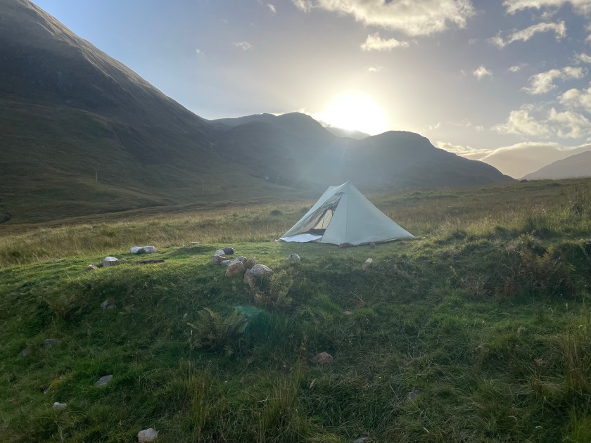
After lunch in Kinlochleven I moved back to the trail and kept moving along into the backcountry with a specific location in mind. Here the trail does climb some out of town, and then chills to a gradual ascent. I found a flat creek amd trailside setup in a great location that was somewhat wind protected, however IF I had kept going another mile I would have been able to pitch behind a rock wall from an abandoned shepherd’s hill home.
Dinner was pleasant, however I finally came to the realization that it is time to finally retire my snowpeak gigapower (it took 30 minutes to boil 1.5L of water, and no I am not getting a Jetboil. Time for an MSR Pocket Rocket). The sunset and surrounding views for the evening were amazing. Being though in livestock grazing land I found it humourous all night cows on both sides of the hill were constantly mooing back and forth to each other. Not enough to keep one awake, but those couple of times I did wake up for a bathroom break I could still hear them wailing away and their bells clanging.


Day 11: Wild Camping to Fort William (~14 miles) 27 – Sept
Last day of the walk, another great day in the Highlands. I had no real schedule and did not need to be anywhere, so I was not in too much of a hurry to get moving, however by 9am plenty of walkers were already moving past me. I am curious when these folks left whereever they started from. If they left Kinlochleven it must have been around 7am as I was two hours past the village. Anyway, with a fresh batch of individuals to walk with I proceeded along the last bit of the Way, but not in too much of a hurry. I wanted to soak up these last few miles of Highlands. So as I noted “yesterday” a mile or so past my camp I found what would have been a perfect place to hide from the winds (had their been any, fortunately last night only brought mild breezes).
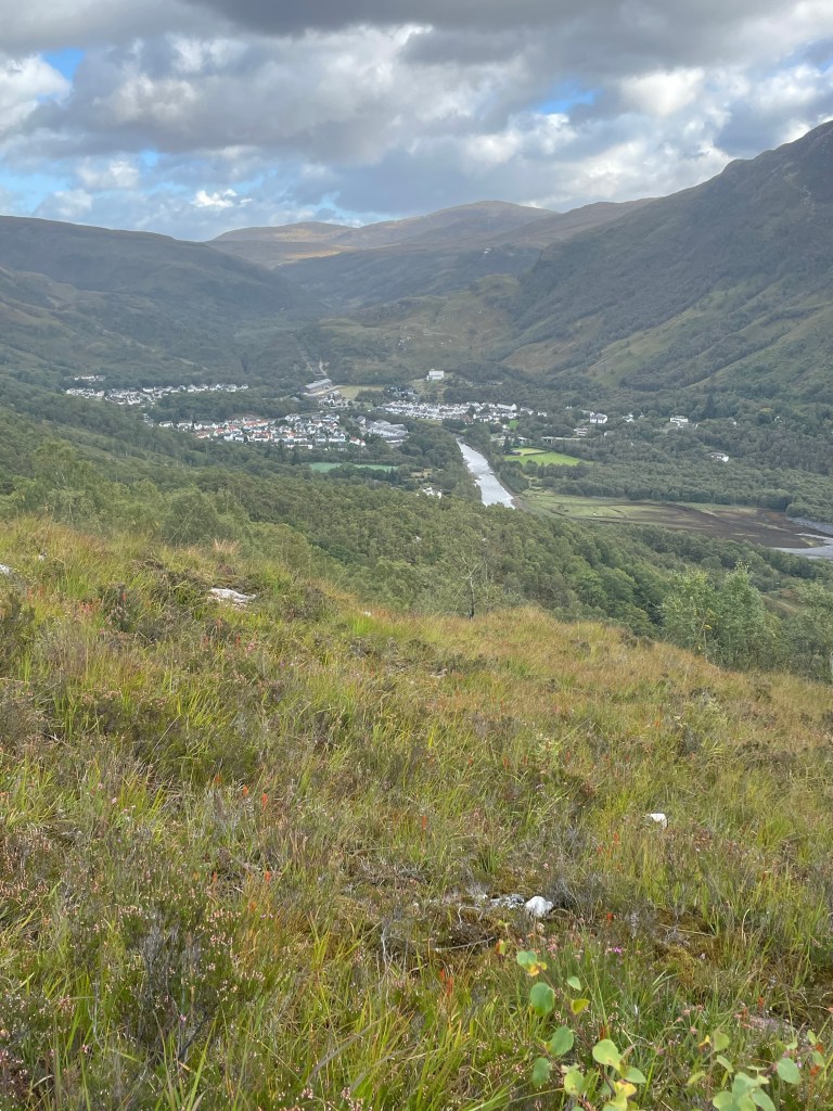
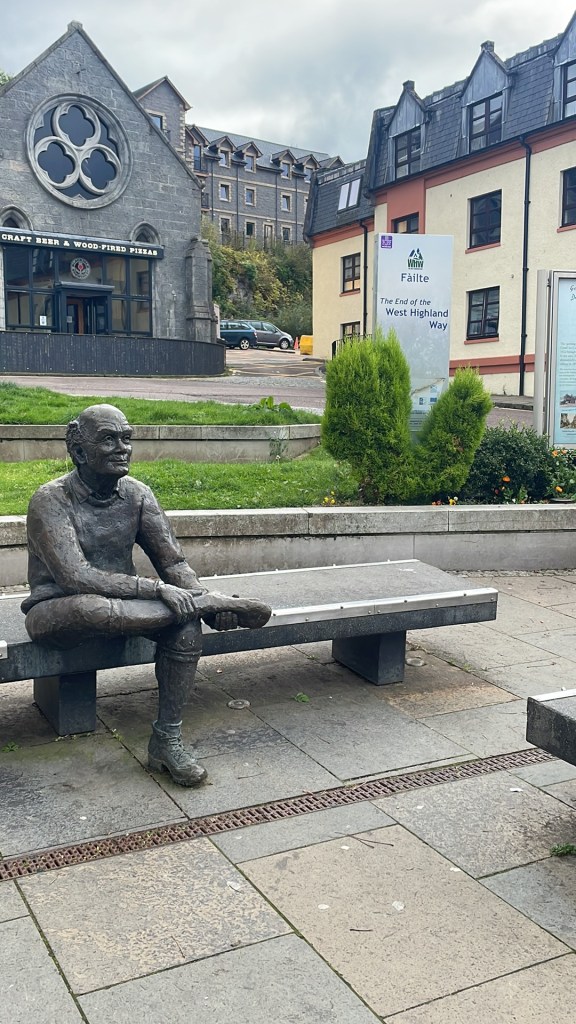
For the first bit of the morning we walked in the wide open valley with views West towards Glencoe and a reservoir or two. However the trail does eventually turn North and you start that last little climb past the Mamore range for the final few miles push into Glen Nevis. Right befote the final drop there is an old Iron Age fort that is worth the 20 minute side trip. If you read the information board, what you see, and what you read do make sense. Also from this high spot you can see Ben Nevis (on a clear day) to your North across the valley. Plus the view up the Valley as your nestled between the Mamores and Nevis range does help give you that small feeling that comes with being in the mountains. Once back on the trail it is all downhill to Glen Nevis and then pavement into Fort William! What a walk


Epilogue:
Tbis trip was well worth the wait, and is one of the few hikes I would love to do again, or at least consider going on past to also add the Great Glen Way. It is possible even without a luggage transfer service to put a posh trip together, but doing the combination of tent nights (4 total) a couple nights in the Hobbit Huts, the Youth Hostels and the two hotels was a new experience for me. However knowing what I know now, and skipping the SOTA factor a completely wild camping experience would be the plan. Trekking through the UK the past few weeks and specifically the WHW in the relaxed manner in which I did it was quite the enjoyable experience. The food here was tasty. The added two years also helped to improve the solar comditions to get those further daytime QSOs. I also have a new found fondness for the QCX mini. I had plenty of fun with it in Tahoe, but hearing all those Balkan and Southern European stations blasting in was a nice new change, the couple of times I did get a NA QSO also made that particular activation more fun.
See you next time!
