I wanted to take advantage of being in the area, so after scouring over sotl.as, finding a peak that met some of my requirements, studying the (digital) topo map and finding very little info for the approach, I went with a peak that seemed well within my wheelhouse. Plus, it has a cute name to boot, “Nutt Benchmark”. It was also a First Activation peak, so those are always fun (and typically involve the most planning and do tend to give me a little anxiety.
Preflight:
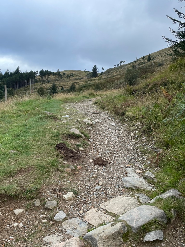
At the Sitgreaves Pass View point is a wonderful (and big) with some flat spots pull out that we ended up using as a post up. That was the one useful tip the couple of trip reports I found contained. So with some daylight left, and me wanting to do a little exploring I managed to climb my way to the top of the nearby ridge line. It turns out that there was a well cairn’d use trail that wandered off in the direction I wanted to head the next day. After walking out about a mile and confirming this approach trail would work, I opted to shift from the route I was going to use to staying up along the ridge line to a specific saddle. From the saddle to the summit is about a mile.
Lets do this:
So with that I was off from the pass at around 8:30 in the AM. I would say the ascent from the parking lot to the ridge line, and then a few segments along the final push are kind of the cruxes along the hike. Well, that and the various cactus (some of which were in bloom on this walk). If you have ever been to Oatman down the hill you have probably encountered the very docile and tame donkeys. However out here in the uplands those donkeys are a bit more feral. As soon as I crossed into the hills and they were aware of my presence, they were gone. The walk is in a N by NE direction until a saddle is reached with great views over towards the Hualapai Mountains. From here turn towards Northwest and knock out the last 800 feet of elevation gain in about a mile.
Because the elevation gain is pretty minimal I made pretty good time scooching along the approach ridge. You actually pass right under another SOTA summit (4975, W7A/SM-055) that would make for a fun two-fer. For what I could tell the approach up 4975 would be pretty easy, but it does look steep. I was considering the two-fer and would allow the build up of clouds determine yes or no. Once the saddle is reached the trail (for the most part) is over, there are plenty of braided paths to the summit, however one thing I would advise is to not push for the final ridge until after that last rock wall you encounter. After that though it’s smooth sailing.
Summit and Activation:
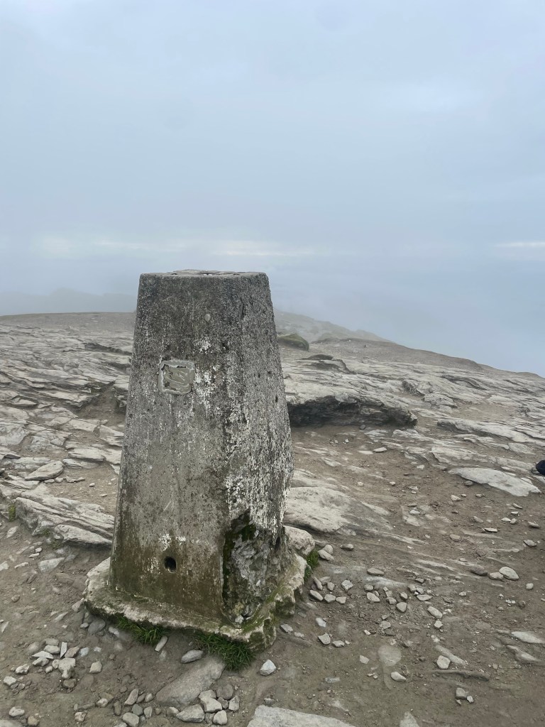
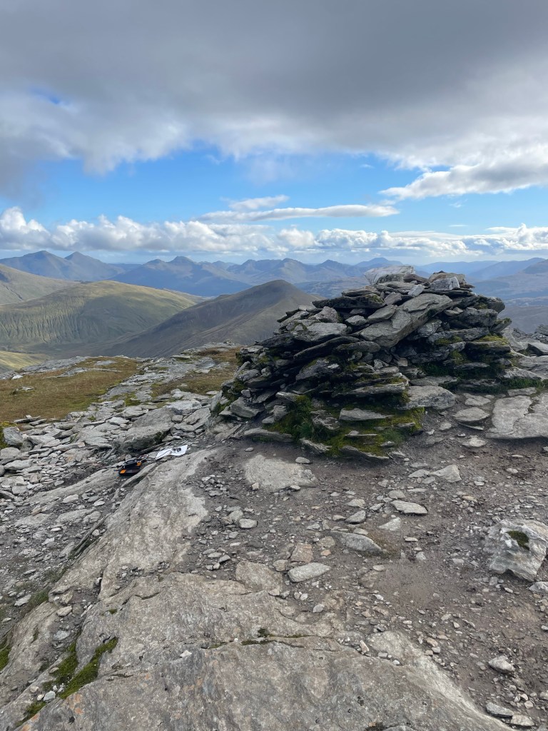
The summit area is a large flat area so plenty of room to spread out and enjoy yourself. Since this is not that popular of a peak (for some reason), it’s not like you have to keep your station setup small. When I say this peak is not that popular, the last person to sign the log that was on the summit was in May of 2023, ten months ago. The log based upon the the business card inside the PB Jar (yah do not use PB jars, those plastic lids deteriorate quick) was placed by the Las Vegas Mountaineering club. No idea if they plan outings or what.
I spent about two hours on the summit on a day following a pretty large solar storm, so the fact that I managed 40 contacts across five bands was pretty impressive. No DX to be had, and as much as that probably had to do with my late start, i am guessing the dead bands also were a part of it. SFI of 195, and K of 4 are not optimal conditions, but as I noted, I made it work.
Time to wrap up:
Part way through the activation I was noticing the same afternoon build up of clouds and virga that we kept getting during the softball tournament, so I opted to stick around a bit longer and keep activating, but would skip the second peak. The walk down was pretty uneventful except that I did step on a chunk of cactus, and it went through the bottom of my shoe (ouch), so that took a few minutes to dig out.. That and for whatever reason I kept losing the trail on the return even after I was on the main path. So pay attention. Overall I would put this as a medium effort peak, I covered a total of 10.25 miles and just shy of 2200 feet of total ascent.
Some final parting shots:
73 de N6JFD/P
Not the best of conditions, but still made it all across the US
The last eight months were filled with a lot of travel, a few continents, 1 new state for me, and some time South of the equator. That said it is now time to head back to work for the summer! Earlier in the year I had planned to make this year a collection of a lot of new unique peaks as well as picking up some completes from chases and S2S over the years. Although the huge winter and me ditching most of my snow/winter worthy gear is keeping me to lower levels and easier more familiar peaks like NS-248, TR-027 etc. That said I do have some backpacking and road trips planned both North of Hwy 80, and up into the Whites. For thsoe that have never looked at the W6 map, definitely check out White Mountain road. With a few days and some full batteries for your kit there are approximately ten summits within an hour walk of White Mountain Road (most are shorter than that).
So most of my summer will be spent on Donner Summit which has my second favorite view (the view from Rainbow Bridge over Donner Lake), and the good news is I have a lot of untapped peaks up there to go after that well I just avoided for years of living in South Lake Tahoe.
TTFN, next up is me just babbling about some mindfulness practices I have used for years, but are at least worth writing about 😀
A quick blurb about playing radio in the evening in New Zealand, and making contacts to Europe.
I love it when a plan comes together, however it is much more satisfying getting lucky and being in the right place at the right time. One of those days I just happened to check the reflector I noticed a posting about the JA/VK/NZ/EU S2S party scheduled for 1, April, and we just happened to be in New Zealand to boot. So far this trip, SOTA had been somewhat frustrating, there are only about 10 CW chasers total between AU and NZ, and the sun was acting like a prima donna being all kinds of super active. To the point I should have been able to see the Aurora Australis when we were in Queenstown, NZ except that it decided to cloud over and rain that night. Also to boot, for some silly reason that escapes me I decided to leave my QCX Mini (18mhz edition) at home, so all I had with me was the MTR3. 3 bands, CW only and NONE of those bands were having it during daylight hours. That said while we had been traveling, I had taken it upon myself to do a couple of night activations, and those were where I made the bulk of my DX and had some fun activations. One on Mt Kaputar (VK2/NW-001), and Mt John (ZL3/CB-625).
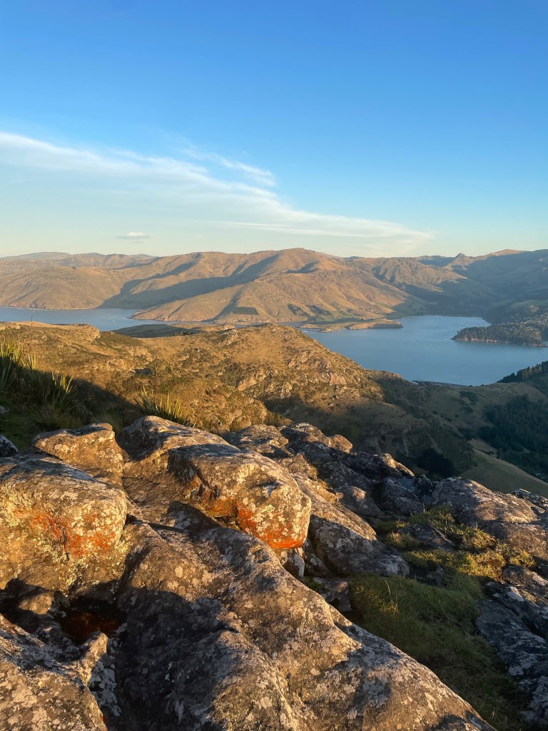
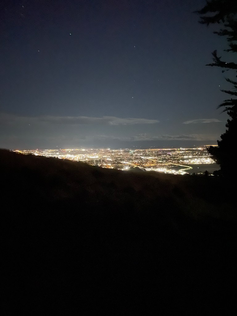
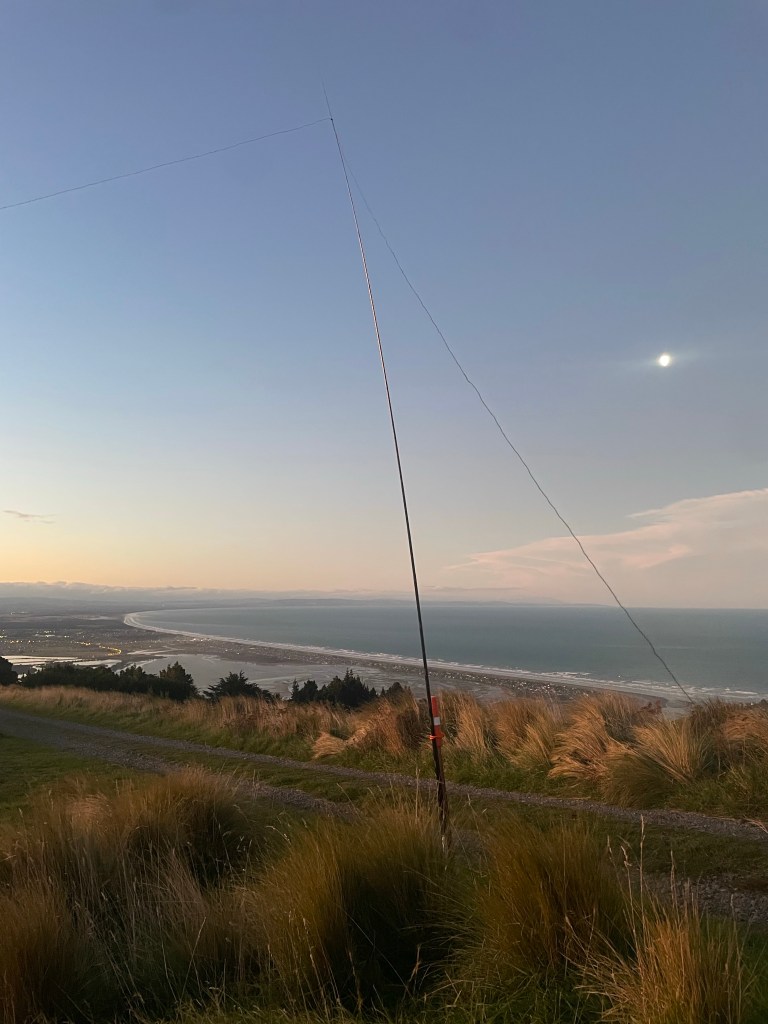
I also just happened to be staying at a friends house in Christchurch who lived a 30 minute walk from the AZ of Mt Pleasant (ZL3/CB-822), so the idea of another fun evening/sunset activation that also happened to overlook the ocean and parts of Christchurch was quite appealing. This activation ended up being my most productive activation of the 2 months down under, and I managed to work 9 different countries, all on 20M. Five contacts were actual S2S contacts, and the breakdown of DX was Germany, France, Hungary, Switzerland, Spain, Australia, Czech Republic, Greece, and Italy. I operated for about 2 hours, and enjoyed the views to be had, but once QSOs dried up it was time to walk down. Oddly enough, no JA stations on this activation, despite the couple of times I managed JA in VK land.
Some parting shots.
The Beach (and some boats)Lyttelton/InletChristchurch at nightoh that sotabeams mast (and moon)
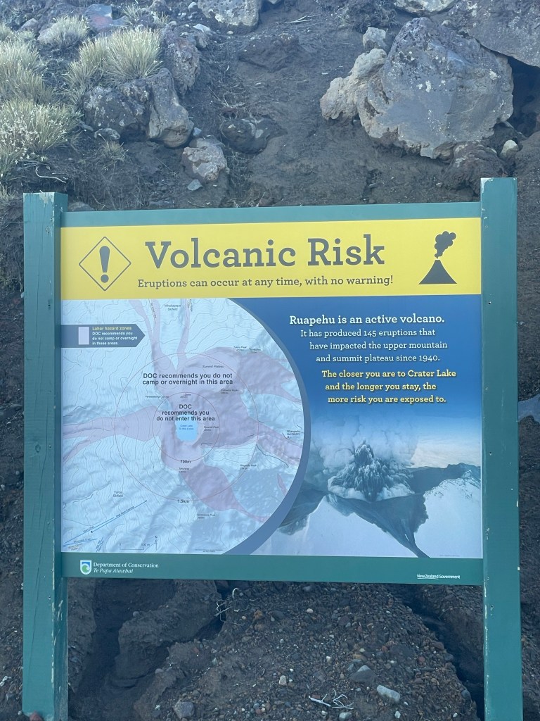
Taking a break from a long road trip to highlight one specific activation. For those not in the know we have been on the road in Au/Nz for 6 weeks now and the trip is winding down with a couple of weeks on the South Island starting later this week. However today I rolled the dice with the weather and decided to head up the North Island High Point. Mt Ruapehu is the proper name for the entire volcano, but the summit block that claims the HP is named Tahurangi. ZL1/MW-001.
nothing to worry about eh? just a pile o rock 😉
This peak has only been activated once, and given some of the other issues I have been having getting contacts (that will be explained in a full write up ar a later date), I was a bit worried about getting this successfully activated on a Monday. Geoff/ZL3GA helped hook me up though with getting the word out to some of the other local cw chasers!
It was also hard finding good approach data for this peak, so well lets just roll the dice and see how we fare!
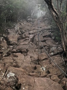
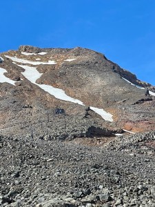
Most write ups did talk about walking up under the ski lifts and that works well, but is not the highlight of the hike. Once at the top of the High Noon chair head to the right/Easterly. There is a creek/ice field that does need to be crossed. Today there was a decent crossing however in my mind tbis was the crux and a bit unnerving. The runout would not have been good, I did find a place further downstream to cross without ice. The next goal is to make the shoulder that runs SW to NE. Take the time to notice the amazing slab that goes from about 2500M to a cliff band around 2650M. The slab is very sticky, and I found it easy for going both up and down in a straight line. Most of the tracks I found avoid the slab, but if you are comfortable on rock its safe and fun. The next bit oh fun is a lot of switchbacks, or some mild class IV climbing, but this is the steepest part of the approach.
Top out on the false summit and the last 100M is pretty mellow, do note though there is about 20-25M of a spine before the shoulder gets really mild. The drop off on both sides is a bot precipitous 🙂
The view from up here is amazing, there is a huge lake down in the crater, a cone on the other side of the lake, and a few more summits as well. The mountain did burp a couple of times while I was up there and that was a touch unnerving, but I did not see anything spewing.
This was my best activation so far of the trip, I managed to get 9 contacts total across VHF 20/30/40M (not used to getting so few, but as noted above another story for a much bigger post).
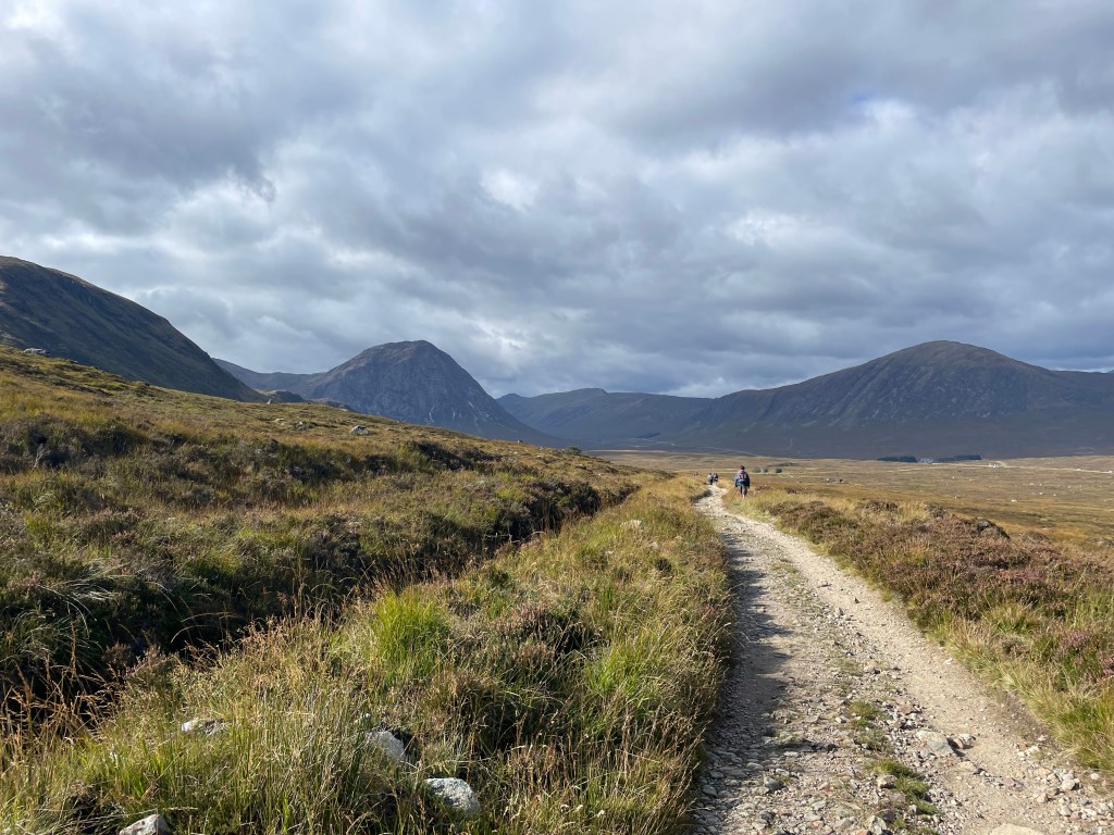
So WAY back in 2019 I had planned to hike the West Highland Way in spring of 2020 and sprinkle in some Summits on the Air as well. I think we know what happened to that though. Since I was working a pretty good job at the time I had booked a a combination of some wild camping and pretty posh stays, and at the beginning of pandemic all but one of those places had agreed to refund the bookings. The Bridge of Orchy hotel was the one place that would not do a full refund and 2022 was the last year they were willing to push the stay back (kind of a “use it or lose it” thing). So with that in mind I put a date kind of in the middle of the end of September and took my original plan to build forward and backwards.
For those that do not know the WHW is about 100 miles long starts in the suburbs of Glasgow, walks north along Loch Lomond and then heads up into the Scottish Highlands, most people take 5-7 days to do, and if I were just doing the trail that would have been a fair assessment for me too, but I was also bagging munros to play radio. So my plan called for about 11-12 days (12 days if I had opted for a side trip up into the Mamores range to circle around and come across the CMD Arete to finish on Ben Nevis before descending into Fort William.
Day 1: Milngavie to Drymen (Camping): 17 – Sept
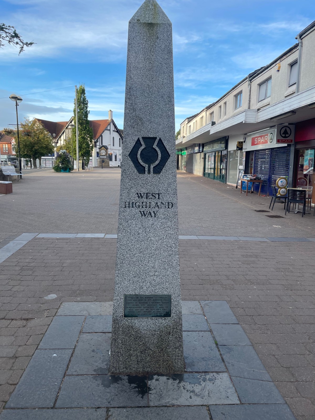
Woke up at the Hostel in Glasgow and hit the train early. I needed to be at the train station in Milngavie (pronounced “Mull-Guy”) to leave my extra clothes/luggage with AMS. They were going to hold and deliver to Fort William on the 28th. Once that was all sorted, I worked my way to the marker that is the start of the WHW. There were already a few groups of people amassing the area as they were getting their pictures in front of the obelisk. I grabbed some breakfast, and a last coffee at the nearby Costa, and hit the trail.
some lone lost forgotten hiker
Walking the first bit is sort of urban, but is not unlike some walking I had recently done in Wales. It is quiet, it is a nice urban path, but in the trees and quiet none-the-less. Keep in mind, this was the suburbs of Glasgow and not in the city centre, so that did help with the quiet factor. You experience what you might normally see at a local town park, the trail runners, the dog walkers (lots of fun dogs to say hello to this morning) and the occasional mountain biker. This is definitely the beginning of the hike though, everyone is clean, everyone is fresh and ready to hit the trail. Within an hour though you are finally getting out of town, and starting to get into some of the more rural areas. Once you get out of town, you really start to experience some strange and interesting stuff, here was a lost hiker that never seemed to get past this one location.
About an hour before Glengoyne (more on that later) I came across a familar name, the “John Muir Way”. Wow so I have now walked the entire John Muir in California, parts of it in Tennessee and now parts of it in Scotland. Even cooler that the West Highland way is considered part of the “International Appalachian Trail”.
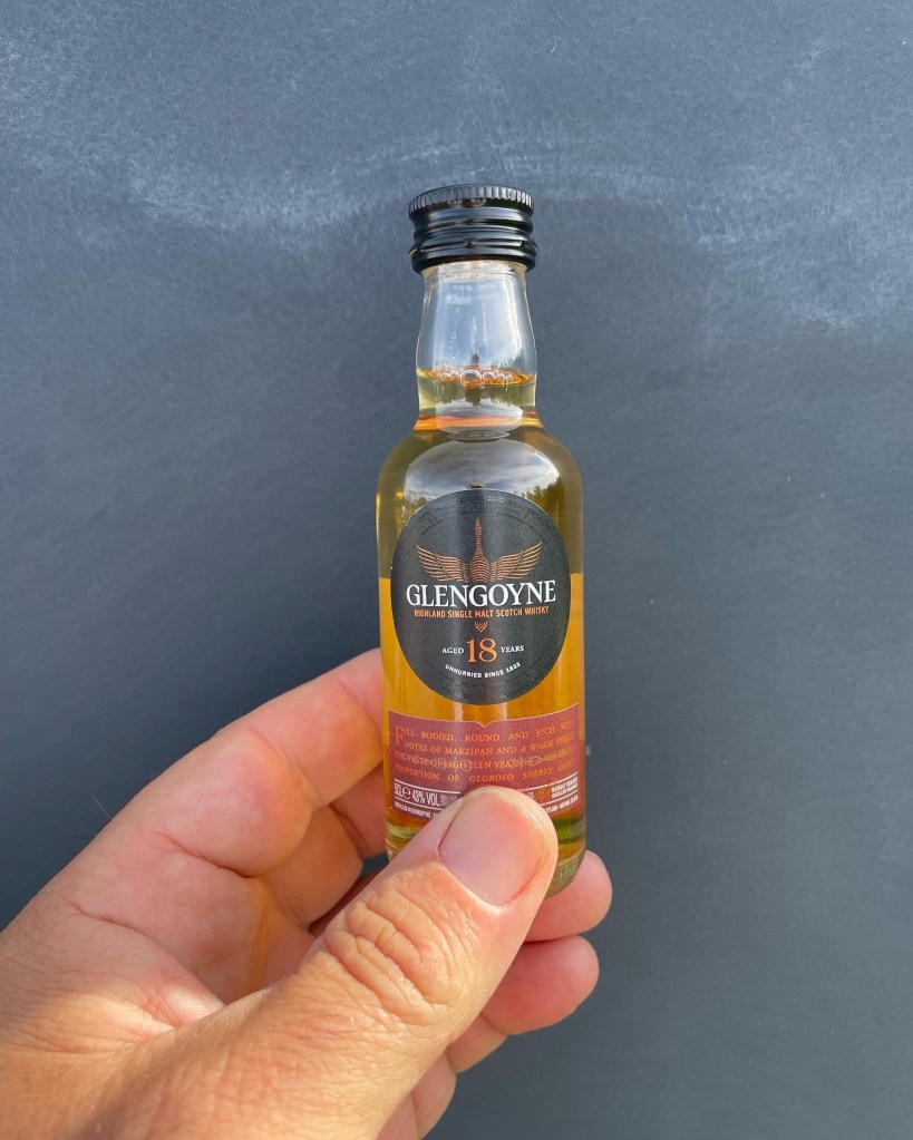
A few hours out of town I made it to a distillery that is just off the Way called “Glengoyne”. Keep in mind I knew this distillery was there, and I have been there before, so I headed on up because it was time to refill the water bottle with some of their natural spring water and I wanted to pick up a little nippy bottle for the end of the trail. I scored this 7.5cl of 18yo scotch, found a good place to carry it so it would not break and headed on. A bit further I started to find some of the honesty boxes, this is the one part of the trail where cash is still required. So far tap and pay (thank you Covid?) has done well, but those honesty boxes do need some cash. Good news is I did bring some along because an Ice Cream was definitely sounding good at this time of the day. The last couple of miles of day one was along a roadway. It was kind of funny as I was swallowed up by a large guided group of folks who were doing the full luggage transfer, carry a light day pack of snacks and water method. Nothing wrong with that, but this groups’ guides had definitely let the group get VERY spread out. As I was walking into the driveway for Drymen Camping one of those hikers thought I was her guide and asked me “how much further till we stop for lunch, I’m tired and hungry”. Well funny enough I had been listening to their guides a while back saying they were going to do lunch up in Drymen. “Oh well I am stopping here but it sounds like ya’ll are eating lunch about a miile further up the road”. It sounds like that group was doing a full 20 miler all the way to Balmaha for day one. Ouch, I was perfectly happy doing my 12-13 miles and just strolling into a relaxing evening camping.
Drymen camping was a nice place, the gentleman (family?) that runs the place had expanded to support larger tents as a result of Covid so on top of the small spots (which was a bunch of us in 1 and 2p tents) up above were some of the big 6-8 people tents as well as some campervans and overland rigs. I do respect the love of campervanning (#vanlife in the US) that the UK folks do. Something I would experience a lot over the days to come.
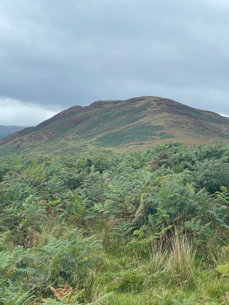
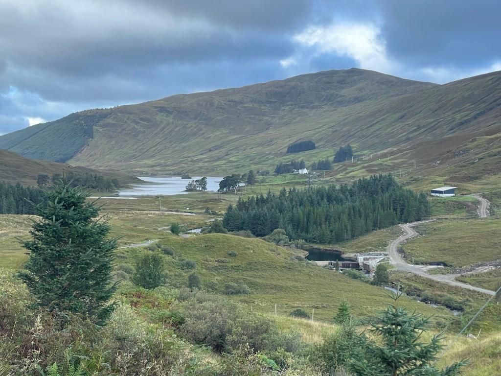
Day 2: Drymen over Conic Hill to Rowardennan 18-Sept
I wanted an early start because today was going to be a SOTA day with my first taste of combining some decent miles, a hill climb AND an activation. I was also looking forward to finally breaking in my new SotaBeams carbon 6. After having some almost not-activations in Wales I reached out to SotaBeams when in Keswick to get a Carbon 6 ordered and delivered to Glasgow before hitting the walk. I pounded some breakfast (while there are very few bag/dehydrated meals I like in the US, I really became a fan of Adventure Food’s breakfast and veggie meals. Their Knusper Meusli is probably my favorite breakfast and you can have it warm or hot. Anyway I was on the trail I think before most people were even up, but I wanted to be on top of Conic Hill by 10am for my activation to ensure I had time to get down to Balmaha for lunch and make the Rowardennan Youth Hostel with plenty of time to chill that evening.
Conic Hill off in the distance
Once I got past Drymen and was getting further into the Trossachs, the environment around me was really starting to change and turn more green. Plus I was staring to get into some easy climbing. That said I was also encountering more sheep/cow/range lands. Plenty of forest lands were encountered too. The final push up Conic Hill was not as hard as I was thinking, but the walking in Wales and the Lakes did have me ready for almost anything :D. At first I was thinking I could just run this activation on 2m, but I really wanted to break in my new mast, so I broke out the MTR2 (Thank you N6IZ, another story for another time, but I normally use an MTR3b_LCD) and setup in a way to not interfere with the ever grown crowds on the summit. I even drew the interest of some drone pilots who were not sure what was going on with my wire and tall mast.
After an hour I managed 13 contacts between 2m, 20m and 40m, but was ready to head down into Balmaha as it was getting crowded on top.
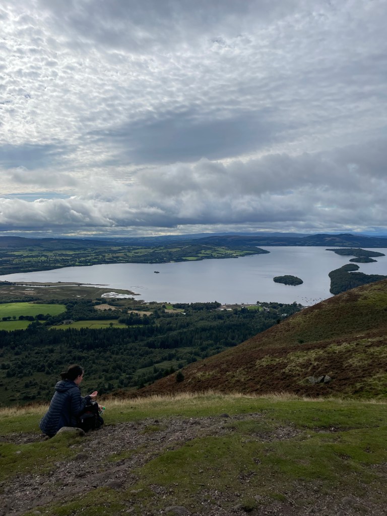
Loch Lomond from Conic Hill
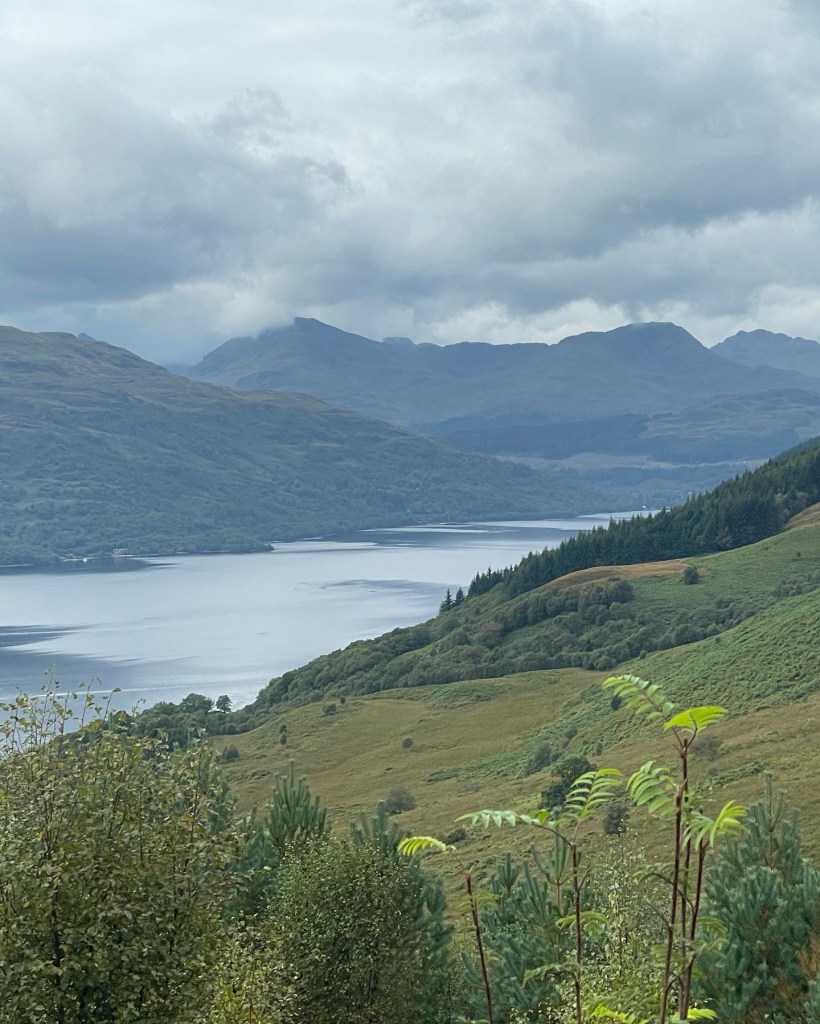
The walk to Rowardennan was pretty uneventful, still playing with both an (sub)urban interface, and getting into the hills while also walking along the Southern end of Loch Lomond. I swear though that it smelled very sea like at this end of the Loch.
So once at the Rowardennan area I do want to make a comment about “The Clansmen”. As a walker you want to get there no later than 6pm. They only want to cater to the clients in the hotel they are attached to. I was able to get in and get some food there, and there was a nice view for sunset, but yah get their early, call ahead or just know that the Youth Hostel (if that is where you are staying ) does serve dinner, or just be ready to have your own food. I was not ready to break into my other camp meals yet so I opted for an early dinner at the Clansmen. The views from the Youth Hostel are quite nice as well!
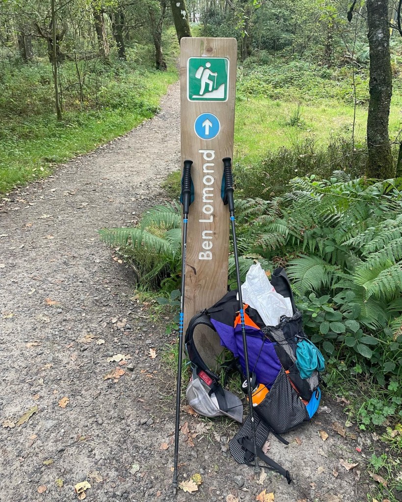
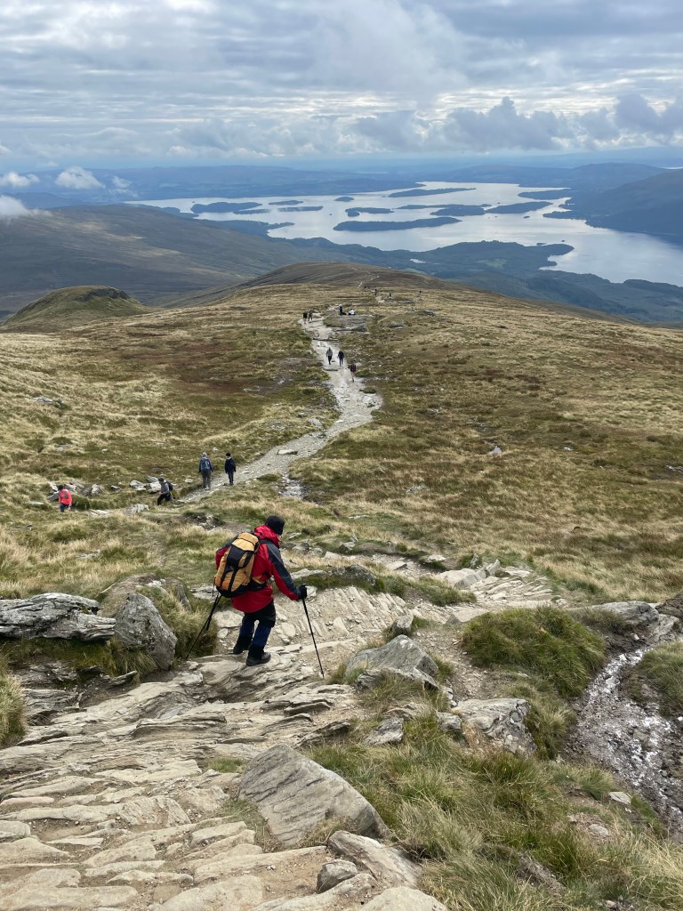
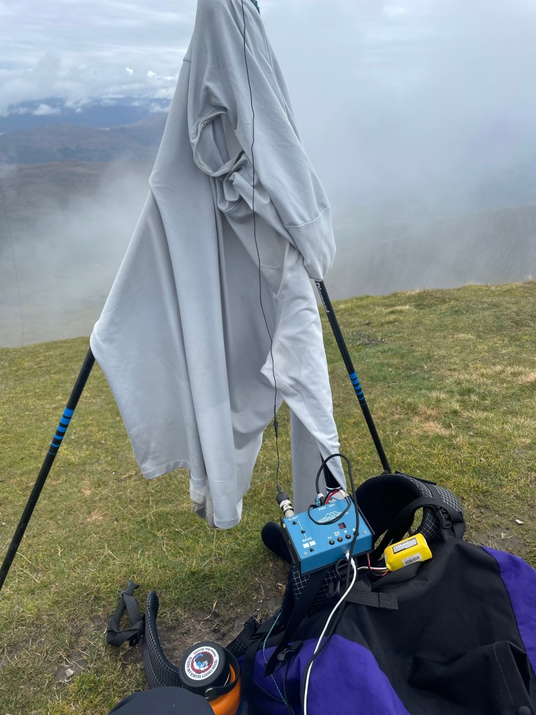
Day 3: Ben Lomond (SOTA day) 19-Sept
So, this could technically be considered a “zero day” since I was not moving forward, however I was doing a day dedicated to just SOTA. Today my goal was Ben Lomond. Another early start was the plan, had a decent breakfast at the YHA and then headed back the 1/2 mile to the trailhead for Ben Lomond. Walking up was a bit of a dreary morning, not that crazy “Scotland rain” I had heard so much about, but dreary none-the-less. Not that I could see them the crowds ahead of me, but once I made it above treeline, the fog was making the visibility “shite”, and I could tell there was a decent amount of folks ont he trail ahead of me. This was my first (second actually) taste of Scottish munro walking; lots of stone steps, straight up, no meandering, just pitter patter, lets get at ‘er. I went ahead and setup just off the summit area, but still at the top block (something that would be a mistake as the day went on). This was another very successful activation though netting 29 contacts on 20/40 on the MTR2 and I even broke out the QCX mini (17m) for a few contacts including one VE (North American) QSO. It was worth it do the extra band for sure. As I went past noon, I noticed the crowd on the summit was actually quite big AND the winds were threatening to knock my makeshift mast supports down, so after 90 minutes of activation time I decommissioned the setup and walked back down the hill. Oh btw, did I mention today was the day of the Queen’s funeral? It was a bank holiday for everyone in the UK, so as a result all the non-royalists(?) from the area decided okay, lets go walk a hill. I was definitely swimming downstream as a million of my not-so-closest friends were heading up to the summit. All in all a great “zero-day” to do some Summits on the Air and get some hill walking in as the day did turn out to be quite sunny and enjoyable.
That evening at dinner I ended up eating with a couple of gentlemen who were also staying in my bunk room at the YH, Roy and his brother Tom from the Bay Area (California). They were both retired and were off on one of their annual adventures together. It was an fun/odd mix because while I was having some big days here and there my zero days would allow the three of us to keep bumping into each other as time went on.
Day 4: Rowardennan to Crianlarich: 20-Sept
Day four was going to be my biggest day of the trip and I was a little nervous. To be fair I did have a strange 18 mile day in Wales but today was going to be a 20+ mile day overall.
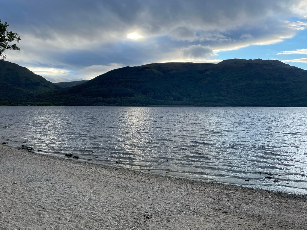
Hit up one last breakfast at the YH and then hit the trail. There is a side trail that takes you directly up from the hostel to the WHW, so no real backtracking. The walk here up until the Inversnaid Hotel is along Loch Lomond, and is quite pretty. I was unable to get a good picture of the Inversnaid falls, but it is pretty impressive. that I can say. It is worth it to grab a snack (second breakfast) and top off your water because from here the fun really begins. Note that shortly after the Inversnaid hotel you have an option; a high route and a low route. The high route is pretty much a doubletrack forest road. The low route (so I have read and was told by folks) is this crazy almost rock climbing up and down affair that runs along Loch Lomond. As noted I had read how rough it was so I, and this other couple I bumped into decided to take the high route. The high route reminded me a lot of walking through some of the coastal areas of Oregon, very rainforest like. The trail does drop to lake level the last few miles of Loch Lomond and it in some ways reminded me of the West Coast Trail up in British Columbia. Off camber ladders, crazy bridges, and some rock scrambling. I made it to Beinglas farm around 2pm and was not really wanting to wait for them to open up at 3pm, so I opted to head on. I had read earlier in the day while walking that Beinglas’ lease was not being renewed next year so what seems to have been a staple for campers and hikers wanting a mid day treat was probably going to be no more (or at least a new/different form) in the years to come. Beware the Willy Wonky Hobbit tunnel that goes under the ScotRail line. It starts out okay for average height folks, but starts to get shorter in the middle and by the end you are bear/crab/crouch/duck walking to get to the end :D. From here on out the trail runs through a farm land with plenty of sheep, but looks East over the valley that is past Crianlarich. I had booked the YHA in Crianlarich (I really do like the YH’s) but this one I can tell was not going to meet the standards that Rowardennan had set.. The room was nice enough but there was mold on the ceiling, and they were starting to run short on things. The Rod and Reel restaurant is really good, I ate there both nights and enjoyed both meals, even had the Steak Pie on the second night (I’m normally a vegetarian but lets just say that the food in EU is so much better than the US that meat made it’s way back into my diet :D).
So, I am just going to set this out now and say this is maybe the 3rd hardest day of hiking ever and my second hardest SOTA day ever. Mt Dubois (W6/WH-001) will probably always be my hardest SOTA day but this day was a very close second. My round trip mileage from Crianlarich was just shy of 13 miles. Four miles was the walk to/from the Ben More Trailhead and Crianlarich.
Once you actually get to the Trailhead, that is when the real fun starts. (see below) The first 2000 feet of elevation gain is pretty much stone steps that are on a steep grade, steep enough that looking down the steps gave me a bit of vertigo. It was a typical weather day this day. The last 500 feet of elevation was in the clouds, and there was no visibility. Given the wonky weather (pretty windy and misty) I decided to go for a VHF only approach. I was also still far enough South that Glasgow was in reach. Both summits did qualify on VHF. The hike down the backside and then back up to Stob Binnein was more of the same, steep down and steep up. The REAL fun of this hike was for the downroute back to the road. No I did not go back over Ben More but followed the goat/sheep trail that is on the Western slope all the way down. The stairs would have been easier :D. The total down route from the col in the middle took me about as long as both up routes. Given the moldy ceilings on the YHA, once I did get back to town I marched straight to the Best Western and booked a nicer room for the night. However I did take advantage of the laundry at the YHA before pulling all my stuff out and relocating. Again another night at the Rod and Reel for some good beers and the Steak Pie I spoke about above.
Yes those are stepsOh look the summit is in the clouds
Day 6: Crianlarich to Tyndrum
Today was supposed to be a walk to Tyndrum with a SOTA peak, but I was still pretty beat from the 20 mile day plus the 4600 feet 13 mile double SOTA day. Today was just a good 7 mile jaunt with a history lesson and some cool valleys along the way as we just start getting further into the Highlands. Once you make it Tyndrum the Green Welly is a great place to restock. I will note that Tyndrum is at some sort of crossroads as it is a pretty busy town. The walk in is pleasant enough as you walk along the stream (Crom Allt). Not that Tyndrum is anything more than a small town, but it is a slight contrast to the villages of the past few nights, as it was quite a busy town. There are a couple of big hotels, quite a few campgrounds and there is still the iconic/idyllic old world style inns too. There are a couple of wild camping spots between “By the Way” and crossing the A road that goes through Tyndrum. I took todays extra free time to snag a massage (she is reachable on WhatsApp), do a little restocking and just relax before pushing on the next leg of the trip.
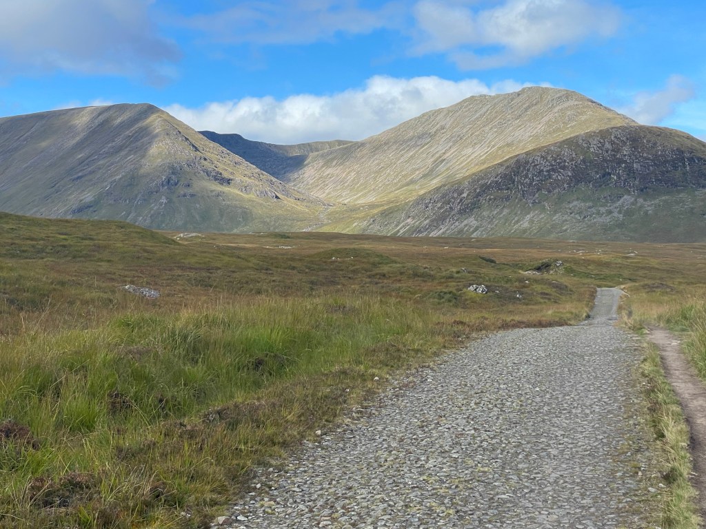
Day 7: Tyndrum to Bridge of Orchy and Beinn Dorain (Hike and SOTA day)
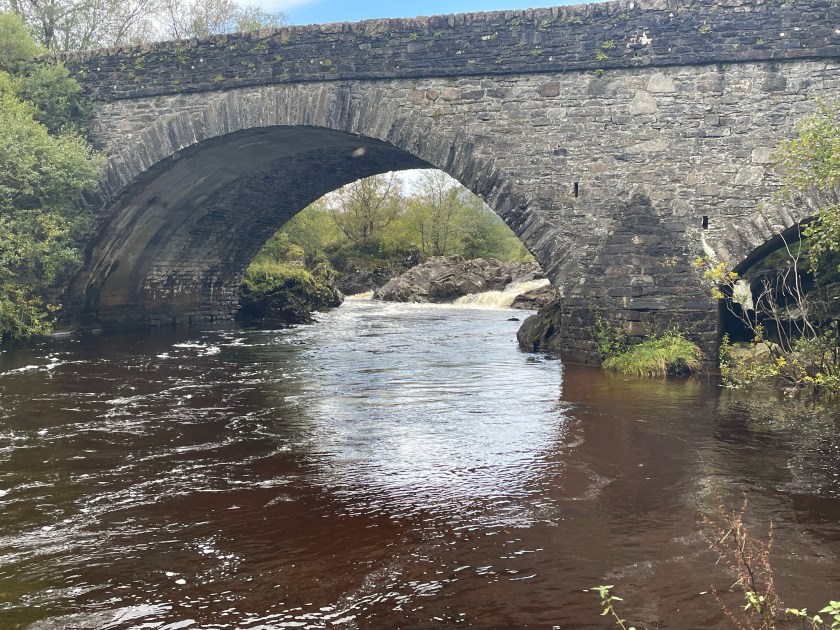
The Bridge of Orchy
All rested up and ready to move on, I grab an early breakfast and hit the trail. Technically there are two options (depending on where you stay), walk right through town, or just head out towards the “By the Way” campsite and pickup the trail. Here the trail starts getting more remote and into the Highlands. The valleys are surrounded by larger hills. I was only going about 7 miles to Bridge of Orchy Hotel (the one that prompted me to run this trip this fall). So, you follow the A82 road a bit but then head out into farm country, and the scenery is beautiful at this rate. I cannot remember the name of the lodging along the way but right before the Kinglass River is a neat little camp site way out in the country. They have a store and depending on the time of day you walk through there second breakfast or lunch is an option. So I made the Hotel around 11am and took this opportunity to offload about half my weight to scale down to just what I needed for heading up and doing some SOTA. This was another one of those straight up trails, although I use the phrase “trail” loosely. Depending on how early you head up, or how late you want to stay up it is possible to get two activations. I went after Beinn Dorain but as noted given enough time (or the desire to come down later) then CS-025 would add about an hour of walking overall (plus the activaiton time). If I had stayed an extra day in Bridge of Orchy the two-fer would have been worth it.
The activation was going well, I qualified the with the MTR2 and some VHF action, but something was itching me to break out the QCX mini today. I netted 12 contacts just on the QCX mini over a 40 minute window including TM2SOTA. Most of the contacts were to the southern end of the EU continent including Spain, Italy and even Ukraine. I took my sweet time with the QCX since I was not going after the second summit. Overall a fun activation.
Bridge of Orchy HotelHad a lot of fun with this guy todayLooking down upon Bridge of Orchy
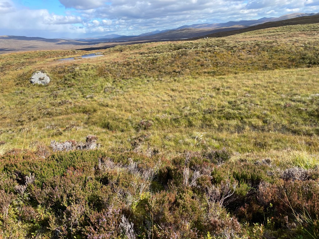
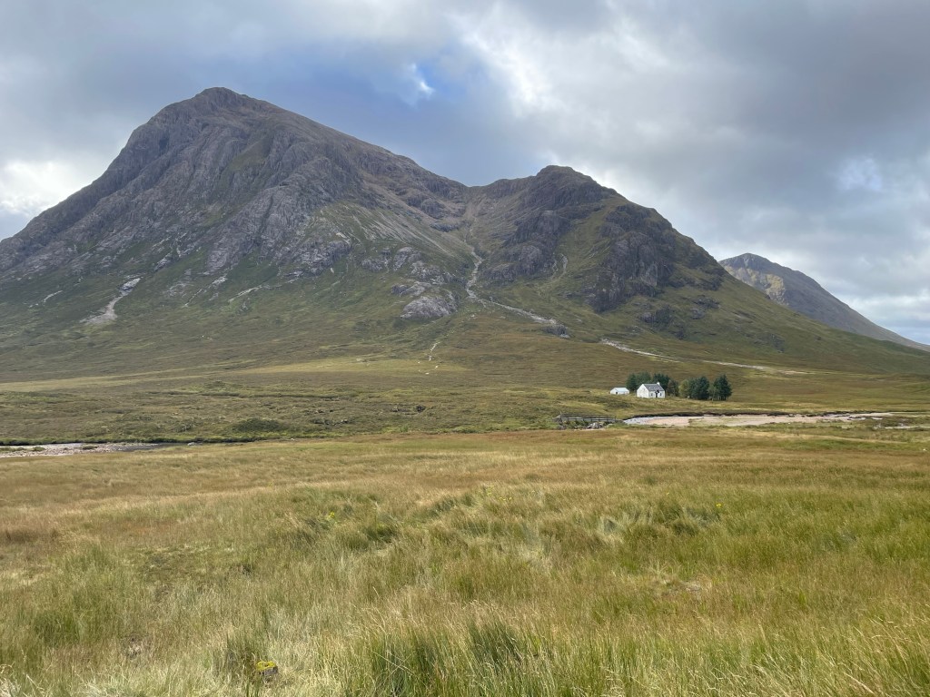
Day 8: Bridge of Orchy to Glencoe Mountain Resort 24-Sept
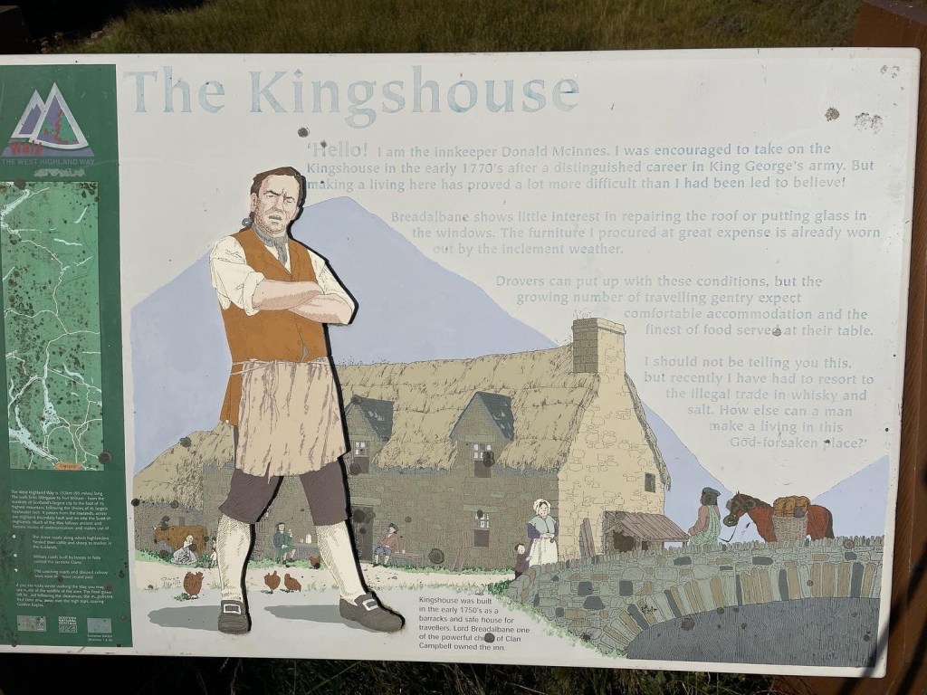
Another short day, only 11 miles and no SOTA. The point of today was to just get to Glencoe Mountain Resort which is across from Kingshouse Inn. Today was the first real autumal day of the year. The air was crisp, the temperature was pleasant, the sun was shining and there were some clouds in the area. A joyous breeze. Inveroran is just over the hill from Bridge of Orchy and offers a quick refreshment, a short ways along the country road and the Way heads over a bridge and heads up the old Drovers road. Not sure how I missed this peak when I was doing my planning but a few miles from GMR is yet another peak I cannot pronounce Stob a’Choire Odhair. This 6 pointer is accessible directly from the West Highland Way. I almost went after this peak, but for some reason just kept enjoying the saunter along the beautiful day. GMR was a two day stop over with the goal of two Summits. A few shots of just how inspiring this area was (at least for me). No roads, mountains, and walking an old Drover’s road.
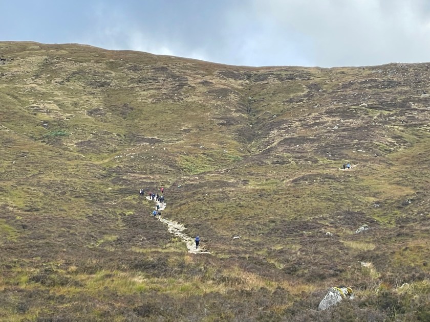
Day 9: Meall a’Bhuiridh (SOTA Day) 25-Sept
SOTA day with the goal of two peaks Meall a’Bhuiridh and Criese. The goal was to head up the lift to get a little head start on the walk head over the col and scale up what (on a topo map) looked like a probably a hard class 3 or maybe an easy class 4 to the next ridge line. Mother Nature had something else in mind. A storm system was moving in and the winds were already starting to rip. Rain was also coming down sideways :D. The winds were such that one side of my body was completely wet while the other side was dry. With that in mind and the wx turning quickly I opted to go ahead and just work Meall a’Bhuiridh instead. That was a smart move as I only mustered one VHF QSO, so I did find a place where the winds were not going to rip up my mast and worked this peak with 17m. I managed 7 QSOs in 15 minutes, tore the setup down quickly and started my way down the peak the way I came up with the winds now howling. On the way down the winds were ripping hard enough to blow me off my feet on one occasion. Strong enough to actually throw me a couple of feet through the air. After some crab walking and lots of bracing I managed to get all the way off the hill in one piece, but yet another epic day on this fun little adventure! By the time I was back down to GMR the winds were ripping and the rain was sheeting hard so I opted to move into one of the little hobbit huts and dry everything out.
Day 10: GMR to wild camping 26-Sept
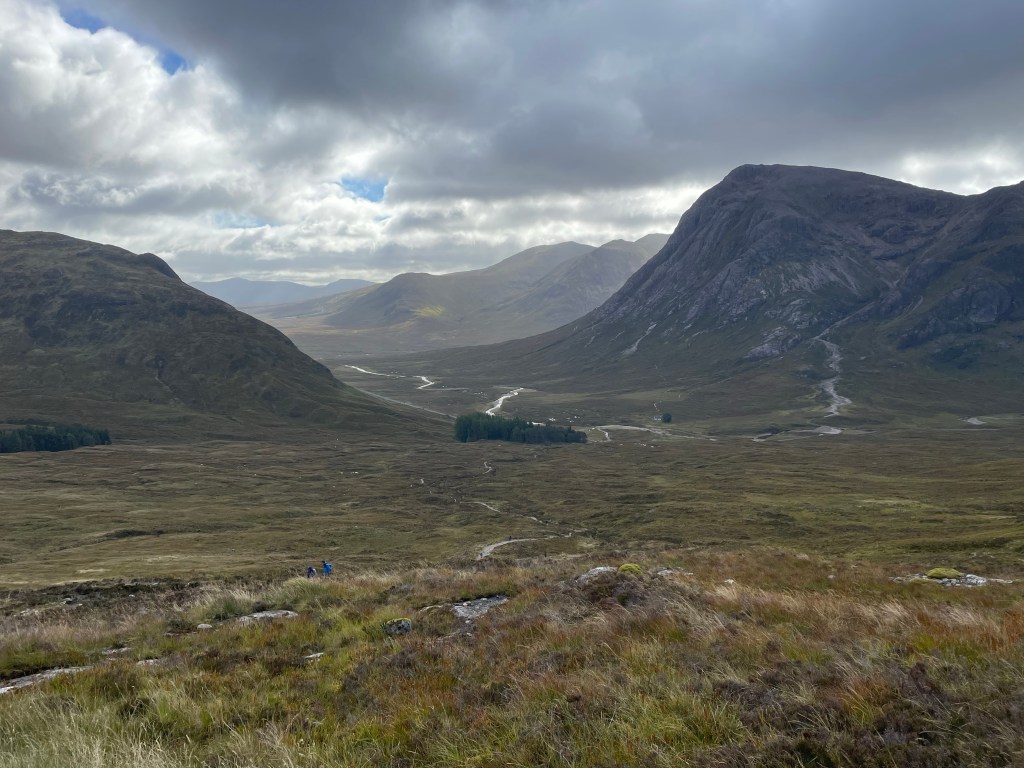
So, after having finished a few good sota peaks and realizing it had been a few years since I finished a named long trail (as opposed to multi-day segments of long trails) I shifted my focus now on the rest of the walk to Fort William (okay it is only two days away), so with a new day and the weather being pleasant again, no crazy Scottish weather the goal was to make Kinlochleven for lunch and then head up into the wild country to have one last night of wild camping. The Way follows the road for the first few miles and then turns up into the high country on a trail feature aptly named “the Devil’s Staircase”. I lifted this from the Internet as a history of the naming.
Between the 18th and 20th century, many people in Glen Coe have been believed to have been ‘claimed by the Devil.’ This is because many workers at the reservoir, after failing to return home after a winter’s night at the local pub, would have struggled the steep path of the route. This is why the nickname ‘Devil’s Staircase’ came about.
This part of the trail is very scenic, and does give you that Highland scenery that one hopes to see. For what it is worth this many days in heading up the Staircase was pretty easy, and for anyone else even on a weeklong itinerary this number of days in the jaunt up the stairs is not going to be that tough, so do not let the name scare you.
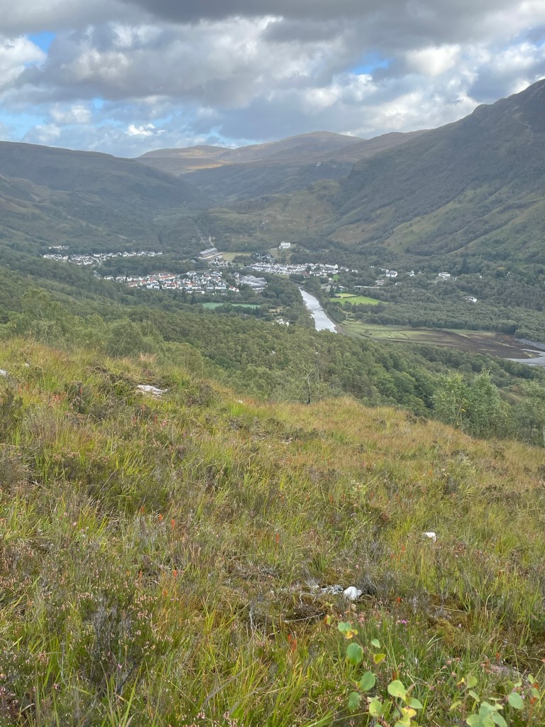
From here you descend down the valley into Kinlochleven over a couple of miles. The trail is nice walking so it should not take very long. You do need to get in before 1500 hours as that is when most shops do shut their kitchen for mid day break. I found a nice sandwich shop, and even enjoyed a milkshake with my lunch. Kinlochleven also hosts the local Ice Climbing centre. It might be worth a visit if you are staying in town or have the time.
My last campsite of the Way, a very pleasant night
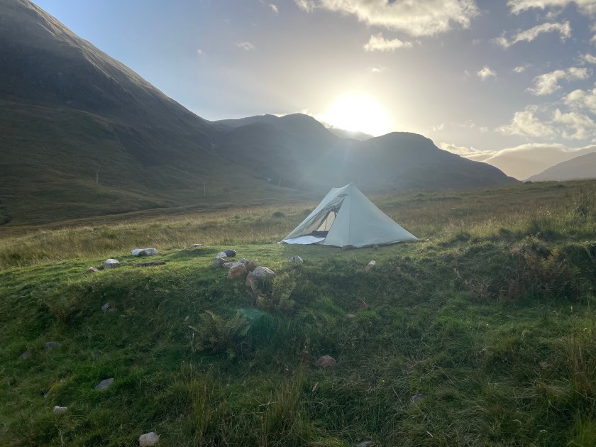
After lunch in Kinlochleven I moved back to the trail and kept moving along into the backcountry with a specific location in mind. Here the trail does climb some out of town, and then chills to a gradual ascent. I found a flat creek amd trailside setup in a great location that was somewhat wind protected, however IF I had kept going another mile I would have been able to pitch behind a rock wall from an abandoned shepherd’s hill home.
Dinner was pleasant, however I finally came to the realization that it is time to finally retire my snowpeak gigapower (it took 30 minutes to boil 1.5L of water, and no I am not getting a Jetboil. Time for an MSR Pocket Rocket). The sunset and surrounding views for the evening were amazing. Being though in livestock grazing land I found it humourous all night cows on both sides of the hill were constantly mooing back and forth to each other. Not enough to keep one awake, but those couple of times I did wake up for a bathroom break I could still hear them wailing away and their bells clanging.
Day 11: Wild Camping to Fort William (~14 miles) 27 – Sept
Last day of the walk, another great day in the Highlands. I had no real schedule and did not need to be anywhere, so I was not in too much of a hurry to get moving, however by 9am plenty of walkers were already moving past me. I am curious when these folks left whereever they started from. If they left Kinlochleven it must have been around 7am as I was two hours past the village. Anyway, with a fresh batch of individuals to walk with I proceeded along the last bit of the Way, but not in too much of a hurry. I wanted to soak up these last few miles of Highlands. So as I noted “yesterday” a mile or so past my camp I found what would have been a perfect place to hide from the winds (had their been any, fortunately last night only brought mild breezes).
The foundation of a pen would have made another good wind break stay out of the house though.
For the first bit of the morning we walked in the wide open valley with views West towards Glencoe and a reservoir or two. However the trail does eventually turn North and you start that last little climb past the Mamore range for the final few miles push into Glen Nevis. Right befote the final drop there is an old Iron Age fort that is worth the 20 minute side trip. If you read the information board, what you see, and what you read do make sense. Also from this high spot you can see Ben Nevis (on a clear day) to your North across the valley. Plus the view up the Valley as your nestled between the Mamores and Nevis range does help give you that small feeling that comes with being in the mountains. Once back on the trail it is all downhill to Glen Nevis and then pavement into Fort William! What a walk
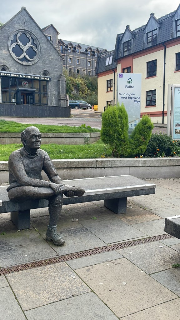
The happy hiker sitting with the statue at the end in Fort William
Epilogue:
Tbis trip was well worth the wait, and is one of the few hikes I would love to do again, or at least consider going on past to also add the Great Glen Way. It is possible even without a luggage transfer service to put a posh trip together, but doing the combination of tent nights (4 total) a couple nights in the Hobbit Huts, the Youth Hostels and the two hotels was a new experience for me. However knowing what I know now, and skipping the SOTA factor a completely wild camping experience would be the plan. Trekking through the UK the past few weeks and specifically the WHW in the relaxed manner in which I did it was quite the enjoyable experience. The food here was tasty. The added two years also helped to improve the solar comditions to get those further daytime QSOs. I also have a new found fondness for the QCX mini. I had plenty of fun with it in Tahoe, but hearing all those Balkan and Southern European stations blasting in was a nice new change, the couple of times I did get a NA QSO also made that particular activation more fun.
Decided to do an overnight for two peaks in the Sierra
Disclaimer: The two peaks I am going to talk about here do require some offtrail/overland navigation skills, and have some high consequence results if something goes wrong. This is a trip report of my experience, and is in no way beta for you to go and tackle these peaks. If you take this data and get hurt, or your loved ones get hurt that is on you period..FWIW I did cut up my hand pretty good on a fall I had while descending Lightning Mountain. In both cases these peaks are thin spine rock piles; one being a large pile of talus and boulders, the other is decomposing volcanic material. Also note these approaches are steep, think avalanche terrain steep. The approach to Disaster Peak was in the Donnell Fire zone from 2018, there is a lot of fire damage along the way including sink holes forming from burnt out tree root systems. Sink holes that could give out and definitely put a damper on your day if you fell in. I had NO cell service from either peak at all, and I was not getting any APRS beacons until I was up high enough to hit something to my west. That said, enjoy the read!
So I have this map of SOTA summits between Carson Pass (HWY 88) and technically the Northern border of Yosemite, but HWY 108/Sonora Pass for all intent and purpose that I have been working off of primarily the past two years. The area I have primarily focussed on this year is along the PCT corridor South of HWY 4. So far this year I had hit up Bloods Ridge, Antelope Peak, Mineral Mountain, Deadwood and a couple of numbered peaks in the area. I also missed 5-6 weeks of hiking in Sept/Oct because of a knee injury sustained doing Tinkers Knob/Mt Lincoln. Funny too, that was probably the easiest hike I had done to that point this summer. Here we are in mid Nov though and my knee was feeling good again five weeks after a meniscectomy, the weather is still plenty warm, there is plenty of sunshine, and the last remnants of any early season storms from back in September were long gone. The only signs of snow were left over patches from the previous long Winter season. So LETS HIT THE TRAIL and get a nice fall overnight in!
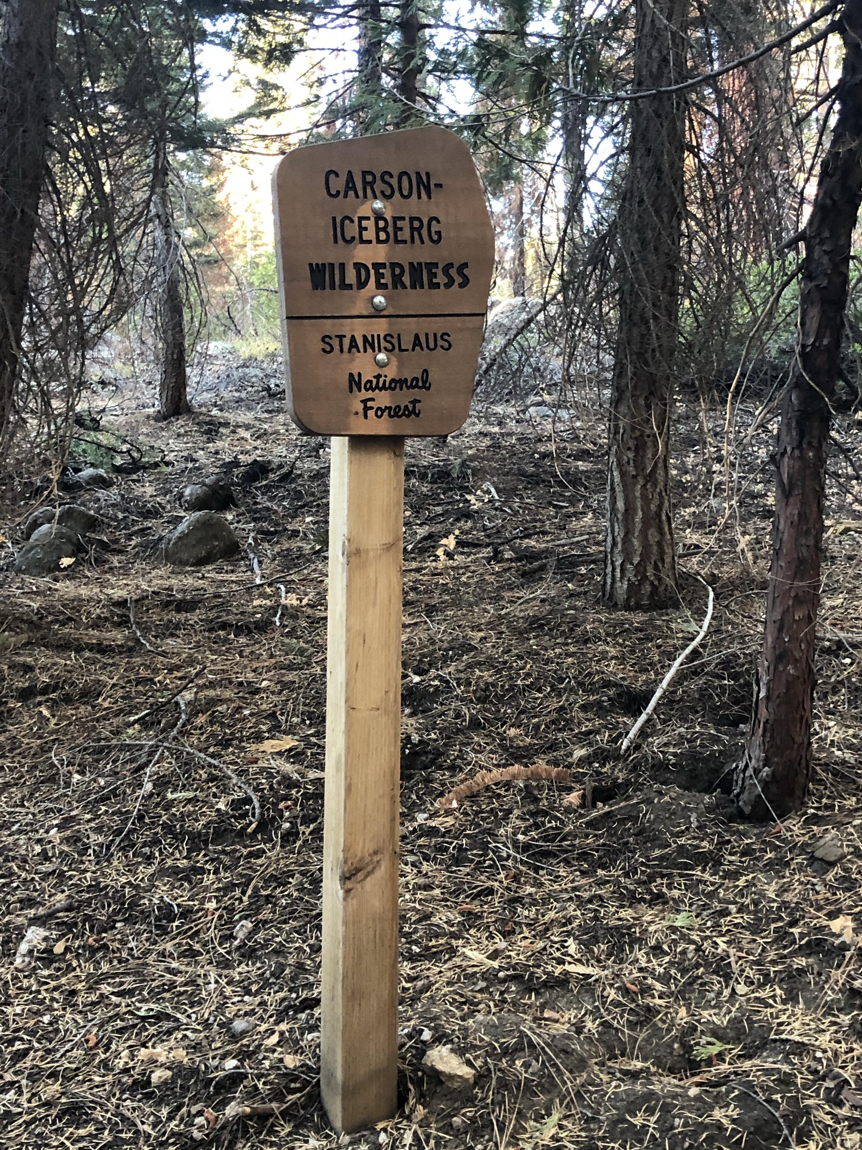
A new sign put up after the Donnell Fire in 2018
I have had my eye on three particular peaks that are all in close proximity, and oddly enough two of them are accessed on the same trail (but from a different direction) as my approach to Arnot peak, specifically the Disaster Creek Trail. The two in question for this trip are Lightning Mountain, and Disaster Peak. The third peak I will have to go after some other time. Compared to some of the other peaks I had done around this area these two peaks were right off a trail, and the on vs off trail ratio would be about 50/50 for once. For context, Antelope Peak was a 15 mile day for me, only 2 miles were on trail, rest of the time I was picking my way across open fields, manzanita and willow thickets and whatever else the mountain could throw my way. This area is the Carson Iceberg Wilderness area and overnights do require a permit. As a day trip (and this is totally doable as a long single day two-fer) no permit needed. The Trailhead is off of Stanislaus FS Road 7N83.
I started heading up the Disaster Creek trail at 8am, and the walking was pretty easy. In 2018 the Donnell fire ravaged some of this area pretty bad, there are plenty of large trees that have fallen as a result and even more on the verge of falling. I stopped at what I think was a Jeffery Pine to count the rings, and made it to 100 but was only 2/3 of the way across, and was easily a 10 foot diameter tree. I’d noticed some recent tracks along the trail, some that looked real recent, but the cattle grazers had already pulled out for the year, and I could tell I was going to be totally alone in the wilderness this weekend =).
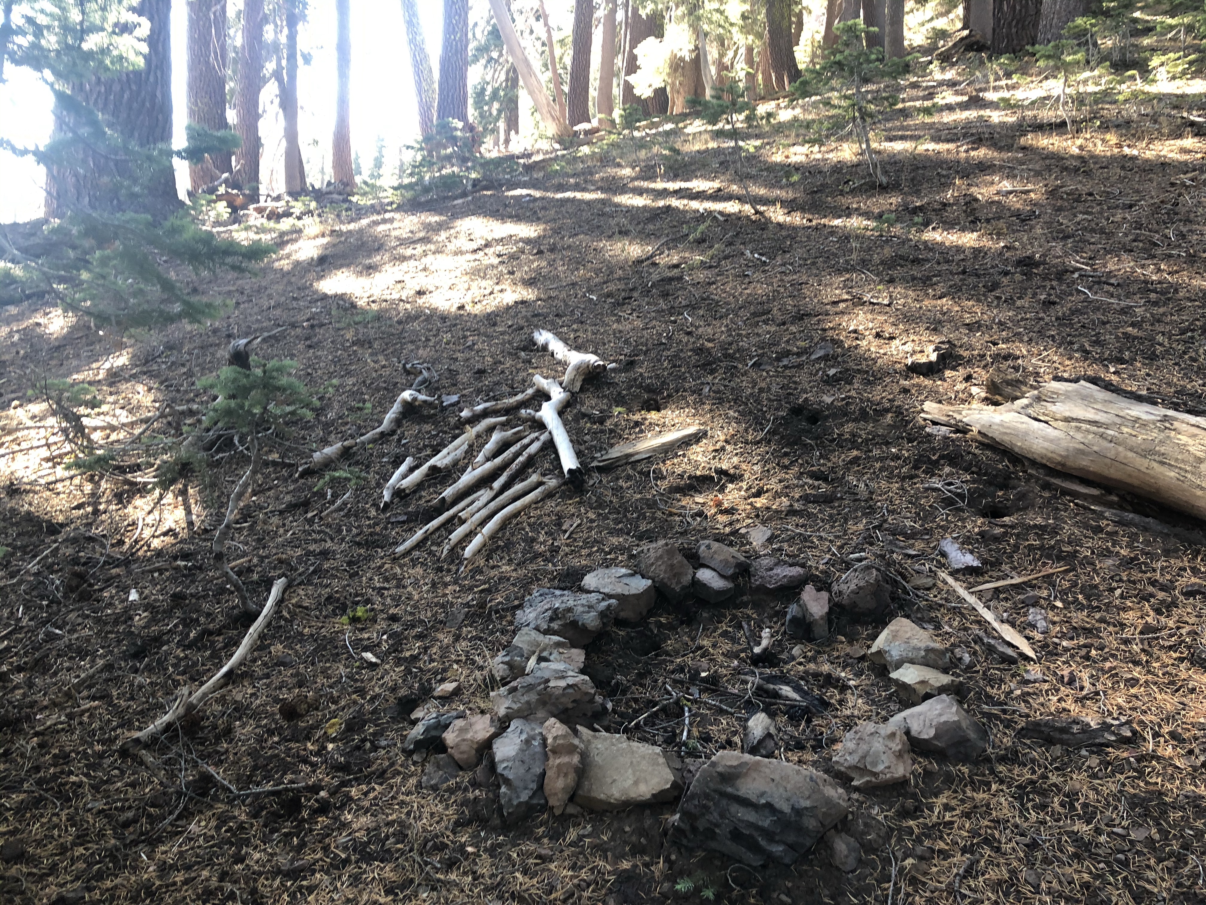
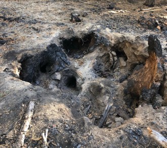
Strange location for a fire ring. Not near any trail
Once I had my basecamp setup I started looking for a way up, and wouldn’t you know there was an animal use trail right behind my camp, so up I went along a shoulder that I had planned as my approach for Lightning Mountain. The approach was approximately 1500 feet and was 3 miles each way. I was in the trees until 8500 feet. Oddly enough along the way I found a fire ring in the strangest place ever at 8300 feet. No real trail, not very flat but someone had spent some time here. After this weekend I actually wondered if the owners stay with the cattle most of the summer.
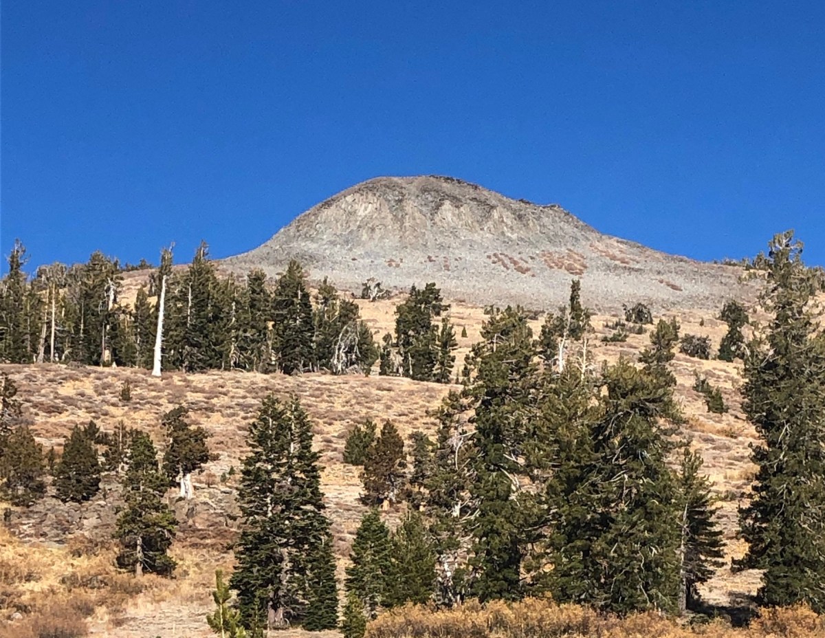
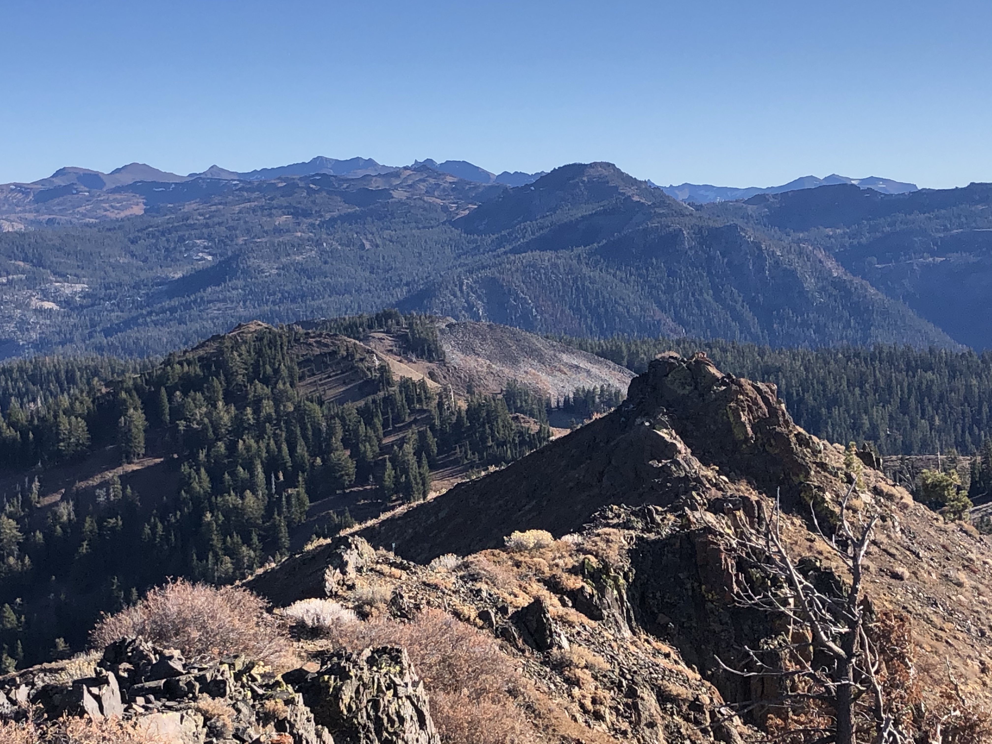
Top of Lightning, looking south from whence i came. Yosemite is down there somewhere
The last few hundred feet is where the pucker factor starts, but not for the full duration. Depending on which shoulder you ascend, you come to a crumbly rocky knob that has bad consequences on one side and devastating consequences on the other. Choose your route, be choosy with your footing and proceed. For the next little bit you just kinda traverse over to the saddle at the base of the rock structure that makes up the summit. The summit is long and spiny, and a little bit of class 2/3 that is crumbly and slidy so again, be careful, and be choosy and test before you weight your foot placement.
There is no cell service (or AT&T) on this peak, so I was relying on APRS to handle my spotting. Back in the summer ON6ZQ did some fun hackery to put all SOTA activators on aprs.fi, and low and behold because I was hitting the summit, a welcome message appeared on APRS. :D. I could hear some guy squawking away on another summit up in North Lake Tahoe area, so I waited 20 minutes to get a QSO with him. Kind of a mistake since he was not actually doing SOTA, but it was at least my first QSO for the first activation on this peak. Overall today I ended up with 1 2m contact 7 on 40m with an S2S, and 4 on 20m. After about 2 hours on the summit, decided it was time to head down mostly retracing my steps. Back at that dicey knob, I did end up losing my footing in one spot, but not on the steeper section, but because the rock was all crumbly and such I did manage to tear up my hand some.
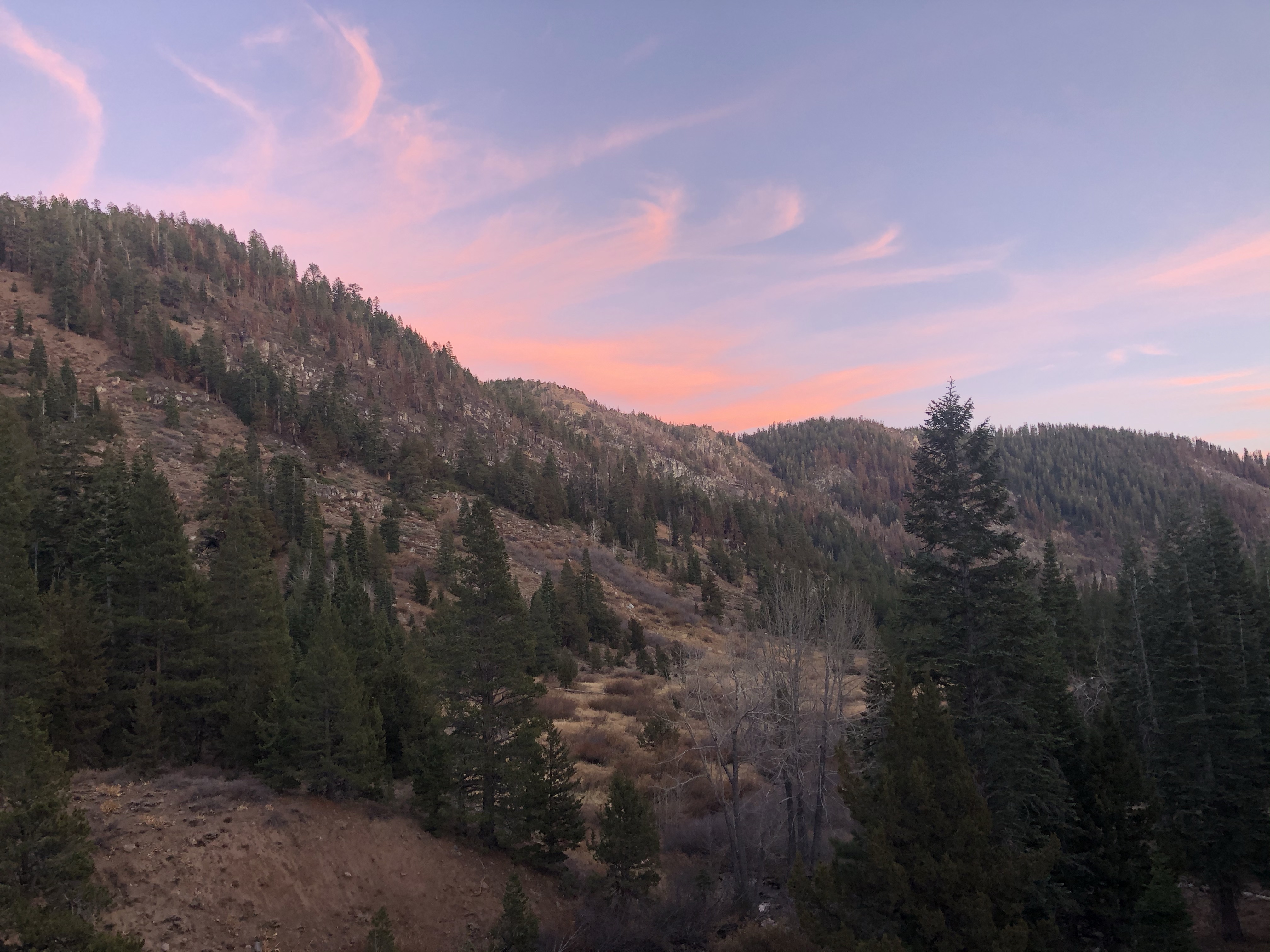
Sunset where I camped. I picked a high perch to have some views.
Camp was camp, nothing to speak of here, but I did have a nice sunset glow (I am looking East in the photo I posted above).
Next morning my plan was simple, get up, break down camp and go find the trail to Disaster Peak; todays peak would be ~2350 feet of gain and another 3 miles each way. I would leave my pack at the bottom, and normally I would say this is probably not a good idea, and I’ll admit there were a few times I was like “damn, hope there are no bears today down in the valley”, but it is what I did. I wonder if the scent of used TP in a ziplock would ward animals away from my pack 😉 (pack it in, pack it out). Reality is I did not bother bringing any extra food on this trip, so I’d eaten my allotment already. Once I found the use trail to Disaster peak (more on that in a minute), found a somewhat hidden place under a tree to park my pack, grabbed my Z-lite sit pad and the case I use to carry my MTR clipped it to my belt, killed a liter of water and went on. (yes, I set off for a 6 mile hike on a hot summer, I mean fall day with no water).
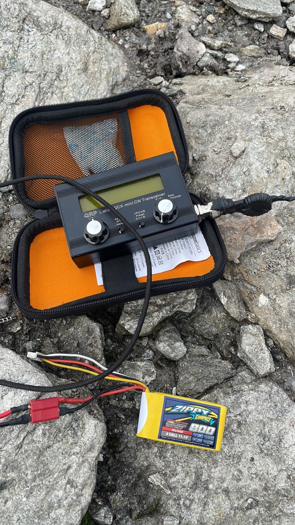
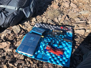
Current SOTA kit
The nice thing about the setup I have, is it weighs < 2lbs. Super easy to just carabiner to a belt loop. I have a trapped EFHW made with 30awg silicon wrapped wire that a buddy built. This thing is LIGHT, the MTR3b, and my 1400mah battery which I am running an experiment on to see just how many operating hours I can get out of it. The battery may be the heaviest part of the kit
So, I mentioned “use trail” before, what i had read was a hard to follow use trail was only partially true, and this was a trip report from well before last years fire. The trail once I did find it was actually a well used pathway that was easy to follow, plus had its fair share of cairns along the way. That was until I got about half way and walked into one of the areas that was damaged pretty bad by the fire. I had never seen the results of a fire that burned so hot it burned out the root system of a tree, but here you go:
You definitely had to be careful because those roots ended up being sink holes, and if you were not aware of where you were stepping it would be easy to cause a sink hole to happen and you would be done hiking for the day. Once past the burn area, you just round a shoulder/corner, and it does get a bit exposed for a minute or two, but you round a corner and your destination is there in full view. At this rate, just work your way up the hill as best you can. In some cases there are some cattle trail, and it does look like if you attain the Southern shoulder the jaunt along that shoulder to the peak is a much easier ascent then straight up the gut. I also saw plenty of camps/fire rings in some more strange places, nothing like what I saw the day before, but strange enough..
On the summit, it was your typical activation, since I was further East on this summit no one could hear me in the central valley, I did pick up someone out in Yerington NV though. Also managed another 11 HF contacts on CW, more 20m today then 40m, so another successful activation of a virgin peak.
Takeaways: Always enamored by the fact that I have studied this area extensively on the maps, and you think it is all spread out, but it is not. I drove some 200+ miles to ultimately access two peaks that were 35 miles crowfly from my home.
Do the cattle grazers stay in the field all season, and where can I sign up for that gig without going out and buying a bunch of cows? 😀 (and does it pay as well as my current job?)
SOTA Activation of a peak I’d been eyeing for a while
So for those that have been following me in anyway know I’ve had a desire to knock off all the peaks that are in some proximity to the Tahoe Rim Trail. This was also the final weekend of the W7N bonus weekend (W6 cuts out on 3/15, that is in the process of getting updated though). There are three possible ways to get to this peak, and as a day hike, all are kind of ambitious. Doing this when there is still a good amount of snow on the ground amps up that factor more.
So the three possible ways to access this peak are from Tahoe Meadows on the Mt Rose hwy, Spooner summit to the South of US-50. Both of these are primarily the Tahoe Rim Trail. I chose to use the Flume Trail/Tunnel Creek route to go up, then hop over towards Twin Lakes. According to my CalTopo route this should have been ~5.23 miles each way and 2722 feet elevation gain. Mt Rose to Herlan peak is ~10 miles each way and has a fair bit of up and down (+2050, -1830 elevation change). Not quite ready to drop a marathon on snowshoes since most of the stuff up high was fluffy and untracked. Half Marathon? No problem.
I have done my fair share of 10-15 mile snowshoe hikes, but the 2600 foot elevation gain was adding to the pucker factor some, fortunately DST and the Spring equinox has kicked in, so we’re already north of 12 hours of sunlight per day. I hit the trailhead approximately 9am and already started making shortcuts across the snow to decrease distance. I really do love snowshoeing when there is a good base, do not have to worry about damaging existing trails. Down low the snow was pretty firm, so I was making some good time. Funny though the higher I went the fewer snowshoe/shoe postholing tracks were present. About 2 miles up I was now breaking trail though on my own.
Even in the winter roads and trails still look obvious so navigating was pretty easy. When I reached the top of Tunnel Creek trail/the Saddle I opted to stay along the ridge instead of dropping down to Twin Lakes. So it was spring time, and not sure why I’d not considered this in my planning, but, I was starting to notice more and more bear tracks going between trees.
The uptrack ended up taking a bit longer then I’d hoped, especially since i was making good time earlier on, but off trail, and deep snow being what it is, it took me longer to go that last 1000 feet up then it did the first 1600. Even with the short cuts and such, I ended up doing just shy of 6 miles. I was not wandering around lost, I just think that the mapping software is not accounting for some of the switchbacks that existed. (My uptrack is posted below). If you are planning this route, anticipate 7-8 if you stick to the trail.
Once on top though, I was greeted with some amazing scenery.
Plenty of peaks off in the distance. The view from North Lake looking South (just my opinion) is so amazing. a lot of nooks and crannies you cannot see from the South looking North
One good thing about deep snow on the summit is uh..it’s easier to anchor that antenna mast..just shove it in, and step around it to pack the snow in.
So, I ended up with 20 QSO across 7SSB, 7CW, 10CW, and 14CW. With 4 S2S. 20m seemed to be pretty good today as some of my QSO were the Eastern seaboard. 30m/10mhz was a bit iffy, I’m wondering if I was close enough to Slide Mountain that I was picking up interference from all the transmitters over there (~5miles North crowfly).
I used my KX2 and my QRPguys Tri-band vertical, and as usual it performed well. That by far is my favorite setup.
The hike down I opted to overland navigate and stay on the Western side of the spine I ascended. I was also wishing for my splitboard as the snow was amazing up high, and would’ve made from some awesome cold blower powder turns. My shortcut worked out well, as i ended up cutting off a mile from my up track, and landed back on the Flume trail right where the signpost/tunnel creek turn off is.
After knocking off Herlan peak I now only have two left from the Rim Trail Challenge. Ellis Peak and Scott Peak both of which are easy and in proximity to each other so I may just knock them out as an overnight backpack this Summer. I just need to stop letting myself get distracted by all the other peaks (and travel) I want to do :D.
Thanks for stopping by. Some more images are below..
uptrack
Wonder where the wind blows from
Sign at the trailhead
Crazy wind depositing on the summit.
South towards Snow Valley Peak (that might be Marlette Peak actually).
Head of a goat, body of a sloth :D. About sums up my hiking, crazy, slow and steady…
Huh?? SlothGoat? What award for Summits on the Air is called SlothGoat?? So I finally hit “Mountain Goat” (1000 Activator points), but on that same activation, I also hit Shack Sloth (1000 chaser points) via an S2S. Shack Sloth if you are a full time chaser is pretty easy to get, but the only time I would chase is to practice some cw or via summit to summit contacts (Log your S2S if you dont). Last fall I realized my chaser points were very close to my activator points, so with a lot of planning, and luck I managed to hit Sloth and Goat on the same activation on top of W6/NS-264 Boca Hill. There was nothing really significant about why I chose this peak. Leading into the weekend and watching the wx forecast, I knew there was a chamce for snow, so I had built 4 different plans/routes based solely upon various outcomes including reactivating the first peak I ever did as a SOTA activator (W6/NS-086 9614), which I activated under my original callsign (KK6TXU). Boca offered me the quickest exit if wx kicked up, and was the safest from an avalanche forecast perspective. It would also have been nice to do a unique peak too, and this activation put me at 110 unique peaks in 120 Activations; a pretty good percentage.
The approach to this peak is not too hard, and another one of those where winter time makes the ascent easier. Honestly I like the snow covered peaks for approach, I really should just bring all my winter modes with me (BC Ski, BC Snowboard, Snowshoes) and make a command decision on which ascent mode to run. Sometimes it is nice getting down the hill faster then up. I parked at the Boca dam and snowshoed over the dam. In the summer you can actually drive across to the NFS roads in the area. Looks like there is an area you can park when there is no snow.
Today marked the most number of contacts I have made on a single activation, I also managed quite a few S2S, and the bulk of the activation was CW.
Callsign
Band
Mode
Notes
KI4SVM
18mhz
cw
S2S, Complete and Sloth!
K0RS
7mhz
cw
K6ARK
7mhz
cw
S2S, booming in with your QRO
NS7P
7mhz
cw
K1LB
7mhz
cw
N0OI
7mhz
cw
K6CPR
7mhz
SSB
(I still phone occasionally :D)
KD6EOD
7mhz
SSB
NW7E
7mhz
SSB
KD6EOD
7mhz
SSB
K6MW
10mhz
CW
KB7HH
10mhz
CW
K1LB
10mhz
CW
Reno on 40 and 30
AA7DK
10mhz
CW
K6HPX
10mhz
CW
N4EX
14mhz
SSB
Nice to hear you again Rich
W0MNA
14mhz
SSB
W5BOX
14mhz
SSB
W0ERI
14mhz
SSB
AA1VX
14mhz
SSB
KX0R
14mhz
CW
S2S/ Bennett Mountain
KE6MT
5 mhz
CW
might be my first 60m QSO
KG3W
14mhz
CW
K3TCU
14mhz
CW
K0GWR
14mhz
CW
NJ0U
14mhz
CW
VE2JCW
14mhz
CW
W2SE
14mhz
CW
AB0BM
14mhz
CW
N1AW
14mhz
CW
N6DNM
7 mhz
SSB
Some other images..
The rock I was sitting on behind here made for a perfect SOTA DESK in the BC 😀 used my vertical today..
So this is my son’s last year in HS and in July he heads off to the Army, so we decided to go REAL BIG for our last “Ski Week” (Presidents Day/mid winter break) trip. Time to head down under to Australia. As usual we were not looking to hit the standard tourists sites, we were just going to go hang out, I would grab some SOTA, he would do some fishing etc. It also helps when a friend from my childhood was living somewhere in country.
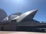
I do not get impressed by man made things, humans will never make something as impressive as the (real) Matterhorn, or El Capitan, but here is the opera house
meh
After walking around the Opera House we took a walk thru the Royal Botanical Gardens and then headed back to the airport for our domestic flight up to Ballina where we would setup our base camp for the week.
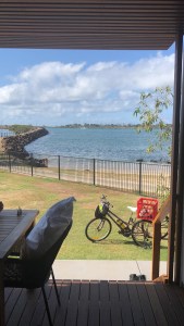
My plan was to knock out some Summits on the Air before really getting setup, but I wanted to get a place setup for staying, so we booked at the Reflections Holiday Park in Shaws Bay. The view was great I’ll say 😀
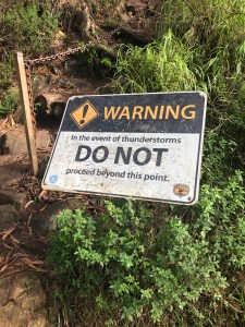
We headed up to a camp area near Mt Warning so that Jason and I could roll up the hill first thing in the morning. Mt Warning VK2/NR-001 is a sacred mountain and the climb up used to be a right of passage for one of the local native tribes. I was walking on hallowed ground, and I was reverent the whole way up. We hit the trail head around 5am, and started the 3.3 miles up. Everything I had read said this trail should take about 5 hours total to do. It took us 4:45 including me spending an hour on the summit doing SOTA. It is always fun getting that first QSO on a new summit/continent! I tossed out a CQ SOTA on 2m 146.500, and VK4IB came back to me from Brisbane. Well that pretty much helped me feel like this was going to be a successful activation. I kept calling CQ on 2 while setting up the KX2. Got my four contacts, closed down and down we hiked. The Feature image is the sunrise from the summit! Definitely heed the sign below.
After we got down, we checked out of our cabin and proceeded to the next summit on the list which was Springbrook Mountain VK4/SE-011 which is for all intent and purpose a drive up. What is funny is that it took us almost as long to drive here from Mt Warning as it took to hike up Mt Warning 😀 even though Warning and Springbrook are only separated by 13 miles/20km crowfly. I noticed that there were two ZS calls nearby also doing the VK thing on a nearby peak, so I S2S’d them. I really should have popped up to that peak too just for the complete :D. I think I helped them get the complete for Springbrook as well.
With some SOTA in the books we traveled on down to the coast coming in just south of Surfer City, checked out the Byron Bay lighthouse for sunset and stayed the night in Lennox Head. It was pretty cool seeing sunrise from a mountain where I could see the ocean, and then seeing the mountain I had climbed that morning from the ocean during sunset! Full Circle
Mt Warning is pretty much dead center under the clouds.
Byron Bay lighthouse.
The next morning, Jeremiah and I did a coastal walk the 6 miles from Lennox Head back to Ballina, got setup in our cabin and fished, and chilled out. By Wednesday I was itching for some more SOTA, so Thursday morning I got up at 8am and headed to the airport to pick up a car and then headed inland towards Tenterfield. I had somewhere else in mind, but while at lunch I started looking for two more peaks close together, and there were two such peaks. One being VK2/NT-025 (Mount MacKenzie) (SotaDB has it as just NT-025). I ended up with 5 QSO overall with a mix of ZL and VK calls. After 50 minutes I figured, lets maybe squeeze in one more peak (which would have pushed me past GOAT). I headed over towards VK2/NT-033, and got pretty close until I found the “Please check in with management before venturing onto these lands”. I am not a fan of folks who trespass without permission, and I was not about to break my own rule, so I turned around and looked for another peak. There was a peak over in VK4/Queensland that looked like it would have a short hike, so I headed that way. (Norman Peak VK4/SD-002). Stymied again, this time a road closure due to the fires in the area. So here I sit 7 points away from Mountain Goat. Reality is, I was not really wanting to get GOAT outside of NA because I want to get GOAT with the chasers that have chased me the most so I was not that bummed that I did not get my two-fer today. Headed back to Ballina just in time to get caught in some TORRENTIAL downpours as a result of Cyclone Oma. Had a wonderful evening dinner with friends both new and old.
We were supposed to fly back down to Sydney midday Friday so we would have some time to relax, repack, and maybe catch a few more gardens in Sydney however Oma had other plans. All flights in and out of Ballina had been cancelled due to the high winds. We got a new one way rental, and headed off down the M1/A1 (wait was I in the UK, or AU?) to Sydney. I do love road tripping, and road tripping in a foreign land is also an amazing experience! Jeremiah finally got to see some kanga’s in the wild. That sums up the SOTA portion of that trip, the rest was just me relaxing, and enjoying a break away from the snow of Tahoe.
Now I am back in W6 land and ready for my 120th activation for Mountain Goat! Stay tuned when I finally get it, but who knows when. Maybe this Saturday as part of the Tahoe/Reno meetup being hosted in Sparks NV.
So for those that do a lot of peak bagging in the Tahoe area you may have heard or read about the Tahoe OGUL list. “Ogul” is the Washoe word for Bighorn Sheep. That is kind of fitting since Cali/W6 has an award called the California Bighorn Ram
“The Bighorn Ram Award is available to those activators who have accumulated 500 points activating W6 summits.” –W6 ARM.
The Tahoe OGUL list is 63 peaks in the area of Lake Tahoe, Carson Pass, Ebbetts Pass, the Sweetwater range and a few others dotted here and there. Please note that not every peak on the OGUL list qualifies as a Summits on the Air summit. SOTA adheres to the P125 meter standard for prominence, and some of the peaks on the OGUL lack the prominence compared to other nearby peaks. Case in point Basin Peak and it’s proximity to Castle Crags, the prominence is only 337 feet and on the same ridge as Castle Crags. I will include those peaks as well just for the sake of keeping the list correct as it exists at the OGUL pages but the SOTA Ref will just say “Not in Sota”.
If you would like more information on the history of the Tahoe OGUL list by all means check out http://www.tahoeogul.org/. Summits on the air can be found at http://sota.org.uk
Yet another list of peaks I was aware of, but did not really bother to look into until I realized I have completed about 60% of these peaks (as of Nov, 2018) including a lot of the non SOTA peaks.
I may reach out to the Association Managers for W6 and W7N to see if a dual state list based award similar to the Tahoe Ogul pages, but SOTA specific is possible.


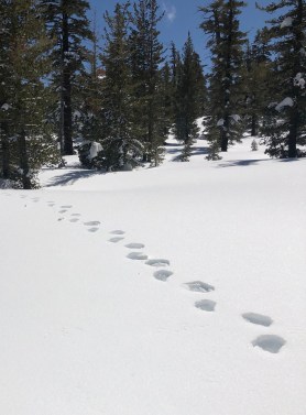 Even in the winter roads and trails still look obvious so navigating was pretty easy. When I reached the top of Tunnel Creek trail/the Saddle I opted to stay along the ridge instead of dropping down to Twin Lakes. So it was spring time, and not sure why I’d not considered this in my planning, but, I was starting to notice more and more bear tracks going between trees.
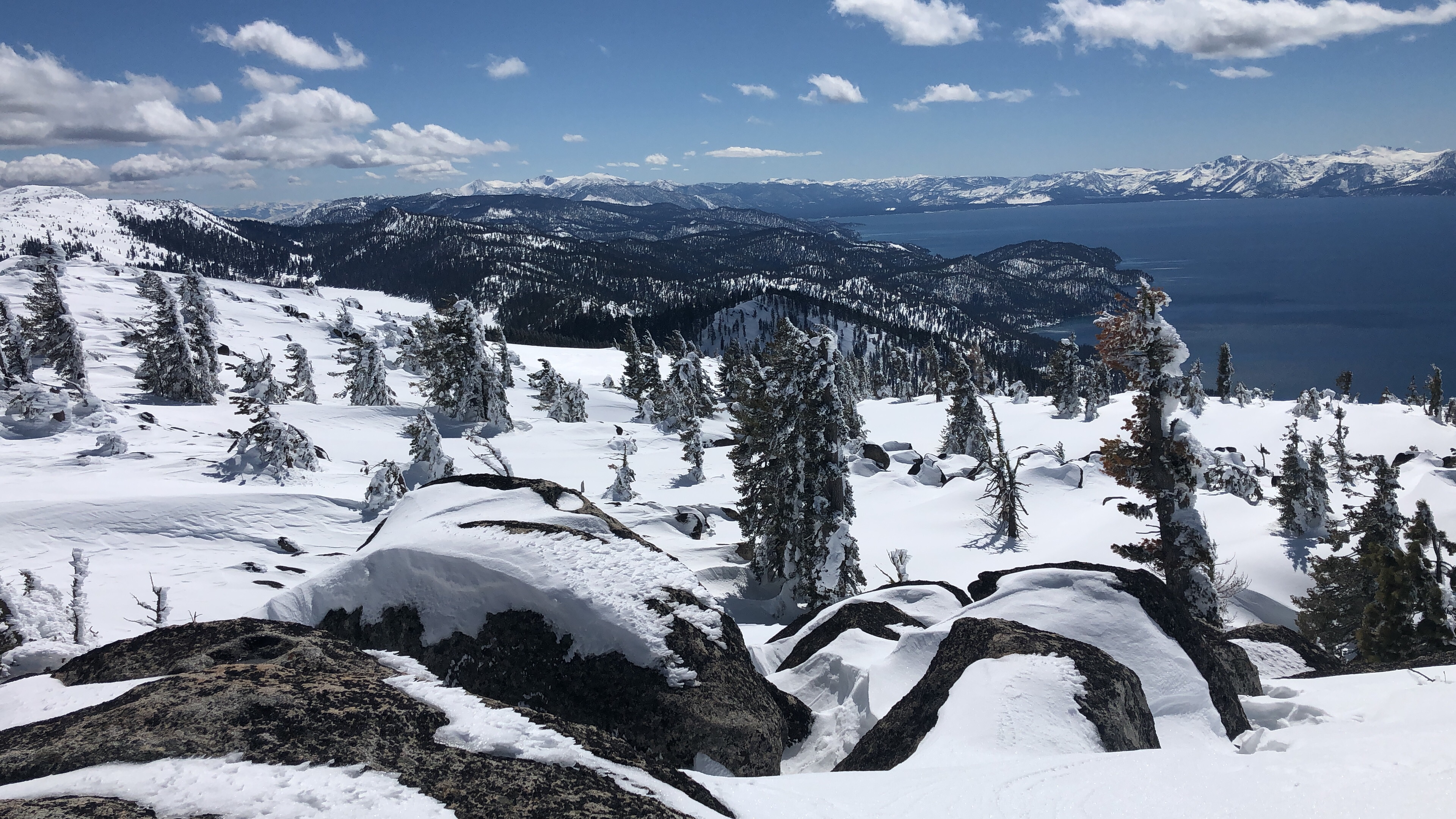


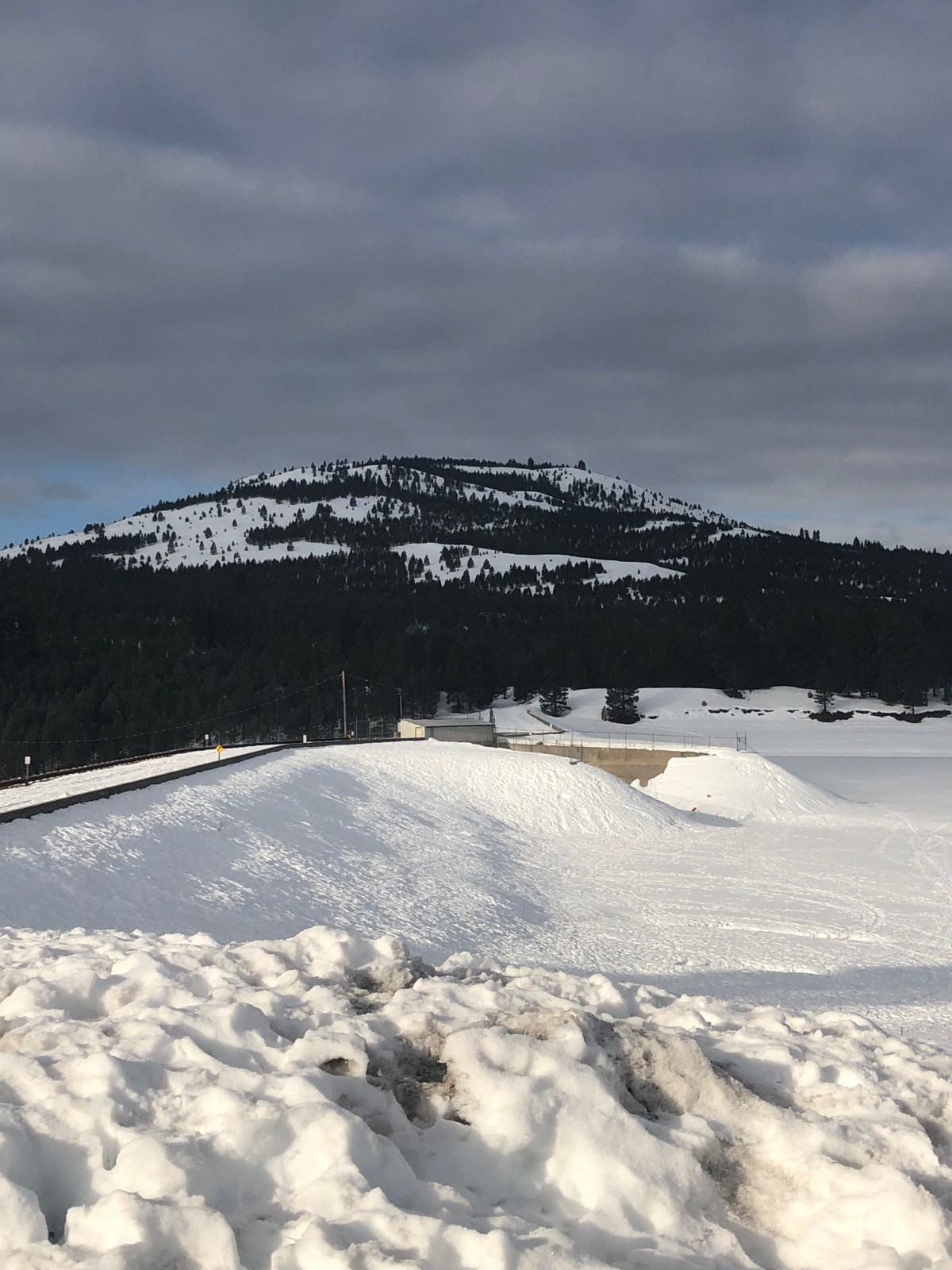
 The approach to this peak is not too hard, and another one of those where winter time makes the ascent easier. Honestly I like the snow covered peaks for approach, I really should just bring all my winter modes with me (BC Ski, BC Snowboard, Snowshoes) and make a command decision on which ascent mode to run. Sometimes it is nice getting down the hill faster then up. I parked at the Boca dam and snowshoed over the dam. In the summer you can actually drive across to the NFS roads in the area. Looks like there is an area you can park when there is no snow.
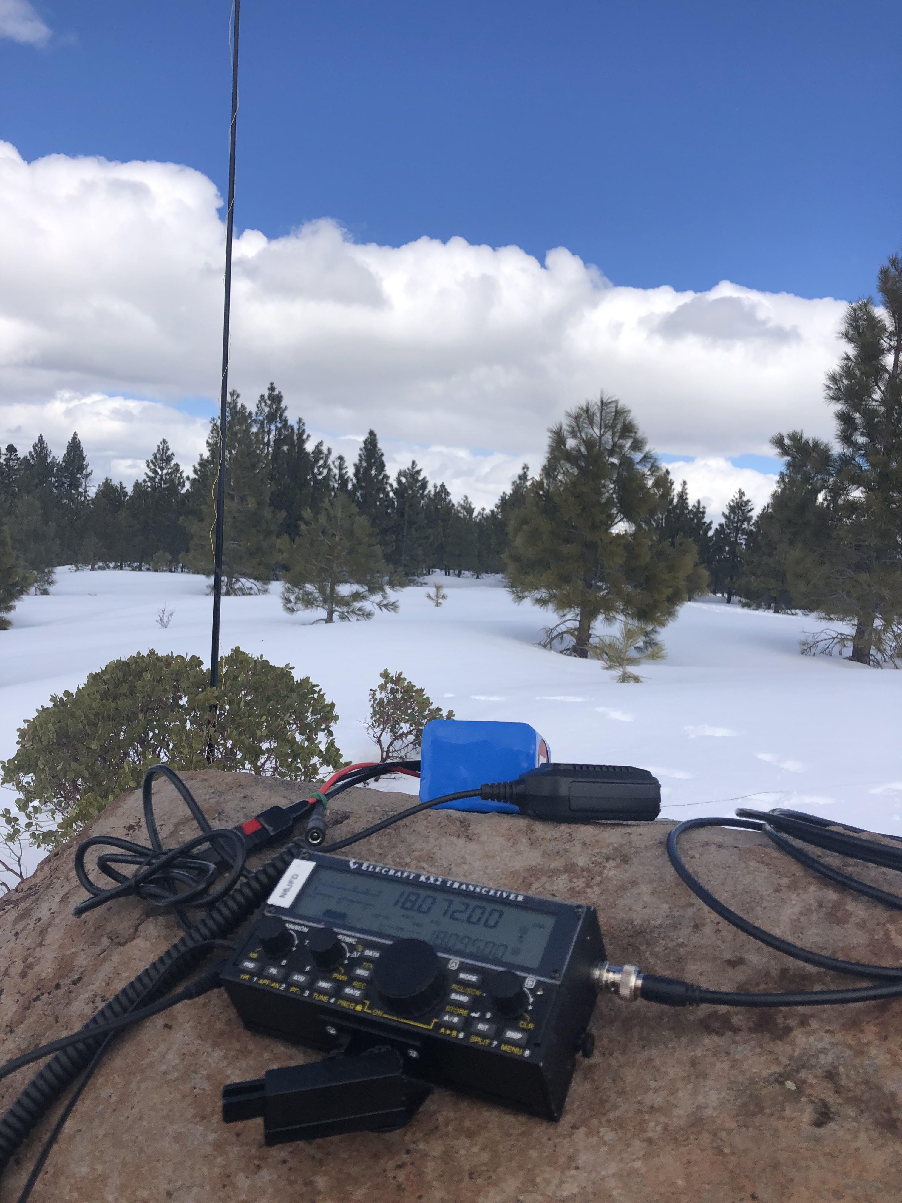
![SOTA down under! VK[2,4]/N6JFD/P](https://backcountrysaunters.com/wp-content/uploads/2019/02/img_3187.jpg?w=1200)