Every year I like to do at least one solo week long backpack trip (but this may have been the last one, more on that below) and decided to make this years a SOTA trip to knock off some of the Rim Trail summits I need for my personal goal. I had locked out the week of August 20th a while back namely because it was a new moon, then there was that solar eclipse thing too. Backpacking in the Sierra under a full moon makes it VERY HARD to sleep, the eclipse was kind of a happy accident. So the plan was as follows when I went in… we’ll see how that turned out 😀
8/19: W6/NS-154 (Lost corner Mountain) && W6/NS-390 (7860) 0900-1300 will be activation time range.
8/20: W6/NS-107 “9269” (mid morning, 4 mile dayhike from basecamp)
8/20: W6/NS-105 “9310” (probably mid afternoon)
8/21 Moving day, but I may try and do something with SEQP before I head out.
8/21 or 8/22 will be time dependent, but W6/NS-095 “9420” if 8/21 late evening (8/22 UTC) or morning of 8/22 PST
8/23: W6/NS-377 Mount Price and W6/NS-094 Little Pyramid sometime between 1030-1400 PST
8/24 or 8/25 W6/NS-068 Dick’s peak and W6/SN-036 Mt Tallac will do both in the same day. (I kept changing my mind on this one)
This was also going to be the longest trip I’d taken Lola (my 3.5 yr old Chocolate Lab) out for a hike, and she was going to carry her own food.
So I got Michele to drop me off at the Rubicon Trail staging grounds and we started walking in from there to the General Creek trail to enter the Wilderness. While the mosquitos are mostly gone from the basin, they were anything but gone on this hot August afternoon. We were making good time, and I noticed that we were within 3/4 a mile of the first peak on my list (W6/NS-390) and decided to drop pack and run up w/ my gear and get this trip started off right. (except that my GPS died 10 minutes after I walked away from my pack). I did not see the point continuing on down the trail to setup for Lost Corner Mountain to have to backtrack back to the peak (and to be fair this was an extra, but 8 points is 8 points). Anyway, The summit was pretty obvious, went to the high spot that matched my location on the map (those paper things) and snagged the first of what should be nine activations for the week. Managed to get three S2S (or which 2 were W0MNA and W0ERI) to boot. So nice to talk to them summit to summit..(They were in North Georgia). Those two are so awesome, they are always chasing, so nice to help them get an activation in there! I did not want to stay too long as I still had some miles to go so Lola and I headed back to our gear..hoping some bear had not made off with her dog food. All was good, and southbound we went on one of the lesser travelled trails in Desolation. We stopped that evening at a spot with some water, and in good proximity to snag Lost Corner Mountain (W6/NS-154) the next morning.

So the next morning after breakfast Lola and I off trailed over to Lost Corner Mountain. GPS said I was 2 miles crow fly, no big deal and 90 minutes later we were on the summit. I only gave myself an hour for setup, and contacts, but managed 3 S2S and 1 FM contact to get the activation. Today was a larger mileage day, so I did not want to dawdle to much. We headed back to our base camp, packed up, watered up and then decided that the best option to get to our next camp site was to stick to the TRT/PCT and avoid the Tahoe-Yosemite/Meeks creek trail. I can see now why permits are so hard to get in Desolation. I passed some twenty people between the General creek cut off and Phipps pass cut off which is an 8 mile stretch. That is a LOT of people for a single day of backpacking. We hiked up to Phipps pass, and then made the cut off trail for Phipps Lake where we were going to do a 2 day stay/base camp while I ticked off the next two peaks on the list. So while Lola’s pads/feet were never messed up she definitely was tired after today’s carry, so I decided that tomorrow I was going to leave her at the camp (on a long lead) and I would go tackle peak 9260 (W6/NS-107). That night for dinner I had my chicken tortilla soup (Bear Creek soups from the grocery store), and had a wild hair to add some mashed potatoes into the soup. OMG…. that will not be the last time I take that on a backpacking trip!! So… I think I might have stumbled upon one of the prettiest and most remote sites in Desolation, but I probably should not put that in print. That is why there are so few quiet places to sneak off to. I’ll even share a picture:

So day three, the plan was just stay posted up here for a base camp, and go after W6/NS-107 (9260) and IF there was time, go after W6/NS-105 (9310). One of the reasons why I said this was a remote site is because I was camped across the lake from the base of 9310 and had an 500 or so foot climb to the summit, 9310 to date is unactivated.. Save the best for last. I left Lola on a lead at the camp while I was gone for the day. I left her plenty of water, and food, and she had cover and such. So I headed back to the trail and started down the canyon towards Rubicon Lake. The destination today is an unnamed peak on a ridge that contains Rubicon pk, and Jakes peak, W6/NS-107. One of these days I will reteach myself how to stick to a contour. I have a problem with climbing too fast, and not getting hitting ridge lines where I want when I am off trailing. So I hit the ridge sooner then I expected, and then dropped a little over the backside, and kept moving on. So today I opted to pound a liter of water and not bring water along thinking it would be a 2-3 hour ordeal overall, and I do actually train like that with some day hiking trips. It took me about three hours from the time I left camp till I was setup and activating. Again, if you chase, THANK YOU! There are always 4-5 activators I can always count on that are fun to talk to, and always willing to work hard to work you if it’s needed!
Once done with the activation, I started down heading towards Stony Ridge Lake. I could see that my best bet was to cross over where I crossed this morning, so “lets contour, and not go down too fast”. I wound up in a HUGE boulder field that was the equivalent to a class 4, and possible class 5 down climb in a few spots but I found some clean water sources to drink from while in the boulder fields. Had to fight a few willow stands, those slowed me down, and made me tired. All told the 8 mile round trip took about 7 hours “tent flap to tent flap”. Lesson learned, but Lola was happy to see me when I got back. I should also note that it’s peak wildfire season despite the water and the super wet winter, Tahoe had quite a few fires burning around the area, including one down by Yosemite. Needless to say, that combined with a low in the area was making for some fun evening weather in the area. To date I had not had rain on this trip, but I managed to get back to camp just as a storm was hitting us. 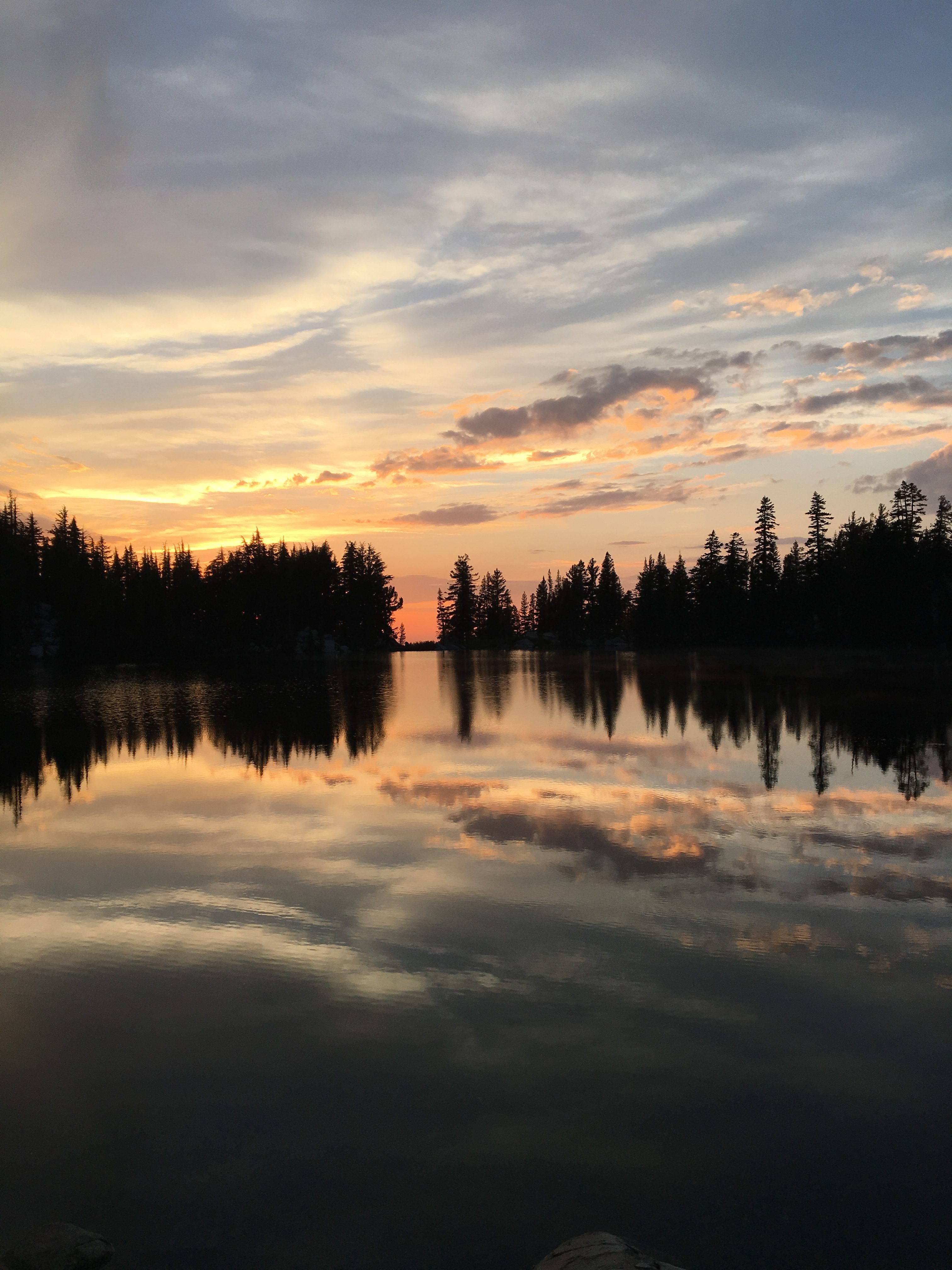 Into the tent I dove, and I had Lola in my vestibule area. (1 man REI Quarterdome). Within 5 minutes we were sitting in the middle of a hail storm, and the hail was bouncing up under the fly and pelting Lola, so into the tent I brought her. She was out cold within five minutes, and snoring. Typical summer storm, it was over in about an hour, it dumped a good amount of quarter sized hail and my tent survived it really well. The cool thing about granite is even after a storm it is still very warm. While nothing inside the tent got wet, we had a river running underneath us. I put everything on granite, while I had dinner, and threw it all back together before dark, everything was dry! Sunset was amazing tonight with the clouds, and the fog coming off the lake and cleared air etc.
Day 4: Solar Eclipse! So today’s activation was going to be super easy from a hiking perspective, but possibly a challenge depending on how the bands were being affected by the Eclipse. I was some 400-500 miles south of the totality, and I could definitely tell that something was going on. Even though the sun was bright, it was cold where I was. After breakfast, I broke everything down, and packed up and moved our gear over to the pass that leads out of Phipps lake, grabbed the radio gear and then headed to the summit. 20 minutes later we were on top and I was setting up. I managed to get 7 QSO’s this morning (I was not in too much of a hurry, but I was not going to hang out).
Lola was moving pretty good, but I could se she was a bit sore and it was time to run her out, plus I wanted to reconfigure some things with my pack. Specifically the radio gear. I let Michele know when I was on top that I would be at the Bayview Trailhead by 5pm and could she either get my truck up there waiting for me, or just come pick me up. Lola and I were moving along well, not as many people on the trail today (it was a Monday, and I was pretty far in). So for the past two years I have been using a LowePro Nova 2 camera bag for carrying my radio gear. It all fits in there (I have a pretty light weight setup). But it was hard to carry water, and it dawned on me I have a 10L hydration pack that I was thinking would work for water, a bit of food, AND the radio gear.
Also part of the reconfigure was breakfast. Growing up I always loved the quaker oats instant oatmeal packs when I was camping/backpacking but as a grown up trying to “eat healthy” I tend to opt for different solutions now. I really should have tested my breakfast before I left b/c I just ended up having PB and Trail Bars for breakfast after realizing on day 1, instant steel cut oats are NOT the same as slow cooked, and well. I got home and threw away what I had packed for my breakfasts (pack it in, pack it out). I hate wasting food, but the McCanns instant steel cuts just do not seem to cook well in the backcountry (in boiling water, yes). I ended up getting a couple of Mountain House breakfasts for when I go back in on Wed (Biscuits and Sausage gravy && Southwest Scramble). I still had at least 2 more peaks I could go for (Tallacs, Dicks), and I was taking off this week, and well I was not ready to plug back in yet! So sure as I thought, my mountain biking pack did the trick. Everything fit, and I was all repacked and ready to go back in and get at least two more peaks.
So I decided to drop the three peaks that run along the Crystal Range part of Desolation (Little Pyramid, Price, W6/NS-095) as part of my get Lola out trip, and focus on Dicks’ (W6/NS-068) and Tallac (W6/SN-036). I’ve been on Tallac a few times just as a hiker, but never with radio gear. The goal for Wednesday was make Lake Gilmore at the base of the climb to Dicks pass, and a 45 minute hike to the summit of Tallac. Dick’s peak has also not been activated yet, and is located in the almost geographic center of Desolation. My legs w
ere still in strong shape, so after a lunch at one of my favorite South Lake Bars, I headed to the Glen Alpine trailhead. It took me just under two hours of hard moving to make Gilmore.
Gilmore is one popular camp site, this was the first night on my trip where I had people around me. I just wish folks would heed the rules on the permit.. NOTHING within 100 feet of water. You do not pitch your feet 10 feet away from the big lake. Anyway I digress. So the next morning I cracked into that Sausage and Biscuits from Mountain House. I’d not eaten dehydrated meals since the 80’s (which IIRC were Mountain House, they had Woodsy the Owl on them. I still have one, here is a picture: <find that MH and take a pic>
So, those biscuits and gravy actually tasted pretty good, but it was a lot of food for one person, and the whole dehydrated thing did leave my stomach in knots. Anyway, today we were going to go after Dick’s peak, that was my only focus…I could still do Tallac tomorrow if I had to really work Dicks. Dick’s peak as noted is not a day hike, unless you plan on starting or finishing in the dark. The climb up the trail to the pass is not that bad, but then at
the last switchback before hitting Dick’s Pass, you turn off trail and start heading along the saddle there to climb the last 1600 feet. Oh btw, there is no trail. I made the summit in a couple of hours, even with the fun climb and started setting up. While looking for the logbook/ammo can on the summit, I found a note that was buried under some rocks. Someone had written a touching letter to someone in their life that had passed away. Out of respect I left it up there, and did not take a picture of it. I forgot to bring my crappie pole mast, so decided to just run my antenna about 2-3 feet off the deck between some rocks, and running off at an angle to get a south and east/west reflection. Oddly enough I managed to get an S2S with a guy up in Washington so something was reflecting me that way too. I scored 6 QSO’s and was starting to think I could manage Tallac too if I got a move on now. The down climb took me about the same amount of time, and it is a pretty well established goat trail, but it is exposed in some spots, so if you are not comfortable in a free scramble situation, I would advise you to take caution.
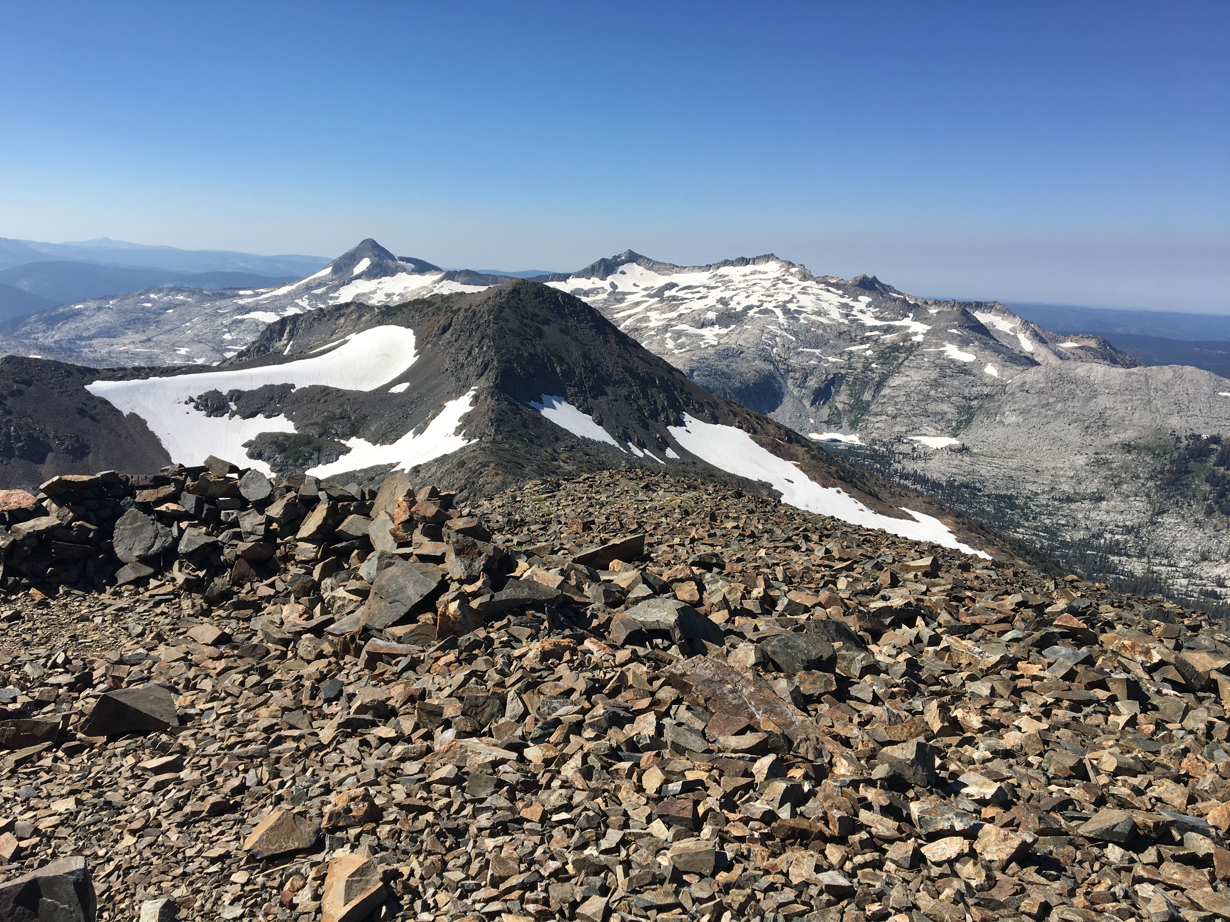
I made Tallac, got my QSO’s but really had to work it hard. I ended up getting more 2M contacts then HF contacts for Tallac, but I was satisfied. I set off to get 9 peaks this week and finish everything in Desolation, I snagged six of them, and managed to do some scouting to see that I will need to come up from the backside of those other peaks to snag them, so best I would have done would’ve been 7 peaks total.
I have 20 peaks left to finish the rim trail, and pretty sure I’ll be down to less then 10 by the end of October. I may be able to get the rest of these this calendar year!
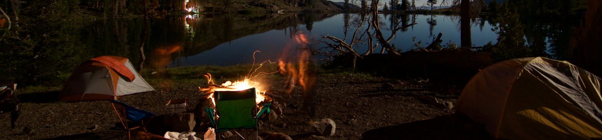
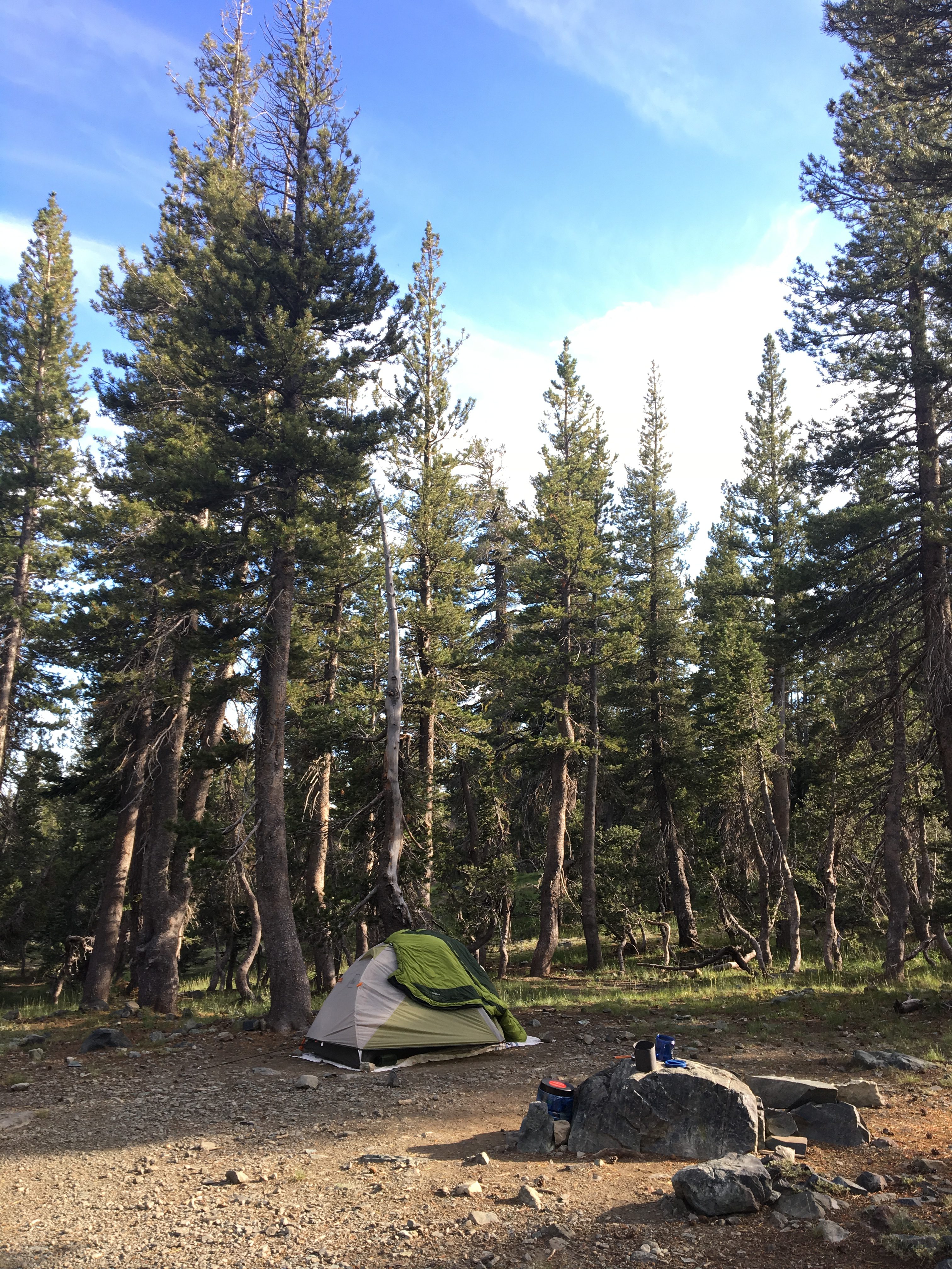
Other images from the trip: