I wanted to take advantage of being in the area, so after scouring over sotl.as, finding a peak that met some of my requirements, studying the (digital) topo map and finding very little info for the approach, I went with a peak that seemed well within my wheelhouse. Plus, it has a cute name to boot, “Nutt Benchmark”. It was also a First Activation peak, so those are always fun (and typically involve the most planning and do tend to give me a little anxiety.
Preflight:
At the Sitgreaves Pass View point is a wonderful (and big) with some flat spots pull out that we ended up using as a post up. That was the one useful tip the couple of trip reports I found contained. So with some daylight left, and me wanting to do a little exploring I managed to climb my way to the top of the nearby ridge line. It turns out that there was a well cairn’d use trail that wandered off in the direction I wanted to head the next day. After walking out about a mile and confirming this approach trail would work, I opted to shift from the route I was going to use to staying up along the ridge line to a specific saddle. From the saddle to the summit is about a mile.
Lets do this:
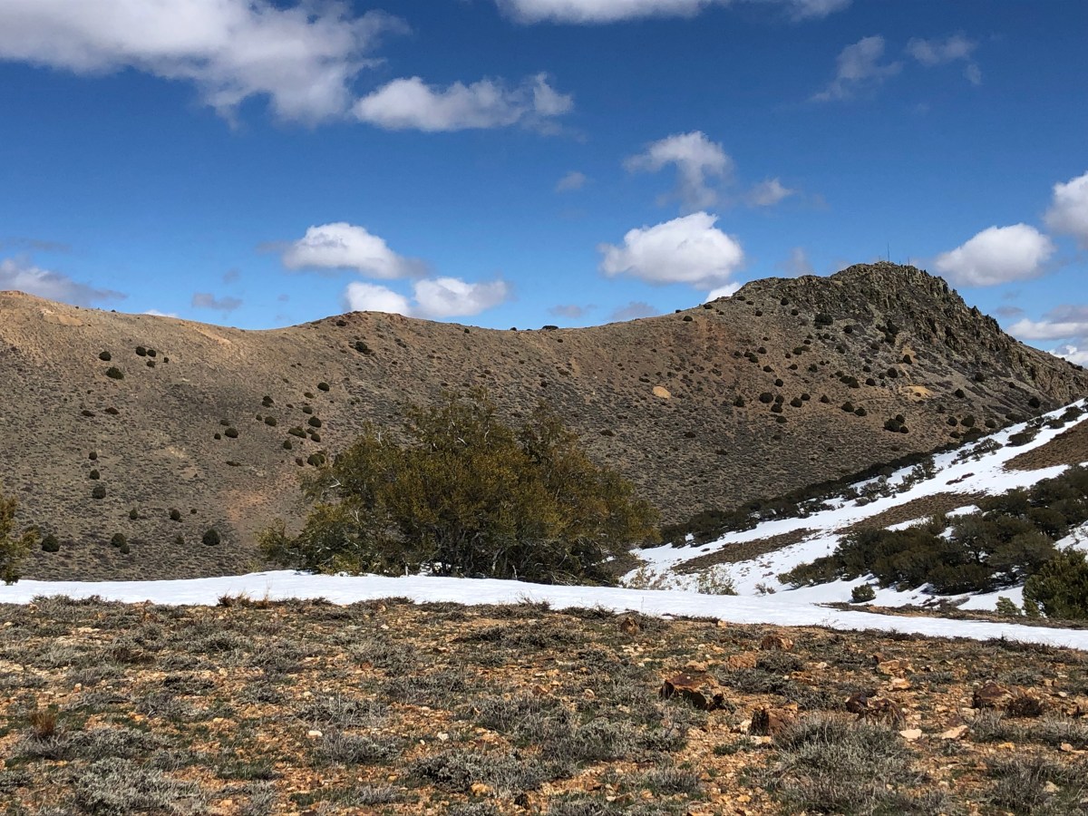
So with that I was off from the pass at around 8:30 in the AM. I would say the ascent from the parking lot to the ridge line, and then a few segments along the final push are kind of the cruxes along the hike. Well, that and the various cactus (some of which were in bloom on this walk). If you have ever been to Oatman down the hill you have probably encountered the very docile and tame donkeys. However out here in the uplands those donkeys are a bit more feral. As soon as I crossed into the hills and they were aware of my presence, they were gone. The walk is in a N by NE direction until a saddle is reached with great views over towards the Hualapai Mountains. From here turn towards Northwest and knock out the last 800 feet of elevation gain in about a mile.
Because the elevation gain is pretty minimal I made pretty good time scooching along the approach ridge. You actually pass right under another SOTA summit (4975, W7A/SM-055) that would make for a fun two-fer. For what I could tell the approach up 4975 would be pretty easy, but it does look steep. I was considering the two-fer and would allow the build up of clouds determine yes or no. Once the saddle is reached the trail (for the most part) is over, there are plenty of braided paths to the summit, however one thing I would advise is to not push for the final ridge until after that last rock wall you encounter. After that though it’s smooth sailing.
Summit and Activation:
The summit area is a large flat area so plenty of room to spread out and enjoy yourself. Since this is not that popular of a peak (for some reason), it’s not like you have to keep your station setup small. When I say this peak is not that popular, the last person to sign the log that was on the summit was in May of 2023, ten months ago. The log based upon the the business card inside the PB Jar (yah do not use PB jars, those plastic lids deteriorate quick) was placed by the Las Vegas Mountaineering club. No idea if they plan outings or what.
I spent about two hours on the summit on a day following a pretty large solar storm, so the fact that I managed 40 contacts across five bands was pretty impressive. No DX to be had, and as much as that probably had to do with my late start, i am guessing the dead bands also were a part of it. SFI of 195, and K of 4 are not optimal conditions, but as I noted, I made it work.
Time to wrap up:
Part way through the activation I was noticing the same afternoon build up of clouds and virga that we kept getting during the softball tournament, so I opted to stick around a bit longer and keep activating, but would skip the second peak. The walk down was pretty uneventful except that I did step on a chunk of cactus, and it went through the bottom of my shoe (ouch), so that took a few minutes to dig out.. That and for whatever reason I kept losing the trail on the return even after I was on the main path. So pay attention. Overall I would put this as a medium effort peak, I covered a total of 10.25 miles and just shy of 2200 feet of total ascent.
Some final parting shots:
73 de N6JFD/P
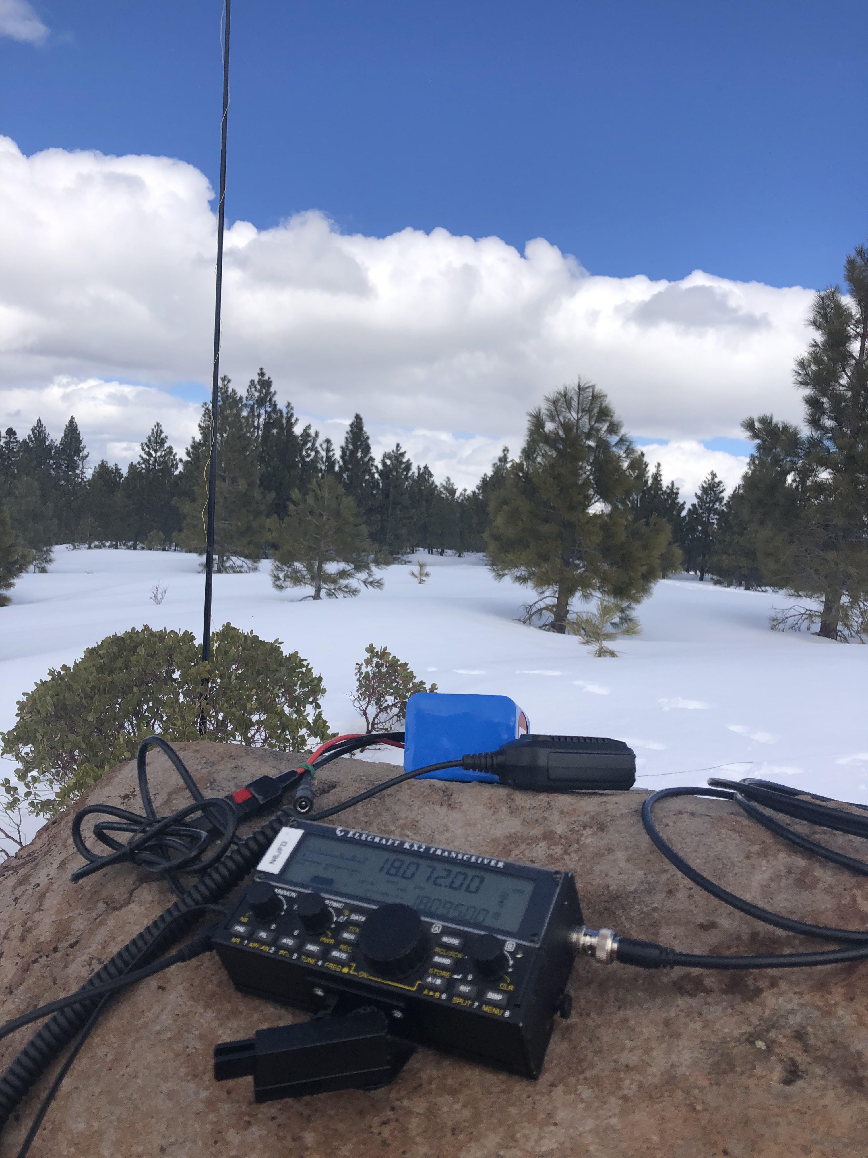
Not the best of conditions, but still made it all across the US
Two days in Guadalupe Mountains National Park for a day of hiking the Texas State High Point
In the quest for state high points and available time for getting up to the PNW we spent two nights at Guadalupe National Park. The Guadalupe Mountains are a North/South running chain in the West of Texas and South East of New Mexico. This area is also close to Carlsbad Caverns which if you have the time is worth a stop over as well. This mountain range at one point was a reef bed and many of the fossils date back to some 40M years ago during the Permian Age1.
Where to stay in the park:
There are two main campgrounds, plus a horse corral. The Pine Springs Campground is at the base of the hike for Guadalupe peak which was my goal on this outing. The Pine Springs CG uses part of the parking lot for 13 “RV” sites, and there is a separate loop in the same area for tent campers to make for an easy leisurely start to get up Texas’ state high point. This area is really close to the Central/Mountain Time Zone line, so at times your phone will present with one or the other. Hopefully while you are there time is not that important because it’s hard to know what time it really is :D. My Garmin once I started my GPS track was using MST even though my phone was still showing CST.
The Hike:
The steepest part of this trail, and the part that is going to make or break you is the first two miles. Lots of steps made by people with long legs and a short torso, so for those of us who are say…average height (or shorter) and are a 50/50 torso/leg split do have a bit of extra work. The other option is follow the others up the side of the rock steps creating new erosion channels (see principle 2 of LNT for why you should not do this). I wanted an early start because as usual the goal was Summits on the Air, and hopefully some EU/UK DX. I was moving pretty early on and greeted by the park volunteers at the bottom of the trail with the usual questions of “enough snacks, enough water, layers?” etc. Today’s weather was calling for high winds and temps in the 40-50s, towards the top there was also some snow, ice and mud on the trail. Also this is a pretty arid area so a good amount of water even on a day like today is necessary. An interesting combination of conditions to really have to prepare for.
Up I went making a good pace ahead of my hiking partner as I knew I would be hanging out on top, and wanted some time to setup. Normally I would not say separate from your group, but this was a pretty straight forward trail with out any real turn offs to end up in the wrong area. I made pretty good time overall for maintaining a consistent pace; the ascent is a tad more than four miles with an elevation gain of about 2900 feet. The Munter method would put this at a 3:45 minute hike, I knocked it out in 2:16. All that walking (and swings and squats) pay off :D. As far as the ascent went and I had an idea that because the trail is on the canyon side of the hills that we were getting a funnel effect. At about 1.5 miles the trail hooks hard left at a rock out cropping and this was the worst bit of the winds this day, but after about 200 yards you end up in a tunnel of Pine trees that cut the wind down for the next bit. I will note that this trail has a bunch fo exposure, which made for a fun descent (more on that later). The last mile was where the snow, mud and some ice was. I was quite surprised to see ice given the semi arid location, but some winter/wet weather had ripped through a few days before. So, be aware that winter weather is a possibility.
Setup the radio gear in a way to not be too wind effected and the wife was not far behind. She too beat the Munter Method timing by a good hour! For the SOTA stuff, I spent 2 hours activating across 5 bands all cw and managed 58 contacts. Most of the DX came on 21mhz and 28mhz was great for the whole US. DX included France, England, Spain and Switzerland.
The Descent:
One of the rules I hike/peak bag by is “anything you go up you have to come down” and that has served me well, as noted in the Big Bend post I almost broke that rule but today is not about me and my descent. I’d been aware of this one particular group on my ascent and while I was hanging out. As I was about 200 yards down I found a party who had one individual near tears and almost frozen in their tracks. This group had left about 30 minutes before me from the summit and this was as far as they got. I called out a bit ago that there was a fair bit of exposure to this walk, you are above treeline, while the summit area is pretty big the trail is exposed with long steep drop offs on the sides and this individual had reached their breaking point. They were not having it. I decided it was time to engage and pull out all those skills I’ve picked up over the years to walk the group down and overall it was a great experience. The single most important thing you can do if you do engage to help someone is listen to what they are saying.. Not just hear, but LISTEN. I had noticed that this person kept asking us to walk down in front on the harder step down. Basically they were learning what we were doing with our feet, so I made sure to wait every time we came to one of those dicey sections. Now keep in mind, I love it when a hike takes me into evening and I can catch a sunset, and I had an idea that this would happen. At one point because the cellular service is pretty dodgy I ended up having the wife monitor Simplex on the radio just in case we needed other assistance up there. Note yes there is some cellular service but it is dodgy at best, and there are parts of the trail where you go 30 minutes with no service (including no SOS), so plan accordingly. It took us about 4 hours to get down, but we all managed to get down safely. Hopefully this individual was not too turned off by the experience and their group of four does continue venturing out into the hills. I really had an enjoyable time talking and walking with the three who remained with me on the descent.
Key Takeaways/epilogue:
This was a great area to stop and play, and I recommend it if you are in this area, that said book early. We did end up having to move from one campsite to another in order to stay for two days. From a hiking preparedness perspective, this is a reminder too/from me to always turn around on your way up to make sure that when you look down you do not freak out. Of the people I have helped over the years both in the name of SAR and as a good samaritan, the mental hurdle is one of the hardest things to overcome when you are in that exposed out situation. We can always warm up, consume calories etc, but when we are freaking out/disregulated getting re-regulated can be the biggest hurdle to getting back on the move. Not a lot planned for March other then work our way up to the PNW and then back down to SoCal , but that said April and May will be another springtime adventure off in the UK.
A quick blurb about playing radio in the evening in New Zealand, and making contacts to Europe.
I love it when a plan comes together, however it is much more satisfying getting lucky and being in the right place at the right time. One of those days I just happened to check the reflector I noticed a posting about the JA/VK/NZ/EU S2S party scheduled for 1, April, and we just happened to be in New Zealand to boot. So far this trip, SOTA had been somewhat frustrating, there are only about 10 CW chasers total between AU and NZ, and the sun was acting like a prima donna being all kinds of super active. To the point I should have been able to see the Aurora Australis when we were in Queenstown, NZ except that it decided to cloud over and rain that night. Also to boot, for some silly reason that escapes me I decided to leave my QCX Mini (18mhz edition) at home, so all I had with me was the MTR3. 3 bands, CW only and NONE of those bands were having it during daylight hours. That said while we had been traveling, I had taken it upon myself to do a couple of night activations, and those were where I made the bulk of my DX and had some fun activations. One on Mt Kaputar (VK2/NW-001), and Mt John (ZL3/CB-625).
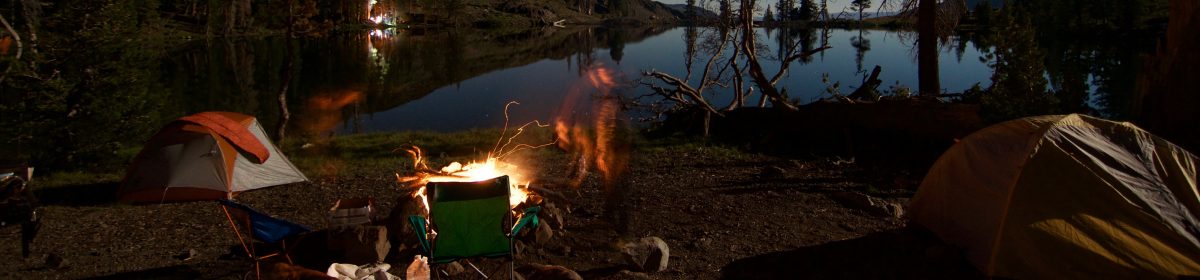
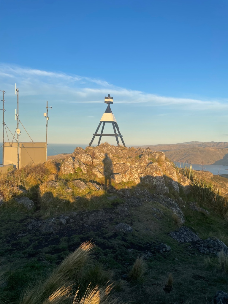
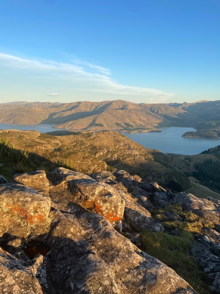
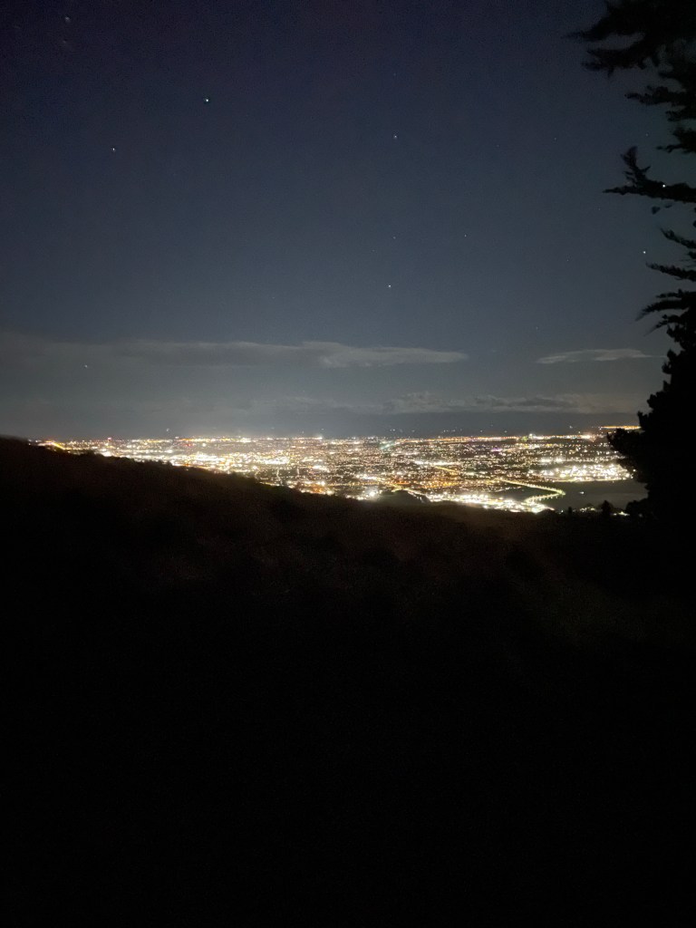
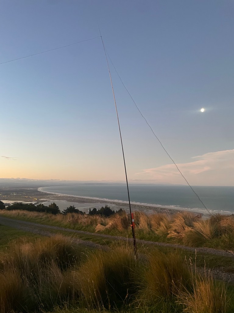
I also just happened to be staying at a friends house in Christchurch who lived a 30 minute walk from the AZ of Mt Pleasant (ZL3/CB-822), so the idea of another fun evening/sunset activation that also happened to overlook the ocean and parts of Christchurch was quite appealing. This activation ended up being my most productive activation of the 2 months down under, and I managed to work 9 different countries, all on 20M. Five contacts were actual S2S contacts, and the breakdown of DX was Germany, France, Hungary, Switzerland, Spain, Australia, Czech Republic, Greece, and Italy. I operated for about 2 hours, and enjoyed the views to be had, but once QSOs dried up it was time to walk down. Oddly enough, no JA stations on this activation, despite the couple of times I managed JA in VK land.
Some parting shots.
The Beach (and some boats)Lyttelton/InletChristchurch at nightoh that sotabeams mast (and moon)
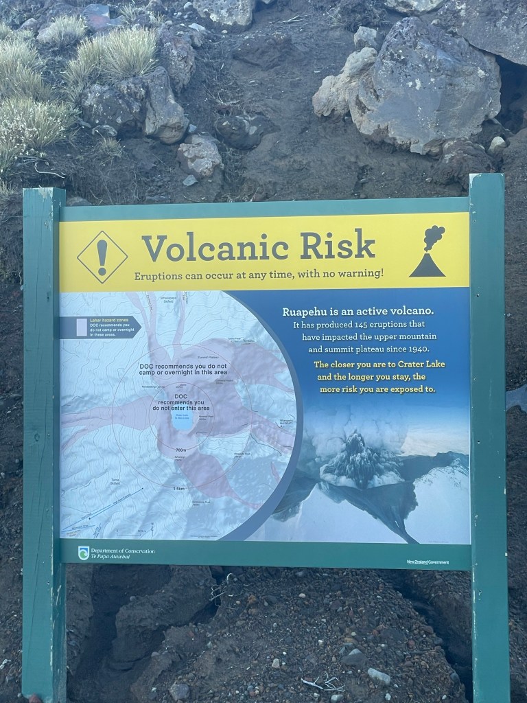
Taking a break from a long road trip to highlight one specific activation. For those not in the know we have been on the road in Au/Nz for 6 weeks now and the trip is winding down with a couple of weeks on the South Island starting later this week. However today I rolled the dice with the weather and decided to head up the North Island High Point. Mt Ruapehu is the proper name for the entire volcano, but the summit block that claims the HP is named Tahurangi. ZL1/MW-001.
nothing to worry about eh? just a pile o rock 😉
This peak has only been activated once, and given some of the other issues I have been having getting contacts (that will be explained in a full write up ar a later date), I was a bit worried about getting this successfully activated on a Monday. Geoff/ZL3GA helped hook me up though with getting the word out to some of the other local cw chasers!
It was also hard finding good approach data for this peak, so well lets just roll the dice and see how we fare!
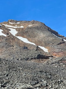
Most write ups did talk about walking up under the ski lifts and that works well, but is not the highlight of the hike. Once at the top of the High Noon chair head to the right/Easterly. There is a creek/ice field that does need to be crossed. Today there was a decent crossing however in my mind tbis was the crux and a bit unnerving. The runout would not have been good, I did find a place further downstream to cross without ice. The next goal is to make the shoulder that runs SW to NE. Take the time to notice the amazing slab that goes from about 2500M to a cliff band around 2650M. The slab is very sticky, and I found it easy for going both up and down in a straight line. Most of the tracks I found avoid the slab, but if you are comfortable on rock its safe and fun. The next bit oh fun is a lot of switchbacks, or some mild class IV climbing, but this is the steepest part of the approach.
Top out on the false summit and the last 100M is pretty mellow, do note though there is about 20-25M of a spine before the shoulder gets really mild. The drop off on both sides is a bot precipitous 🙂
The view from up here is amazing, there is a huge lake down in the crater, a cone on the other side of the lake, and a few more summits as well. The mountain did burp a couple of times while I was up there and that was a touch unnerving, but I did not see anything spewing.
This was my best activation so far of the trip, I managed to get 9 contacts total across VHF 20/30/40M (not used to getting so few, but as noted above another story for a much bigger post).
Here it is towards the end of April, spring is in full swing in some areas, however the Sierras are still coated with feet of snow, but the mountains in NV are calling and open with easy access. So for the past two years I have been operating with a KX2 and that is an amazing rig, full of features, and I am sure i am only scratching that surface, and my kit weight has varied over that two years as I have added/subtracted batteries changed up antenna configurations etc, but it does come in around 5lb.
All that said last year I went thru level 1 of CWops and started doing some CW on my activations. I immediately went from hoping to get 10 contacts, to always getting more then 10 contacts when I started doing CW as the bulk of my activation. I’ll still hit some 40m SSB because some of my friends still are SSB. Why I brought up old news, is that going to cw opened up 30m for me, and on those weekends when 20/40 are in use for some contest, that can make an activation a bit more challenging. What I have found with 30m is I still get the same chasers I do on 40/20, but the signal reports are not as strong, with the exception for W5N, and W7A which are stronger. W7O is down in the 3s and W7W is in the 4s for me and I can consistently hit W0C. While I am not saying 30m will always get me the most number of contacts all the time, it will at least get the job done, and the regular chasers will do their best to work you, especially if they know you are mono-banding.
About this same time the NASOTA slack channel really started to grow. A few of those fellow SOTA folks are kit builders, and love tinkering with their rigs etc. K6ARK has added a touch sensitive keyer directly into his MTR3b as an example, since then he even built a micro-pixie with built in matching unit and direct attach end fed for a SOTA capable rig that he has used on an activation that weighs in the 3oz range. KT5X out in NM is always looking to make a lighter kit as well, and often writes the NASOTA groups.io forum with his updates. KE6MT has also been a fountain of information on the builder front and has helped me immensely (he better, I’m his associate association manager ;P ). That said, I took it upon my self to order a 30m QCX (from qrp-labs.com) with the intention of using that as a light-weight SOTA rig on those days where I want to do a lot of miles, and I may be shooting for a lighter pack to focus on miles while still carrying the 10essentials, or I am time limited. The Black Diamond Distance 15l fills the bill well, and I used it on a recent co-activation with Rex on Waterhouse Peak. Maybe I will be one of the first SOTA guys to do an UltraThon AND an activation on the same event. (doubtful, but one can dream).
My current kit:
KX2
4.5mah BioEnno battery (I get ~11 hours of operation on a single charge with the KX2 at 10w)
LNR Trail Friendly, or QRPGuys 20/30/40 Vertical antenna
That five pound mark is not too bad overall, and I know folks who carry more, and even with that list, there are some changes I could make to get it lighter yet. End Feds are great just draping off the side of the mountain as a “sloper” and in some cases, some peaks already have things you can use to help go inverted vee (like tree limbs or no longer used antenna towers). So I can drop the fishing rod all together in the future.
I have set my goal to be less then 2lb overall because I have a few hikes I want to try as a “HaRunk” (ham radio trail run). So I have set out on how to accomplish this mission, enter the QCX and a new kit
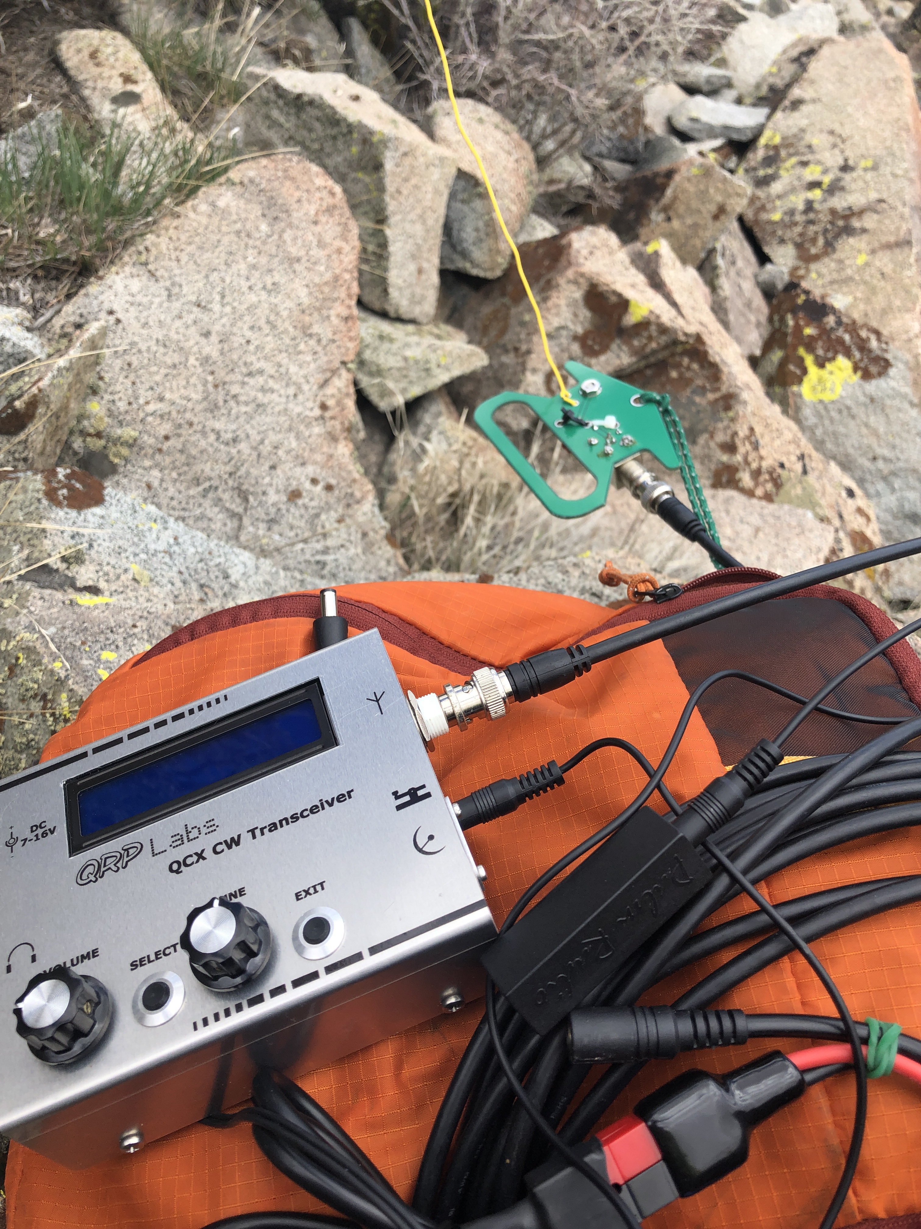
I have chased a few folks with the QCX from the QTH, but now it was finally time to use the QCX as my activation rig. It was on Easter Sunday and on a day that 30m propagation was not great and I was not on summit till noon. SotaWatch showed that I was the first spot in over two hours. I managed seven QSO over 25 minutes and then my battery decided it was time to shut off for recharge (oops..been testing a lot, forgot to check levels). Either way it was a successful activation on a unique summit. Full disclosure it was also the first time I have done an activation without using the decoder, and I managed to get a good copy on all those who called me whom I could hear, so I am getting better there too. Contacts included: AG6VA, K0RS, KR7RK, W7USA, WA9STI, W7GA and K7RJ. According to RBN I was reaching the VE6WZ beacon up in Calgary, approximately 700 miles. Last time I checked, I was putting out 2watts of power, but that was before I really tuned my EFHW. On the approach drive in *4×4 road* I managed to make it to within a mile of the summit, but overall this is a drive up summit. Either way, b/c I am in run training, the 1 mile 400 foot elevation just helps with the training, and I do my best thinking when I’m walking (more on that below). Those structures you see on the summit proper are from past deployments I think, all the radio towers, cell towers, and TV towers have been moved to other nearby peaks, overall (at least on 30m) this was an RF quiet peak.
Now on to the kit you see pictured above: (Phase one of weight reduction)
When I started tinkering with the idea of a single band antenna I went and snagged a qrpguys NoTune end fed HW antenna. I was still lugging that big 4.5mah battery, so I am thinking next up there will be to go snag an 1800-2200mah LiFE/LiPo battery; that should give me 3-5 hours of operation overall. Weight difference there is almost a pound. I love having that mono band EFHW antenna, but I was concerned that banging the PCB around on rocks, or letting it hit snow, or snag on a limb could be detrimental. While I was hiking out, it dawned on me, that all I really needed from that PCB is the transformer and capacitor, and some way to shove it inside the QCX enclosure or protect it another way. I actually went back to the QRP guys page b/c I’d heard rumors they were making a self contained matchbox version of the same antenna, and sure enough they have a mini version. Purchase complete, hopefully here by the end of the week. That actually helps me solve a couple of issues as I can use the matchbox to cover the opening that removing the BNC from the QCX will create. I will also be able to use that to wire the components direct to the QCX PCB. (I am just a rookie at the tinkerer thing, so things will probably look/be clunky at first). I will have to plug the hole on the matchbox for the BNC, so a new problem to solve, but not major. Honestly the best outcome is to somehow figure out if I can get the full setup inside the QCX enclosure, and then tap two screws for counterpoise and antenna thru the enclosure. I will also be able to roll the wire (42’6″) around the QCX case as a winder. Moving to this will also eliminate the need for a feedline, or a BNC/BNC coupler and with lighter battery will help achieve that 2lb goal I am shooting for. I am hoping to have that all setup for the Lake District SOTA weekend in the UK, as I am looking to do some mileage on my first day over in Wales to snag Snowdon and YLlwedd before heading up to Ambleside. I may actually break it on Mt Shasta the weekend prior to heading out.
Once i get the new changes put in, I’ll start doing some power drain measurements and add those to a followup post. This is the part of SOTA that makes Ham Radio fun, the tinkering and playing and seeing what can be accomplished with small gear.
So let me re-iterate: I do not condone leaving the 10-essentials at home, but we always have room for improvement in reducing pack weight. Given enough time and creativity really coming up with ways to build a walkabout kit with SOTA gear that borders on featherweight on the back is in and of itself a fun exercise.
Head of a goat, body of a sloth :D. About sums up my hiking, crazy, slow and steady…
Huh?? SlothGoat? What award for Summits on the Air is called SlothGoat?? So I finally hit “Mountain Goat” (1000 Activator points), but on that same activation, I also hit Shack Sloth (1000 chaser points) via an S2S. Shack Sloth if you are a full time chaser is pretty easy to get, but the only time I would chase is to practice some cw or via summit to summit contacts (Log your S2S if you dont). Last fall I realized my chaser points were very close to my activator points, so with a lot of planning, and luck I managed to hit Sloth and Goat on the same activation on top of W6/NS-264 Boca Hill. There was nothing really significant about why I chose this peak. Leading into the weekend and watching the wx forecast, I knew there was a chamce for snow, so I had built 4 different plans/routes based solely upon various outcomes including reactivating the first peak I ever did as a SOTA activator (W6/NS-086 9614), which I activated under my original callsign (KK6TXU). Boca offered me the quickest exit if wx kicked up, and was the safest from an avalanche forecast perspective. It would also have been nice to do a unique peak too, and this activation put me at 110 unique peaks in 120 Activations; a pretty good percentage.
The approach to this peak is not too hard, and another one of those where winter time makes the ascent easier. Honestly I like the snow covered peaks for approach, I really should just bring all my winter modes with me (BC Ski, BC Snowboard, Snowshoes) and make a command decision on which ascent mode to run. Sometimes it is nice getting down the hill faster then up. I parked at the Boca dam and snowshoed over the dam. In the summer you can actually drive across to the NFS roads in the area. Looks like there is an area you can park when there is no snow.
Today marked the most number of contacts I have made on a single activation, I also managed quite a few S2S, and the bulk of the activation was CW.
Callsign
Band
Mode
Notes
KI4SVM
18mhz
cw
S2S, Complete and Sloth!
K0RS
7mhz
cw
K6ARK
7mhz
cw
S2S, booming in with your QRO
NS7P
7mhz
cw
K1LB
7mhz
cw
N0OI
7mhz
cw
K6CPR
7mhz
SSB
(I still phone occasionally :D)
KD6EOD
7mhz
SSB
NW7E
7mhz
SSB
KD6EOD
7mhz
SSB
K6MW
10mhz
CW
KB7HH
10mhz
CW
K1LB
10mhz
CW
Reno on 40 and 30
AA7DK
10mhz
CW
K6HPX
10mhz
CW
N4EX
14mhz
SSB
Nice to hear you again Rich
W0MNA
14mhz
SSB
W5BOX
14mhz
SSB
W0ERI
14mhz
SSB
AA1VX
14mhz
SSB
KX0R
14mhz
CW
S2S/ Bennett Mountain
KE6MT
5 mhz
CW
might be my first 60m QSO
KG3W
14mhz
CW
K3TCU
14mhz
CW
K0GWR
14mhz
CW
NJ0U
14mhz
CW
VE2JCW
14mhz
CW
W2SE
14mhz
CW
AB0BM
14mhz
CW
N1AW
14mhz
CW
N6DNM
7 mhz
SSB
Some other images..
The rock I was sitting on behind here made for a perfect SOTA DESK in the BC 😀 used my vertical today..
(From April) Time for my spring trip to TN to visit the homestead, and I wanted to pick up some W4G action since I just finished mapping the SOTA peaks on the AT. I will post that as a separate blog, as that was a very interesting planning effort, and maybe in a couple of years I’ll take the 4 months it will take to do the AT+SOTA as a single thru hike mission.
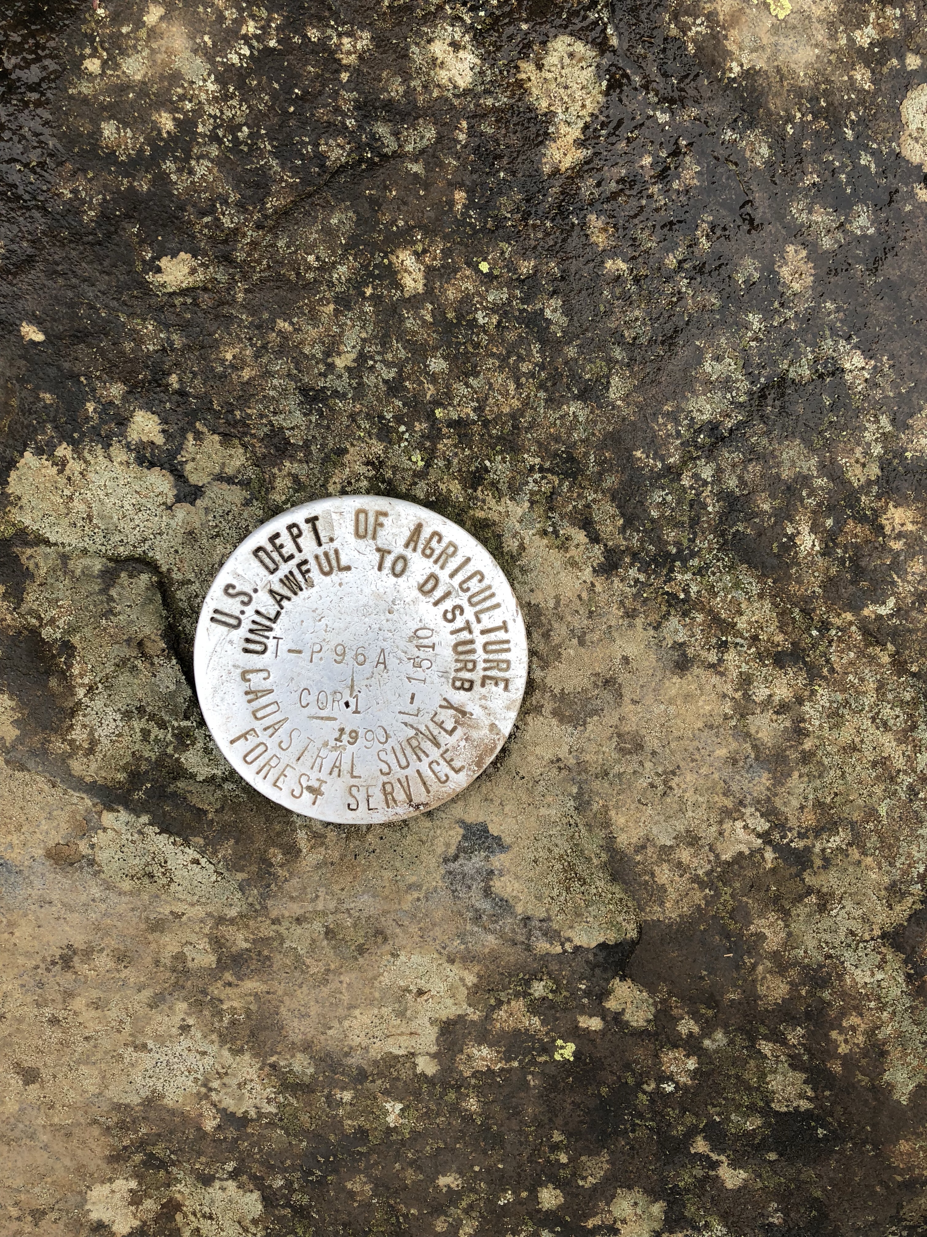
Anyway back to this trip, landed in Knoxville and picked up a 4wd since I’d heard that there was going to maybe be some snow in the area.. Wait, did I hear that right? Snow? it’s April, it’s the Southeast, again, SNOW? Like they always said when I was growing up, do not like the weather, wait 10 minutes. Dropped the son off at my dad’s, picked up a sleeping bag, pad and wool blanket then rolled down to the Blood Mountain trailhead for some sleep. Finally drifted off to sleep around 6am, but woke up at 730 to start the hike up.. snagged some breakfast, downed a liter of water and hit the trail around 800am. The crazy thing about the AT is that you do a LOT of UP climbing, and the folks that built the AT did not believe in doing switchbacks, I bet adding switchbacks to most of the major climbs would add another 500 miles to the AT ;-). Anyway, so UP I climbed, to hit the summit of Blood mountain. It had rained the day before, then got cold overnight and a freezing fog moved in which made from some really cool rime ice on the trees and spider webs. <insert frozen web here> While on the hike up the temps warmed up enough that the rime ice started falling off the trees, and dropping a fresh layer of frost on the ground. The view was not that great today because of the heavy fog in the area, but I found a nice rock platform to sit on only to realize I was sitting on the Blood Mountain marker <insert marker here>
Contacts from this activation: 20m: K6MW, W7RV, N5ZC. 40m: KG3W, W0MNA, W9MRH, KD9JJE, K3TCU.
I was a bit early for the west coast on this peak, and ended up getting more 40 then 20 today. Now that the contacts were slowing down, decided I wanted to snag a second summit, and realized I was very close to Brasstown Bald (NG-001) so opted to book it down the hill and hit that on the drive up to Carvers Gap. FYI, this is a fee area with a good lookout platform up top kind of like Clingmans Dome, but it also has some towers on top that can inject some RFI.. You have the option to take the shuttle up, but this is SOTA, and the hike from the parking lot is ~6/10 of a mile and a couple hundred feet. NOTE: the parking lot is NOT in the AZ, so do not try and activate from there..(not that you should be activating from a motorized vehicle anyway 😉 ).
The bands either dropped out in the 2 hours since I left the summit of Blood, or there really was a good amount of RFI on the peak. Quite a few folks though showed interest in what I was doing though, so I was helping “spread the gospel of Amateur Radio and SOTA”. while playing with various antenna angles and setups. I started on the platform itself since no one was up there, but it did start to get crowded, so I moved across the road to the top of the walking route and setup there on a nice park bench. Not that it helped much. I managed to eek out 4 contacts with 1 being an S2S on 18m while on the peak today but even 2m was a challenge as I was trying to S2S with a guy who was on a peak 20 miles crowfly away. I could barely make this guy on Clingman’s dome as well, (he was not doing SOTA, but was trying to act as a relay). I’ve hit S2S on VHF for Clingman’s from Black Mountain in Kentucky, but yes I know conditions change, and other factors apply..still I was not that far from either the activator I was trying to hit, nor Clingmans dome in the grand scheme of things.
If you happen to be driving by Brasstown Ga, and have your gear by all means go bag this summit.
contacts for Brasstown Bald: S2S: KJ6HOT on 18m we had to work it hard, but ended up getting 2×2 to each other so digging each other out of the QSB. 20m W0MNA, K6HPX, and 40m W9MRH.
So this adds W4G to the association list, and I am finally silver on the Mountain Hunter. (SOTA is not a competition, SOTA is not a competition).
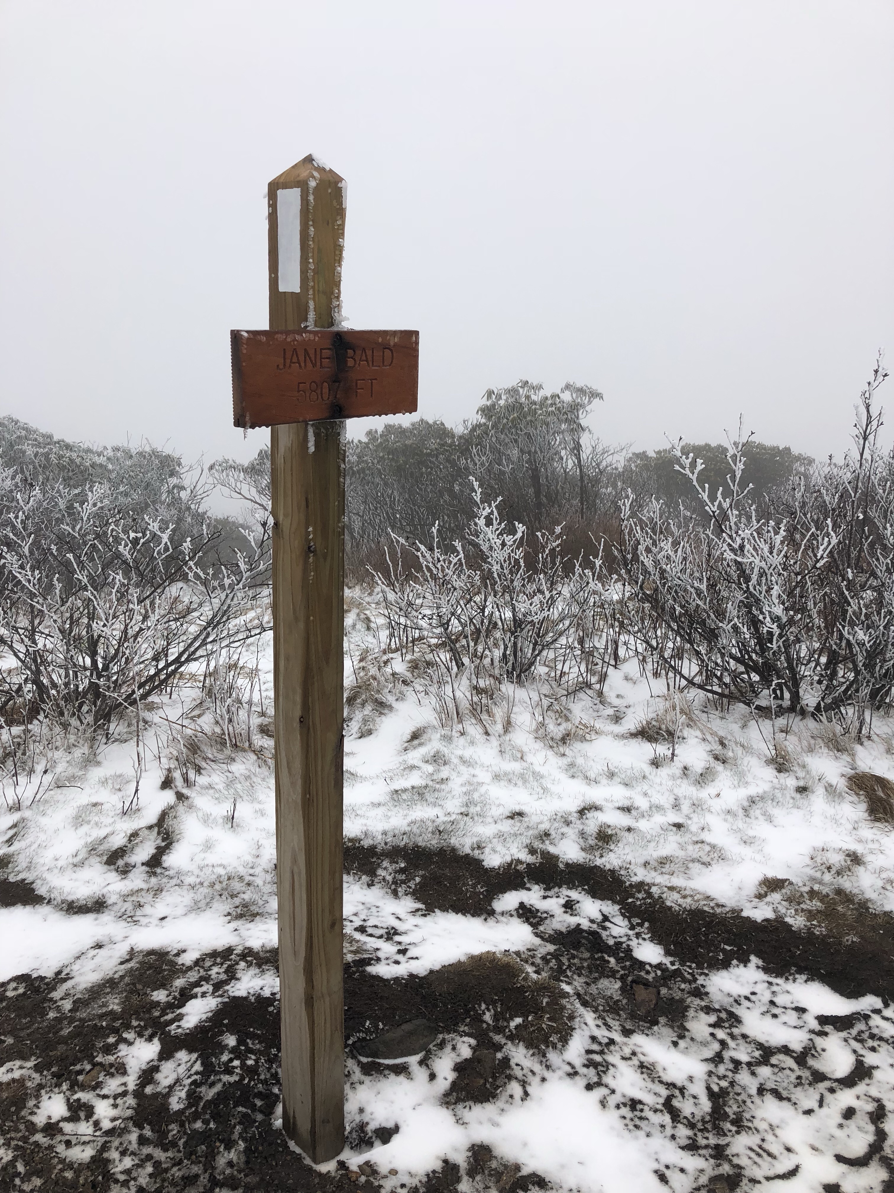
Growing up the section of AT from Carvers Gap to 19E was always one of my favorites, I’d managed a lot of volunteer trail hours and numerous hikes “across the balds”. Hump mountain was always fun because it really is a hump up it when you are schlepping a pack. I guess i’ve always enjoyed hiking UP mountains :D. Anyway I decided early on I wanted to go ahead and snag Roan High Knob and Grassy Ridge as well on this trip to the East coast. Leading up to this trip I’d been talking to KI4SVM hoping to meet up either OTA, or at some TH, and as an awesome turn of fate he joined me for the RHK and GR activations. I love getting out with other folks as it allows me to see how others setup, and maybe how to change my own setup to improve my QSO count per activation. Carvers Gap has always had some of the strangest weather in contrast to the region around it. It can be 70 or 80 down in Knoxville and cold, blowing and snowing up there. This trip was no different. Woke up on Monday morning with an inch of fresh snow. Needless to say, I broke a few of my own rules on preparedness today, but even if I had gotten in a pickle I was not that far from the trailhead, and I knew the area well enough that I am able to navigate it in the clouds pretty well. Lets face it the AT is more of a trough in the ground, definitely well past the “well worn in path” stage at this rate of it’s life, so it’s kind of hard to get lost in the context of being on the AT. So KI4SVM and I headed up to Roan High Knob with the intention that I would take the first hour for my own activation, and then I would book it over to Grassy Ride while Pat worked his own activation and then we would S2S and I would also get the SOTA complete for RHK. The hike up to RHK is about less then an hour or approximately 2 miles (and is not as steep as Blood Mountain) from the trailhead at Carvers Gap, in the summer you can access from the upper parking lot and it’s shorter. KI4SVM setup his antenna setup and it is based upon a setup I’d learned back in EC-001 so this may be one thing I am looking to add to my own kit depending on the weight it adds. He also showed me how to properly work with the HAM log APP to make it efficient for SOTA, so I am looking to use that method in the future when my hands are not too frozen to use the iphone for logging. Had a lot of local contacts directly beneath us on 20, gotta love that LOS etc. I managed more QSO on RHK then the other three summits, I’m beginning to think it’s operator error.
Contacts here where: 80m: N4EX, KW4R, 40m: K4MF, KG3W, KE8CYC, W2SE, W0MNA, W0ERI, K3TCU, and K9ER, and on 20m: K1LIZ, KI4TN, KB1RJD, KB1RJC, and KX0R.
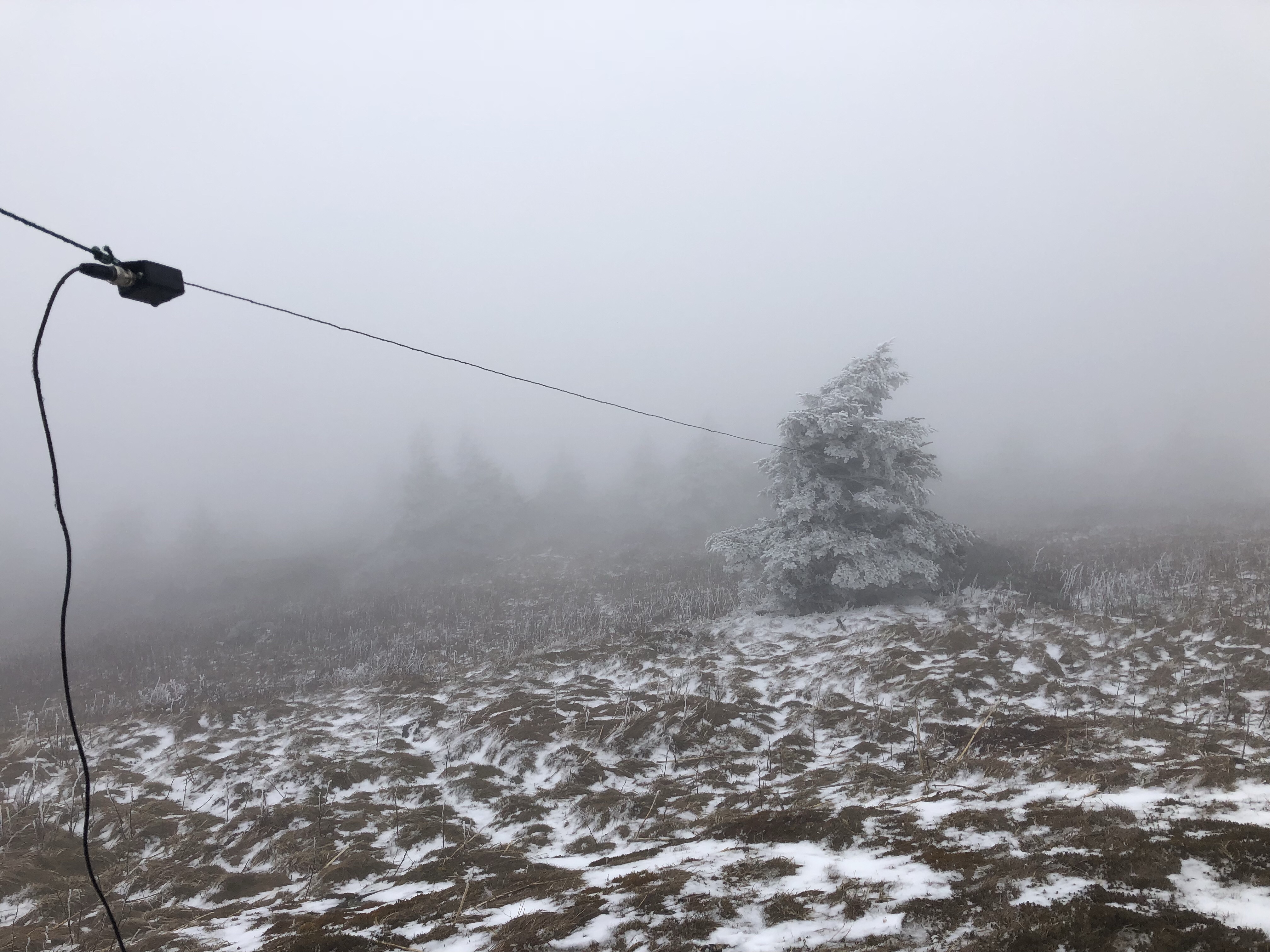
Since we used KI4SVM rig for the setup here, all I needed to do was grab my pack and drop down and over. On a good day, with good weather this should take you about 90 minutes, I kept bumping into thru hikers, so I would chit chat while making progress. It took me just under 2 hours to cover the 4 miles. Spent about 15 minutes talking to one person about SOTA, and why I always carry an HT even when I am backpacking etc.. So we may have a new operator in our midsts some time soon. For not having my normal antenna mast, there was a decent enough area to setup between the rock on the summit and a nearby tree. My EFHW was just long enough to make that span, although I am not sure if it improved my ability to make contacts by much b/c it seemed after an hour EVERYTHING including 2m and my iphone all stopped working right. Maybe the cold, maybe some other atmospheric condition, but something changed for the negative overall.
I would comment about how pretty this hike is, and if you can get a hike up there in June/July when the Gray’s lily is in bloom (please do not pick it) and when you can see more then 10 feet ahead; it really is an awesome hike, but today, like so many times before when I hit this in early season I was shrouded in the clouds and winds so visibility was non-existent. . I’ll be coming back later this year to bag Hump Mountain for sure, so maybe I can get some good images in then, I’ll even do the Carvers gap long approach just for the sake of good views (and maybe images).
As noted above, something changed during the activation, but I did manage enough QSO for a good summit, and as noted the S2S with Pat for a SOTA complete! anyway QSO info: 2m: KI4SVM, KJ4ZFK KI4AAU, WX4ET (i’ve been trying to contact this guy forever!). 20m: K0RS, K6MW, and K5WLT who happened to hear my CQ. and 40m: KG3W. The hike out was more clouds, winds, and chit chatting with the thru hikers.
Just a couple of observations from this and the last couple of East coast trips. Once you get chased by someone that’s normally out of your reach, they tend to try and extend it when you are back in your home activating region. Folks that I made QSO with last year when doing W4K/W4V now chase me when I’m on the W6 and other peaks out west, so that is good! Also have noticed just as a general observation the number of W6, W7W and W7O activators does seem to be increasing, so glad to see that more and more folks in the W regions are getting on the air as well as on the air on summits!!!. Ham Radio is NOT a dying art.
As always images below, thanks for stopping by, 73 and hope to hear you OTA, or hike with you at some point!
So, this peak has stymied me four times in the past. Twice due to weather, and twice because I ran out of time trying to pull a two-fer with Rose, and Houghton. What is funny is that I originally wanted to do those three peaks as a three-fer..I’m wondering if a two-fer with Rose or Houghton is even possible at this rate..(camp in the area, leave at first light, sure!), but as noted, even in summer with easy access to Mt Rose I still had a hard time getting back to Tamarack in time to get a same day activation..
So all that aside it was time to finally push for this peak today. The weather was going to be awesome, the avalanche danger was low for the aspects I was ascending, all I had to deal with was snowshoeing up the fresh powder from the previous week. Fresh untouched powder being the main caveat. The GPS says it’s only one mile from the parking area to the summit, however I logged two miles each way. It took three hours to cover the two miles. The first 1/2 mile was pretty easy thanks to the snowmobiles packing down the snow. Above the forest service road, it was fresh tracks the rest of the way. Even with floaty snowshoes I was sinking up to my calves. Definitely glad I do TRX mountain climbers and buzzsaws. Three hours up, but 45 minutes down. The climb from where I started is approximately 1300 feet.
So to note, this was a winter ascent (yah Winter Bonus!) The summer route is much different, I had been scoping just coming in on the Rim Trail from the pass on Mt Rose highway and then grabbing the ridge before the Rim Trail passes under the shadow of Tamarack on ti’s way to Rose. For a winter ascent, you can either do a backcountry ski/snowboard route from the North that is most definitely a fun route down, or as I did snowshoe straight up from the Tahoe Meadows parking area. In more firm snow conditions it is possible to get up the hill faster. Also note you can access W7N/WC-005 (9225) from this area, it is South along the Rim Trail. Slide Mountain is in the area too, but that is better coming out of the Rose Parking lot (or just cheat and take the lift up during the ski season ;)..
Chasers you all are awesome, I think my alert was for 930, I left the trailhead at about 930, Once I made it to the fresh tracks I added a new spot/alert saying “ETA 11”, but as noted I started my activation just after 1300 PST. Although it’s not the first time I’ve blown my start time. For some reason I decided to start with 40m today, and kind of glad I did, when I finished up with 40, and moved to 20 there was some sort of big contest going on. I could not even find a freq to post up, so I called CQ on 2m and got one reply from a guy out in Fallon. I counted it about 60 miles crow fly. After that, I just wrapped it up and headed down…If you normally chase me on 20 (W0MNA/W0ERI as an example) sorry i did not try for 20, but I was not about to compete with the contesters.
QSO for this activation..
Time
Call
Band
Mode
Notes
20:14z
NS7P
7MHz
SSB
R5x7, S5x5 Thanks Phil!
20:15z
K6EL
7MHz
SSB
R 5×8, QSB, S:5×5 Thanks Phillip!
20:17z
N6DNM
7MHz
SSB
R5x7, S5x5 Thanks Dmitry!
20:18z
NG6R
7MHz
SSB
R5x4, S5x9. Thanks Jerry
20:19z
W6TDX
7MHz
SSB
R55, S44 Thanks Chris, new chaser..
20:22z
W7RV
7MHz
SSB
5×2, to AZ.. Thanks Thomas
20:24z
W3WJL
7MHz
SSB
R58, S52 to OR, Thanks Walter
20:36z
K7NNV
144MHz
FM
FQ to Fallon… that’s a long QSO for HT
And now some parting shots.
that I still cannot get to fly right 😀
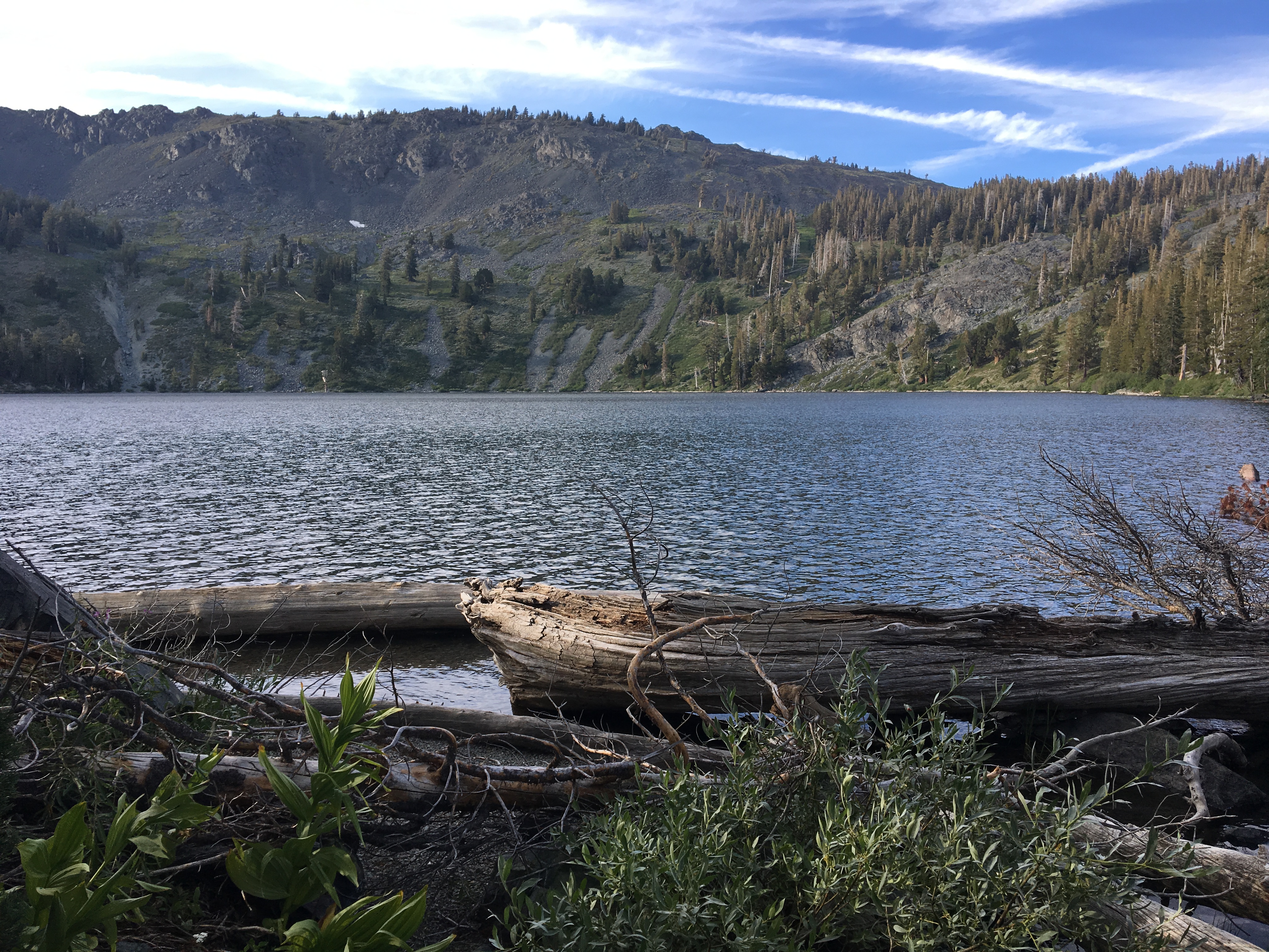
There is a lake down there somewhere..
W7N/WC-001, Mt Rose, and then some snowboard/ski tracks leading off Tamarack below me..
Hope Valley, Lost Lakes, and Upper Blue Lake (NE to SE direction)
TLDR version:
SOTA summit: Pt 9347, W6/NS-380
Activation Date: Jan 13 2018
Radio(s): Elecraft KX2 operating at 10 watts SSB, Yaesu FT1DX
Antenna: LNR Trailfriendly
Bands used: 2m for S2S (see below), 20m and 40m
Total QSO: 19, 2 on 2m, 7 on 40m, 10 on 20m
Furthest QSO: N4EX (North Carolina) and he’s ticking his way up my most active chasers..but NS7P will probably keep the lead for a while :D..
I have been eyeing this peak for a while, and figured it would be a summer approach. However with Carson Pass area being the only area with a semi decent amount of snow for snowmobiling I figured I would use this opportunity to try a snow machine approach for a summit..park about a 1/2 mile out and walk into the AZ. This time out Forestdale road was actually covered in snow all the way to 88. A nice change, but still needed to drop the scratchers to keep the hyfax/track lubed up.. Did not want a repeat of my last snowmobile outing.. This makes my third time ever heading out on a snow machine, and a few friends were like “do you really wanna go solo” . Play it safe, assess the risk and do not do anything to beyond your limits. Basically my same philosophy when I’m solo hiking. Today it really mattered to for while the avy danger was low when I started, as the day warmed up and the snow softened I could tell I was not going to get a two-fer so had to abandon my attempt on the Nipple.
It took me about 30 minutes to get to the Divide. There I parked and started my hike up the hill. 1/2 mile and 400 feet of elevation gain… Did not need the snowshoes as the snow was wind buffed and plenty firm, also other snowmobilers that had ridden to the summit and on the final approach the rocks were exposed so that made it super easy (and safe) to make the summit.
I was aware that KK6YYD and WC6J were going to be on Tahoe Mountain (W6/NS-397). They were also the first to activate this peak, so I made it a point to get to the summit while they were on Tahoe Mountain so we could get the S2S and they could both get the complete! Success.
I had originally intended to do the Nipple too (I have activated it before, but unfortunately I split UTC midnight so 2 before, and 2 after, no points :(. That said by the time I reached Upper Blue Lake the snow was turning too soft and lacked coverage to run the machine up the hill to where i had intended to park, and I was thinking it was going to be a bit too slide-ish to make the summit safely, so I played my way back to Red Lake to get some snow time on the sled playing in the variable snow.
All in all a successful day. I am finally starting to learn how to ride that snow machine in deeper snow, and make it do what I want, but gotta remember the throttle is your friend. Another summit accomplished, and there seems to be some new chasers out there these days! Next up..who knows..it all depends on the snow.
And some images from the summit:
and looking towards Deadwood peak (W6/NS-073) (which I will be doing as soon as the summer permits!
Making gains from the sled to the summit
Decided to try something new this year for winter since snowboarding is getting a bit long in the tooth.
That snow line is still way to high for this being January 😦 (more like Junuary)
Every year I like to do at least one solo week long backpack trip (but this may have been the last one, more on that below) and decided to make this years a SOTA trip to knock off some of the Rim Trail summits I need for my personal goal. I had locked out the week of August 20th a while back namely because it was a new moon, then there was that solar eclipse thing too. Backpacking in the Sierra under a full moon makes it VERY HARD to sleep, the eclipse was kind of a happy accident. So the plan was as follows when I went in… we’ll see how that turned out 😀
8/19: W6/NS-154 (Lost corner Mountain) && W6/NS-390 (7860) 0900-1300 will be activation time range.
8/20: W6/NS-107 “9269” (mid morning, 4 mile dayhike from basecamp)
8/20: W6/NS-105 “9310” (probably mid afternoon)
8/21 Moving day, but I may try and do something with SEQP before I head out.
8/21 or 8/22 will be time dependent, but W6/NS-095 “9420” if 8/21 late evening (8/22 UTC) or morning of 8/22 PST
8/23: W6/NS-377 Mount Price and W6/NS-094 Little Pyramid sometime between 1030-1400 PST
8/24 or 8/25 W6/NS-068 Dick’s peak and W6/SN-036 Mt Tallac will do both in the same day. (I kept changing my mind on this one)
This was also going to be the longest trip I’d taken Lola (my 3.5 yr old Chocolate Lab) out for a hike, and she was going to carry her own food.
So I got Michele to drop me off at the Rubicon Trail staging grounds and we started walking in from there to the General Creek trail to enter the Wilderness. While the mosquitos are mostly gone from the basin, they were anything but gone on this hot August afternoon. We were making good time, and I noticed that we were within 3/4 a mile of the first peak on my list (W6/NS-390) and decided to drop pack and run up w/ my gear and get this trip started off right. (except that my GPS died 10 minutes after I walked away from my pack). I did not see the point continuing on down the trail to setup for Lost Corner Mountain to have to backtrack back to the peak (and to be fair this was an extra, but 8 points is 8 points). Anyway, The summit was pretty obvious, went to the high spot that matched my location on the map (those paper things) and snagged the first of what should be nine activations for the week. Managed to get three S2S (or which 2 were W0MNA and W0ERI) to boot. So nice to talk to them summit to summit..(They were in North Georgia). Those two are so awesome, they are always chasing, so nice to help them get an activation in there! I did not want to stay too long as I still had some miles to go so Lola and I headed back to our gear..hoping some bear had not made off with her dog food. All was good, and southbound we went on one of the lesser travelled trails in Desolation. We stopped that evening at a spot with some water, and in good proximity to snag Lost Corner Mountain (W6/NS-154) the next morning.
Guide peak another W6 peak is in this picture as is a couple other SOTA summits
So the next morning after breakfast Lola and I off trailed over to Lost Corner Mountain. GPS said I was 2 miles crow fly, no big deal and 90 minutes later we were on the summit. I only gave myself an hour for setup, and contacts, but managed 3 S2S and 1 FM contact to get the activation. Today was a larger mileage day, so I did not want to dawdle to much. We headed back to our base camp, packed up, watered up and then decided that the best option to get to our next camp site was to stick to the TRT/PCT and avoid the Tahoe-Yosemite/Meeks creek trail. I can see now why permits are so hard to get in Desolation. I passed some twenty people between the General creek cut off and Phipps pass cut off which is an 8 mile stretch. That is a LOT of people for a single day of backpacking. We hiked up to Phipps pass, and then made the cut off trail for Phipps Lake where we were going to do a 2 day stay/base camp while I ticked off the next two peaks on the list. So while Lola’s pads/feet were never messed up she definitely was tired after today’s carry, so I decided that tomorrow I was going to leave her at the camp (on a long lead) and I would go tackle peak 9260 (W6/NS-107). That night for dinner I had my chicken tortilla soup (Bear Creek soups from the grocery store), and had a wild hair to add some mashed potatoes into the soup. OMG…. that will not be the last time I take that on a backpacking trip!! So… I think I might have stumbled upon one of the prettiest and most remote sites in Desolation, but I probably should not put that in print. That is why there are so few quiet places to sneak off to. I’ll even share a picture:
Phipps Lake
So day three, the plan was just stay posted up here for a base camp, and go after W6/NS-107 (9260) and IF there was time, go after W6/NS-105 (9310). One of the reasons why I said this was a remote site is because I was camped across the lake from the base of 9310 and had an 500 or so foot climb to the summit, 9310 to date is unactivated.. Save the best for last. I left Lola on a lead at the camp while I was gone for the day. I left her plenty of water, and food, and she had cover and such. So I headed back to the trail and started down the canyon towards Rubicon Lake. The destination today is an unnamed peak on a ridge that contains Rubicon pk, and Jakes peak, W6/NS-107. One of these days I will reteach myself how to stick to a contour. I have a problem with climbing too fast, and not getting hitting ridge lines where I want when I am off trailing. So I hit the ridge sooner then I expected, and then dropped a little over the backside, and kept moving on. So today I opted to pound a liter of water and not bring water along thinking it would be a 2-3 hour ordeal overall, and I do actually train like that with some day hiking trips. It took me about three hours from the time I left camp till I was setup and activating. Again, if you chase, THANK YOU! There are always 4-5 activators I can always count on that are fun to talk to, and always willing to work hard to work you if it’s needed!
Once done with the activation, I started down heading towards Stony Ridge Lake. I could see that my best bet was to cross over where I crossed this morning, so “lets contour, and not go down too fast”. I wound up in a HUGE boulder field that was the equivalent to a class 4, and possible class 5 down climb in a few spots but I found some clean water sources to drink from while in the boulder fields. Had to fight a few willow stands, those slowed me down, and made me tired. All told the 8 mile round trip took about 7 hours “tent flap to tent flap”. Lesson learned, but Lola was happy to see me when I got back. I should also note that it’s peak wildfire season despite the water and the super wet winter, Tahoe had quite a few fires burning around the area, including one down by Yosemite. Needless to say, that combined with a low in the area was making for some fun evening weather in the area. To date I had not had rain on this trip, but I managed to get back to camp just as a storm was hitting us. Into the tent I dove, and I had Lola in my vestibule area. (1 man REI Quarterdome). Within 5 minutes we were sitting in the middle of a hail storm, and the hail was bouncing up under the fly and pelting Lola, so into the tent I brought her. She was out cold within five minutes, and snoring. Typical summer storm, it was over in about an hour, it dumped a good amount of quarter sized hail and my tent survived it really well. The cool thing about granite is even after a storm it is still very warm. While nothing inside the tent got wet, we had a river running underneath us. I put everything on granite, while I had dinner, and threw it all back together before dark, everything was dry! Sunset was amazing tonight with the clouds, and the fog coming off the lake and cleared air etc.
Day 4: Solar Eclipse! So today’s activation was going to be super easy from a hiking perspective, but possibly a challenge depending on how the bands were being affected by the Eclipse. I was some 400-500 miles south of the totality, and I could definitely tell that something was going on. Even though the sun was bright, it was cold where I was. After breakfast, I broke everything down, and packed up and moved our gear over to the pass that leads out of Phipps lake, grabbed the radio gear and then headed to the summit. 20 minutes later we were on top and I was setting up. I managed to get 7 QSO’s this morning (I was not in too much of a hurry, but I was not going to hang out).
Lola was moving pretty good, but I could se she was a bit sore and it was time to run her out, plus I wanted to reconfigure some things with my pack. Specifically the radio gear. I let Michele know when I was on top that I would be at the Bayview Trailhead by 5pm and could she either get my truck up there waiting for me, or just come pick me up. Lola and I were moving along well, not as many people on the trail today (it was a Monday, and I was pretty far in). So for the past two years I have been using a LowePro Nova 2 camera bag for carrying my radio gear. It all fits in there (I have a pretty light weight setup). But it was hard to carry water, and it dawned on me I have a 10L hydration pack that I was thinking would work for water, a bit of food, AND the radio gear.
Also part of the reconfigure was breakfast. Growing up I always loved the quaker oats instant oatmeal packs when I was camping/backpacking but as a grown up trying to “eat healthy” I tend to opt for different solutions now. I really should have tested my breakfast before I left b/c I just ended up having PB and Trail Bars for breakfast after realizing on day 1, instant steel cut oats are NOT the same as slow cooked, and well. I got home and threw away what I had packed for my breakfasts (pack it in, pack it out). I hate wasting food, but the McCanns instant steel cuts just do not seem to cook well in the backcountry (in boiling water, yes). I ended up getting a couple of Mountain House breakfasts for when I go back in on Wed (Biscuits and Sausage gravy && Southwest Scramble). I still had at least 2 more peaks I could go for (Tallacs, Dicks), and I was taking off this week, and well I was not ready to plug back in yet! So sure as I thought, my mountain biking pack did the trick. Everything fit, and I was all repacked and ready to go back in and get at least two more peaks.
So I decided to drop the three peaks that run along the Crystal Range part of Desolation (Little Pyramid, Price, W6/NS-095) as part of my get Lola out trip, and focus on Dicks’ (W6/NS-068) and Tallac (W6/SN-036). I’ve been on Tallac a few times just as a hiker, but never with radio gear. The goal for Wednesday was make Lake Gilmore at the base of the climb to Dicks pass, and a 45 minute hike to the summit of Tallac. Dick’s peak has also not been activated yet, and is located in the almost geographic center of Desolation. My legs w
Nice little tree stand behind the tent
ere still in strong shape, so after a lunch at one of my favorite South Lake Bars, I headed to the Glen Alpine trailhead. It took me just under two hours of hard moving to make Gilmore.
Gilmore is one popular camp site, this was the first night on my trip where I had people around me. I just wish folks would heed the rules on the permit.. NOTHING within 100 feet of water. You do not pitch your feet 10 feet away from the big lake. Anyway I digress. So the next morning I cracked into that Sausage and Biscuits from Mountain House. I’d not eaten dehydrated meals since the 80’s (which IIRC were Mountain House, they had Woodsy the Owl on them. I still have one, here is a picture: <find that MH and take a pic>
So, those biscuits and gravy actually tasted pretty good, but it was a lot of food for one person, and the whole dehydrated thing did leave my stomach in knots. Anyway, today we were going to go after Dick’s peak, that was my only focus…I could still do Tallac tomorrow if I had to really work Dicks. Dick’s peak as noted is not a day hike, unless you plan on starting or finishing in the dark. The climb up the trail to the pass is not that bad, but then at
looking at the Crystal Range, W6/NS-067 (Pyramid Peak) is the image on the left in the distance. There are two other SOTA peaks in this image.
the last switchback before hitting Dick’s Pass, you turn off trail and start heading along the saddle there to climb the last 1600 feet. Oh btw, there is no trail. I made the summit in a couple of hours, even with the fun climb and started setting up. While looking for the logbook/ammo can on the summit, I found a note that was buried under some rocks. Someone had written a touching letter to someone in their life that had passed away. Out of respect I left it up there, and did not take a picture of it. I forgot to bring my crappie pole mast, so decided to just run my antenna about 2-3 feet off the deck between some rocks, and running off at an angle to get a south and east/west reflection. Oddly enough I managed to get an S2S with a guy up in Washington so something was reflecting me that way too. I scored 6 QSO’s and was starting to think I could manage Tallac too if I got a move on now. The down climb took me about the same amount of time, and it is a pretty well established goat trail, but it is exposed in some spots, so if you are not comfortable in a free scramble situation, I would advise you to take caution.
I made Tallac, got my QSO’s but really had to work it hard. I ended up getting more 2M contacts then HF contacts for Tallac, but I was satisfied. I set off to get 9 peaks this week and finish everything in Desolation, I snagged six of them, and managed to do some scouting to see that I will need to come up from the backside of those other peaks to snag them, so best I would have done would’ve been 7 peaks total.
I have 20 peaks left to finish the rim trail, and pretty sure I’ll be down to less then 10 by the end of October. I may be able to get the rest of these this calendar year!


 I have chased a few folks with the QCX from the QTH, but now it was finally time to use the QCX as my activation rig. It was on Easter Sunday and on a day that 30m propagation was not great and I was not on summit till noon. SotaWatch showed that I was the first spot in over two hours. I managed seven QSO over 25 minutes and then my battery decided it was time to shut off for recharge (oops..been testing a lot, forgot to check levels). Either way it was a successful activation on a unique summit. Full disclosure it was also the first time I have done an activation without using the decoder, and I managed to get a good copy on all those who called me whom I could hear, so I am getting better there too. Contacts included: AG6VA, K0RS, KR7RK, W7USA, WA9STI, W7GA and K7RJ. According to RBN I was reaching the VE6WZ beacon up in Calgary, approximately 700 miles. Last time I checked, I was putting out 2watts of power, but that was before I really tuned my EFHW. On the approach drive in *4×4 road* I managed to make it to within a mile of the summit, but overall this is a drive up summit. Either way, b/c I am in run training, the 1 mile 400 foot elevation just helps with the training, and I do my best thinking when I’m walking (more on that below). Those structures you see on the summit proper are from past deployments I think, all the radio towers, cell towers, and TV towers have been moved to other nearby peaks, overall (at least on 30m) this was an RF quiet peak.
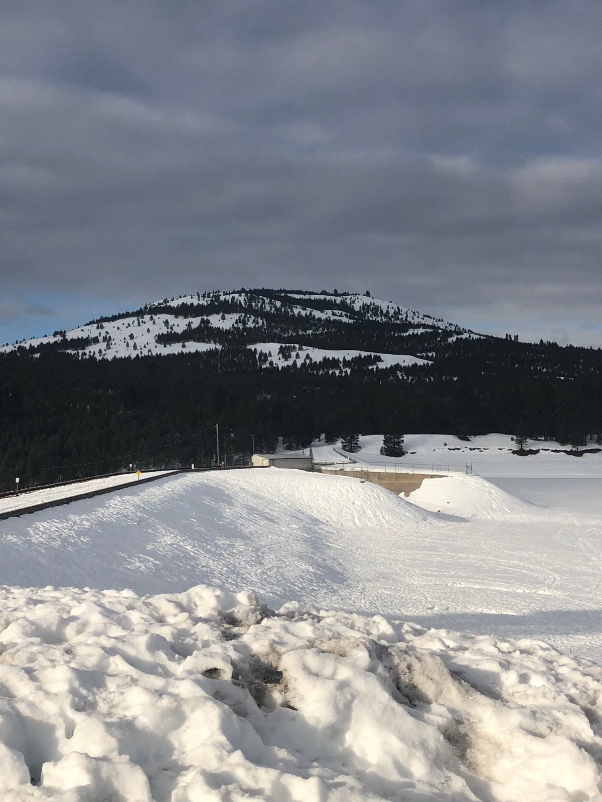

 The approach to this peak is not too hard, and another one of those where winter time makes the ascent easier. Honestly I like the snow covered peaks for approach, I really should just bring all my winter modes with me (BC Ski, BC Snowboard, Snowshoes) and make a command decision on which ascent mode to run. Sometimes it is nice getting down the hill faster then up. I parked at the Boca dam and snowshoed over the dam. In the summer you can actually drive across to the NFS roads in the area. Looks like there is an area you can park when there is no snow.