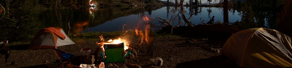

Here we go, here we go again, yet another trip to the UK for some distance backpacking. To be honest I just really love the walking vibe in the UK. In the US taking your doggos on long trails adds some serious logistical nightmares, especially since most State and National Parks have a ban on dogs pretty much anywhere outside of “paved” areas. The UK however, there are dogs everywhere, and I just find the walking vibe pretty chill over all. I was already heading to Scotland for the TGO (The Great Outdoors) Challenge. and the wife gave me a pass for a second month so I decided to add the Pennine Way on the front end for the month of April. What is nice about the Pennine Way is there are quite a few Summits on the Air peaks, and I have also added a variation to include the Yorkshire Dales Three Peaks Challenge for an additional two SOTA peaks.
Why the Pennine Way?

What drew me to the PW first was I wanted to make sure I was in walking shape for the TGO, and I am essentially walking to Scotland along “the spine of England”. During our Coast to Coast last year we crossed paths with the PW near Keld. Since I missed out on some travel last year for some personal things and after my success of doing SOTA + Thru-hiking on the WHW, I wanted to step it up one more level with a trip that was >200 miles. The PW offers that, and M1EYP did a similar style trip back in 2013, plus my 3 peaks challenge variation gives me plenty of distance to get strong. I am allowing 20 days total on the PW and looking to mostly wild camp it, however I do have a couple of nicer stays which will also be resupplies. Also when in a town named “Once Brewed” and a pub named “Twice Brewed” you have to pay the extra just to check it out. Of course I will be finishing with the Border Hotel before moving on.
And then Scotland?
After the Pennine Way, I have about 15 days before I need to be in Glen Shiel for the start of my TGO Crossing. I’ll probably get up there a little early as the 5 sisters of Kintail looks pretty enticing from a hiking (and Summits on the Air) perspective. The Lakes are calling my name as usual so I may roll that way some too! Kendal here I come for some Mint Cake!!

The TGO Crossing starts somewhere in the second week of May and finishes two weeks later. I only have 3 days to get from WAY up North back to London. Lets go, fingers crossed for no train strikes!!
So now for the nitty gritty, this whole trip like is one big backpacking trip (albeit a posh one), and I will do everything with a single backpack. Note: Trekking Poles, tent stakes and a few other things will have to go under the plane, and I’ve got a few ideas for that.
So what does the gear load out look like for this trip (and keep in mind I am not a weight nerd. Plus I am comfortable with 20 mile days at 40lbs, so I am shooting for 35lbs just to be safe. Although keep in mind, food tends to be what pushes most pack weights into the ‘uuugggghhh’ realm, and with this being the UK there are chippies, kebab shops and cafes everywhere so I’ll probably only ever have 2-3 days of food on me at any given time. I will have to up that to 4 days though once I start the TGO.
Packing List:
So what gear am I taking for 2 months on the road/trail/travel? (note other than the Drink LMNT link, all other links are not affiliates and go direct to the manufacturer were possible. I am not getting paid/sponsored/asked just including the links because it is gear I believe in). The list is kind of long, and I will skip the little odds and ends and stick the macro items. AS of the time of this writing and for the things going with me, the pack weight is at 24 lbs. Once I add in food (mostly breakfast since I am wild camping most of the walk) I’ll be closer to 30lbs
I’ve embedded my walk through video at the bottom if you do not want to read it all, it’s about eight minutes long.

The Big Three: 7.15lbs
- Backpack: Atom Packs Custom Mo 50L. I really do love this pack.
- Shelter: Durston X-Mid 1P
- Sleeping System: Big Agnes Rapide SL and Western Mountaineering Terralite (25F/-4C bag)
- Cooking Kit: MSR Pocket Rocket Deluxe, GSI Haulite dualist Pot, Snow Peak Titanium Spoon (have had since 2004, love this thing).
Summits on the Air kit: 2lb 11.5oz
- Elecraft KX2 (it is a bit heavy, and I might be looking at a KH1 soon)
- Elecraft AX1 (and AX-e 40M extension)
- write in the rain book for contact logging
- 5000mah Battery
- I would normally also carry a SotaBeams carbon 6 with an EFRW, however I am going to try out Elecrafts smaller “compromise” whip antennas. Consider this a dry run for the possibility that I end up getting a KH1, which would drop about 1.5 lbs off my base load out.
Rest of the Kit:
Clothing:
- Evolved Supply Co Mirage Sun Hoody
- Montane Terra Pants
- Smartwool Socks (sorry Darn Tough, I have Hobbit feet and your socks do not fit me)
- Xero shoes Daylight Fusion (walking shoes, and I know i am going to get wet)
- Xero Z-Trail sandals
- REI Silk Boxers for sleeping
- REI Boxer Briefs for walking (2 pair)
- Smartwool 250 base layer for those REAL cold days
- Smartwool 150 t-shirt (for only slightly cool days)
- Outdoor Research lightweight Puffy
- Mountain hardware Dome Perignome beanie (do they even make this anymore?)
- Outdoor Research Foray II Rain Jacket
- Mountain Equipment Rain Pants
Other Odds and Ends:
- 40 packets of Drink LMNT various flavors
- 20 or so left over sachets of Mt Hagen instant coffee
- Hilltop Packs 5-7 day food bag
- Hilltop Packs medium ditty (battery banks, toiletries etc)
- Hilltop Packs large bag for clothes
- Power Banks 1 ea. Anker 20mah and 10mah
- The usual toiletries
- Garmin Fenix 5X (and charge cable)
- Short Apple Charge cable
- USB cable for charging


