Nutt Benchmark (W7A/SM-046)

I wanted to take advantage of being in the area, so after scouring over sotl.as, finding a peak that met some of my requirements, studying the (digital) topo map and finding very little info for the approach, I went with a peak that seemed well within my wheelhouse. Plus, it has a cute name to boot, “Nutt Benchmark”. It was also a First Activation peak, so those are always fun (and typically involve the most planning and do tend to give me a little anxiety.

Preflight:

At the Sitgreaves Pass View point is a wonderful (and big) with some flat spots pull out that we ended up using as a post up. That was the one useful tip the couple of trip reports I found contained. So with some daylight left, and me wanting to do a little exploring I managed to climb my way to the top of the nearby ridge line. It turns out that there was a well cairn’d use trail that wandered off in the direction I wanted to head the next day. After walking out about a mile and confirming this approach trail would work, I opted to shift from the route I was going to use to staying up along the ridge line to a specific saddle. From the saddle to the summit is about a mile.

Lets do this:

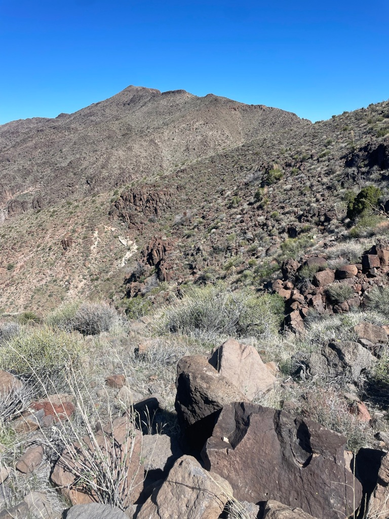
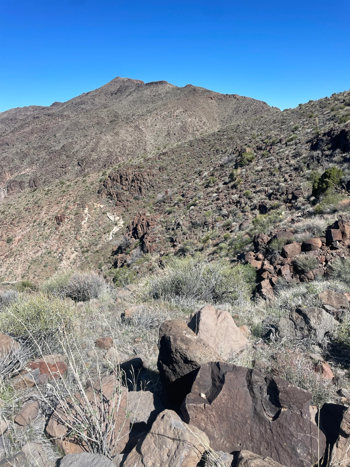
So with that I was off from the pass at around 8:30 in the AM. I would say the ascent from the parking lot to the ridge line, and then a few segments along the final push are kind of the cruxes along the hike. Well, that and the various cactus (some of which were in bloom on this walk). If you have ever been to Oatman down the hill you have probably encountered the very docile and tame donkeys. However out here in the uplands those donkeys are a bit more feral. As soon as I crossed into the hills and they were aware of my presence, they were gone. The walk is in a N by NE direction until a saddle is reached with great views over towards the Hualapai Mountains. From here turn towards Northwest and knock out the last 800 feet of elevation gain in about a mile.
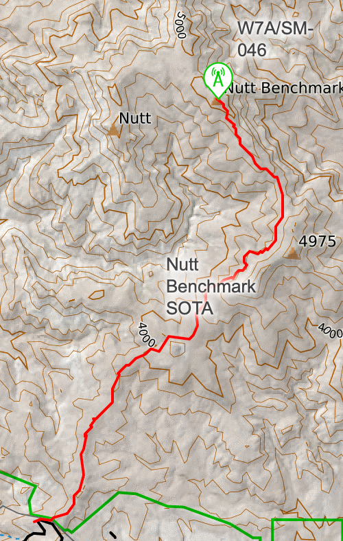
Because the elevation gain is pretty minimal I made pretty good time scooching along the approach ridge. You actually pass right under another SOTA summit (4975, W7A/SM-055) that would make for a fun two-fer. For what I could tell the approach up 4975 would be pretty easy, but it does look steep. I was considering the two-fer and would allow the build up of clouds determine yes or no. Once the saddle is reached the trail (for the most part) is over, there are plenty of braided paths to the summit, however one thing I would advise is to not push for the final ridge until after that last rock wall you encounter. After that though it’s smooth sailing.

Summit and Activation:
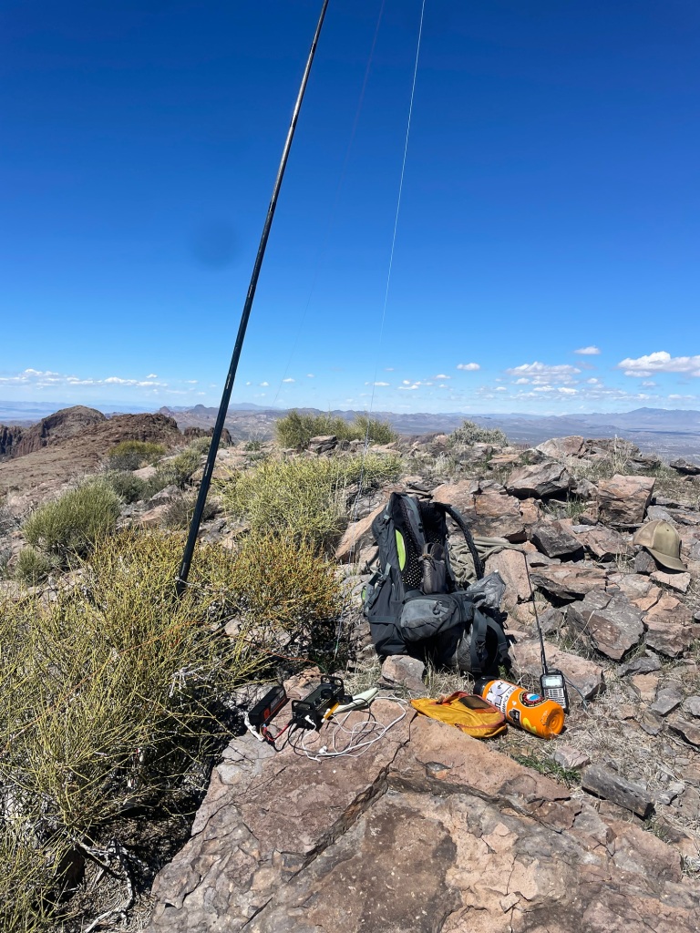
The summit area is a large flat area so plenty of room to spread out and enjoy yourself. Since this is not that popular of a peak (for some reason), it’s not like you have to keep your station setup small. When I say this peak is not that popular, the last person to sign the log that was on the summit was in May of 2023, ten months ago. The log based upon the the business card inside the PB Jar (yah do not use PB jars, those plastic lids deteriorate quick) was placed by the Las Vegas Mountaineering club. No idea if they plan outings or what.

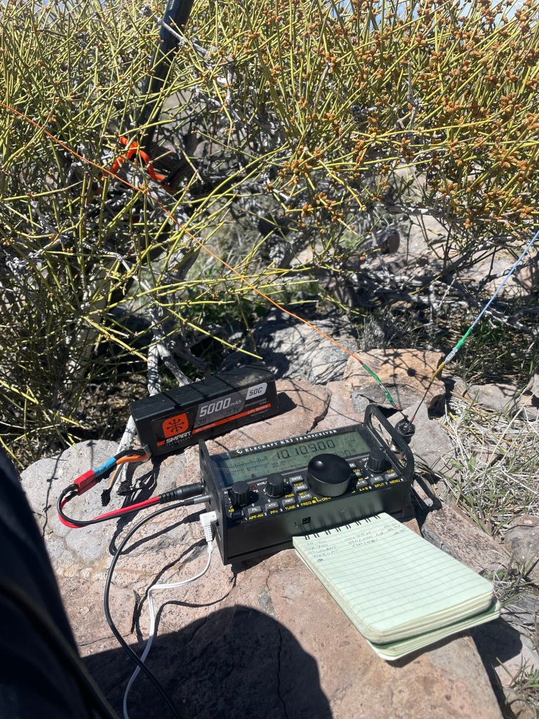
I spent about two hours on the summit on a day following a pretty large solar storm, so the fact that I managed 40 contacts across five bands was pretty impressive. No DX to be had, and as much as that probably had to do with my late start, i am guessing the dead bands also were a part of it. SFI of 195, and K of 4 are not optimal conditions, but as I noted, I made it work.

Time to wrap up:

Part way through the activation I was noticing the same afternoon build up of clouds and virga that we kept getting during the softball tournament, so I opted to stick around a bit longer and keep activating, but would skip the second peak. The walk down was pretty uneventful except that I did step on a chunk of cactus, and it went through the bottom of my shoe (ouch), so that took a few minutes to dig out.. That and for whatever reason I kept losing the trail on the return even after I was on the main path. So pay attention. Overall I would put this as a medium effort peak, I covered a total of 10.25 miles and just shy of 2200 feet of total ascent.

Some final parting shots:
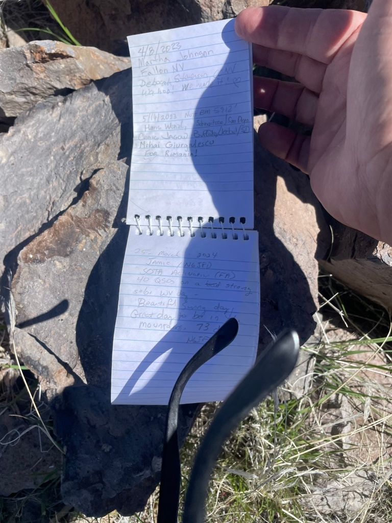
73 de N6JFD/P
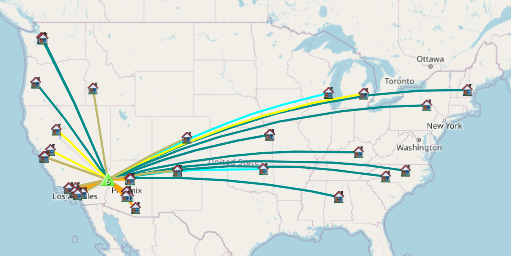
Not the best of conditions, but still made it all across the US

From sand to snow.. two activations to totally different types of zones, and finally 100pts on SOTA!


A couple of false summits to keep your hopes up

The weekend of April 1/2 I managed to snag two different peaks in two different zones and states, and two very different types of hikes :D.  The CVHams meet on the first Saturday of the month, so I headed to Carson Valley with the intention of doing two different activations, but ran out of time scouting the entry roads.  So I opted to head to the meeting w/ the purpose of snagging W7N/TR-042 (McTarnahan Hill) after the fact.  This morning my goal was to hit that peak before the meeting, but yah those NV back roads are in rough shape from winter.  Anyway that said, I managed to get within 1/2 mile from the backside of the peak, but if you went up the front side from Carson City side, and had a Quad/Motorcycle you can make it to 20 feet from the summit.   I know better then to activate this close to 0000 UTC.. Oh well, I allowed the Auchard’s to get double chaser points.  Another successful activation, As noted the Auchards both before and after 0000, as well as a local guy in Carson City, and NG6R from Southern Cal.

Leave no Trace!A campsite on the side of the road where folks left unopened beers and other various trash.Look folks, LEAVE NO TRACE.  Leave it how you found it.  Oddly enough when I came back thru the second time, the bottles were actually gone.  I guess the runners I saw out on Sunshine Pass Road needed a pick me up on this fine day!


And now the Snow Zone 😀

Panorama from Big Blue and Desolation, Hope Valley on around to Carson Pass


So Sunday the goal was get up to Stevens Peak (W6/NS-345).  This is one of the peaks on my “TRT Challenge to Self” so one checked off, a few more to go.  No this summit does not help me from a miles perspective.  There was still plenty of snow, so I opted to go up the backcountry skiers route, but the sun was blasting that hillside, so it was getting soft. Sidehilling in soft snow on a 30 degree slope is risky for a multitude of reasons, unless you have solid self arrest skills, do not bother. HOWEVER..you gain 1000 feet in the first mile, making for a mellow grade for that last 1/2 mile push up the summer trail. Even though there was ample snow in the first 2.5 miles the last mile was pretty snow free on the climb. The top still had plenty of snow though. People are pecuiliar, I followed these two skiers up the bowl, and watched em descend. Turns out one of the guys was on his third day out ever, not third day of learning BC Skiing, but third day of skiing period. 30 degree slopes are hard blues/easy blacks. Is BC on a spring corn day on avalanche terrain really the place to be learning how to ski? Saw a couple of snow bunnies and a few bear prints in the snow while hiking. All in all, I love snowshoeing thru the snow. Once on the summit, I saw my fair share of BC skiers/snowboards who had come up the main face of Stevens (as opposed to Carson Pass). Oddly enough there were two backcountry riders who ferried one of those super expensive drones that have “follow the subject mode’ or whatever it’s called. The guy was complaining that my antenna was creating interference. Odd that the drones are impacted by the RF from a radio on 20m. I was nice and let them film and ski out, b/c the sooner they were gone the sooner I could get to it. So the nice thing about my SOTA attempts is they are always a learning experience. The experience on this trip is that snow does affect radiation patterns and such, oh and I need to figure out how to use APRS2SOTA. I somehow managed a contact on 20m at ~60miles crow fly. Thanks KK6CUG for the spot, that brought the chasers on. That and since I could see Kirkwood Ski resort, I managed a few simplex contacts from folks with their HT’s riding the lifts. Funny, I never considered carrying my HT while resort riding, but if you snag ski patrol’s frequency, I can see why it’s worth it. The hike out was pretty uneventful, but I went back the summer/PCT path instead of trudging down that hillside I came up. It would be easy to snag Stevens and Red Lake in a single day, and I almost considered it, if I had been off Stevens 30 minutes earlier I probably would have gone for it. Anyway some pics from the summit and from the surrounding areas. Oh how I do love the Tahoe/Carson area!  My particular path was 7.1 miles total, the return path was a bit longer then the up path, but I was going for the safety factor, and even did some butt glissading.  I was also scouting the route for my attempt on Red Lake peak, I’ll be skipping the skiers bowl that overlooks HWY 88 the next time

A few images of the area. Nothing specific,  Round Top (W6/NS-055) which is on my list to do. Red Lake Peak (W6/NS-062) as well.  There is probably 50-70 SOTA points in the various pictures there with named peaks in the W6/NS (and some W7N/TR designator) in the panorama.


All in all it was a great weekend, Some sand, some snow, some awesome scenery and an overdose of Vitamin D (the uncovered parts of my face are purple thanks to the reflective power of the snow :D).

Loving the KX2 and took care of the easy Tahoe Summits

Another activation with the KX2 while I continue to get used to the radio, and another Tahoe Summit off the list.  W6/NS-248.  Not as easy as Tahoe Mountain, but still easy enough.  Snowshoes today though.  Oddly enough for as short as the run up this hill is, there was a skin track (backcountry ski/snowboarding) up to the peak.  Usually takes me about 30 minutes to bust up this hill, and today was about on par with that with the snowshoes on.  Anyway, successful summit, got 1 2M QSO, but I am friends with WA6EWV, I may have to introduce him to chasing, or summiting :D.  Not sure his level of adventure etc.  Anyway, I commented that I had my longest and shortest QSO a few days ago, Tahoe to North Carolina..no crushed that today, well by 300 miles.   KB1RJD, and KB1RJC gotta love those husband wife teams!  Tahoe to NH…approximately 2520 miles.  Anyway, 6 more points, finally broke 100 points on SOTA, and am finally getting my system dialed in well.  Managed to get a good working headset mic combo, although I probably need to work on the TX EQ to get my headset audio up.    The pic below is the flagpole I used as a mast today, normally there is a flag on there.  They take the flag down for the season, and if you climb up on the rock there is an eye hook you can use for your antenna.  Do not use it though when the flag is on there.  I see that as disrespectful.  Behind it is Tallac: (W6/NS-036).  Another one I’ll have at some point before summer.  Anyway that’s all, loving the KX2, just need to keep babying it, and hope it holds up well for the 4 summits I intend on this weekend.

oh he’s on the list too!

A new radio, and finally W6/NS-397

Well this is probably the easiest peak to get in the basin, but today was my second attempt (radio issues first time around). So, I sold my old HF radio in December knowing it would not last me thru this year. I toiled for months trying to figure out which was the right radio for me, and by then had narrowed it down to the tank, and the new pocket rocket: FT-817, or KX2. The 817 is like a tank, everyone I ever talked to swore by it, tons of blogs praise it. It set the standard for backpacking durability and HF QPR. For someone like myself who is hard on gear, this seemed like the right way to go. So I went with the KX2 instead ;-). Maybe I just like taking risk, or maybe as I get older i’m finding ways to not be so rough on things. Maintaining constant situational awareness, blah blah. Probably what intrigued me is the BIG readout, the way easy to use buttons, and while I have a few Yaesu radios, enough of my other SOTA buddies convinced me I would be a lot happier with the KX2. Well, I cannot say I would not be happy with the 817, but damn, that KX2 is nice. I am not going to really review the radio today, but it did show up on the 27th at my house. I did a lot of listening to other SOTA folks from the desk while working, and while also testing my battery life on my LiPo battery. So far I am at 10 hours with ~3 hours of me yacking away and still at 11.55v (started at 12.5). Well I have already surpassed my old radio on power consumption..and apparently the KX2 is a lot better then the 817, but I cannot do a direct comparison.. Anyway that said, I’ve had this thing for 2 days, I’ve been listening at home, but I have not made any contacts with anyone, so time to go run up W6/NS-397. As noted above, it’s the easiest peak in the basin, it’s a 10 minute drive and then a 10 minute walk up to the tower on top. Tossed my line up in a tree, and extended my EndFedz antenna, self spotted on SotaGOAT and started calling on 14mhz. I knocked out 6 QSO on 20M in 20 minutes..Not a record by any stretch, but I was playing with antenna direction and such (about 25-30 feet up in the tree, at probably a 30-40 degree take off angle) so I was moving from E/W polarity to N/S polarity etc. All my connections came from the east needless to say. I was 3×4 into NC, and he was 5×5 to me.. The Chaser couple that live in KS had me at 5×5 (Thanks Gary and Martha, you two ROCK!) , and managed MN, and IA as well. flipped to 40M and adjusted angle slightly to be more NW/SE angle. I managed ID, Reno x2, UT, AZ, and OR x2 in 14 minutes. I could have kept going, but I was on a time budget. From my house to the summit back to my house in 90 minutes, and managed an activation that marked my shortest and longest HF QSO to date… Probably nothing new for most SOTA activators, and I cared more about playing w/ the new radio then anything else :D. I may have to bag the other 6 pointer in the basin on Thursday towards the end of the day..

That is that, and I get more and more familiar and comfortable with the KX2 then I may go ahead and toss a more formal review up..