![SOTA down under! VK[2,4]/N6JFD/P](https://backcountrysaunters.com/wp-content/uploads/2019/02/img_3187.jpg?w=1200)
So this is my son’s last year in HS and in July he heads off to the Army, so we decided to go REAL BIG for our last “Ski Week” (Presidents Day/mid winter break) trip. Time to head down under to Australia. As usual we were not looking to hit the standard tourists sites, we were just going to go hang out, I would grab some SOTA, he would do some fishing etc. It also helps when a friend from my childhood was living somewhere in country.
I do not get impressed by man made things, humans will never make something as impressive as the (real) Matterhorn, or El Capitan, but here is the opera house


After walking around the Opera House we took a walk thru the Royal Botanical Gardens and then headed back to the airport for our domestic flight up to Ballina where we would setup our base camp for the week.

My plan was to knock out some Summits on the Air before really getting setup, but I wanted to get a place setup for staying, so we booked at the Reflections Holiday Park in Shaws Bay. The view was great I’ll say 😀
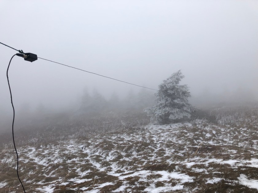
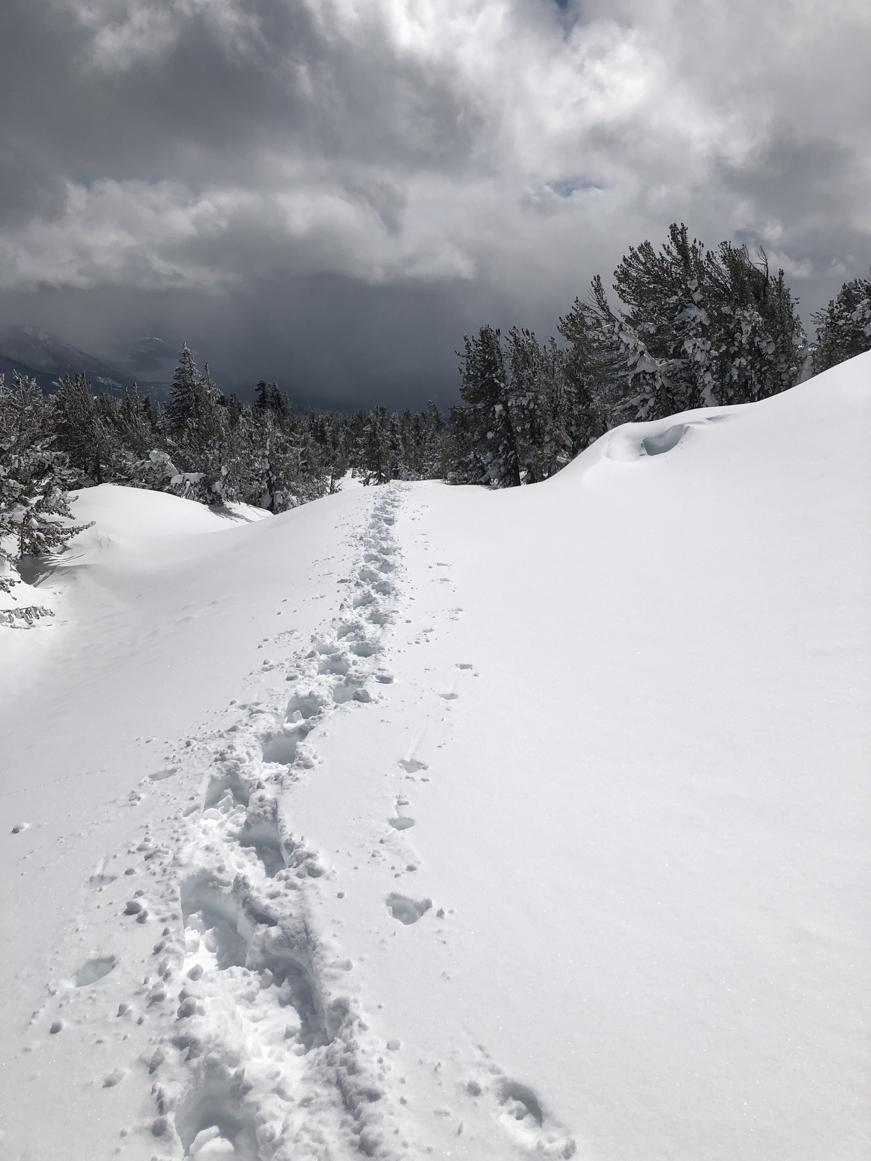
We headed up to a camp area near Mt Warning so that Jason and I could roll up the hill first thing in the morning. Mt Warning VK2/NR-001 is a sacred mountain and the climb up used to be a right of passage for one of the local native tribes. I was walking on hallowed ground, and I was reverent the whole way up. We hit the trail head around 5am, and started the 3.3 miles up. Everything I had read said this trail should take about 5 hours total to do. It took us 4:45 including me spending an hour on the summit doing SOTA. It is always fun getting that first QSO on a new summit/continent! I tossed out a CQ SOTA on 2m 146.500, and VK4IB came back to me from Brisbane. Well that pretty much helped me feel like this was going to be a successful activation. I kept calling CQ on 2 while setting up the KX2. Got my four contacts, closed down and down we hiked. The Feature image is the sunrise from the summit! Definitely heed the sign below.


After we got down, we checked out of our cabin and proceeded to the next summit on the list which was Springbrook Mountain VK4/SE-011 which is for all intent and purpose a drive up. What is funny is that it took us almost as long to drive here from Mt Warning as it took to hike up Mt Warning 😀 even though Warning and Springbrook are only separated by 13 miles/20km crowfly. I noticed that there were two ZS calls nearby also doing the VK thing on a nearby peak, so I S2S’d them. I really should have popped up to that peak too just for the complete :D. I think I helped them get the complete for Springbrook as well.
With some SOTA in the books we traveled on down to the coast coming in just south of Surfer City, checked out the Byron Bay lighthouse for sunset and stayed the night in Lennox Head. It was pretty cool seeing sunrise from a mountain where I could see the ocean, and then seeing the mountain I had climbed that morning from the ocean during sunset! Full Circle


The next morning, Jeremiah and I did a coastal walk the 6 miles from Lennox Head back to Ballina, got setup in our cabin and fished, and chilled out. By Wednesday I was itching for some more SOTA, so Thursday morning I got up at 8am and headed to the airport to pick up a car and then headed inland towards Tenterfield. I had somewhere else in mind, but while at lunch I started looking for two more peaks close together, and there were two such peaks. One being VK2/NT-025 (Mount MacKenzie) (SotaDB has it as just NT-025). I ended up with 5 QSO overall with a mix of ZL and VK calls. After 50 minutes I figured, lets maybe squeeze in one more peak (which would have pushed me past GOAT). I headed over towards VK2/NT-033, and got pretty close until I found the “Please check in with management before venturing onto these lands”. I am not a fan of folks who trespass without permission, and I was not about to break my own rule, so I turned around and looked for another peak. There was a peak over in VK4/Queensland that looked like it would have a short hike, so I headed that way. (Norman Peak VK4/SD-002). Stymied again, this time a road closure due to the fires in the area. So here I sit 7 points away from Mountain Goat. Reality is, I was not really wanting to get GOAT outside of NA because I want to get GOAT with the chasers that have chased me the most so I was not that bummed that I did not get my two-fer today. Headed back to Ballina just in time to get caught in some TORRENTIAL downpours as a result of Cyclone Oma. Had a wonderful evening dinner with friends both new and old.
We were supposed to fly back down to Sydney midday Friday so we would have some time to relax, repack, and maybe catch a few more gardens in Sydney however Oma had other plans. All flights in and out of Ballina had been cancelled due to the high winds. We got a new one way rental, and headed off down the M1/A1 (wait was I in the UK, or AU?) to Sydney. I do love road tripping, and road tripping in a foreign land is also an amazing experience! Jeremiah finally got to see some kanga’s in the wild. That sums up the SOTA portion of that trip, the rest was just me relaxing, and enjoying a break away from the snow of Tahoe.
Now I am back in W6 land and ready for my 120th activation for Mountain Goat! Stay tuned when I finally get it, but who knows when. Maybe this Saturday as part of the Tahoe/Reno meetup being hosted in Sparks NV.
73 de N6JFD
 That’s right, I’m getting to the stretch to make Mountain Goat. As of Nov 5 I am sitting on 841 points. I’ve already set the date for Mountain Goat on a peak back east.


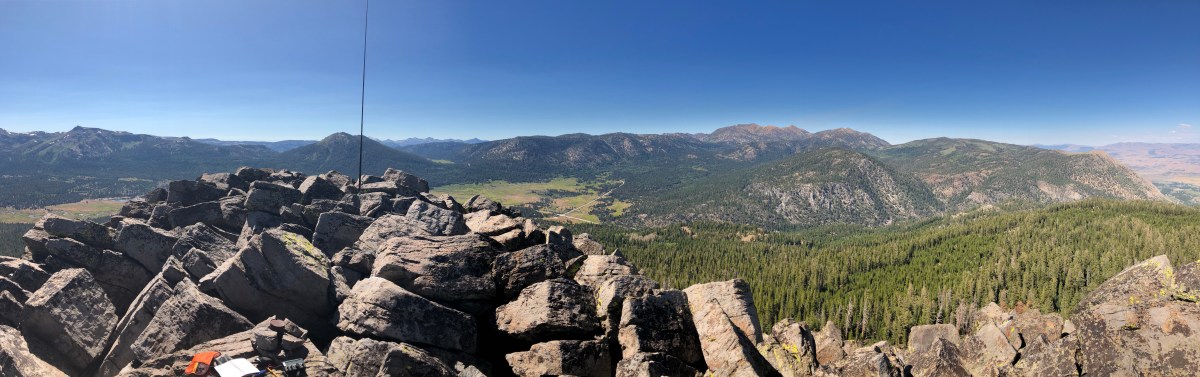
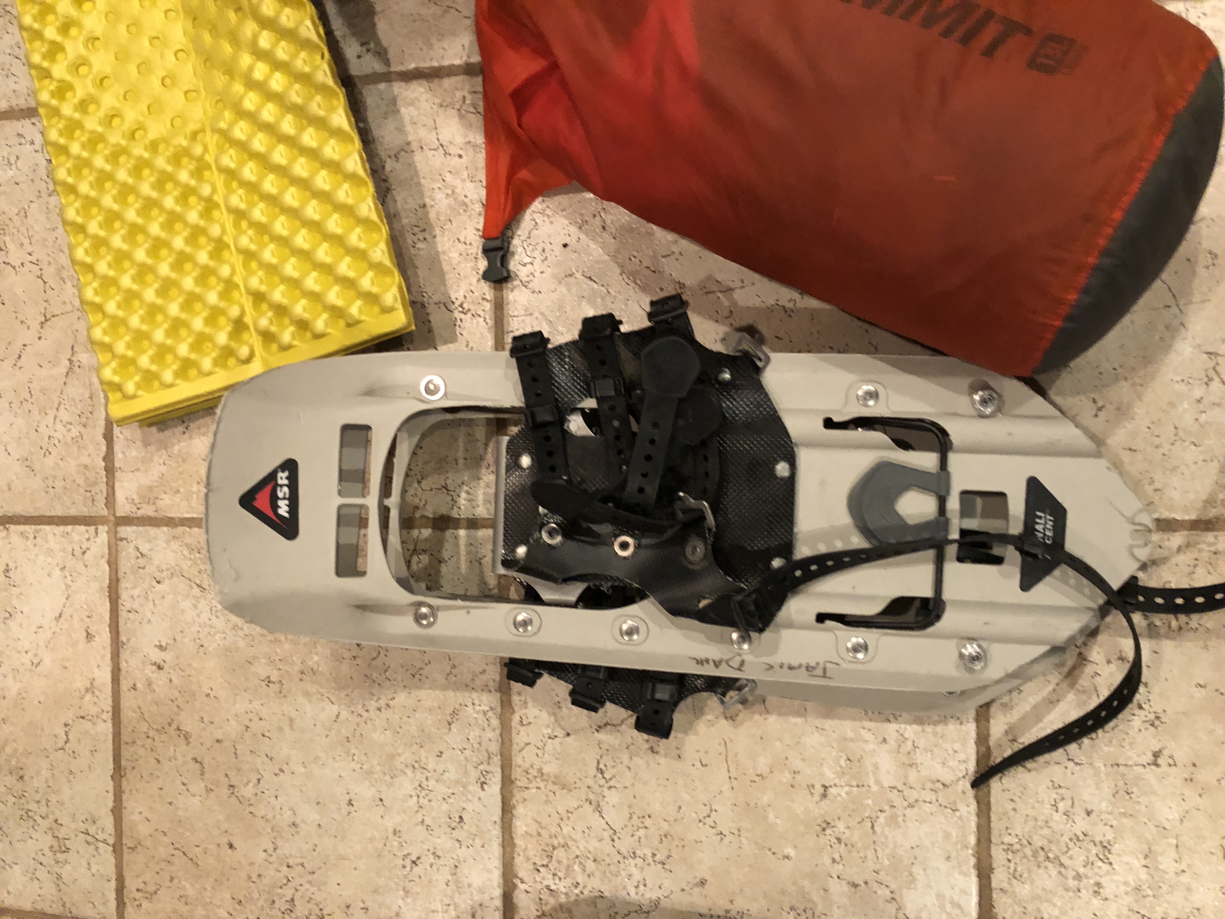
 After spending all day on SAR duty Saturday, it was time to do some SOTA on Sunday, but I wanted to be in range of the basin if a SAR did break out. I goto the Burnside area a lot for camping and was thinking that since both peaks are near drive up i would see if I could snag em both in a single day.. Reality was I woke up Sunday morning without that as a plan, and just decided over breakfast to get after it. I had tried to drive up to Hawkins back in May to do a “sleep on top and activate overnight” activation, but the road was still blocked by snow, and the winds picked up with some sort of incoming weather so I had to bail on that idea. Similar with Pickett’s I’d hiked up from the gate at Pickett’s junction to scout the road, and since I had Lola (my pup) with me, I did not want her on that rock as it would tear up her pads etc.. This was a pretty straight forward activation though. Drive out Burnside road grab the road that goes up Hawkins, park past the solar station and walk up the 15 minutes it takes to get to the summit. Another option that is probably faster is before the road loops around on the north side, there is a pull out/sort of road on the right that goes straight up. I am thinking that might save a few minutes on approach. Regardless see my notes below about doing a 2-fer here so you wont even be on this road ;-). About the time I was realizing I left my cell phone in the truck was about the time I was topping out. Oh well, I had my HT with me, APRS ftw yet again! (just no summit pics).
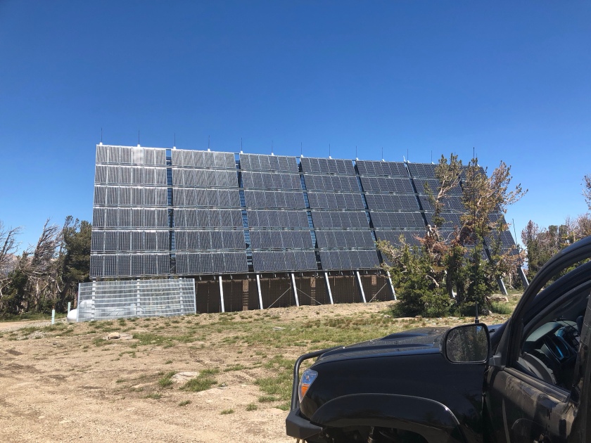
 It took me about an hour to drive around and up to an area that could access Pickett’s peak. I ended up with about a 30 minute bushwhack, so not that bad. It sounded like a SAR was about to break out so I made it to a flat spot in the AZ, and setup and started my activation on 20ssb. The SAR worked itself out, and I opted to relocate onto the summit proper. (this explains the break in QSO times in the chart below). I ended up with 10 contacts between 20 and 17 ssb, and 30 cw. I was not getting any responses on 40 hear either. 17m seemed to give me the longest QSO of the day.
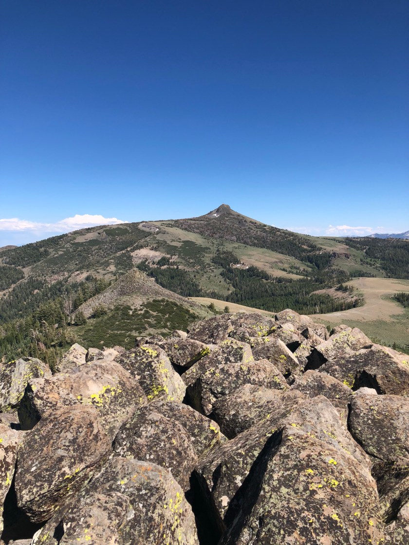
 So time for the annual family trip, and this year we decided England and Germany ftw. I was not sure how much SOTA I would get to do, but I took my gear anyway!! After spending a few days in London we took one of those awesome cheap flights on Ryan air to Germany and landed in Memmingen, picked up a rental and away we went. Stop one was going to be Neuschwanstein, and would you not guess but yes there was some SOTA action to be had. There is a trail up by the castle that accesses two different SOTA peaks and that being
  The hike from Neuschwanstein to Branderscrofen is ~5.5 miles of which the first 2.5 miles gains 80% of the elevation. Once we reached the cruising altitude, (I mean flat stretch) up high the hike went pretty quick. There is also a tram you can take to reach an area that is ~25 minutes from the summit, and also has a restaurant, and heli port for hang gliders and paragliders. The summit is a knife edge ridge, and there is not a lot of room for what is a very popular summit. I ended up tossing my vertical for HF off the side and radials deployed as normal. A few folks showed interest in what I was doing and as usual I obliged. I ended up getting three s2s one of of which was a gentlemen who was 15km away in Austria (vhf). In less then an hour I ended up with contacts in the UK, Munich, Sweden, Austria and Poland.
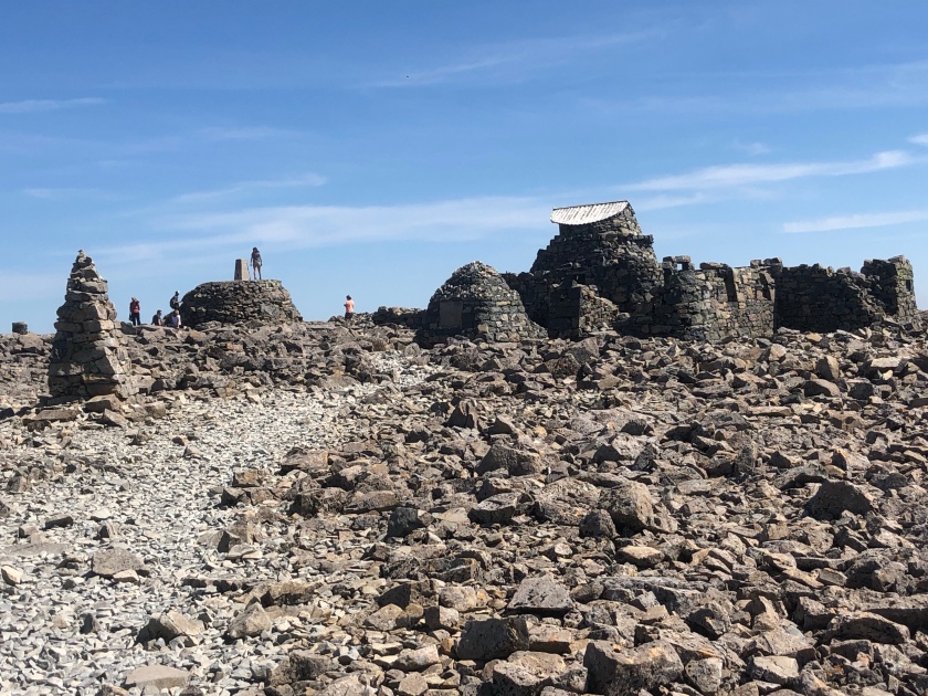
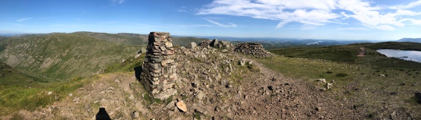
 ish our SAR team could get away with that, we have had calls similar to that in our area. So, with all that in mind, and the fact that Ben Nevis is socked in more days then not I checked the weather and noticed that Scotland was under a high pressure and was going to be the warmest day in some 100+ years etc.