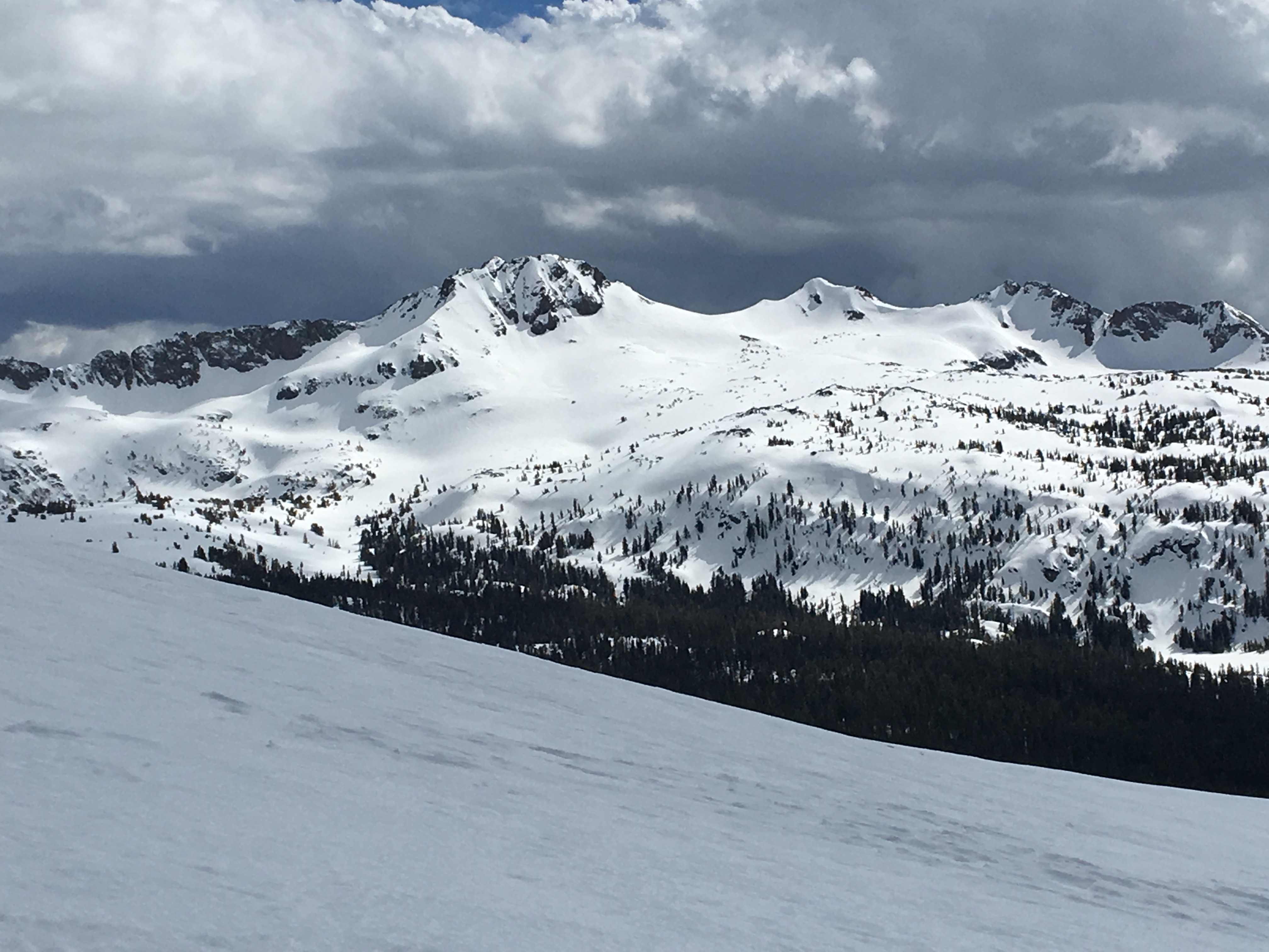
I volunteered to help with communications for the Pony Express re-ride. I also figured it would give me an opportunity at parts of NV I probably will not see often. Lets just say that Golden Earring wrote “Radar Love” with US50 in mind. I drew a section near Austin NV, but because of some recent weather issues my first assignment was unattainable. The second assignment though was no problem as I followed along the horse along the highway. There is not a lot out that way, it is very dark, it is very quiet, all the things you would normally find in an off the radar backpacking trip. I ended up sleeping near Cold Springs Station, there was a pull off with a bathroom, blah blah. It was also just far enough away from Austin that it was out of the weather. That said, next morning, I rolled back to Austin and grabbed breakfast at the only cafe in town open, and met up with Jeff and Sue from the SIERA amateur radio club and we had breakfast. Also met up with some other folks from the Pony too. After breakfast I checked the SOTA map to see what was close by.. There are four 10 pointers, a few 8 pointers south of Austin but the roads were a mess. So I opted for Mount Prometheus right outside of town and right off US50. A short run of off-road, and parked I was. There is no trail, just park somewhere on a BLM/Rancher/Forest service access road where you feel comfortable and start walking.  . For where I parked the walking was pretty easy. Made the first small ridge and then contoured across to the structure the peak is a part of. I maybe hiked a mile, not the hardest hike I have ever done. The summit has two different Geodetic markers, but they both say the same thing, and they are about 10 feet from each other. A rock pile and such on the summit make it easy to erect a mast for your antenna. This is one of the first times I erected solely in an NVIS style angle on my antenna wire. I was able to get my four contacts pretty quick, and because of the nature of why i was out there, I opted to boogie off the summit pretty quickly so stopped at four QSO. I had 1 contact on 20m (W0MNA) everything else was on 40m. The bands were being REALLY bad at this time. For the Pony comms we had hoped to run an HF relay on a couple of peaks and the conditions were not such that we could. The topo above should give you some idea of how easy of a hike this is..and reality is if there had not been snow on the road I would’ve kept driving for an easier summit hike. Keep driving north on that BLM approach road and you can also get W7N/EL-064, Telegraph Peak.


Genoa Peak, TRT/SOTA challenge part 1b
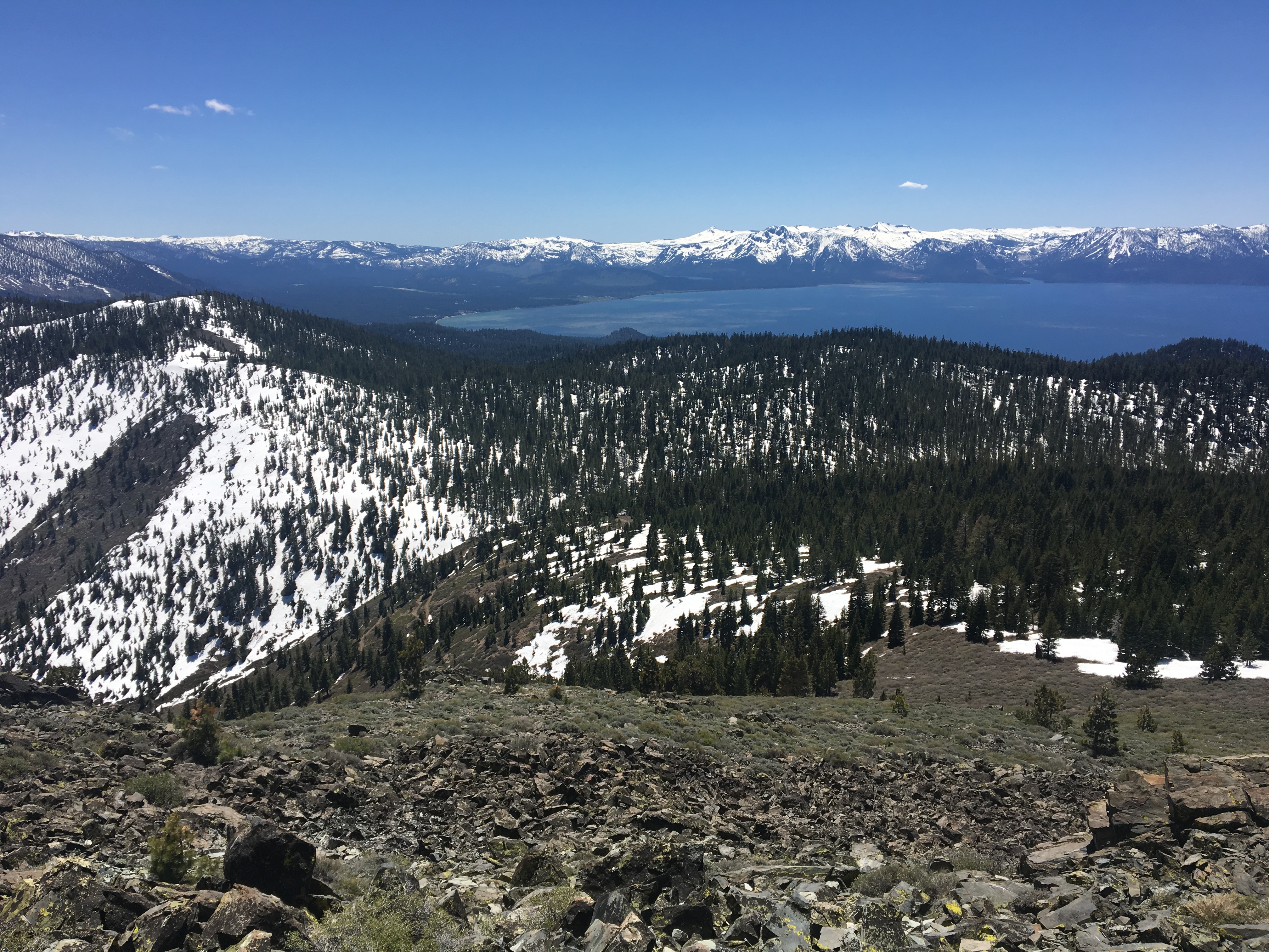
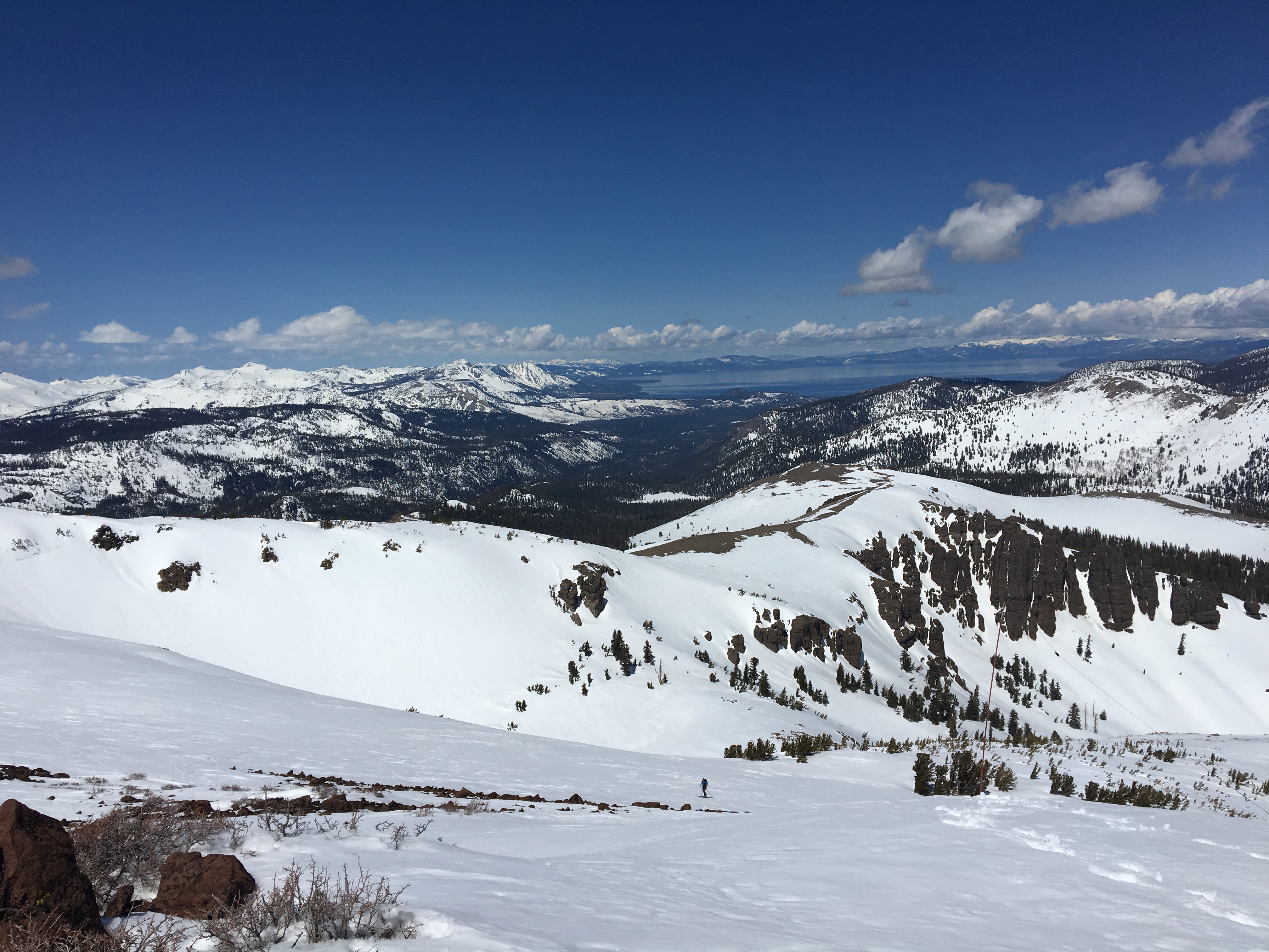
Ah Big Blue: Looking down at the lake while walking back to the trail. Genoa Peak, this is the 2nd peak of the Nevada half of the TRT that I am working on for the summer challenge.. Although I have enough other fun peaks on the list, I am beginning to wonder if I am going to complete it..oh who knows we have till November. That said, I opted to skip the trail here and head up the road, probably a mistake given the fact that I saw mountain bikes drop into the trail and ended up hiking thru snow.
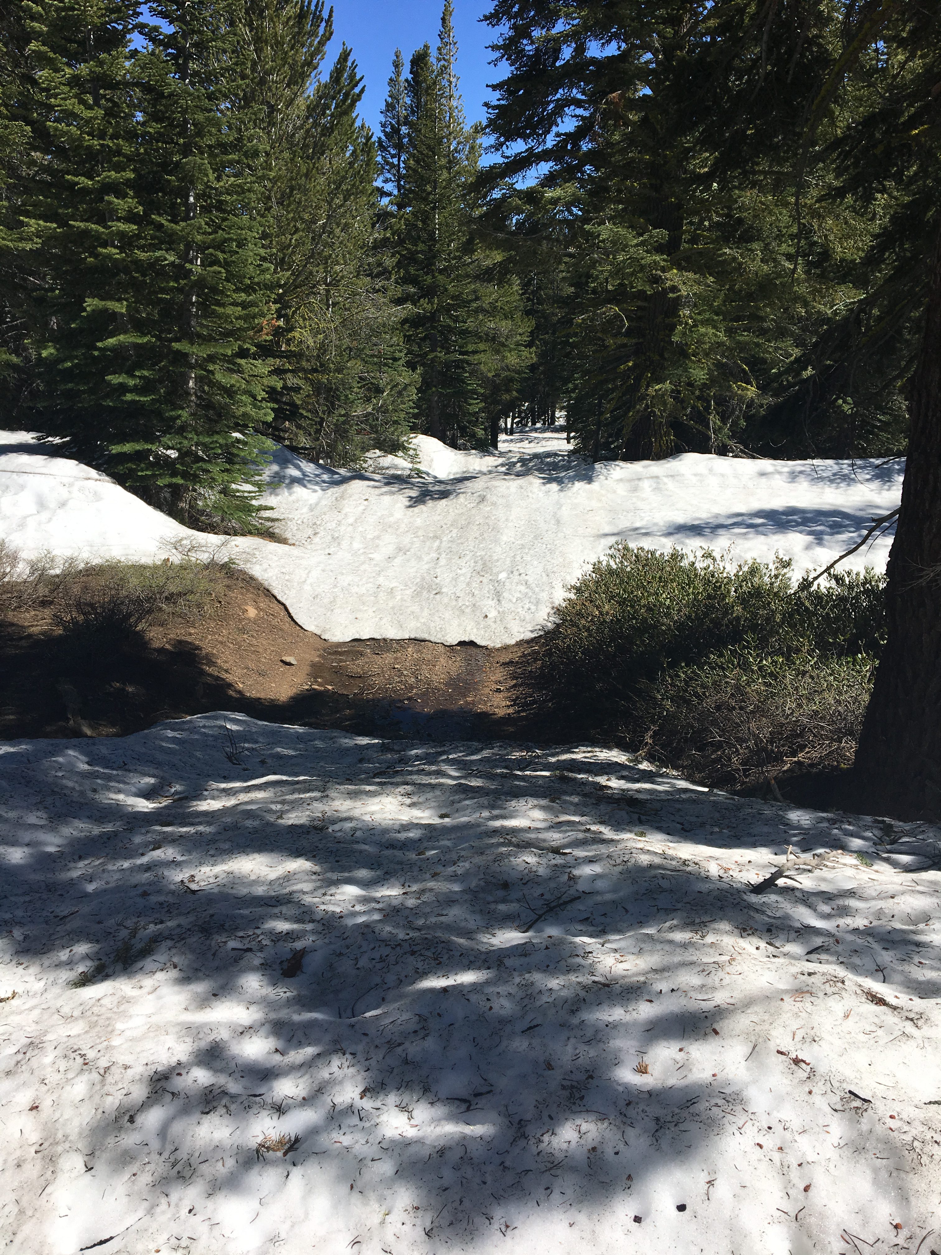
I am also learning quickly do NOT trust Google maps. GM said it was 2.2 miles to the summit. Even with me taking a short cut (across the snow), it was 4.4 miles to the summit. overall I did 9.8 miles, I guess PhD’s do not know much about mapping and navigation when it comes to non-pavement surfaces. Yet another reason to NOT rely solely upon technology and smart phones.. Soapboxing aside, it took about two and half hours to make the summit. Down below me at the lake the AMBBR was going on so I was listening to the NR7A repeater to the comms as things went on. If you are interested in EMCOMM I highly suggest you go sign up and volunteer for an event like that. While these biking events are not EMCOMM, a lot of the same principles apply. The last two years I’ve done the California Death Ride (Tour of the Cali alps) and this year I’m doing the Pony Express re-ride thru NV as well as the Tour-de-Tahoe in Sept. On the summit there are a lot of radio structures, so do get a tad off peak to setup. Since I was not in a hurry to get off the top I decided to play around w/ some different antenna setups. I managed three QSO’s in like 2 minutes, then things slowed down, and I shifted over to 2m. So my first antenna setup was my typical straight wire in a N/S orientation so I could throw E-2-W. After a bit I shifted direction slightly. On 2m, I could hear a local guy operating another SOTA activator that I could not hear etc. Reached out to him, got him some chaser points, and then got the details on KE6MT who was working a peak about 30 miles crowfly south of me (On Leviathon Peak W6/SN-039). We could not hit each other on 2m, but we did manage a contact on 40m. By then I’d shifted my antenna to an NVIS setup b/c I was also trying to reach activator W6SAE who was working a peak down towards San Francisco. I could hear him buried deep, but he was unable to pull me out. Oddly enough with an NVIS setup, I managed to snag W0ERI and W0MNA out in Oklahoma. They could hear me using an NVIS setup, but could not hear me when I was pointed specifically in their direction. I think I noted this in my previous post, but damn the bands have been acting funky so far this year.
All in all I made 10 contacts, and added one “SOTA Complete” thanks to the S2S with Leviathon peak. Funny too, Monitor pass only recently opened, and last I heard the road to the antenna towers still had a fair amount of snow on it. Break out your snowshoes!
Couple of parting images from the activation!


Some W7N action and Memorial day weekend
The snow is still deep in the Sierra, and that is a good thing. So lets head a tad east and start exploring the W7N/TR association near Carson Valley. It is right in my backyard (or would that be front yard?).
Since May 20th I have snagged 3 peaks and 20 points. Gotta get my points per activation back up, need to hit some 10 pointers.
 First up was W7N/TR-019, Mineral Peak. After all the work I’d done with the Tacoma, it was time to start breaking it in on the roads east of Carson City, NV, and this was a peak that had never been activated. This peak does not really have any trails to the summit, so it was time to just brave the heat, and head straight up the side of the mountain, and see what the GPS tells me. Here is my GPS track from that hike. Pretty straight forward activation, only got 4 QSOs 3 on 20 and had to fall back to 2m for the fourth. Managed a Summit to Summit too :D. There may be a method for making the peak from the East side of the peak, I came up from the west and just walked straight up. Do be aware though that it can be steep, and there is some loose rock at the top, so do be careful. The approach is off Johnson Lane in Minden, head out Sunshine Pass road. I could have headed up an extra road, but I like my paint job. Head to SummitPost if you would like more info about this peak and how to approach it. I forgot my phone, so no images, however this image is from Mount Como. Mineral Peak is across the valley from Mt Como just off center right. In both cases I managed to snag two peaks with zero activations.
Memorial Day weekend:

I managed to snag two more peaks for the holiday weekend. On Saturday I headed back out Sunrise pass road to do some more exploring of the desert area between Carson and Fallon, also wanted to snag another peak with zero activations (W7N/TR-008, Mt Como). The SummitPost page has some good beta for where to park and how to get closer however part of the road had washed out 2 miles from the place I intended to park. There is another road in to this area from the East that gets you to the same area if you do not want to walk that far. There are a few spots along the walk that would make a great high altitude campsite. The snow is not too bad out here, but I did encounter mosquitoes and some bogs from the melting snow. Managed three Summit to Summits, and 5 total contacts, the bands have been odd, or I am just doing stupid stuff with the direction of my antenna. June is going to have quite a bit of W7N in it :D. One interesting thing though, one of the S2S guys jumped onto my frequency to make contact, and next thing I know a bunch of chasers piled him, and pushed me off frequency. Odd that they could not all hear me. One of these days I’m just going to head to a summit for a few hours and try chasing only without actually setting my own spots. The hike out was uneventful, but I did get to pull a truck out of a bog.
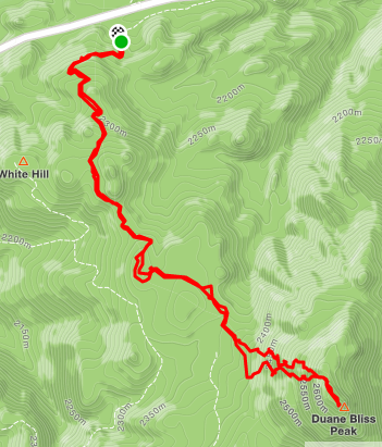
On Monday, I went after Duane Bliss peak (W7N/TR-014) as part of my Tahoe Rim Trail/SOTA challenge. I had hoped to make this and W7N/TR-007 as a two fer day hike however there is still a lot of snow on the trail corridor which does slow you down (it slows me down about 1/2 mile an hour). I tagged another Summit to Summit, and 6 total QSOs, 2 on 20, 2 on 40, and 2 on 2m. Nothing really exciting on the approach to this peak. Park at Spooner summit, head out the Rim Trail for 3 miles, then turn left and go UP off trail :D.
A busy two weeks for me and SOTA, working my way to my GOAT. I’ve already done more peak points this year then each of the last two years, here is to hoping I keep it up :D.
From sand to snow.. two activations to totally different types of zones, and finally 100pts on SOTA!

The weekend of April 1/2 I managed to snag two different peaks in two different zones and states, and two very different types of hikes :D. The CVHams meet on the first Saturday of the month, so I headed to Carson Valley with the intention of doing two different activations, but ran out of time scouting the entry roads. So I opted to head to the meeting w/ the purpose of snagging W7N/TR-042 (McTarnahan Hill) after the fact. This morning my goal was to hit that peak before the meeting, but yah those NV back roads are in rough shape from winter. Anyway that said, I managed to get within 1/2 mile from the backside of the peak, but if you went up the front side from Carson City side, and had a Quad/Motorcycle you can make it to 20 feet from the summit. I know better then to activate this close to 0000 UTC.. Oh well, I allowed the Auchard’s to get double chaser points. Another successful activation, As noted the Auchards both before and after 0000, as well as a local guy in Carson City, and NG6R from Southern Cal.
 A campsite on the side of the road where folks left unopened beers and other various trash.Look folks, LEAVE NO TRACE. Leave it how you found it. Oddly enough when I came back thru the second time, the bottles were actually gone. I guess the runners I saw out on Sunshine Pass Road needed a pick me up on this fine day!
And now the Snow Zone 😀

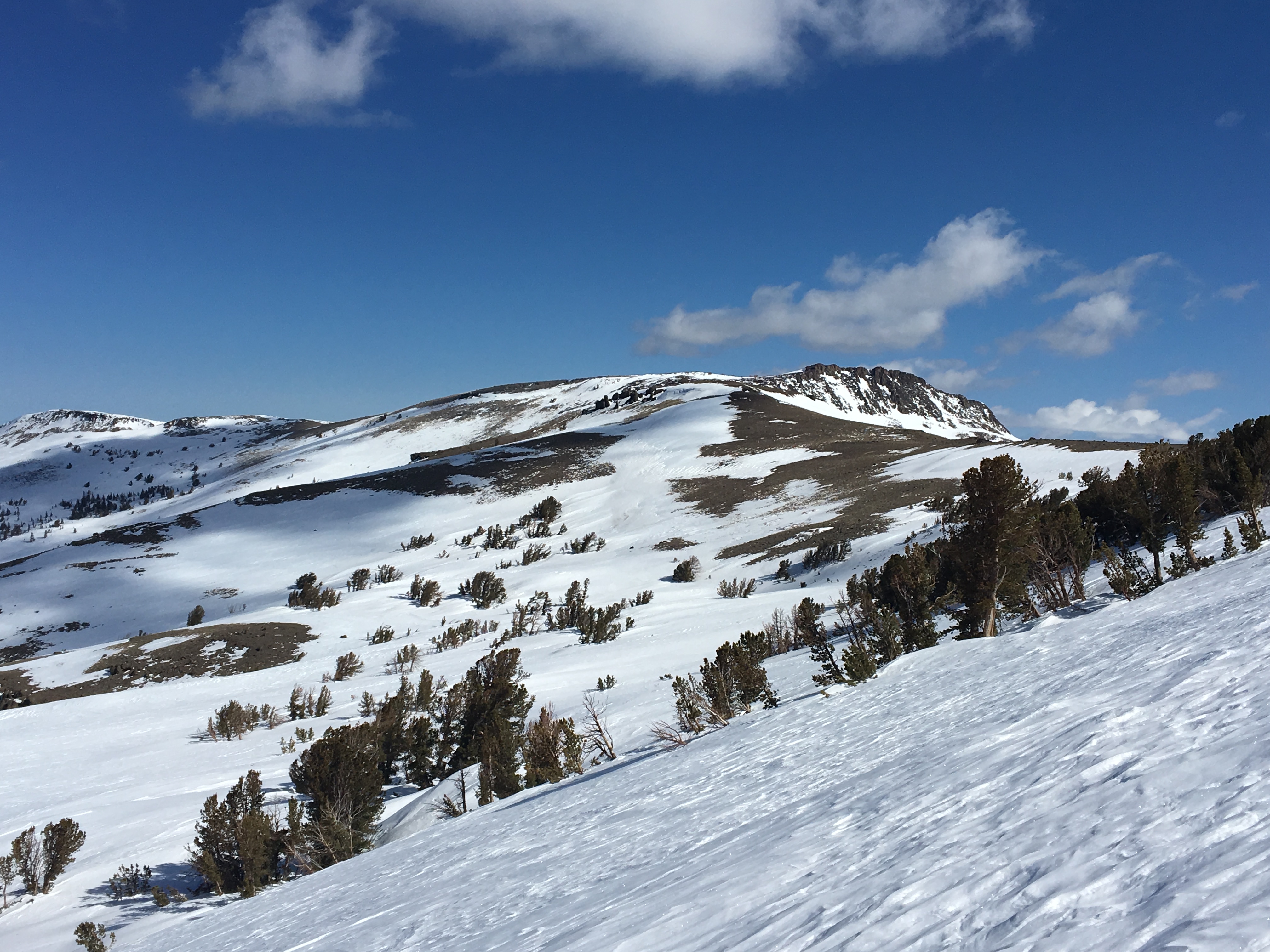
So Sunday the goal was get up to Stevens Peak (W6/NS-345). This is one of the peaks on my “TRT Challenge to Self” so one checked off, a few more to  go. No this summit does not help me from a miles perspective. There was still plenty of snow, so I opted to go up the backcountry skiers route, but the sun was blasting that hillside, so it was getting soft. Sidehilling in soft snow on a 30 degree slope is risky for a multitude of reasons, unless you have solid self arrest skills, do not bother. HOWEVER..you gain 1000 feet in the first mile, making for a mellow grade for that last 1/2 mile push up the summer trail. Even though there was ample snow in the first 2.5 miles the last mile was pretty snow free on the climb. The top still had plenty of snow though. People are pecuiliar, I followed these two skiers up the bowl, and watched em descend. Turns out one of the guys was on his third day out ever, not third day of learning BC Skiing, but third day of skiing period. 30 degree slopes are hard blues/easy blacks. Is BC on a spring corn day on avalanche terrain really the place to be learning how to ski? Saw a couple of snow bunnies and a few bear prints in the snow while hiking. All in all, I love snowshoeing thru the snow. Once on the summit, I saw my fair share of BC skiers/snowboards who had come up the main face of Stevens (as opposed to Carson Pass). Oddly enough there were two backcountry riders who ferried one of those super expensive drones that have “follow the subject mode’ or whatever it’s called. The guy was complaining that my antenna was creating interference. Odd that the drones are impacted by the RF from a radio on 20m. I was nice and let them film and ski out, b/c the sooner they were gone the sooner I could get to it. So the nice thing about my SOTA attempts is they are always a learning experience. The experience on this trip is that snow does affect radiation patterns and such, oh and I need to figure out how to use APRS2SOTA. I somehow managed a contact on 20m at ~60miles crow fly. Thanks KK6CUG for the spot, that brought the chasers on. That and since I could see Kirkwood Ski resort, I managed a few simplex contacts from folks with their HT’s riding the lifts. Funny, I never considered carrying my HT while resort riding, but if you snag ski patrol’s frequency, I can see why it’s worth it. The hike out was pretty uneventful, but I went back the summer/PCT path instead of trudging down that hillside I came up. It would be easy to snag Stevens and Red Lake in a single day, and I almost considered it, if I had been off Stevens 30 minutes earlier I probably would have gone for it. Anyway some pics from the summit and from the surrounding areas. Oh how I do love the Tahoe/Carson area! My particular path was 7.1 miles total, the return path was a bit longer then the up path, but I was going for the safety factor, and even did some butt glissading. I was also scouting the route for my attempt on Red Lake peak, I’ll be skipping the skiers bowl that overlooks HWY 88 the next time
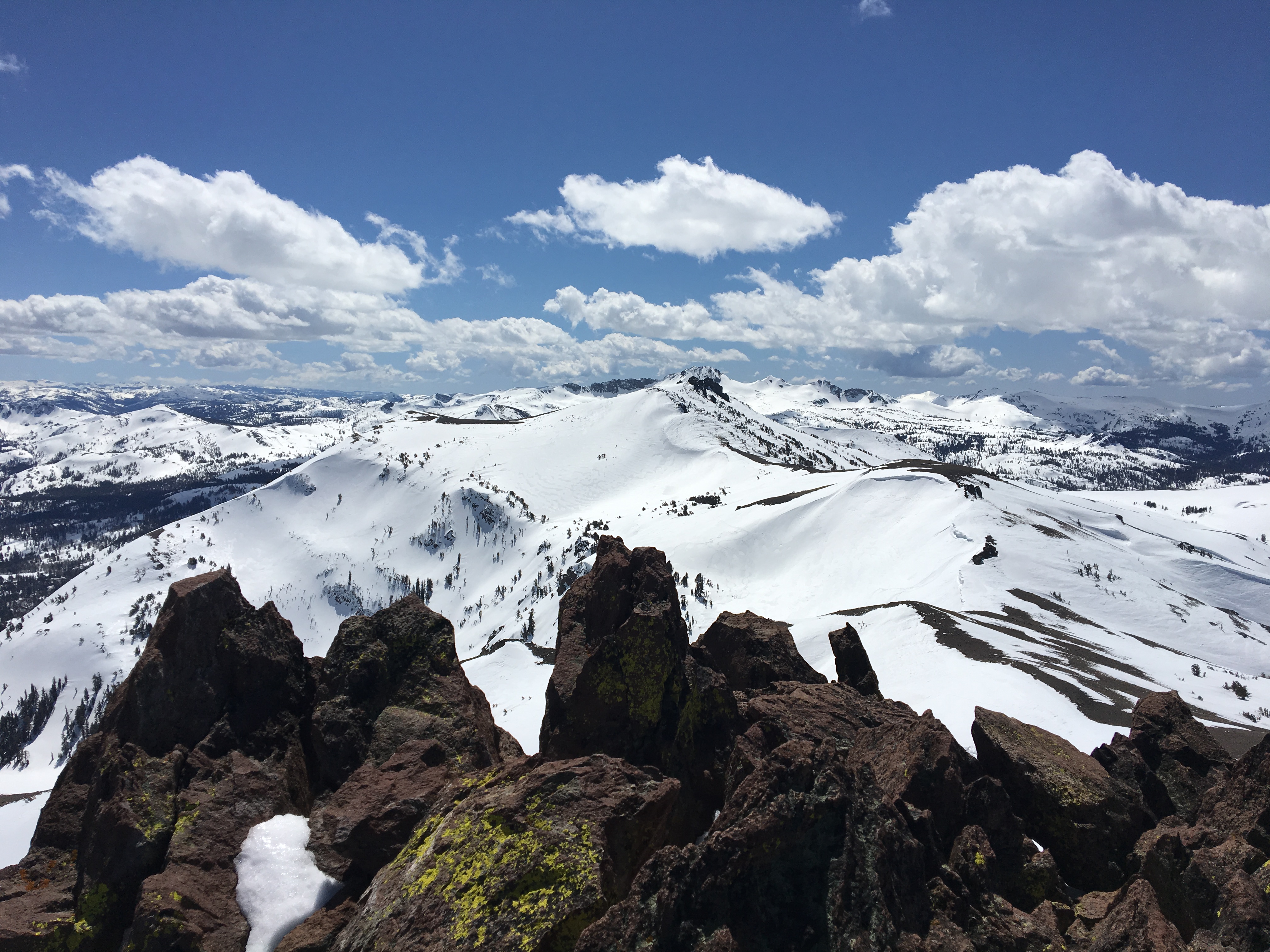


A few images of the area. Nothing specific, Round Top (W6/NS-055) which is on my list to do. Red Lake Peak (W6/NS-062) as well. There is probably 50-70 SOTA points in the various pictures there with named peaks in the W6/NS (and some W7N/TR designator) in the panorama.
All in all it was a great weekend, Some sand, some snow, some awesome scenery and an overdose of Vitamin D (the uncovered parts of my face are purple thanks to the reflective power of the snow :D).
Loving the KX2 and took care of the easy Tahoe Summits
Another activation with the KX2 while I continue to get used to the radio, and another Tahoe Summit off the list. W6/NS-248. Not as easy as Tahoe Mountain, but still easy enough. Snowshoes today thoug h. Oddly enough for as short as the run up this hill is, there was a skin track (backcountry ski/snowboarding) up to the peak. Usually takes me about 30 minutes to bust up this hill, and today was about on par with that with the snowshoes on. Anyway, successful summit, got 1 2M QSO, but I am friends with WA6EWV, I may have to introduce him to chasing, or summiting :D. Not sure his level of adventure etc. Anyway, I commented that I had my longest and shortest QSO a few days ago, Tahoe to North Carolina..no crushed that today, well by 300 miles. KB1RJD, and KB1RJC gotta love those husband wife teams! Tahoe to NH…approximately 2520 miles. Anyway, 6 more points, finally broke 100 points on SOTA, and am finally getting my system dialed in well. Managed to get a good working headset mic combo, although I probably need to work on the TX EQ to get my headset audio up. The pic below is the flagpole I used as a mast today, normally there is a flag on there. They take the flag down for the season, and if you climb up on the rock there is an eye hook you can use for your antenna. Do not use it though when the flag is on there. I see that as disrespectful. Behind it is Tallac: (W6/NS-036). Another one I’ll have at some point before summer. Anyway that’s all, loving the KX2, just need to keep babying it, and hope it holds up well for the 4 summits I intend on this weekend.

A new radio, and finally W6/NS-397
 Well this is probably the easiest peak to get in the basin, but today was my second attempt (radio issues first time around). So, I sold my old HF radio in December knowing it would not last me thru this year. I toiled for months trying to figure out which was the right radio for me, and by then had narrowed it down to the tank, and the new pocket rocket: FT-817, or KX2. The 817 is like a tank, everyone I ever talked to swore by it, tons of blogs praise it. It set the standard for backpacking durability and HF QPR. For someone like myself who is hard on gear, this seemed like the right way to go. So I went with the KX2 instead ;-). Maybe I just like taking risk, or maybe as I get older i’m finding ways to not be so rough on things. Maintaining constant situational awareness, blah blah. Probably what intrigued me is the BIG readout, the way easy to use buttons, and while I have a few Yaesu radios, enough of my other SOTA buddies convinced me I would be a lot happier with the KX2. Well, I cannot say I would not be happy with the 817, but damn, that KX2 is nice. I am not going to really review the radio today, but it did show up on the 27th at my house. I did a lot of listening to other SOTA folks from the desk while working, and while also testing my battery life on my LiPo battery. So far I am at 10 hours with ~3 hours of me yacking away and still at 11.55v (started at 12.5). Well I have already surpassed my old radio on power consumption..and apparently the KX2 is a lot better then the 817, but I cannot do a direct comparison.. Anyway that said, I’ve had this thing for 2 days, I’ve been listening at home, but I have not made any contacts with anyone, so time to go run up W6/NS-397. As noted above, it’s the easiest peak in the basin, it’s a 10 minute drive and then a 10 minute walk up to the tower on top. Tossed my line up in a tree, and extended my EndFedz antenna, self spotted on SotaGOAT and started calling on 14mhz. I knocked out 6 QSO on 20M in 20 minutes..Not a record by any stretch, but I was playing with antenna direction and such (about 25-30 feet up in the tree, at probably a 30-40 degree take off angle) so I was moving from E/W polarity to N/S polarity etc. All my connections came from the east needless to say. I was 3×4 into NC, and he was 5×5 to me.. The Chaser couple that live in KS had me at 5×5 (Thanks Gary and Martha, you two ROCK!) , and managed MN, and IA as well. flipped to 40M and adjusted angle slightly to be more NW/SE angle. I managed ID, Reno x2, UT, AZ, and OR x2 in 14 minutes. I could have kept going, but I was on a time budget. From my house to the summit back to my house in 90 minutes, and managed an activation that marked my shortest and longest HF QSO to date… Probably nothing new for most SOTA activators, and I cared more about playing w/ the new radio then anything else :D. I may have to bag the other 6 pointer in the basin on Thursday towards the end of the day..
That is that, and I get more and more familiar and comfortable with the KX2 then I may go ahead and toss a more formal review up..
A brief note about wildlife!
So, one thing living in Tahoe affords me is experiencing wildlife on a semi regular basis. What I also witness though is just how dumb people can be, and the things they say in regards to wildlife, especially bears. On my very first Summits on the Air activation of “Pt 9614” (W6/NS-086) I had what could have been a very dangerous experience with a bear. Some would say I am lucky, I do not necessarily disagree with that, but the one thing that mattered is that I did not lose my cool and panic, and THAT had a lot to do with getting out of the situation. So I will not go too much into the trip report for this other then to say I hiked up the High Meadow Road from the basin, and instead of heading up to the Rim Trail via Star Lake, I decided to do some overland hiking and navigation skills. That is one nice thing about hiking above tree level, plenty of hand rails for navigating. So I made my way across the meadow, and started up on my climb, had a few creek crossings. Reality is, I was using an old road on the map I was using to short cut my way from High meadow to the Rim Trail. One thing you want to do whenever in bear country is make a lot of noise, and yes I make plenty of noise. I will sit there and yell “Hey Bear” about every 5-10 minutes, and whistle, and sing and what not. If there is a bear, or cougar, or any other wildlife, they know I am coming. That said, I’ve navigated so far so good, and I’m about 300 yards from the Rim Trail and can actually see the trail, and see bikes go whizzing by from time to time, so no worries. At one point, I yelled out a “hey bear” and heard a rustle up ahead of me, and managed to see a small ball of black fur go take off across the trail. “Oh shit! that’s a baby” is probably what I thought, it’s been a couple of years. All STOP! Do not go forward, do not go backwards, again. I started scanning the area around me, by now Junior was way off to my left about 100 yards (man those animals can move.another reason NOT 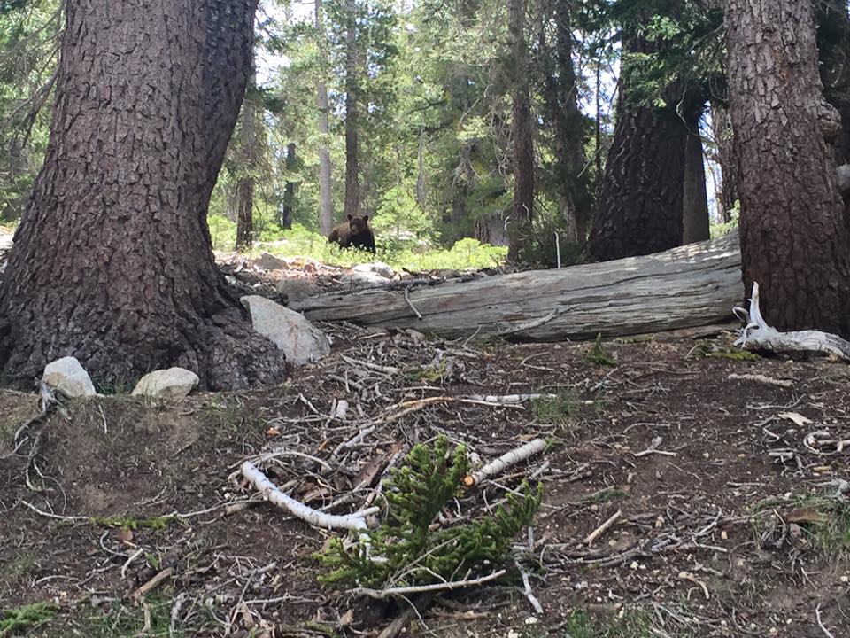 TO RUN!). That said, where was big momma? I scanned to the right, and above me, about 100-200 feet up the hill was mom. I was in the one position you NEVER want to be in with a mom and cubs (in the middle). She had not taken any offensive positioning with me, yet, she had not risen up on her hind legs, but she was definitely checking me out. At that rate, I figured the best thing I could do was start to back down the hill a little bit. I did not turn around and run, I did not maintain eye contact, I just backed down the hill slowly. Once I added another 50-100 feet between us, I started to move to my right (in her general direction) but away from the direction of the cub. The goal was to put her between me and the cub. Once I was well to her right, I started to move up the hill, she maintained and even pace with my ascent and it stayed that way for about 100-200 yards. Then about 50 yards below the trail a mountain biker came whizzing by and she took off. I do wonder what she would have done if I had made the trail, but no bikers or hikers had come by. Moral of the story though, I did not act threatening, I talked calmly, but loud enough she could here me “Away with your weapons, I mean you no harm” etc and moved slowly. Maintain calm, and composure. Remember, we’re in their house, it is their rules, and best to be respectful. I did manage to grab one pic though during a tense part of the encounter.
My ’17 challenge to self (Tahoe Rim Trail and ALL SOTA summits in this zone)
In 2005, I attempted the Tahoe Rim Trail, and pulled out early for a couple of varying reasons..primarily I did not take care of my feet. Not that it was a hard trail, I’d knocked the JMT out the year before in 13 days, and I was still in great backpacking shape (although not as good as I am now). We finished the Desolation to Brockway Summit portion of the trail, and over the years I’ve done segments from Luther Pass, and Spooner Summit, but mostly dis-contiguous segments. That said, it’s a new year (well first day of spring of a new year), and it is time to do some goal setting. 2016 saw the least number of trail miles I’d done since my mid 20s, and this is a good year to bounce back.. I’ve only got about 100 SOTA points, and I have neglected my backyard. This year the goal is simple and still allows for other opportunities for getting out: lots of day hikes, 3 day weekends, and overnights to finish the TRT, and retrace, or take liberties with side trails the parts I’ve already done to get more SOTA summits. I intend to activate EVERY SOTA summit in the TRT corridor (and also knock off all summits in Desolation wilderness. This does NOT get every summit related to the Tahoe basin, but it’s going to be a lot of fun miles, and hopefully a pile of points for myself and chasers! I am a huge embracer of Leave NO Trace ethics. Anytime you venture into the backcountry you are a visitor in someone else’s home. Wildlife and the like depend on you not trashing their home.. SO..if you pack it in, pack it out, do not burn it, do not toss it, do not let it drift away in the wind. Leave the backcountry exactly as you found it, or a saying popular in the 80’s “Take only pictures, leave only footprints”.
I will put up a spreadsheet of sections, mileages etc as I finish the planning, so do consider this post a work in progress. All but five of the peaks are 8 point summits. All five of those summits are in the W7N association (Nevada), one is a 10 pointer and the last four are 6 pointers. One thing to note is that quite a few of the summits do require some off trail, and questionable terrain (in one case a whole day trip of off trail paralleling the trail). This plan is based upon my skills, and any followup trip reports are in NO WAY a scouting report for you. You the individual reading this must assess your own skills. As a member of local SAR, I see a lot of examples where humans tend to overestimate their capabilities with a tad bit too much reliance upon technology. Know the 10 essentials, carry them, and be weather smart! If you have any interest, but no experience in this level of hiking then I suggest you start easy in and around your home hills as altitude is not the place to break in a new skill set. I am not responsible if you get lost, and will not be making any GPX files available. You will need to do your own planning and use your own ‘noggin based upon your skills with navigation, off trail walking, and general trail walking.
For this purpose the trail will be broken down into a few segments with Desolation Wilderness being the last segment I intend to address. Desolation is my favorite area to visit; I love granite. It is part of the carrot that will keep me going! There are 104 points inside the boundary of Desolation; to date I have done one SOTA attempt and activation in Desolation (Maggie’s Peak W6/NS-135). So 96 to go. I have also snagged a few other peaks on the southern end of the trail.
Echo to Luther: I’ve not hiked the segment from Echo Summit south, however I have completed the segment to Luther Pass via Carson Pass to Big Meadow day hike. This segment of the trail (the Southern most end of the trail) gives an opportunity at Little Round Top (W6/NS-087), This would be a very doable overnighter with rolling out on a Friday night to make Showers Lake area (8 miles), grab Little Round Top first thing, then move over to the Red Lake Peak (W6/NS-062) and Stevens Peak (W6/NS-375) spine. At this rate there is one other kinda far off side peak, and time of day matters. That is Waterhouse Peak (W6/NS-092). Waterhouse is a side trip, rejoin the TRT at Big Meadow via the Scotts Lake Trail. Again, this assumes you have hiked this segment of the TRT, if you have not, then Waterhouse is WAY off the rails, and I’m viewing it more as a bonus challenge!
Luther Pass to Kingsbury Grade: There are four SOTA summits (five if time permits) to be gained on this segment, but there is a LOT of hiking and elevation involved. I have hiked and biked the majority of this segment, and have been on all five peaks at various times, and have activated three of them. Since I am focussing on uniques I will be skipping those three, but will call them out. The focus peaks this summer are Feel Peak (W6/SN-034) and Monument Peak (W6/NS-061). For those with time and ambition, camp at somewhere near Freel or on Jobs Sister and side trip to Jobs Peak (W6/NS-047). I would not consider it for this challenge because it leaves the TRT corridor. This side trip is probably a half day effort if you camped up high but it is another 8 points. Start at Big Meadow where I left off from the previous section. The first SOTA summit you can get is an unnamed and off trail ascent that has about 30-60 minutes of climbing from the trail corridor Pt 9647( W6/NS-084). For future reference a summit named “Pt ####” is named for it’s height as it is not a named peak. I have already completed this summit so I’ll be pushing for Freel, and do plan on camping on top on Job’s Sister. A night DX activation could be fun :D, and I could self spot from up here if needed. This should be a long day backpack in, and yes I am well aware there are two other ways to sneak up Freel, but remember, the goal is stick to the TRT corridor (or very nearby) and complete as many miles as possible! The third summit on this segment is “Pt 9614” (W6/NS-086) Another Nameless summit..and to date, I’m still the only person who has bagged this (under my previous call sign). This write up from that trip is a good lesson on how to handle yourself around wildlife. The nice thing about this peak is it is a few hundred feet climb directly above the TRT. The fourth summit and possibly the hardest to attain is Monument Peak (W6/NS-061) in the Heavenly ski resort. This will require some off trail with a 1000 foot climb to reach the peak from the pass the trail rolls thru. If it is anything like the scramble for the previous peak, it’s very sandy, so 3 steps up, 2 steps down etc..
Kingsbury to Spooner: This is one section I’ve identified as a day hike section. There are two summits on this stretch, and it’s only 11 miles. The two summits are nothing like the side day trips I’ve mentioned so far. Start early at Daggett Pass/Kingsbury Grade and head North. About half way up is Genoa Peak (W7N-TR-007) snag some lunch and do your activation. Genoa is a short off trail climb, it also may have a road since there are antennas up there. Continuing north is Duane Bliss Peak (W7N-TR-014). After this, it’s mostly a descent to Spooner Summit. Once at Spooner if time permits grab Captain Pomin Rock (W7N-TR-027), it’s outside the TRT zone in my opinion, but it is right off the road. Trying to do it as part of the next trip adds a bit of an epic factor. (or skip it, it’s only 6 points)
Spooner to Mt Rose Hwy: is a twenty-two mile stretch that runs along the eastern crest of Lake Tahoe. This is one section I am going to do as a southbound, and not northbound for where the summits lie on the trail. There are five summits along this stretch, three of the summits are 8 pointers, and two are 6 pointers. From Mt Rose highway side trip up Slide Mountain (W7N/WC-004). Head back down to the road and hop the TRT southbound. The next summit along this stretch. Pt 9225 (W7N/WC-005).This is one section of trail that is normally dry, this year might be the exception, but it’s a nine mile stretch of trail that normally does not have water (that’s 3-5 hours of hiking depending on speed). The next peak to snag is probably going to be first thing in the morning and camp will be very near the north end of Marlette Lake. The best access for this peak looks to be from the south: Herlan Peak (W7N/WC-008). I am probably going to camp in this area as I see water nearby. Herlan Peak is the northern most point of three prominent peaks heading north of Marlette lake.  So, the last two peaks create a bit of a conundrum and will require some massive backtracking up hill to re-attain the TRT. There are two peaks that are pretty much on either side of the trail, however the side trip for this is a large downhill. The peak on the right is Snow Valley Peak (W7N/TR-006), and is right off the Rim Trail. There is a four way junction just before the peak and here is a road that heads all the way to the top as it is an antenna peak. Take the down trail and goto the peak on the left which sits above Marlette Lake and is unnamed: Pt 8728 (W7N/TR-013) . Plan for 60-90 minutes of walking to get to the peak on the left, the TRT stays high on the ridge, so you will need to back track to finish the TRT proper. Plan for that to be a 3-5 hour ordeal. Once back on the TRT you still have two more hours of walking (downhill) to Spooner Summit. This is possibly the hardest slog section just because of the terrain and the water situation. This is one trip report I am looking forward to doing, and hope to have this section done before the Rose to Toads mountain bike race
Rose Highway to Brockway: I am not sure how to address this one. There are only three summits on this section, and they are all at the Rose Hwy side of the trek. First up is Tamarack Peak (W7N/WC-003). Second up is Mt Rose (W7N/WC-001) which is the only 10 pointer on the whole trek. Last up in the same zone is Mount Houghton (W7N-WC-002). I’ve thought about doing these three peaks as a single day hike (and you could probably snag Slide Mountain the same day too). That said, after knocking off the three head on towards the west. One other option is to leave Slide Mountain off the previous section, and go for four peaks in a single day.
Brockway to Tahoe City: Three eight point peaks. The first one is right off the trail, and only a mile in, Gold Star Peak W6/NS-189. Another four miles in are the other two peaks. Mt Pluto (W6/NS-138) which sits on Northstar ski resort. Still within the corridor and is a side trip, but mellow grades. After Pluto, head up to Mt Watson (W6/NS-147) which is right above Watson Lake. This can probably be done as a single day hike, or another opportunity to do a night activation on Watson and camp at Watson lake. It’s another 8-9 miles down to Tahoe City, you are also in Mountain Bike territory here, (or fat tire bike if it’s still snowy).
Tahoe City to DesolationLeave Tahoe City heading Southbound there are two peaks before hitting the Desolation boundary. The first one is Scott Peak (W6/NS-153). This is going to be a 90 minute hike up, and 60 minute hike down, so plan time well. Might be worth to just day hike this as a stand alone summit, and not part of the larger TRT effort. Next up is East Twin Peaks (W6/NS-128). After Twin Peaks, merge with the Pacific Crest Trail and start heading south 11 miles to the first peak inside of Desolation. Lost Corner Mountain (W6/NS-154). I am done with my challenge to finish the TRT (actually finished at Brockway Summit). Now I’m just going to piece together ALL the peaks in Desolation via lots of day hikes and overnights.
Total points: 154 for everything outside of Desolation.
Desolation points: 104
Mileage: To be determined, I am guessing more then the 165 posted miles with the side trips. Maybe 200 ;-).
It would be cool to do this as a single trip, but uh..responsibilities. That’s probably a full 2-3 week effort with some of the side tripping. Guess it’s time to join the TRTA though and get my 165 miler badge.
